Map of Nevis city
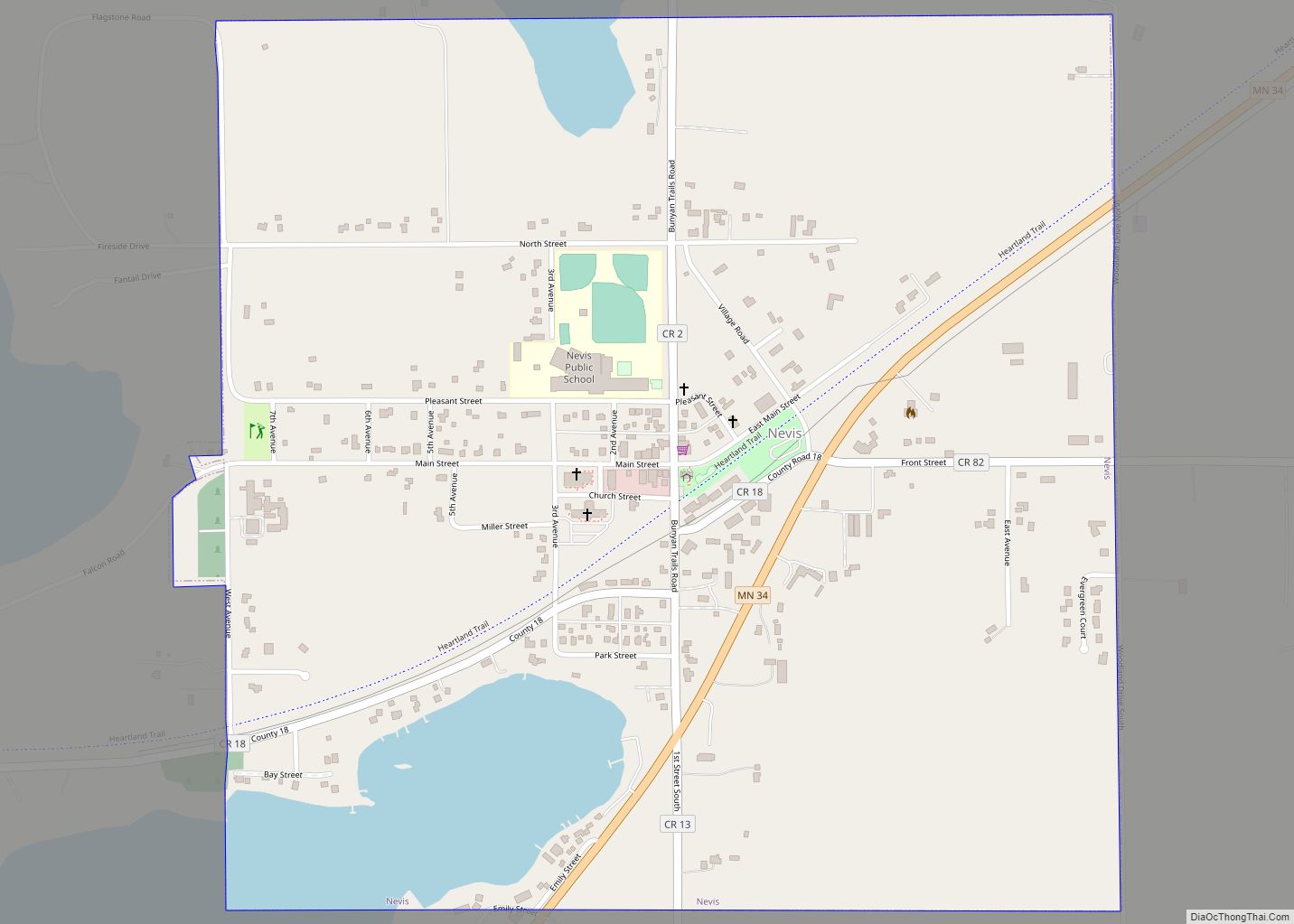
Nevis (/ˈniːvɪs/ NEE-viss) is a city in Hubbard County, Minnesota, United States. The population was 377 at the 2020 census. Minnesota State Highway 34 serves as a main arterial route in the community. Nevis began as a railway village. A post office was established in 1899, and the village separated from Nevis Township and incorporated ... Read more
Map of Nevis city
Map of Nett Lake CDP
Nett Lake is an unincorporated community and census-designated place (CDP) in Nett Lake Territory, Saint Louis County, Minnesota, United States; located on the shore of Nett Lake. As of the 2010 census, its population was 284. The community of Nett Lake is located 18 miles west of Orr, and 31 miles northwest of Cook. Saint ... Read more
Map of Nett Lake CDP
Map of Nerstrand city
Nerstrand (/ˈnɪərstʃrænd/ NEER-schrand) is a city in Rice County, Minnesota, United States. The population was 294 at the 2018 census. Minnesota State Highway 246 serves as a main route in the community. Minnesota State Highways 56 and 60 are nearby. Nerstrand city overview: Name: Nerstrand city LSAD Code: 25 LSAD Description: city (suffix) State: Minnesota ... Read more
Map of Nerstrand city
Map of Nelson city, Minnesota
Nelson is a city in Douglas County, Minnesota, United States. The population was 182 at the 2020 census. Nelson city overview: Name: Nelson city LSAD Code: 25 LSAD Description: city (suffix) State: Minnesota County: Douglas County Elevation: 1,362 ft (415 m) Total Area: 0.66 sq mi (1.71 km²) Land Area: 0.66 sq mi (1.71 km²) Water Area: 0.00 sq mi (0.00 km²) Total Population: 182 Population ... Read more
Map of Nelson city, Minnesota
Map of Naytahwaush CDP
Naytahwaush (/ˈneɪtəwɔːʃ/ NAY-tə-wawsh) is a census-designated place (CDP) in Mahnomen County, Minnesota, United States. The population was 578 at the 2010 census. Naytahwaush CDP overview: Name: Naytahwaush CDP LSAD Code: 57 LSAD Description: CDP (suffix) State: Minnesota County: Mahnomen County Elevation: 1,486 ft (453 m) Total Area: 3.28 sq mi (8.49 km²) Land Area: 2.90 sq mi (7.52 km²) Water Area: 0.37 sq mi (0.97 km²) ... Read more
Map of Naytahwaush CDP
Map of Nassau city, Minnesota
Nassau (/ˈnæsɔː/ NASS-aw) is a city in Lac qui Parle County, Minnesota, United States. The population was 72 at the 2010 census. Nassau city overview: Name: Nassau city LSAD Code: 25 LSAD Description: city (suffix) State: Minnesota County: Lac qui Parle County Elevation: 1,129 ft (344 m) Total Area: 0.16 sq mi (0.41 km²) Land Area: 0.16 sq mi (0.41 km²) Water Area: ... Read more
Map of Nassau city, Minnesota
Map of Nashwauk city
Nashwauk (/ˈnæʃwɔːk/ NASH-wawk) is a city in Itasca County, Minnesota, United States. The population was 983 at the 2010 census. U.S. Highway 169 and Minnesota State Highway 65 are two of the main routes in Nashwauk. Nashwauk city overview: Name: Nashwauk city LSAD Code: 25 LSAD Description: city (suffix) State: Minnesota County: Itasca County Elevation: ... Read more
Map of Nashwauk city
Map of Newport city, Minnesota
Newport is a city in Washington County, Minnesota, United States. The population was 3,797 at the 2020 census. According to 2021 census estimates, the city is estimated to have a population of 4,328. Newport city overview: Name: Newport city LSAD Code: 25 LSAD Description: city (suffix) State: Minnesota County: Washington County Elevation: 742 ft (226 m) Total ... Read more
Map of Newport city, Minnesota
Map of Newfolden city
Newfolden is a city in Marshall County, Minnesota, United States, along the Middle River. The population was 352 at the 2020 census. Old Mill State Park is nearby. Newfolden city overview: Name: Newfolden city LSAD Code: 25 LSAD Description: city (suffix) State: Minnesota County: Marshall County Elevation: 1,096 ft (334 m) Total Area: 1.02 sq mi (2.63 km²) Land Area: ... Read more
Map of Newfolden city
Map of New York Mills city, Minnesota
New York Mills is a city in Otter Tail County, Minnesota, United States. The population was 1,294 at the 2020 census. New York Mills city overview: Name: New York Mills city LSAD Code: 25 LSAD Description: city (suffix) State: Minnesota County: Otter Tail County Founded: 1884 Elevation: 1,411 ft (430 m) Total Area: 1.46 sq mi (3.77 km²) Land Area: ... Read more
Map of New York Mills city, Minnesota
Map of New Ulm city
New Ulm (/ˈnjuː ˈʌlm/ NEW ULM)is a city in Brown County, Minnesota, United States. The population was 14,120 at the 2020 census. It is the county seat of Brown County. It is located on the triangle of land formed by the confluence of the Minnesota River and the Cottonwood River. The city is home to ... Read more
Map of New Ulm city
Map of New Trier city
New Trier (/ˈnjuː ˈtʃrɪər/ NEW CHREER) is a city in Dakota County, Minnesota, United States. The population was 112 at the 2010 census. Minnesota Highway 50 serves as a main route in the community. New Trier city overview: Name: New Trier city LSAD Code: 25 LSAD Description: city (suffix) State: Minnesota County: Dakota County Elevation: ... Read more
Map of New Trier city