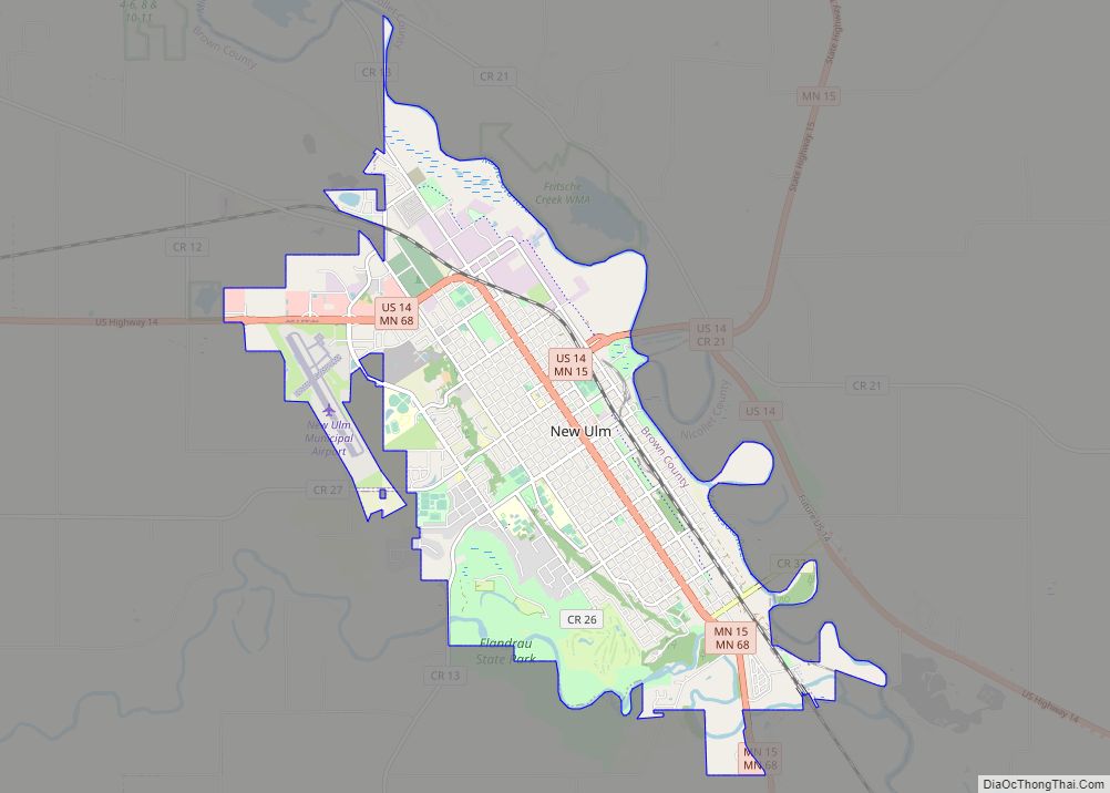
New Ulm (/ˈnjuː ˈʌlm/ NEW ULM)is a city in Brown County, Minnesota, United States. The population was 14,120 at the 2020 census. It is the county seat of Brown County. It is located on the triangle of land formed by the confluence of the Minnesota River and the Cottonwood River.
The city is home to the Hermann Heights Monument, Flandrau State Park, the historic August Schell Brewing Company, and the Minnesota Music Hall of Fame. The city is known for its German heritage and its historical sites and landmarks dating back to the Dakota War of 1862.
New Ulm is the episcopal see of the Roman Catholic Diocese of New Ulm. The Dakota called New Ulm the “Village on the Cottonwood” or Wachupata.
U.S. Highway 14 and Minnesota State Highways 15 and 68 are three of the main routes in the city.
| Name: | New Ulm city |
|---|---|
| LSAD Code: | 25 |
| LSAD Description: | city (suffix) |
| State: | Minnesota |
| County: | Brown County |
| Elevation: | 899 ft (274 m) |
| Total Area: | 10.29 sq mi (26.66 km²) |
| Land Area: | 10.16 sq mi (26.31 km²) |
| Water Area: | 0.14 sq mi (0.36 km²) |
| Total Population: | 14,120 |
| Population Density: | 1,390.31/sq mi (536.78/km²) |
| ZIP code: | 56073 |
| Area code: | 507 |
| FIPS code: | 2746042 |
| GNISfeature ID: | 0648523 |
| Website: | ci.new-ulm.mn.us |
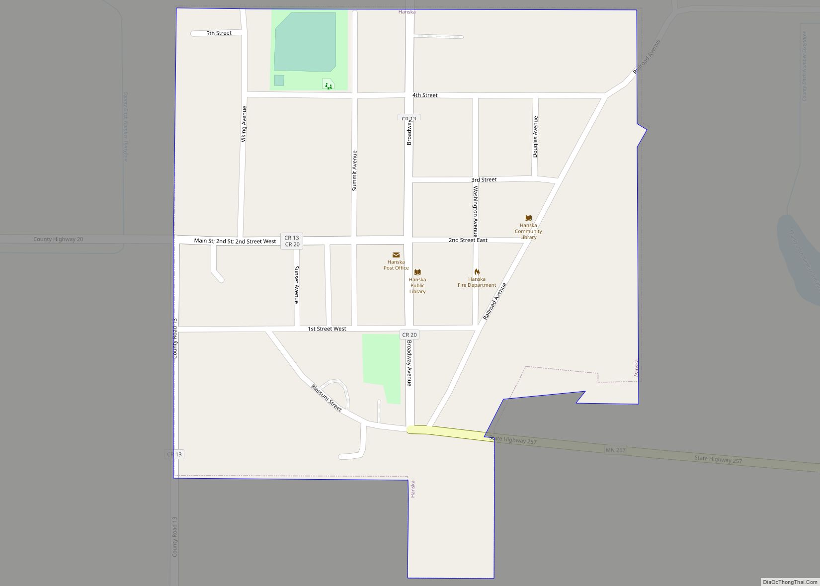
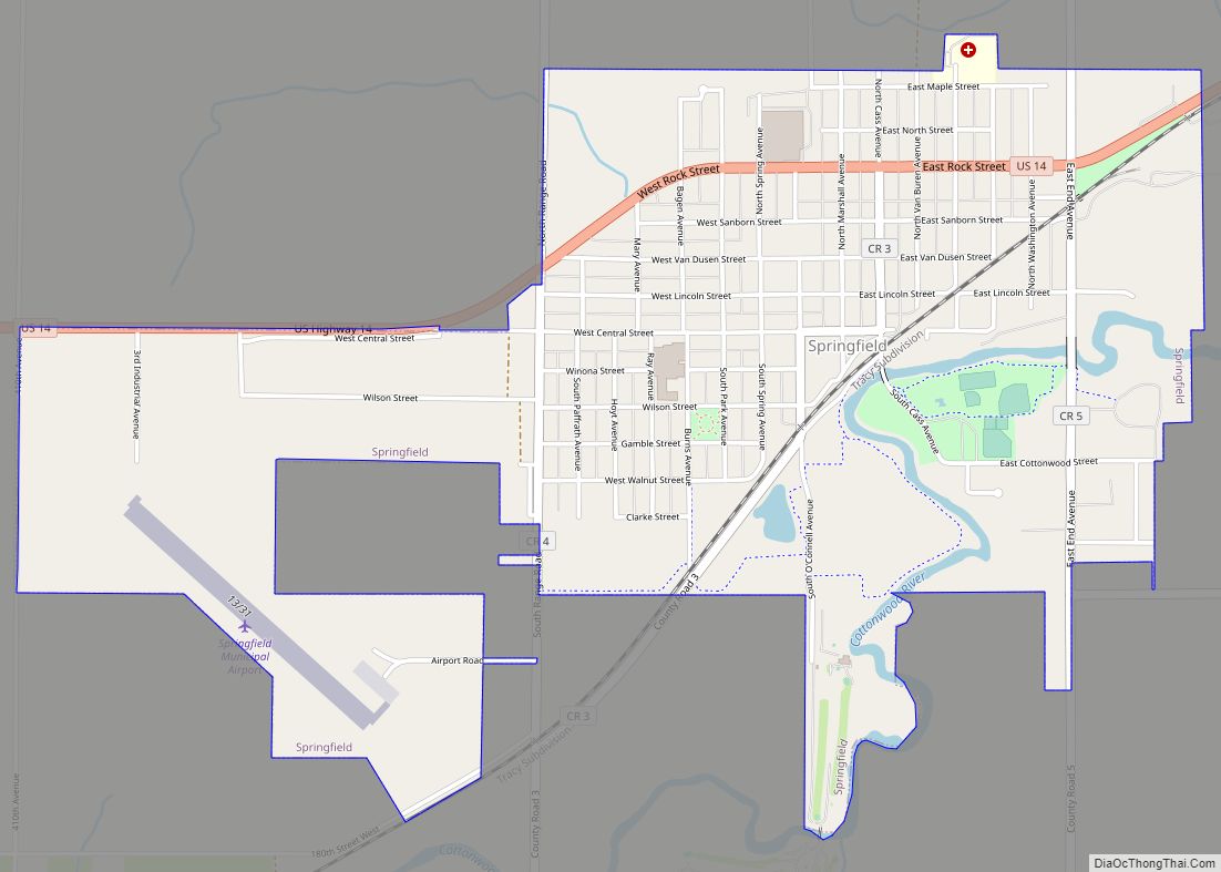
Online Interactive Map
Click on ![]() to view map in "full screen" mode.
to view map in "full screen" mode.
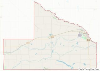
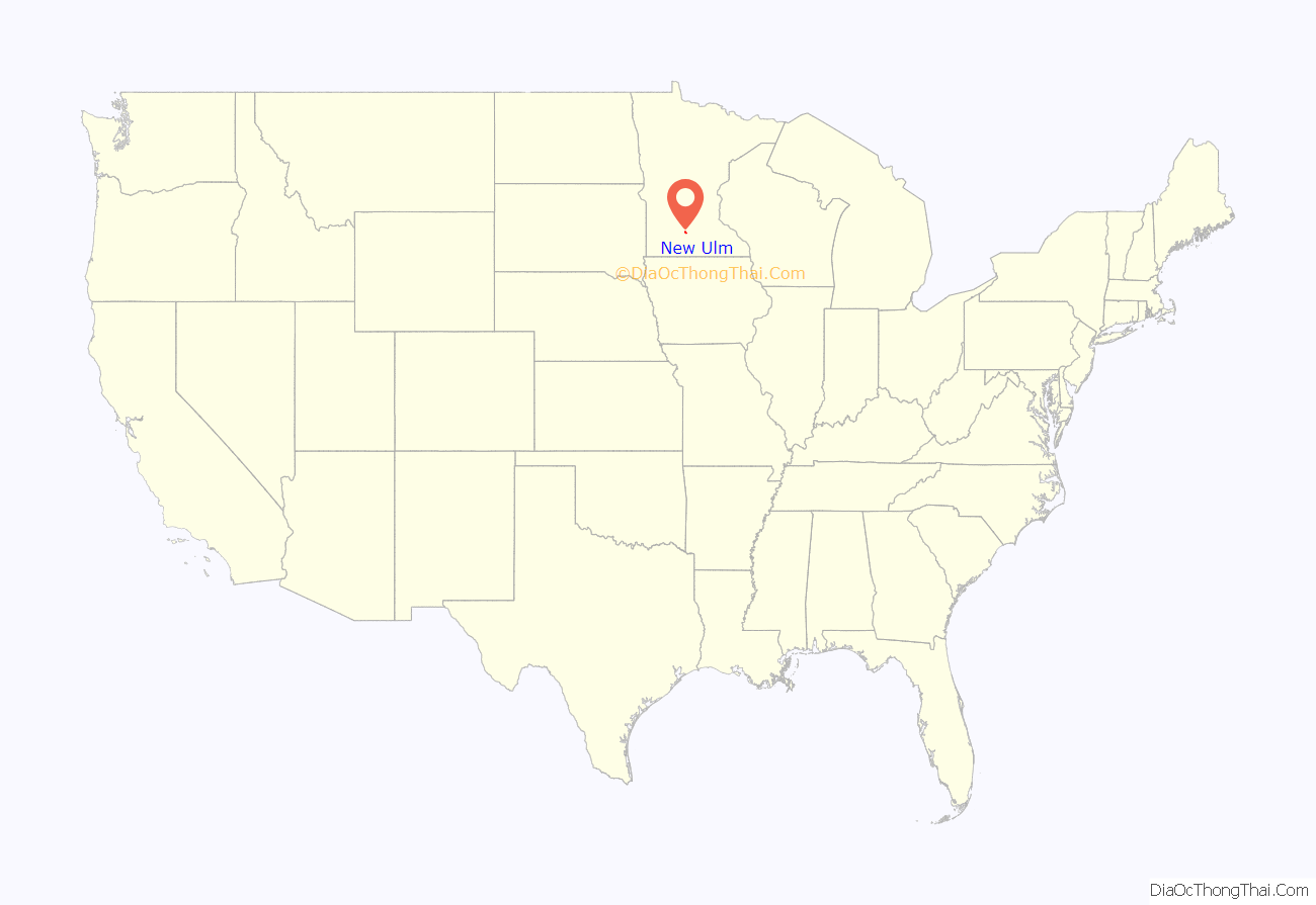
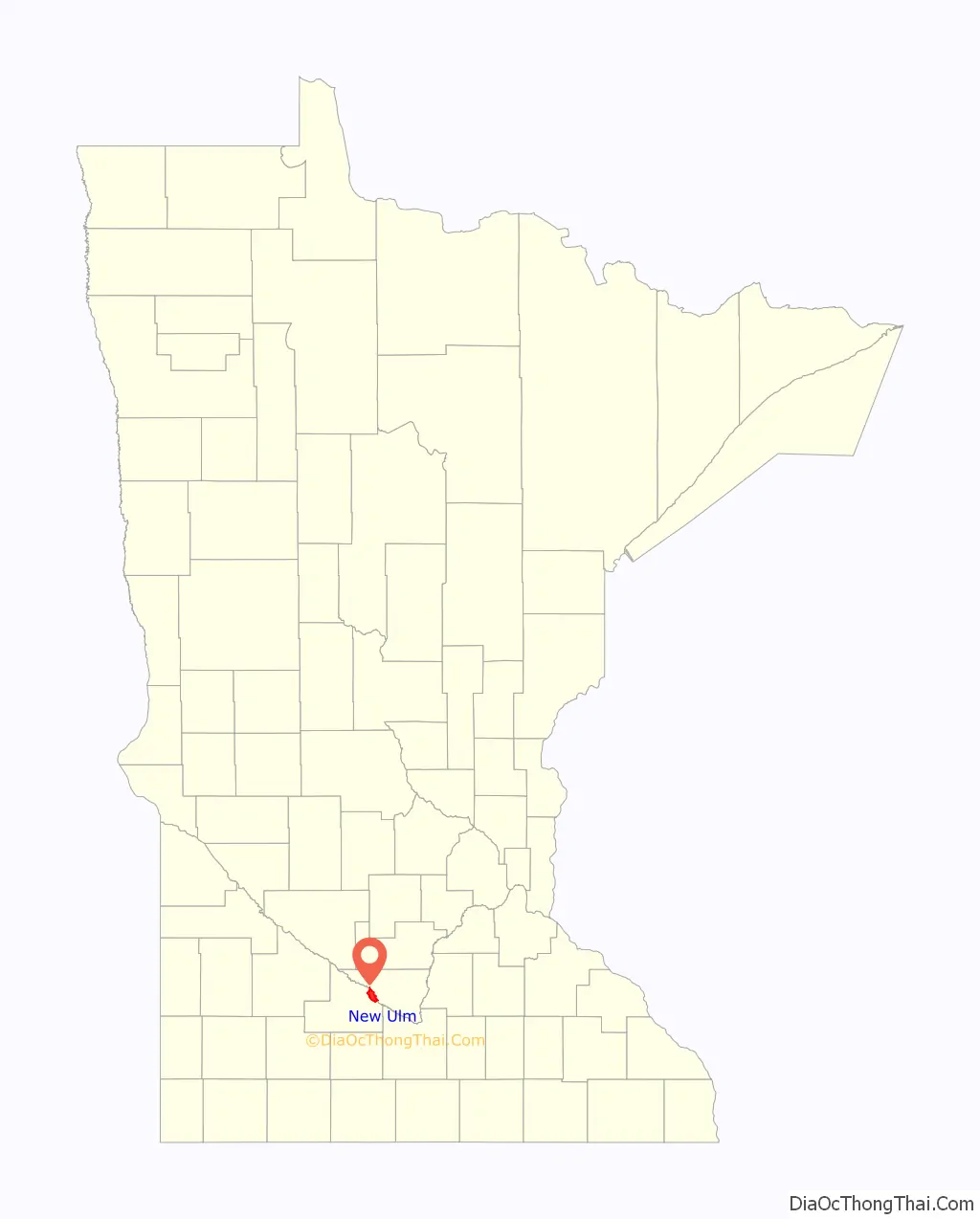
New Ulm location map. Where is New Ulm city?
History
Settlement
The city was founded in 1854 by the German Land Company of Chicago. The city was named after the city of Neu-Ulm in the state of Bavaria in southern Germany. Ulm and Neu-Ulm are twin cities, with Ulm being situated on the Baden-Württemberg side of the Danube River and Neu-Ulm on the Bavarian side. In part due to the American city’s German heritage, it became a center for brewing in the Upper Midwest. It is home to the August Schell Brewing Company. The Sioux called it Wakzupata which roughly means the “village on the cottonwood”.
In 1856, the Settlement Association of the Socialist Turner Society (“Turners”) helped to secure the future of New Ulm. The Turners (German for “gymnasts”) originated in Germany in the first half of the nineteenth century, whose motto was “Sound Mind, Sound Body”. Their clubs combined gymnastics with lectures and debates about the issues of the day. Following the failed Revolutions of 1848, numerous Germans emigrated to the United States. In their new land, Turners formed associations (Vereins) throughout the eastern, midwestern, and western states. This was the largest secular German-American organization in the country in the nineteenth century.
Following a series of attacks by nativist mobs in major cities such as Chicago, Cincinnati, and Louisville, a national convention of Turners authorized the formation of a colony on the frontier. Intending to develop a community that expressed Turner ideals, the Settlement Association joined the Chicago Germans who had struggled here due to a lack of capital. The Turners supplied that, as well as hundreds of colonists from the east who arrived in 1856.
The city plan represented Turner ideals. The German Land Company hired Christian Prignitz to complete the plan for New Ulm, which was filed in April 1858. This master plan for New Ulm expressed a grand vision of the city’s future. At the heart of the community stood blocks reserved for Turner Hall, the county courthouse, and a public school, representing the political, social, and educational center of the community. The westernmost avenues were named after American heroes George Washington, Benjamin Franklin, Thomas Jefferson, and Thomas Paine—the latter three noted for their freethinking philosophies. Members were given the means to support themselves — in harmony with nature — through the distribution of four-acre garden lots located outside the residential area. Historian Dennis Gimmestad wrote,
U.S.–Dakota War of 1862
On August 18, 1862, the Dakota War began with the attack at the Lower Sioux Agency only 30 miles up the Minnesota River from New Ulm. As the closest significant town to the Dakota Reservation, New Ulm fell under attack by a Mdewakanton force the next day. A hastily-formed militia of armed townspeople repelled the attack and immediately set about constructing barricades around the center of the town.
The Dakota returned with a larger force on the morning of August 23. Bolstered by the timely arrival of volunteer militia from other towns under Charles Flandrau, the outnumbered defenders of New Ulm again repelled the attack. Most of the town outside the barricades was burned, however, leaving only 49 buildings to house a population of 2500. Short of shelter and ammunition and facing outbreaks of disease, the majority of the population evacuated to Mankato on August 25. The dead were buried in New Ulm’s streets.
1881 Tornado
On July 15, 1881, New Ulm was struck by a large tornado that killed six people and injured 53.
World War I and II
Between the outbreak of World War I in 1914 and U.S. entry into the conflict, the citizens of New Ulm closely followed events in Europe. Local newspapers sometimes printing news from relatives and friends in Germany. In an unofficial referendum in early April 1917, local voters opposed war by a margin of 466 to 19. Even as President Woodrow Wilson prepared his Declaration of War, a Brown County delegation arrived in Washington, D.C. to voice its opposition to that action.
On the national level, the Wilson administration organized an active campaign to suppress antiwar fervor, joined on the state level by Minnesota Governor James Burnquist. The Minnesota Commission of Public Safety was granted broad powers to protect the state and assist in the war effort. Specific actions taken by the commission included surveillance of alleged subversive activities, mobilization of opposition to labor unions and strikes (which were considered even more suspect in wartime), pursuit of draft evaders, and registration and monitoring of aliens (foreign nationals).
Given the strong German heritage of New Ulm residents, federal and state agents began to visit the city soon after the United States’ entry into the Great War. They filed reports to offices in Washington and St. Paul because immigrants and first-generation ethnics were suspected of having divided loyalties at best, and perhaps favoring Prussia and the Central Powers. Locally, several business and civic leaders joined in efforts to root out antiwar fervor.
On July 25, 1917, a massive rally, attended by 10,000 people, was held on the grounds of Turner Hall. The people had gathered to “enter a protest against sending American soldiers to a foreign country.” Speakers included Louis Fritsche, mayor of New Ulm; Albert Pfaender, city attorney and former minority leader of the Minnesota House of Representatives; Adolph Ackermann, director of Dr. Martin Luther College; and F. H. Retzlaff, a prominent businessman. Federal and state agents mingled through the crowd, gathering information.
A month later, Governor Burnquist removed Fritsche and Pfaender from their positions. The Commission of Public Safety pressured the college to fire Ackermann. These blows sharply divided the community — on one side, many residents took the removals as an attack on the city’s heritage and traditions. Albert Pfaender was the son, and Fritsche, the son-in-law, of the city’s principal founder, Wilhelm Pfaender. On the other side, prominent local businessmen, including flour mill managers, feared economic repercussions and promoted pro-war parades and bond drives.
During World War II, German POWs were housed in a camp to the immediate southeast of New Ulm, in what is now Flandrau State Park. In 1944, a New Ulm family was fined $300 for removing a prisoner from the camp, housing him, and taking him to church.
New Ulm Road Map
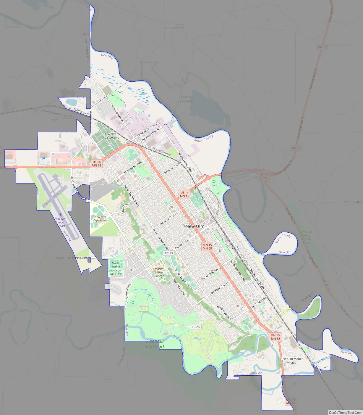
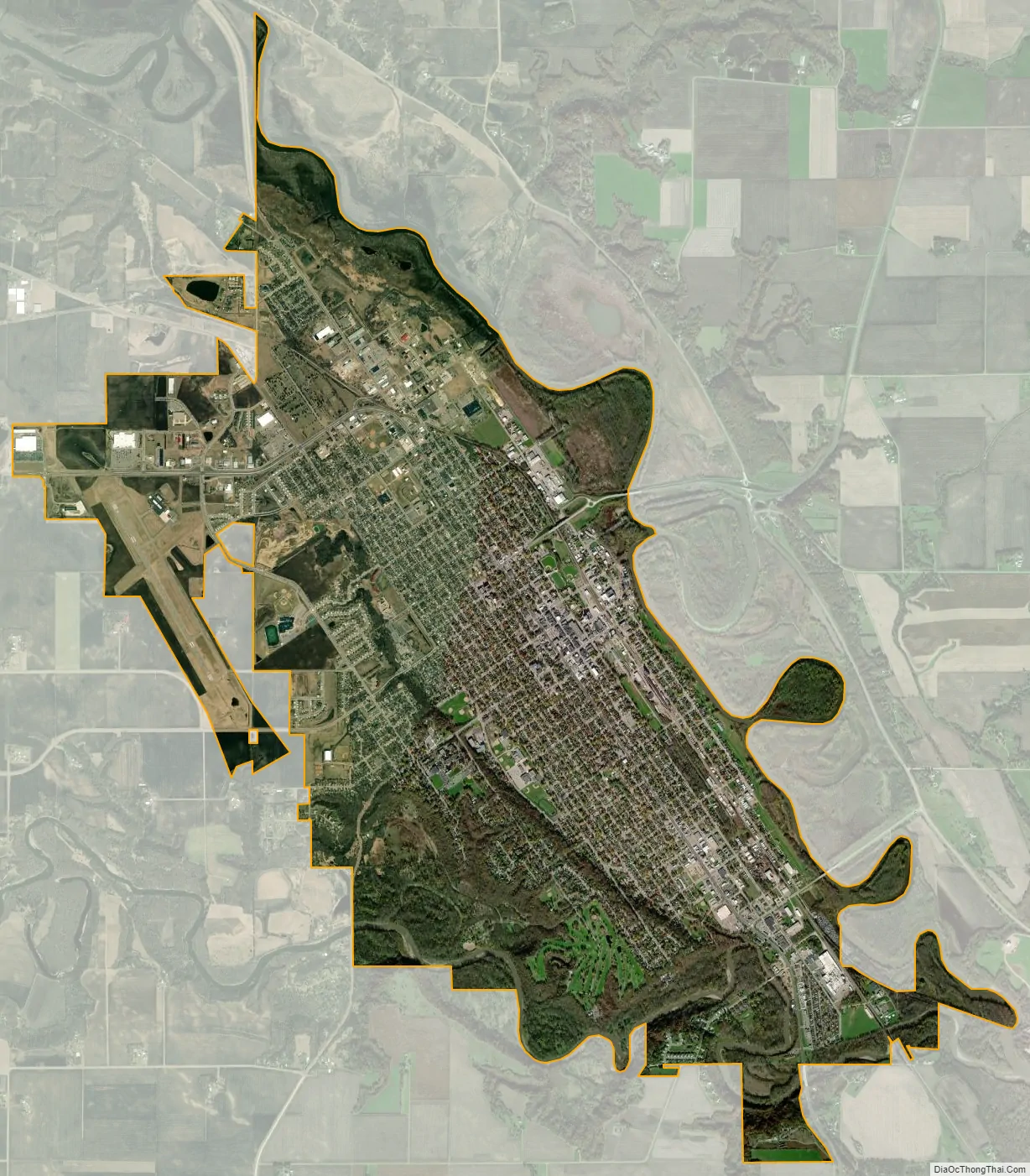
New Ulm city Satellite Map
Geography
According to the United States Census Bureau, the city has a total area of 10.26 square miles (26.57 km), of which 9.92 square miles (25.69 km) is land and 0.34 square miles (0.88 km) is water. The Minnesota River and the Cottonwood River flow past the city on their way to the Mississippi River.
Climate
New Ulm has a hot-summer humid continental climate (Köppen Dfa), and it experiences four distinct seasons. Summers in New Ulm are typically warm to hot with thunderstorms being common. Winters are quite cold and snowy, yet not quite as snowy as other areas further east in Minnesota.
See also
Map of Minnesota State and its subdivision:- Aitkin
- Anoka
- Becker
- Beltrami
- Benton
- Big Stone
- Blue Earth
- Brown
- Carlton
- Carver
- Cass
- Chippewa
- Chisago
- Clay
- Clearwater
- Cook
- Cottonwood
- Crow Wing
- Dakota
- Dodge
- Douglas
- Faribault
- Fillmore
- Freeborn
- Goodhue
- Grant
- Hennepin
- Houston
- Hubbard
- Isanti
- Itasca
- Jackson
- Kanabec
- Kandiyohi
- Kittson
- Koochiching
- Lac qui Parle
- Lake
- Lake of the Woods
- Lake Superior
- Le Sueur
- Lincoln
- Lyon
- Mahnomen
- Marshall
- Martin
- McLeod
- Meeker
- Mille Lacs
- Morrison
- Mower
- Murray
- Nicollet
- Nobles
- Norman
- Olmsted
- Otter Tail
- Pennington
- Pine
- Pipestone
- Polk
- Pope
- Ramsey
- Red Lake
- Redwood
- Renville
- Rice
- Rock
- Roseau
- Saint Louis
- Scott
- Sherburne
- Sibley
- Stearns
- Steele
- Stevens
- Swift
- Todd
- Traverse
- Wabasha
- Wadena
- Waseca
- Washington
- Watonwan
- Wilkin
- Winona
- Wright
- Yellow Medicine
- Alabama
- Alaska
- Arizona
- Arkansas
- California
- Colorado
- Connecticut
- Delaware
- District of Columbia
- Florida
- Georgia
- Hawaii
- Idaho
- Illinois
- Indiana
- Iowa
- Kansas
- Kentucky
- Louisiana
- Maine
- Maryland
- Massachusetts
- Michigan
- Minnesota
- Mississippi
- Missouri
- Montana
- Nebraska
- Nevada
- New Hampshire
- New Jersey
- New Mexico
- New York
- North Carolina
- North Dakota
- Ohio
- Oklahoma
- Oregon
- Pennsylvania
- Rhode Island
- South Carolina
- South Dakota
- Tennessee
- Texas
- Utah
- Vermont
- Virginia
- Washington
- West Virginia
- Wisconsin
- Wyoming