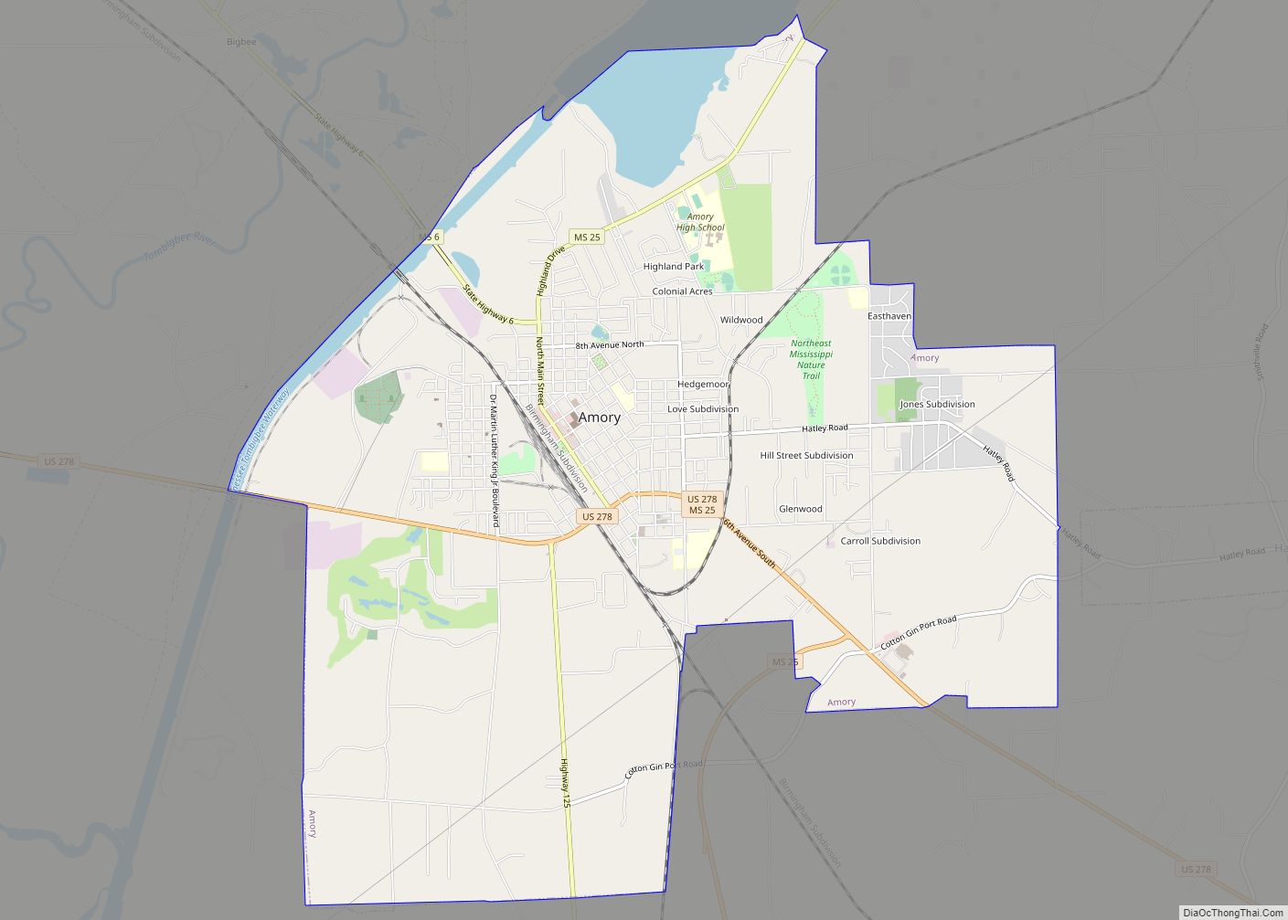
Amory is a city in Monroe County, Mississippi, United States. The population was 6,666 at the 2020 census, down from 7,316 at the 2010 census. Located in the northeastern part of the state near the Alabama border, it was founded in 1887 as a railroad town by the Kansas City, Memphis and Birmingham Railroad. As a result, Cotton Gin Port, along the Tombigbee River to the east, was abandoned as businesses and people moved for railroad access.
| Name: | Amory city |
|---|---|
| LSAD Code: | 25 |
| LSAD Description: | city (suffix) |
| State: | Mississippi |
| County: | Monroe County |
| Elevation: | 240 ft (70 m) |
| Total Area: | 13.14 sq mi (34.03 km²) |
| Land Area: | 12.53 sq mi (32.46 km²) |
| Water Area: | 0.61 sq mi (1.58 km²) |
| Total Population: | 6,666 |
| Population Density: | 531.96/sq mi (205.39/km²) |
| ZIP code: | 38821 |
| Area code: | 662 |
| FIPS code: | 2801260 |
| Website: | cityofamoryms.com |
Online Interactive Map
Click on ![]() to view map in "full screen" mode.
to view map in "full screen" mode.
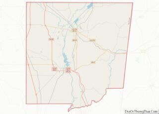
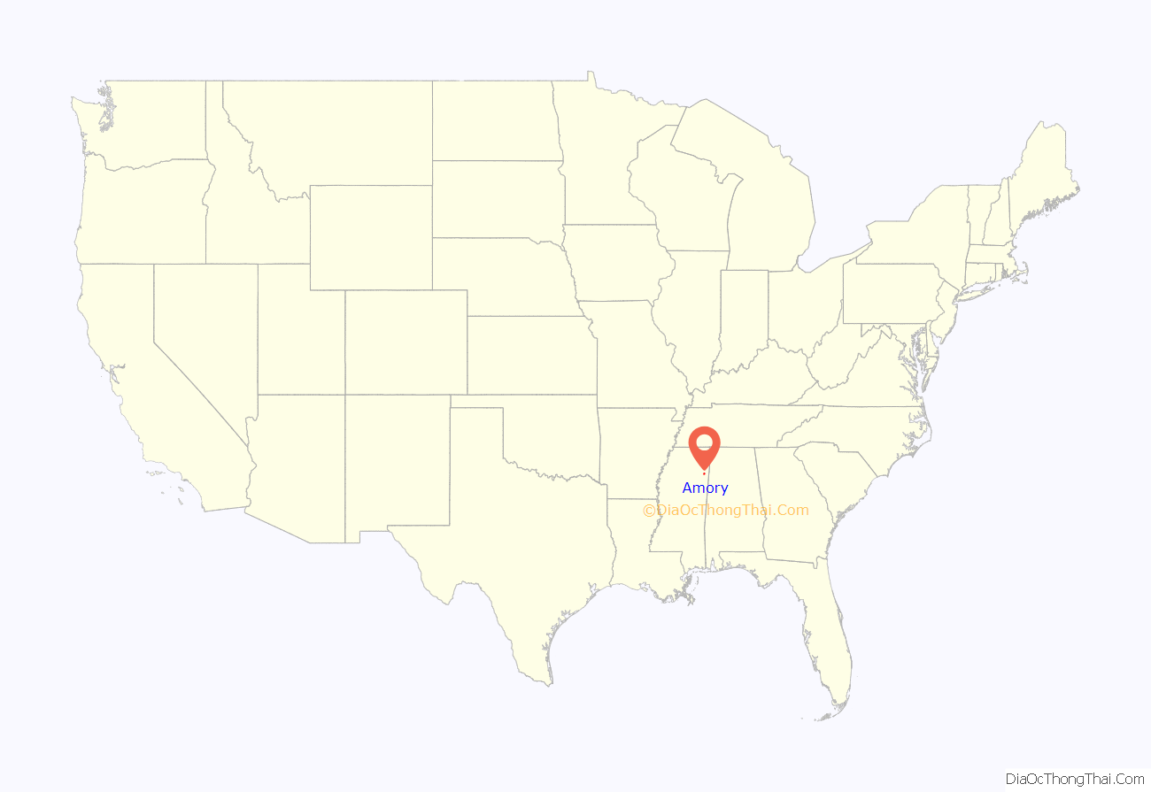
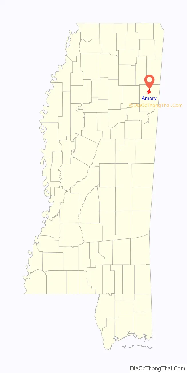
Amory location map. Where is Amory city?
History
Amory was founded as a planned railroad town. The Kansas City, Memphis & Birmingham Railroad was expanding in the South and needed a midpoint between Memphis, Tennessee, and Birmingham, Alabama, to service their locomotives. They laid out the new town of Amory, Mississippi, near the Alabama border, in 1887.
Believing railroad access to be critical, people from nearby Cotton Gin Port, about 1.5 miles away and located along the Tombigbee River, abandoned their town and moved to Amory. All that remains of the former Cotton Gin Port are the ruins of buildings and an old cemetery.
Two field recordings were made at Monroe County Training School in Amory.
2023 tornado
On the evening of Friday, March 24, 2023, Amory was struck by a EF3 tornado, resulting in significant residential damage, as well as multiple injuries and two fatalities. At Amory High School, cameras caught the tornado damaging the building, ripping the roof off the building and flying debris impacted the schools’ athletic facility. The same tornado also impacted Egypt prior, and Wren thereafter.
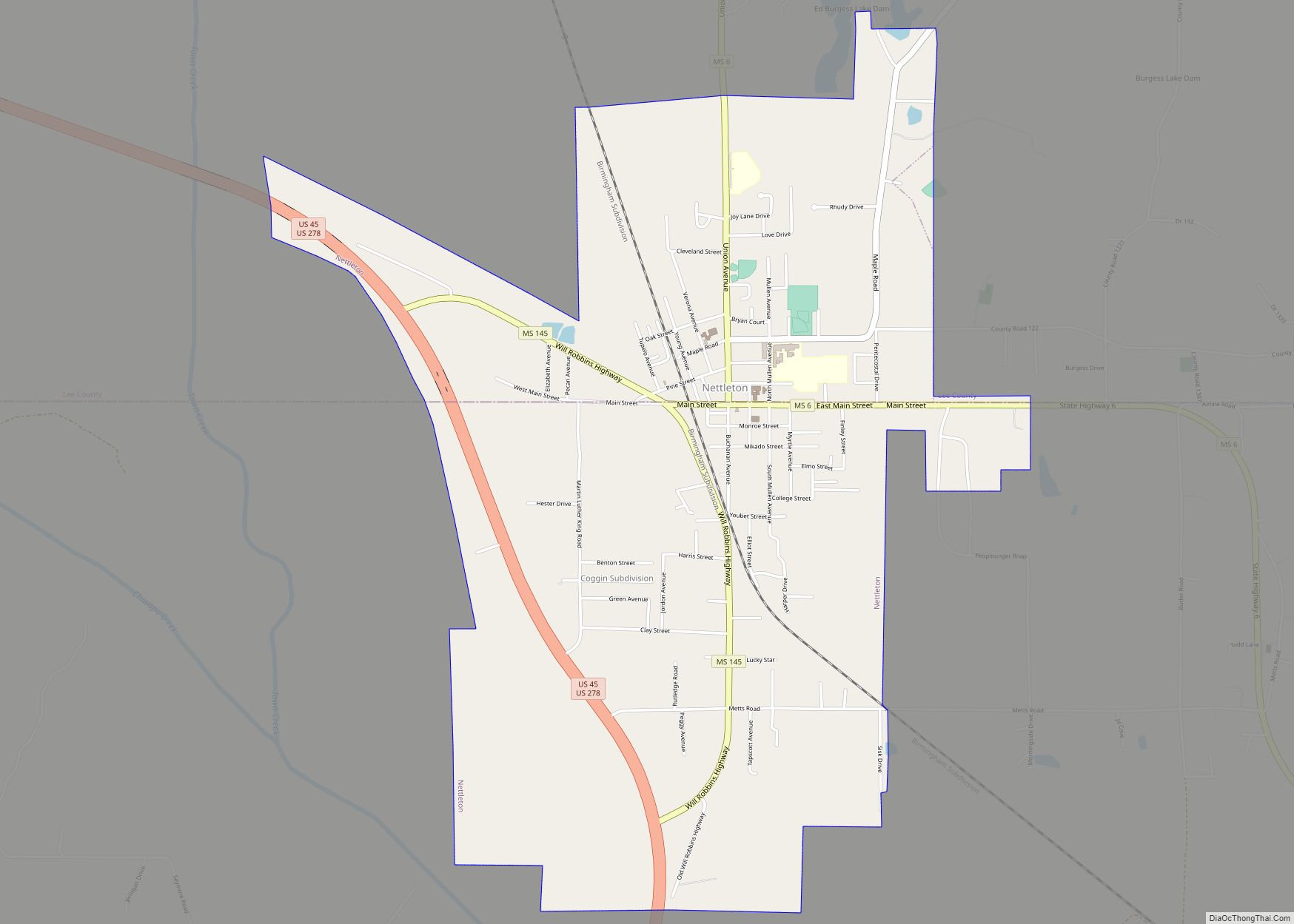
Amory Road Map
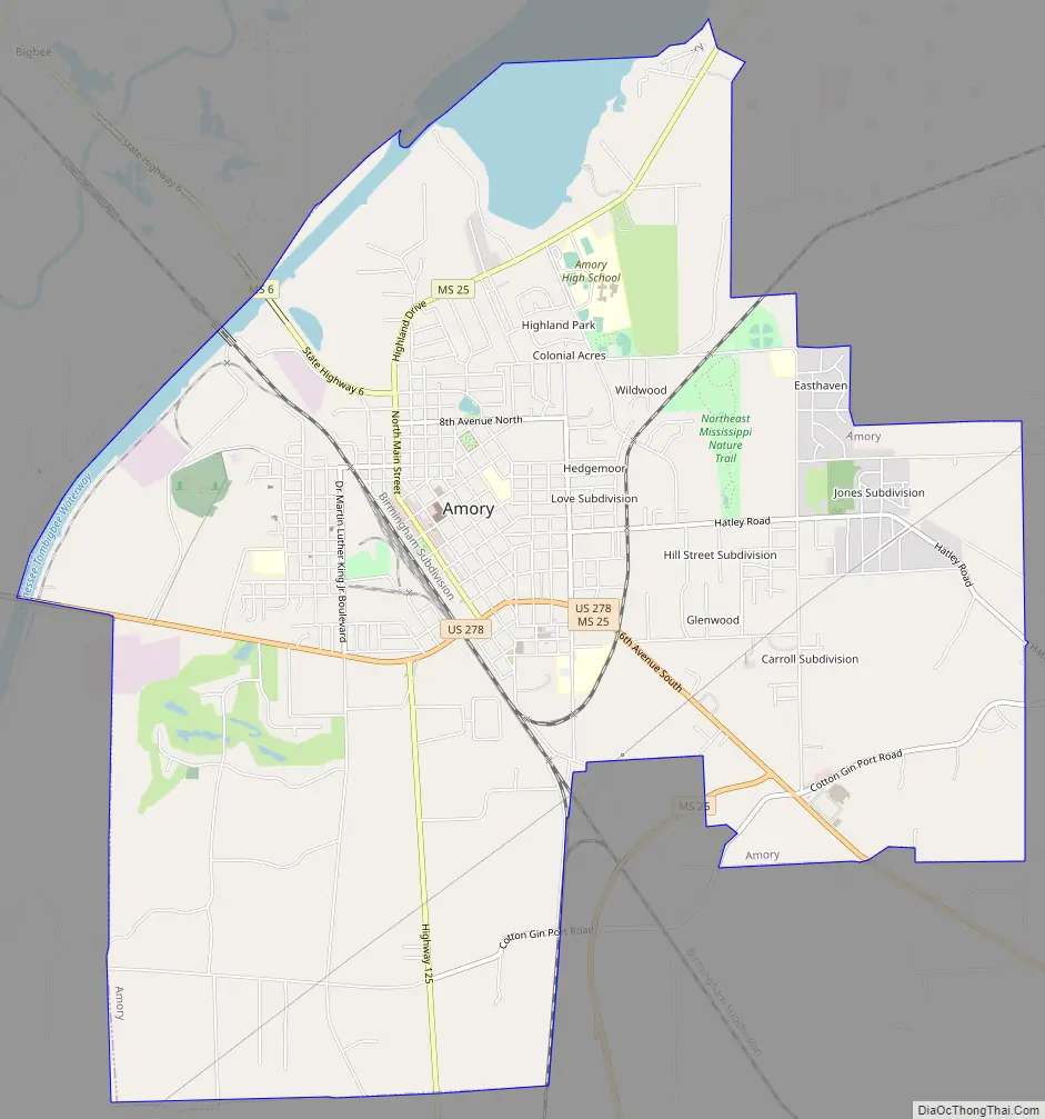
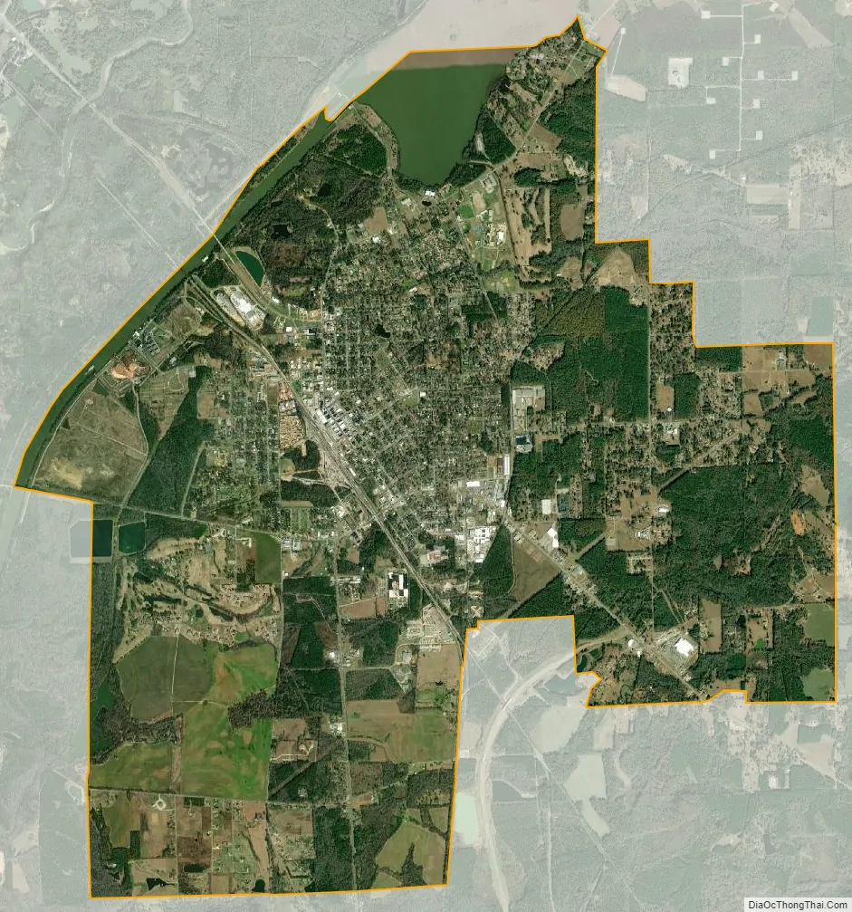
Amory city Satellite Map
Geography
According to the United States Census Bureau, the city has a total area of 8.0 square miles (21 km), of which 7.5 square miles (19 km) is land and 0.5 square miles (1.3 km) (6.37%) is water.
See also
Map of Mississippi State and its subdivision:- Adams
- Alcorn
- Amite
- Attala
- Benton
- Bolivar
- Calhoun
- Carroll
- Chickasaw
- Choctaw
- Claiborne
- Clarke
- Clay
- Coahoma
- Copiah
- Covington
- Desoto
- Forrest
- Franklin
- George
- Greene
- Grenada
- Hancock
- Harrison
- Hinds
- Holmes
- Humphreys
- Issaquena
- Itawamba
- Jackson
- Jasper
- Jefferson
- Jefferson Davis
- Jones
- Kemper
- Lafayette
- Lamar
- Lauderdale
- Lawrence
- Leake
- Lee
- Leflore
- Lincoln
- Lowndes
- Madison
- Marion
- Marshall
- Monroe
- Montgomery
- Neshoba
- Newton
- Noxubee
- Oktibbeha
- Panola
- Pearl River
- Perry
- Pike
- Pontotoc
- Prentiss
- Quitman
- Rankin
- Scott
- Sharkey
- Simpson
- Smith
- Stone
- Sunflower
- Tallahatchie
- Tate
- Tippah
- Tishomingo
- Tunica
- Union
- Walthall
- Warren
- Washington
- Wayne
- Webster
- Wilkinson
- Winston
- Yalobusha
- Yazoo
- Alabama
- Alaska
- Arizona
- Arkansas
- California
- Colorado
- Connecticut
- Delaware
- District of Columbia
- Florida
- Georgia
- Hawaii
- Idaho
- Illinois
- Indiana
- Iowa
- Kansas
- Kentucky
- Louisiana
- Maine
- Maryland
- Massachusetts
- Michigan
- Minnesota
- Mississippi
- Missouri
- Montana
- Nebraska
- Nevada
- New Hampshire
- New Jersey
- New Mexico
- New York
- North Carolina
- North Dakota
- Ohio
- Oklahoma
- Oregon
- Pennsylvania
- Rhode Island
- South Carolina
- South Dakota
- Tennessee
- Texas
- Utah
- Vermont
- Virginia
- Washington
- West Virginia
- Wisconsin
- Wyoming