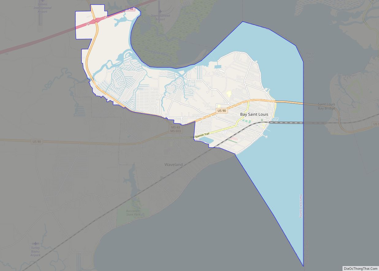
Bay St. Louis is a city in and the county seat of Hancock County, Mississippi, in the United States. Located on the Gulf Coast on the west side of the Bay of St. Louis, it is part of the Gulfport–Biloxi Metropolitan Statistical Area. The population was 9,284 at the 2020 census, up from 9,260 at the 2010 census.
| Name: | Bay St. Louis city |
|---|---|
| LSAD Code: | 25 |
| LSAD Description: | city (suffix) |
| State: | Mississippi |
| County: | Hancock County |
| Elevation: | 23 ft (7 m) |
| Total Area: | 26.62 sq mi (68.95 km²) |
| Land Area: | 14.69 sq mi (38.05 km²) |
| Water Area: | 11.93 sq mi (30.90 km²) |
| Total Population: | 9,284 |
| Population Density: | 631.91/sq mi (243.99/km²) |
| ZIP code: | 39520, 39521, 39522 |
| Area code: | 228 |
| FIPS code: | 2803980 |
| GNISfeature ID: | 0666588 |
| Website: | www.baystlouis-ms.gov |
Online Interactive Map
Click on ![]() to view map in "full screen" mode.
to view map in "full screen" mode.
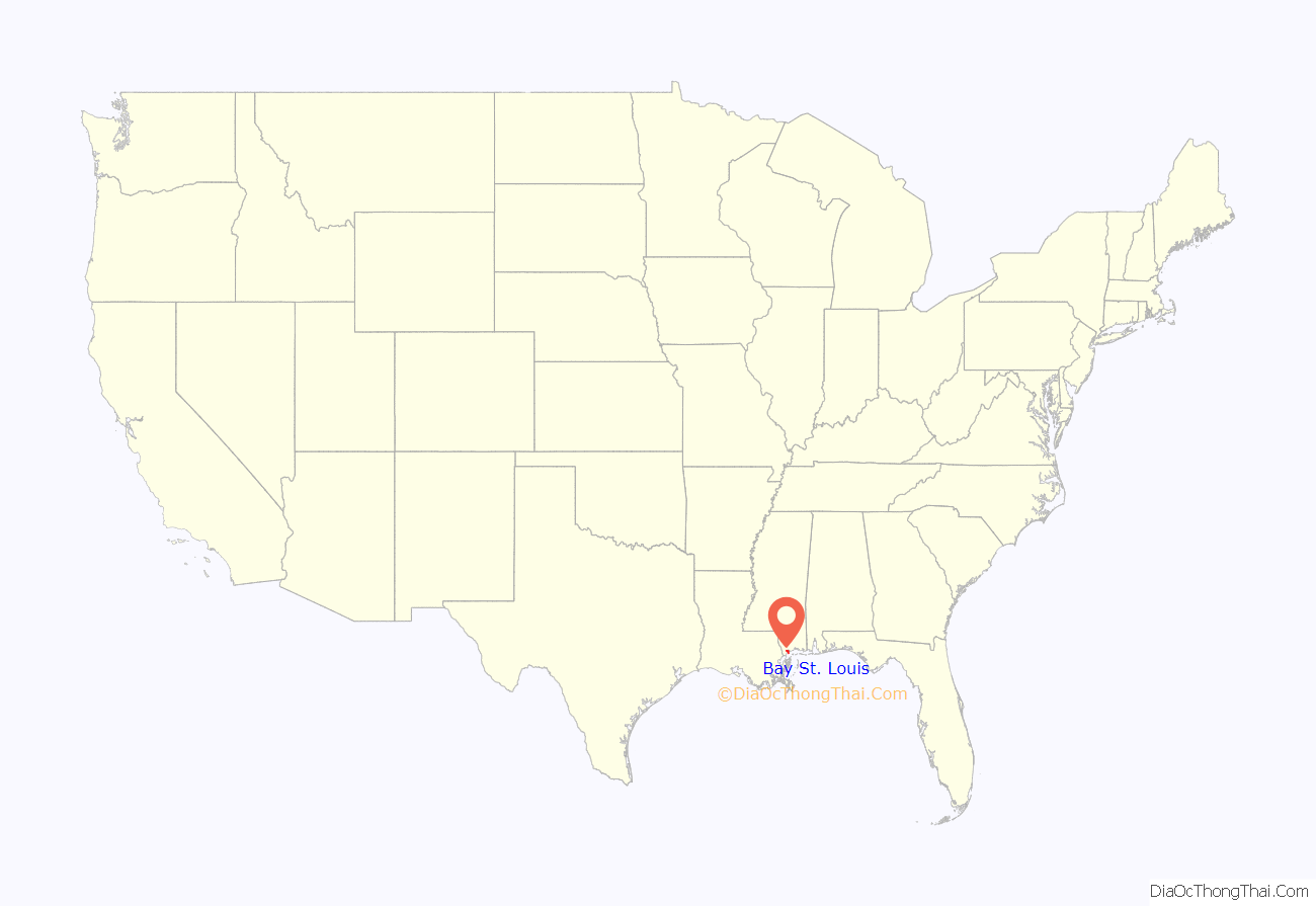
Bay St. Louis location map. Where is Bay St. Louis city?
History
The first European settlers in this area were French colonists, whose culture still influences the small city and who imported enslaved people from Africa. A Louisiana Creole population developed, featuring people of color as well as white colonists of largely French descent.
The county was organized by European Americans, who named it after John Hancock, who was a Founding Father of the United States. While more Protestant Americans migrated into this area after Indian Removal in the 1830s, there are still many Catholic families, some dating to both African and French ancestors of the colonial era. Roman Catholic schools still draw area students.
The 1966 movie This Property is Condemned starring Natalie Wood and Robert Redford was filmed in Bay St. Louis, which was called “Dodson” in the movie, with some additional shooting in Biloxi, Mississippi, and New Orleans, Louisiana.
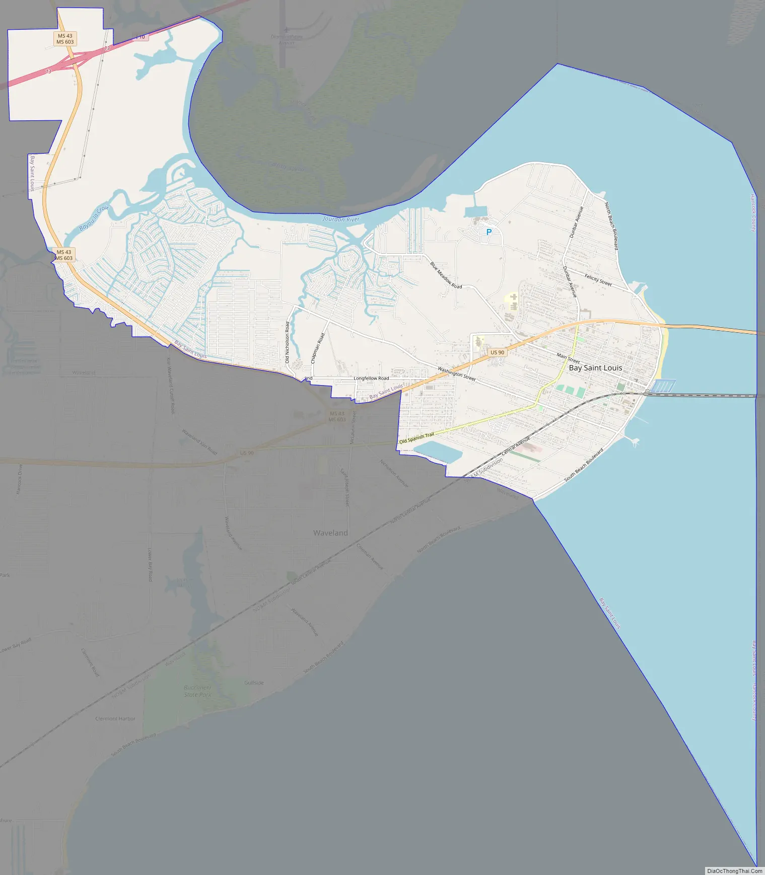
Bay St. Louis Road Map
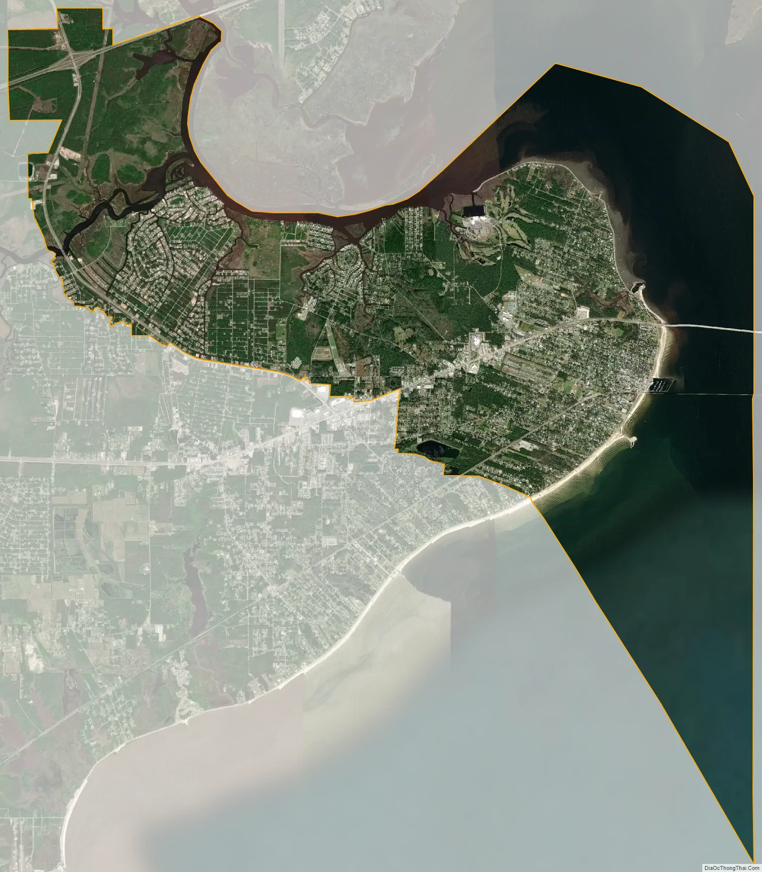
Bay St. Louis city Satellite Map
Geography
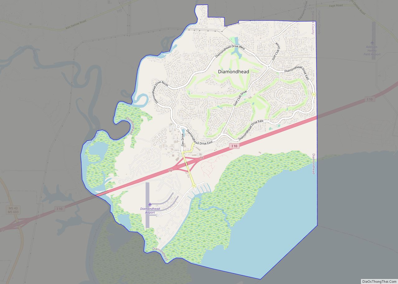
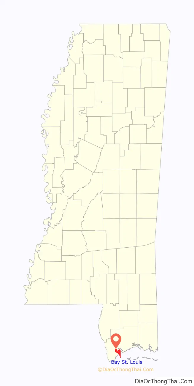
Bay St. Louis is located in southeastern Hancock County at 30°18’53” North, 89°20’39” West (30.314696, −89.344096). It is situated on the west side of the Bay of St. Louis which empties into the Mississippi Sound, adjacent to Pass Christian to the east. The city is bordered to the north by the Jourdan River, the primary inlet of the bay and Diamondhead. The eastern border of the city is the Harrison County line in the middle of the bay.
According to the United States Census Bureau, the city has a total area of 26.6 square miles (69.0 km), of which 14.7 square miles (38.1 km) are land and 11.9 square miles (30.9 km), or 44,82%, are water.
Major highways
- Interstate 10 passes through the northern extension of the city, 10 miles (16 km) northwest of downtown, with access from Exit 13 (Highway 603). I-10 leads east 37 miles (60 km) to Biloxi and southwest 54 miles (87 km) to New Orleans.
- U.S. Highway 90 passes just north of downtown Bay St. Louis, leading east across the St. Louis Bay Bridge to Pass Christian. Via US 90 it is 15 miles (24 km) east to Gulfport and 60 miles (97 km) southwest to New Orleans.
- Mississippi Highway 603 runs along the western edge of the Bay St. Louis city limits, connecting US 90 and Interstate 10.
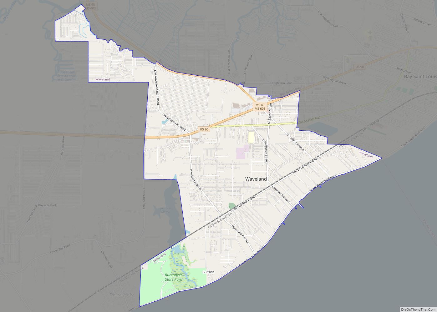
Adjacent cities and towns
- Diamondhead (north)
- Pass Christian (east)
- Waveland (west)
See also
Map of Mississippi State and its subdivision:- Adams
- Alcorn
- Amite
- Attala
- Benton
- Bolivar
- Calhoun
- Carroll
- Chickasaw
- Choctaw
- Claiborne
- Clarke
- Clay
- Coahoma
- Copiah
- Covington
- Desoto
- Forrest
- Franklin
- George
- Greene
- Grenada
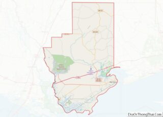
- Hancock
- Harrison
- Hinds
- Holmes
- Humphreys
- Issaquena
- Itawamba
- Jackson
- Jasper
- Jefferson
- Jefferson Davis
- Jones
- Kemper
- Lafayette
- Lamar
- Lauderdale
- Lawrence
- Leake
- Lee
- Leflore
- Lincoln
- Lowndes
- Madison
- Marion
- Marshall
- Monroe
- Montgomery
- Neshoba
- Newton
- Noxubee
- Oktibbeha
- Panola
- Pearl River
- Perry
- Pike
- Pontotoc
- Prentiss
- Quitman
- Rankin
- Scott
- Sharkey
- Simpson
- Smith
- Stone
- Sunflower
- Tallahatchie
- Tate
- Tippah
- Tishomingo
- Tunica
- Union
- Walthall
- Warren
- Washington
- Wayne
- Webster
- Wilkinson
- Winston
- Yalobusha
- Yazoo
- Alabama
- Alaska
- Arizona
- Arkansas
- California
- Colorado
- Connecticut
- Delaware
- District of Columbia
- Florida
- Georgia
- Hawaii
- Idaho
- Illinois
- Indiana
- Iowa
- Kansas
- Kentucky
- Louisiana
- Maine
- Maryland
- Massachusetts
- Michigan
- Minnesota
- Mississippi
- Missouri
- Montana
- Nebraska
- Nevada
- New Hampshire
- New Jersey
- New Mexico
- New York
- North Carolina
- North Dakota
- Ohio
- Oklahoma
- Oregon
- Pennsylvania
- Rhode Island
- South Carolina
- South Dakota
- Tennessee
- Texas
- Utah
- Vermont
- Virginia
- Washington
- West Virginia
- Wisconsin
- Wyoming