Map of Shubuta town

Map of Shubuta town

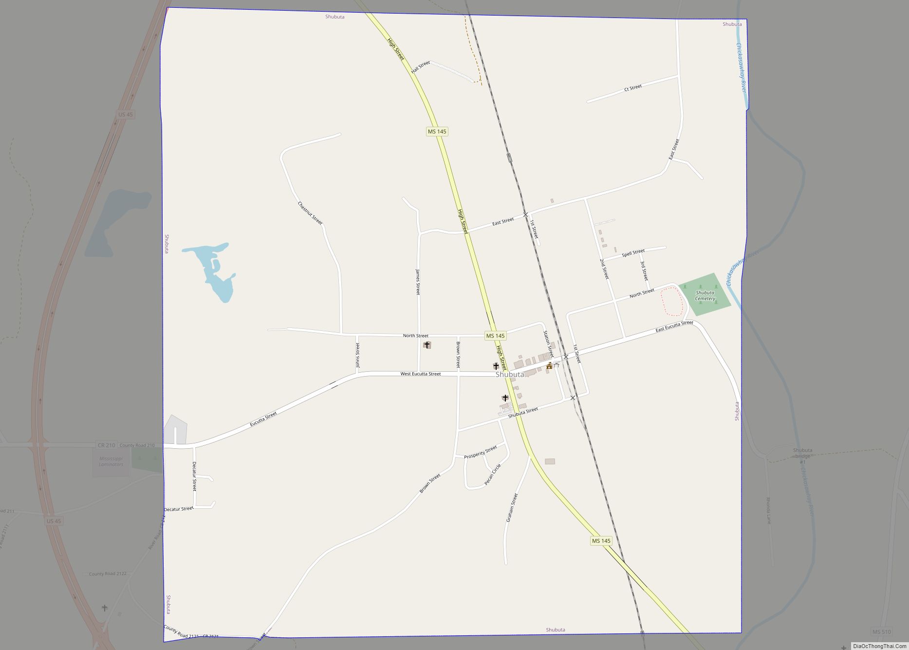
Shubuta is a town in Clarke County, Mississippi, United States, which is located on the eastern border of the state. The population was 441 as of the 2010 census, down from 651 at the 2000 census. Developed around an early 19th-century trading post on the Chickasawhay River, it was built near a Choctaw town. Shubuta … Read more

Map of Soso town

Map of Soso town

Soso is a town in Jones County, Mississippi, United States. The population was 418 at the 2020 census. Paul Davis, a singer and songwriter from Meridian, Mississippi, wrote a song called “Sweet Magnolia Blues”, which refers to Soso. Soso town overview: Name: Soso town LSAD Code: 43 LSAD Description: town (suffix) State: Mississippi County: Jones … Read more

Map of Snow Lake Shores town

Map of Snow Lake Shores town

Snow Lake Shores is a town in Benton County, Mississippi, United States. The population was 319 at the 2010 census. Snow Lake Shores town overview: Name: Snow Lake Shores town LSAD Code: 43 LSAD Description: town (suffix) State: Mississippi County: Benton County Incorporated: 1996 Elevation: 417 ft (127 m) Total Area: 0.90 sq mi (2.32 km²) Land Area: 0.68 sq mi (1.76 km²) … Read more

Map of Smithville town, Mississippi

Map of Smithville town, Mississippi

Smithville is a town in Monroe County, Mississippi, United States. The population was 509 at the 2020 census. Smithville town overview: Name: Smithville town LSAD Code: 43 LSAD Description: town (suffix) State: Mississippi County: Monroe County Elevation: 262 ft (80 m) Total Area: 1.61 sq mi (4.17 km²) Land Area: 1.48 sq mi (3.84 km²) Water Area: 0.12 sq mi (0.32 km²) Total Population: 509 Population … Read more

Map of Sledge town

Map of Sledge town

Sledge is a town located in Quitman County, Mississippi, United States. As of the 2020 census, the town had a total population of 368. Sledge town overview: Name: Sledge town LSAD Code: 43 LSAD Description: town (suffix) State: Mississippi County: Quitman County Elevation: 167 ft (51 m) Total Area: 0.53 sq mi (1.38 km²) Land Area: 0.53 sq mi (1.38 km²) Water Area: … Read more

Map of Slate Springs village

Map of Slate Springs village

Slate Springs is a village in Calhoun County, Mississippi, United States. The population was 110 at the 2010 census. Slate Springs village overview: Name: Slate Springs village LSAD Code: 47 LSAD Description: village (suffix) State: Mississippi County: Calhoun County Total Area: 1.42 sq mi (3.67 km²) Land Area: 1.42 sq mi (3.67 km²) Water Area: 0.00 sq mi (0.00 km²) Total Population: 105 Population … Read more

Map of State Line town, Mississippi

Map of State Line town, Mississippi

State Line is a town in Greene and Wayne counties, Mississippi, in the United States. The population was 452 at the 2020 census. State Line town overview: Name: State Line town LSAD Code: 43 LSAD Description: town (suffix) State: Mississippi County: Greene County, Wayne County Elevation: 253 ft (77 m) Total Area: 4.30 sq mi (11.13 km²) Land Area: 4.26 sq mi … Read more

Map of Starkville city, Mississippi

Map of Starkville city, Mississippi

Starkville is a city in, and the county seat of, Oktibbeha County, Mississippi, United States. Mississippi State University is a land-grant institution and is located partially in Starkville but primarily in an adjacent unincorporated area designated by the United States Census Bureau as Mississippi State, Mississippi. The population was 25,653 in 2019. Starkville is the … Read more

Map of Standing Pine CDP

Map of Standing Pine CDP

Standing Pine is a census-designated place (CDP) in Leake County, Mississippi, United States. It is one of the eight communities of the Mississippi Band of Choctaw Indians Reservation, and the population is 94% Choctaw. The total population of the CDP was 517 at the 2020 census. Standing Pine CDP overview: Name: Standing Pine CDP LSAD … Read more

Map of St. Martin CDP, Mississippi

Map of St. Martin CDP, Mississippi

St. Martin is a census-designated place (CDP) in Jackson County, Mississippi, United States. It is part of the Pascagoula Metropolitan Statistical Area. The population was 7,730 at the 2010 census, up from 6,676 at the 2000 census. St. Martin CDP overview: Name: St. Martin CDP LSAD Code: 57 LSAD Description: CDP (suffix) State: Mississippi County: … Read more

Map of Stonewall town, Mississippi

Map of Stonewall town, Mississippi

Stonewall is a town in Clarke County, Mississippi, United States. The population was 1,088 at the 2010 census. Stonewall town overview: Name: Stonewall town LSAD Code: 43 LSAD Description: town (suffix) State: Mississippi County: Clarke County Elevation: 230 ft (70 m) Total Area: 2.66 sq mi (6.90 km²) Land Area: 2.65 sq mi (6.88 km²) Water Area: 0.01 sq mi (0.02 km²) Total Population: 879 Population … Read more

Map of Sunflower town

Map of Sunflower town

Sunflower is a town in Sunflower County, Mississippi. The population was 1,159 at the 2010 census. Sunflower town overview: Name: Sunflower town LSAD Code: 43 LSAD Description: town (suffix) State: Mississippi County: Sunflower County Elevation: 118 ft (36 m) Total Area: 0.61 sq mi (1.57 km²) Land Area: 0.61 sq mi (1.57 km²) Water Area: 0.00 sq mi (0.00 km²) Total Population: 964 Population Density: 1,590.76/sq mi … Read more