Smithville is a town in Monroe County, Mississippi, United States. The population was 509 at the 2020 census.
| Name: | Smithville town |
|---|---|
| LSAD Code: | 43 |
| LSAD Description: | town (suffix) |
| State: | Mississippi |
| County: | Monroe County |
| Elevation: | 262 ft (80 m) |
| Total Area: | 1.61 sq mi (4.17 km²) |
| Land Area: | 1.48 sq mi (3.84 km²) |
| Water Area: | 0.12 sq mi (0.32 km²) |
| Total Population: | 509 |
| Population Density: | 342.99/sq mi (132.45/km²) |
| ZIP code: | 38870 |
| Area code: | 662 |
| FIPS code: | 2868720 |
| GNISfeature ID: | 0677945 |
| Website: | www.smithvillems.org |
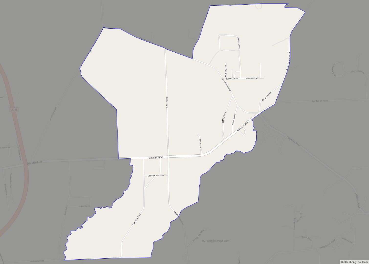
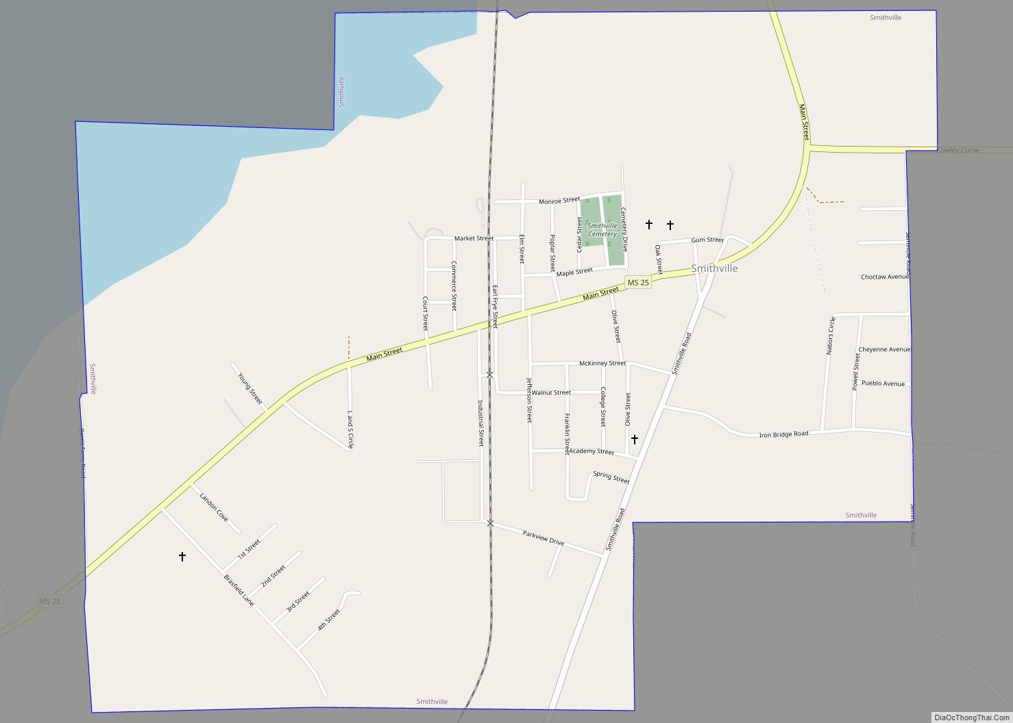
Online Interactive Map
Click on ![]() to view map in "full screen" mode.
to view map in "full screen" mode.
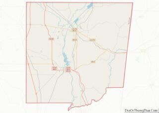
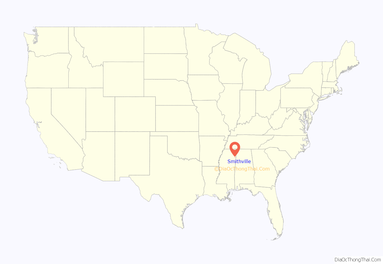
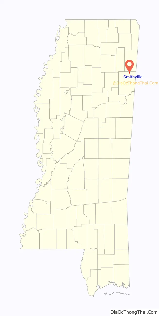
Smithville location map. Where is Smithville town?
History
Smithville is located on lands purchased from Chickasaw chief Che-lah-cha-chubby in 1836. The town is named for William Smith, an early settler who established a store at the site around 1840. The town was incorporated in 1845.
2011 tornado
On April 27, 2011, at approximately 3:45 p.m. CDT, an EF5 tornado struck the town with winds which were estimated to have peaked at 205 mph (330 km/h). A total of 16 people were killed, and 40 people were injured. In total, 117 structures were destroyed and 50 more sustained major damage from the storm in Monroe County alone, before the tornado continued into Itawamba County. In Smithville, an SUV was lofted and thrown a half mile into the water tower, making a dent. Before being carried even further downwind. Other damage included the complete destruction of the city hall, post office, police station, and four churches, along with appliances and plumbing fixtures being shredded or ripped away from foundations and numerous granite tombstones being knocked down.
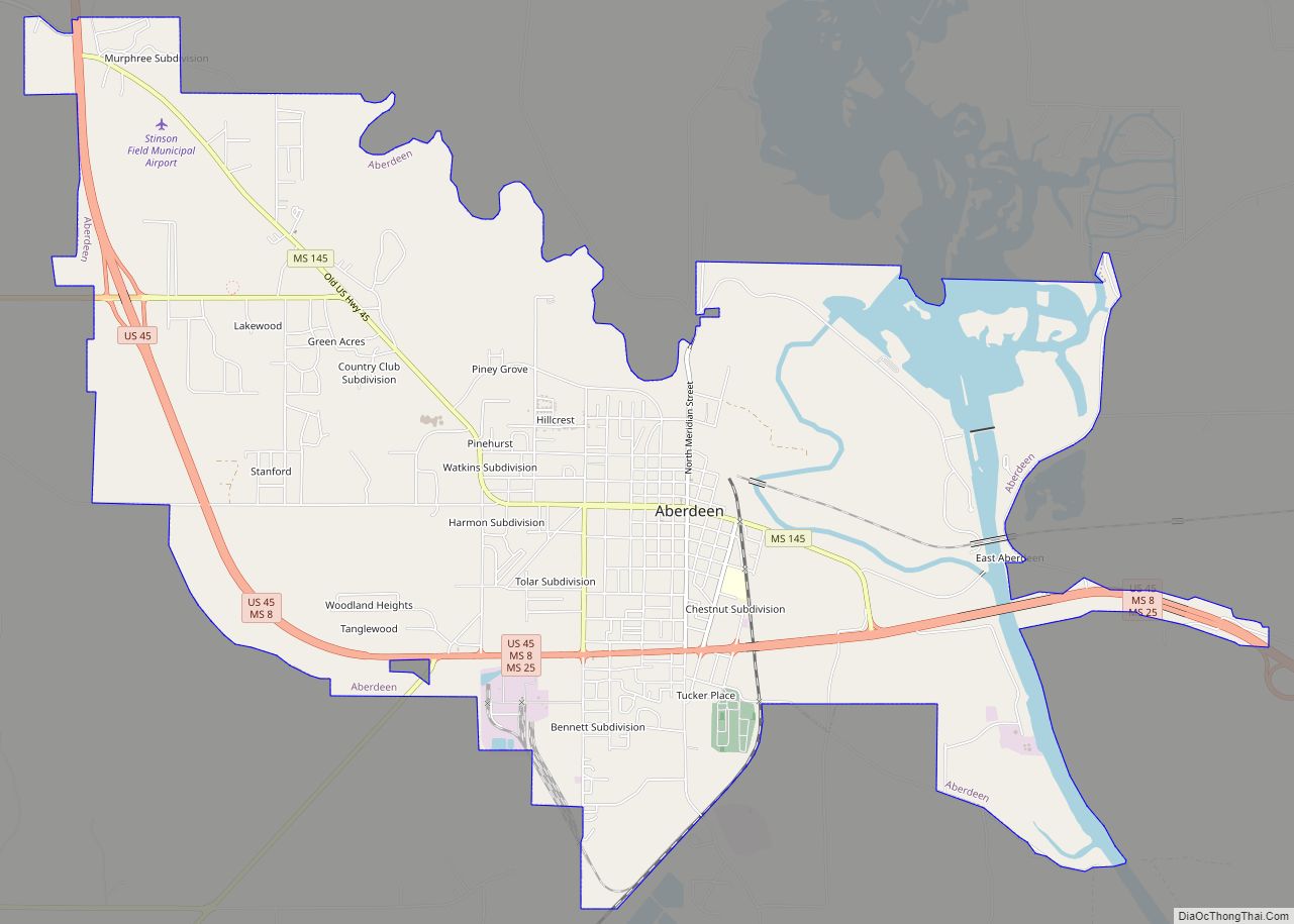
Smithville Road Map
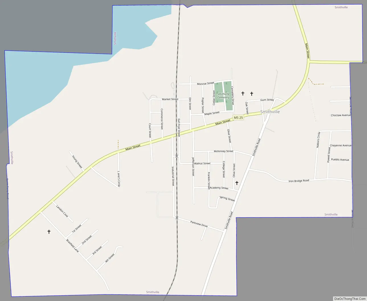
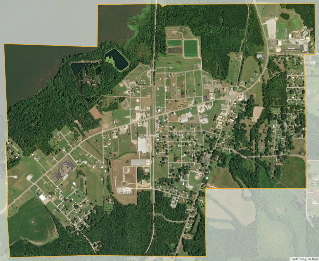
Smithville city Satellite Map
Geography
Smithville is located at 34°4′7″N 88°23′44″W / 34.06861°N 88.39556°W / 34.06861; -88.39556 (34.068605, -88.395486). The town is situated along the east bank of Tennessee-Tombigbee Waterway in northern Monroe County. The waterway’s Glover Wilkins Lock is located just downstream. Mississippi Highway 25 traverses Smithville, connecting the town with Fulton to the north and Amory to the south.
According to the United States Census Bureau, the town has a total area of 1.6 square miles (4.1 km), of which 1.5 square miles (3.9 km) is land and 0.1 square miles (0.26 km) (8.12%) is water.
See also
Map of Mississippi State and its subdivision:- Adams
- Alcorn
- Amite
- Attala
- Benton
- Bolivar
- Calhoun
- Carroll
- Chickasaw
- Choctaw
- Claiborne
- Clarke
- Clay
- Coahoma
- Copiah
- Covington
- Desoto
- Forrest
- Franklin
- George
- Greene
- Grenada
- Hancock
- Harrison
- Hinds
- Holmes
- Humphreys
- Issaquena
- Itawamba
- Jackson
- Jasper
- Jefferson
- Jefferson Davis
- Jones
- Kemper
- Lafayette
- Lamar
- Lauderdale
- Lawrence
- Leake
- Lee
- Leflore
- Lincoln
- Lowndes
- Madison
- Marion
- Marshall
- Monroe
- Montgomery
- Neshoba
- Newton
- Noxubee
- Oktibbeha
- Panola
- Pearl River
- Perry
- Pike
- Pontotoc
- Prentiss
- Quitman
- Rankin
- Scott
- Sharkey
- Simpson
- Smith
- Stone
- Sunflower
- Tallahatchie
- Tate
- Tippah
- Tishomingo
- Tunica
- Union
- Walthall
- Warren
- Washington
- Wayne
- Webster
- Wilkinson
- Winston
- Yalobusha
- Yazoo
- Alabama
- Alaska
- Arizona
- Arkansas
- California
- Colorado
- Connecticut
- Delaware
- District of Columbia
- Florida
- Georgia
- Hawaii
- Idaho
- Illinois
- Indiana
- Iowa
- Kansas
- Kentucky
- Louisiana
- Maine
- Maryland
- Massachusetts
- Michigan
- Minnesota
- Mississippi
- Missouri
- Montana
- Nebraska
- Nevada
- New Hampshire
- New Jersey
- New Mexico
- New York
- North Carolina
- North Dakota
- Ohio
- Oklahoma
- Oregon
- Pennsylvania
- Rhode Island
- South Carolina
- South Dakota
- Tennessee
- Texas
- Utah
- Vermont
- Virginia
- Washington
- West Virginia
- Wisconsin
- Wyoming