Starkville is a city in, and the county seat of, Oktibbeha County, Mississippi, United States. Mississippi State University is a land-grant institution and is located partially in Starkville but primarily in an adjacent unincorporated area designated by the United States Census Bureau as Mississippi State, Mississippi. The population was 25,653 in 2019. Starkville is the most populous city of the Golden Triangle region of Mississippi. The Starkville micropolitan statistical area includes all of Oktibbeha County.
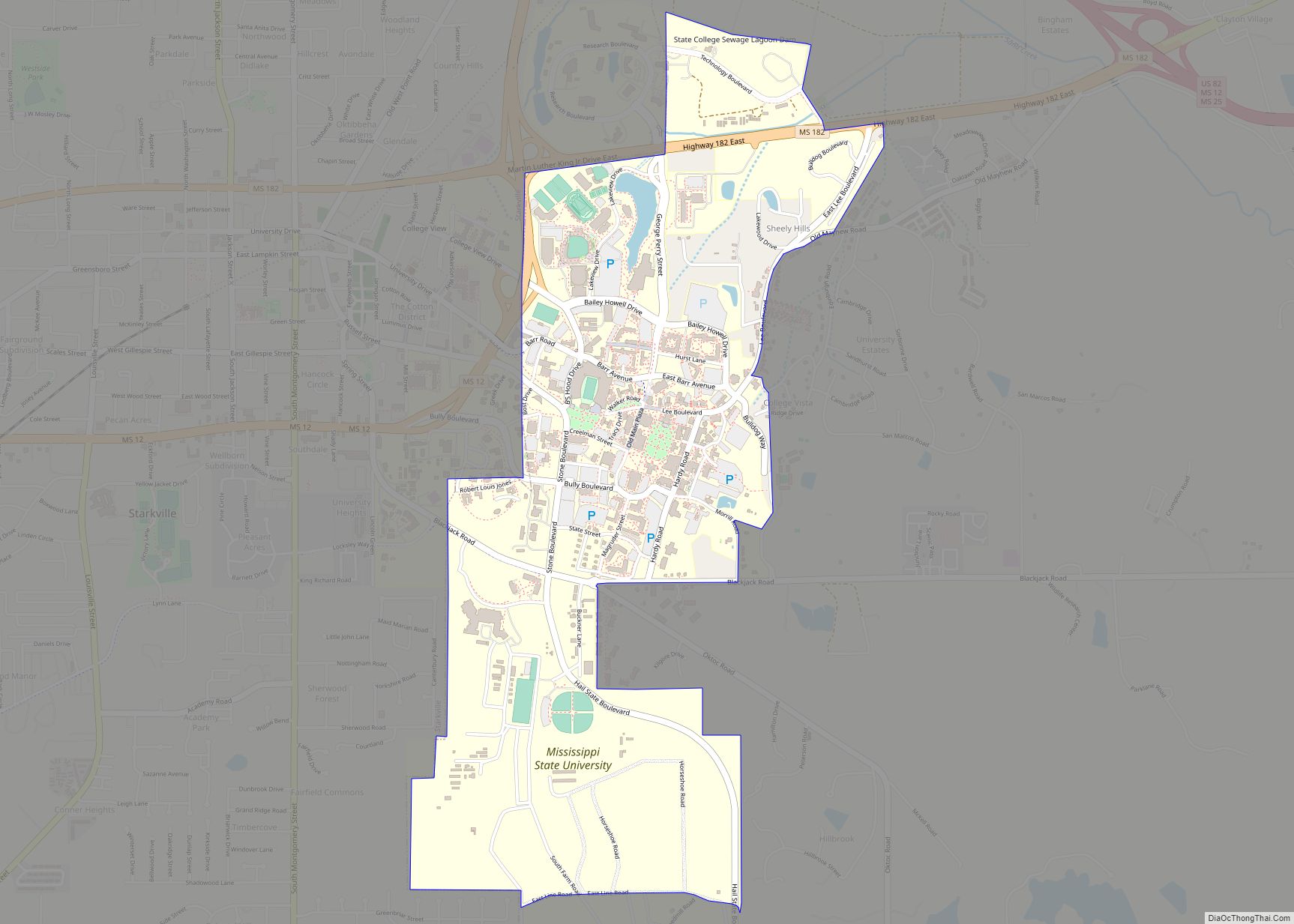
The growth and development of Mississippi State in recent decades has made Starkville a marquee American college town. College students and faculty have created a ready audience for several annual art and entertainment events such as the Cotton District Arts Festival, Super Bulldog Weekend, and Bulldog Bash. The Cotton District, North America’s oldest new urbanist community, is an active student quarter and entertainment district located halfway between Downtown Starkville and the Mississippi State University campus.
| Name: | Starkville city |
|---|---|
| LSAD Code: | 25 |
| LSAD Description: | city (suffix) |
| State: | Mississippi |
| County: | Oktibbeha County |
| Elevation: | 335 ft (102 m) |
| Total Area: | 25.62 sq mi (66.37 km²) |
| Land Area: | 25.51 sq mi (66.08 km²) |
| Water Area: | 0.11 sq mi (0.28 km²) |
| Total Population: | 24,360 |
| Population Density: | 954.77/sq mi (368.63/km²) |
| ZIP code: | 39759-39760 |
| Area code: | 662 |
| FIPS code: | 2870240 |
| GNISfeature ID: | 0678227 |
Online Interactive Map
Click on ![]() to view map in "full screen" mode.
to view map in "full screen" mode.
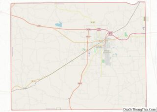
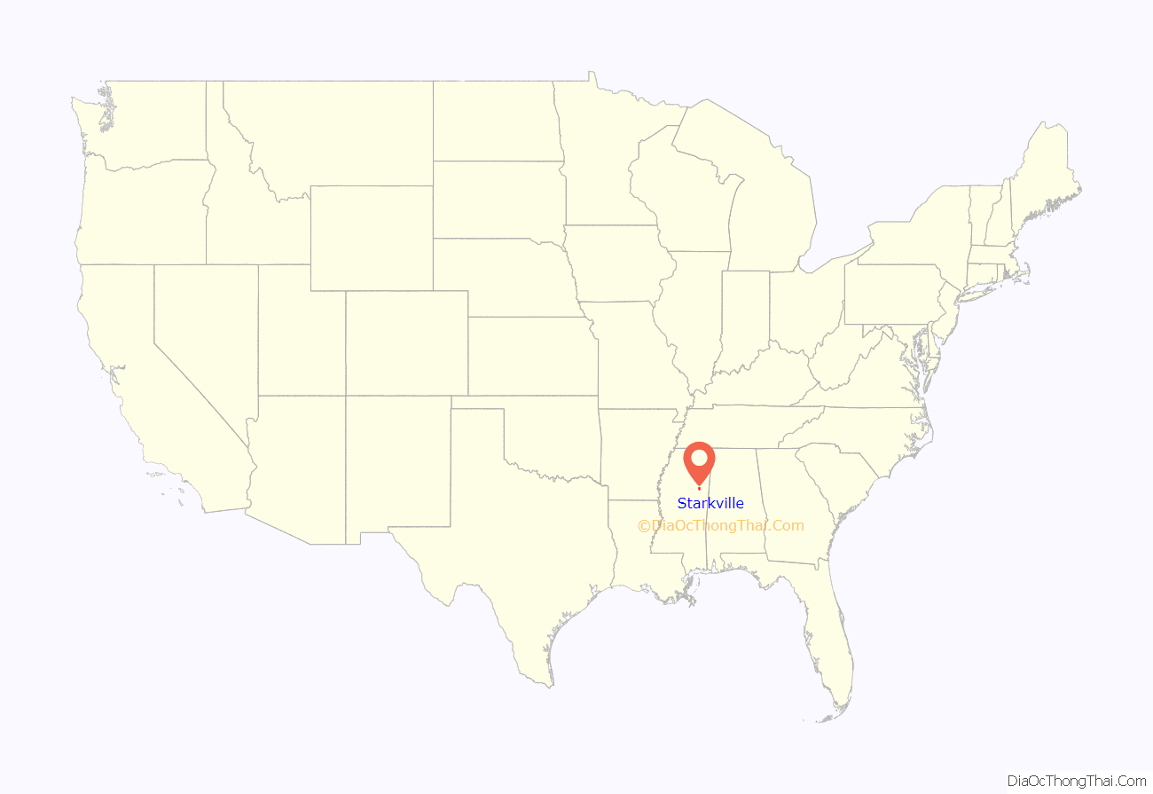
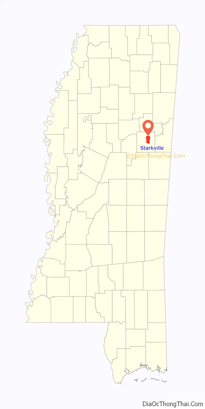
Starkville location map. Where is Starkville city?
History
The Starkville area has been inhabited for over 2,100 years. Artifacts in the form of clay pot fragments and artwork dating from that time period have been found east of Starkville at the Herman Mound and Village site, which is listed on the National Register of Historic Places. The village site can be accessed from the Indian Mound Campground. The earthwork mounds were made by early Native Americans of moundbuilder cultures as part of their religious and political cosmology.
Shortly before the American Revolutionary War period, the area was inhabited by the Choccuma (or Chakchiuma) tribe. They were annihilated about that time by a rare alliance between the Choctaw and Chickasaw peoples.
Early 19th century
The modern European-American settlement of the Starkville area was started after the Choctaw inhabitants of Oktibbeha County surrendered their claims to land in the area in the Treaty of Dancing Rabbit Creek in 1830. Most of the Native Americans of the Southeast were forced west of the Mississippi River during the 1830s and Indian Removal.
White settlers were drawn to the Starkville area because of two large springs, which Native Americans had used for thousands of years. A mill on the Big Black River southwest of town produced clapboards, giving the town its original name, Boardtown in 1834. The first court met in 1834 under a large tree. In 1835, when Boardtown was established as the county seat of Oktibbeha County, it was renamed as Starkville in honor of Revolutionary War hero General John Stark. A log courthouse and a one-room jailhouse were constructed in 1835. The jailhouse was unusual in that it had no doors or windows. Prisoners were made to climb a ladder to the roof and then let down through a trap door using a rope.
The first newspaper was founded in 1847. Originally titled The Starkville Whig, it was later renamed The Broad Ax.
Reconstruction to the 20th century
In 1865, during reconstruction, the officer in charge of Starkville allowed a black man accused of raping a white girl to be lynched by running him down with hounds.
In 1875 a fire destroyed 52 buildings. The entire business district was destroyed.
A carpetbagger named McLaughlin, who served as the local head of the Freedmen’s Bureau, assisted in the establishment of a black Methodist church and established a cooperative store for blacks in his home. This enraged the white citizens so the Klan attacked the store.
On May 5, 1879, two black men who had been accused of burning a barn, Nevlin Porter and Johnson Spencer, were taken from the jail by a mob of men and hung from crossties of the Mobile and Ohio Railroad.
In 1888, a mob hanged an African-American man, Eli Bryant, for an alleged attack on a white woman.
Several newspapers were founded in this time period, including The Starkville News in 1891. Early banks included The Peoples Bank in 1889 and Security State Bank in 1896.
A yellow fever epidemic in 1898 resulted in a quarantine of Starkville’s railroads by the towns of West Point, Columbus, Artesia and Kosciusko. This resulted in a depletion of medical and other supplies which ultimately resulted in intervention by the state.
20th century
Before the Civil War, Colonel Montgomery imported cattle from the isle of Jersey, initiating the areas prominence as a dairy center. In 1912, the co-operative creamery was created, and in 1926 the Borden Condensary was established.
In April 1912, Gabe (sometimes reported as Abe) Coleman, an African-American man was accused of attacking a farmer’s wife and was shot to death by a mob. Nine men were tried for the murder. In February 1912, another African-American man, Mann Hamilton, was murdered by a mob for allegedly attacking a woman. Following an incident in which whites fired into a Republican Meeting at a church in Chapel Hill, Mississippi, killing a black man, a group of black men planned a march in Starkville. They were met at a bridge near the A & M dairy barn by white men from Starkville and West Point armed with cannon loaded with buckshot and iron.
In 1915, two African-American men, Dit Seals and Peter Bolen, were hanged in a public execution while a crowd of 5,000, including blacks and whites, and children watched and sang There is a Land of Pure Delight. The crowd ate lunch while the execution was being conducted. Vendors were on hand selling popcorn, soda water and sandwiches. The men had been convicted of killing Willie Taylor, an African-American porter on the Mobile and Ohio Railroad. The story was widely reported as a “gala hanging” sponsored by the merchants of Starkville by various newspapers including the New York World and Chicago Tribune, while the Detroit Times described it as little better than a lynching.
In 1922, Starkville was the site of a large rally of the Ku Klux Klan.
In 1926 the Borden Condensery was established, the first condensery in the southern U.S. At the time, Starkville was served by two railroads, the Illinois Central and the Mobile and Ohio.
In 1970, several Black organizations organized a boycott or selective buying campaign. This was met with firebombings, and a crowd of African-Americans assembled near Henderson High School was broken up by gunfire.
21st century
On March 21, 2006, Starkville became the first city in Mississippi to adopt a smoking ban for indoor public places, including restaurants and bars. This ordinance went into effect on May 20, 2006.
In February 2018, Starkville denied a local LGBTQ organization a permit to host a pride parade. The organizers initiated legal action, after which the city reversed its decision. The parade was held in March 2018 with almost 3,000 attendees.
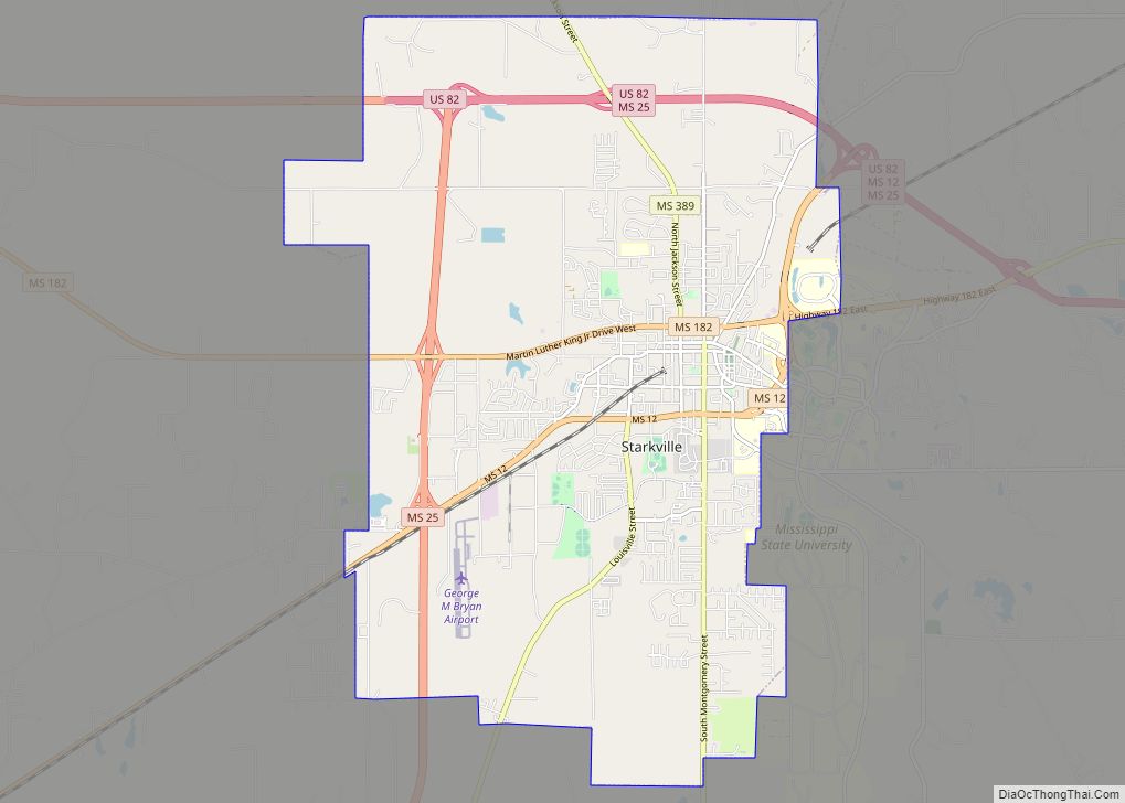
Starkville Road Map
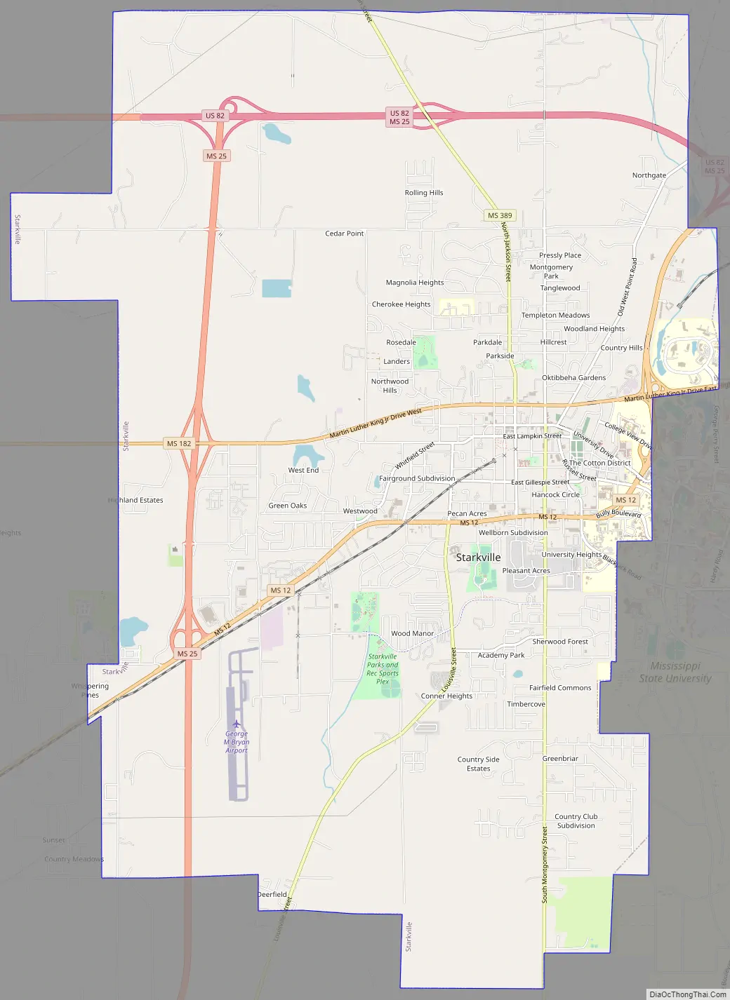
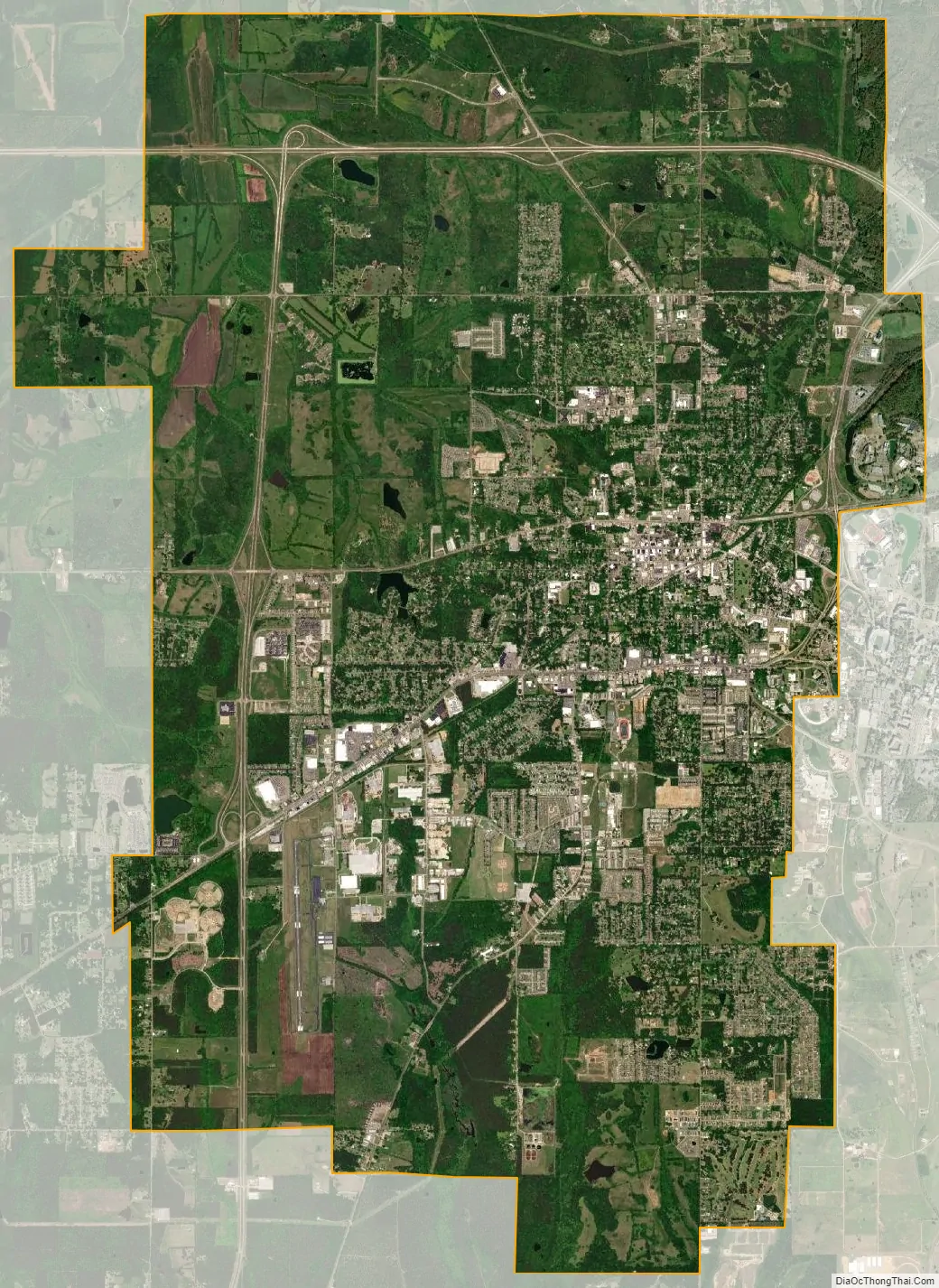
Starkville city Satellite Map
Geography
According to the United States Census Bureau, the city has a total area of 25.8 square miles (66.9 km²), of which 25.7 square miles (66.5 km) is land and 0.2 square miles (0.4 km) (0.58%) is water.
U.S. Route 82 and Mississippi Highways 12 and 25 are major roads through Starkville. US 82 runs east to west across the northern portion of the city as a bypass, leading east 25 mi (40 km) to Columbus and northwest 28 mi (45 km) to Eupora. Route 25 leads south 31 mi (50 km) to Louisville and Route 12 leads southwest 26 mi (42 km) to Ackerman. The nearest airport with scheduled service is Golden Triangle Regional Airport (GTR). George M. Bryan Field (KSTF) serves as Starkville’s general aviation airport. There are multiple privately owned airstrips in the area.
Climate
See also
Map of Mississippi State and its subdivision:- Adams
- Alcorn
- Amite
- Attala
- Benton
- Bolivar
- Calhoun
- Carroll
- Chickasaw
- Choctaw
- Claiborne
- Clarke
- Clay
- Coahoma
- Copiah
- Covington
- Desoto
- Forrest
- Franklin
- George
- Greene
- Grenada
- Hancock
- Harrison
- Hinds
- Holmes
- Humphreys
- Issaquena
- Itawamba
- Jackson
- Jasper
- Jefferson
- Jefferson Davis
- Jones
- Kemper
- Lafayette
- Lamar
- Lauderdale
- Lawrence
- Leake
- Lee
- Leflore
- Lincoln
- Lowndes
- Madison
- Marion
- Marshall
- Monroe
- Montgomery
- Neshoba
- Newton
- Noxubee
- Oktibbeha
- Panola
- Pearl River
- Perry
- Pike
- Pontotoc
- Prentiss
- Quitman
- Rankin
- Scott
- Sharkey
- Simpson
- Smith
- Stone
- Sunflower
- Tallahatchie
- Tate
- Tippah
- Tishomingo
- Tunica
- Union
- Walthall
- Warren
- Washington
- Wayne
- Webster
- Wilkinson
- Winston
- Yalobusha
- Yazoo
- Alabama
- Alaska
- Arizona
- Arkansas
- California
- Colorado
- Connecticut
- Delaware
- District of Columbia
- Florida
- Georgia
- Hawaii
- Idaho
- Illinois
- Indiana
- Iowa
- Kansas
- Kentucky
- Louisiana
- Maine
- Maryland
- Massachusetts
- Michigan
- Minnesota
- Mississippi
- Missouri
- Montana
- Nebraska
- Nevada
- New Hampshire
- New Jersey
- New Mexico
- New York
- North Carolina
- North Dakota
- Ohio
- Oklahoma
- Oregon
- Pennsylvania
- Rhode Island
- South Carolina
- South Dakota
- Tennessee
- Texas
- Utah
- Vermont
- Virginia
- Washington
- West Virginia
- Wisconsin
- Wyoming