Map of Bolton town

Map of Bolton town, Mississippi

Bolton is a town in Hinds County, Mississippi, United States. The population was 567 at the 2010 census, down from 629 at the 2000 census. It is part of the Jackson Metropolitan Statistical Area. Bolton town overview: Name: Bolton town LSAD Code: 43 LSAD Description: town (suffix) State: Mississippi County: Hinds County Elevation: 220 ft (67 m) … Read more

Map of Bogue Chitto CDP

Map of Bogue Chitto CDP

Bogue Chitto is a census-designated place (CDP) situated in Kemper and Neshoba counties, Mississippi. The population was 864 at the 2020 census. It is part of the Mississippi Band of Choctaw Indians Reservation and the population is 93% Choctaw. Bogue Chitto CDP overview: Name: Bogue Chitto CDP LSAD Code: 57 LSAD Description: CDP (suffix) State: … Read more

Map of Brandon city, Mississippi

Map of Brandon city, Mississippi

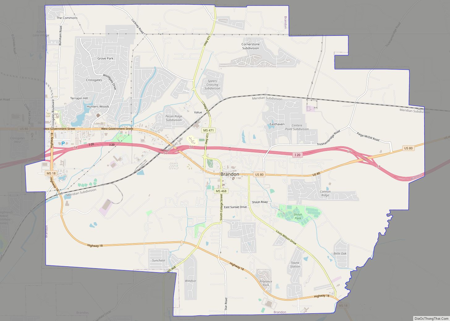
Brandon is a city in and the county seat of Rankin County, Mississippi, United States. It was incorporated on December 19, 1831. The population was 25,138 in the 2020 census. Brandon is part of the Jackson Metropolitan Statistical Area, and is located east of the state capital. Brandon city overview: Name: Brandon city LSAD Code: … Read more

Map of Boyle town

Map of Boyle town

Boyle is a town in Bolivar County, Mississippi, United States. The population was 650 at the 2010 census. Boyle town overview: Name: Boyle town LSAD Code: 43 LSAD Description: town (suffix) State: Mississippi County: Bolivar County Elevation: 141 ft (43 m) Total Area: 1.48 sq mi (3.82 km²) Land Area: 1.48 sq mi (3.82 km²) Water Area: 0.00 sq mi (0.00 km²) Total Population: 532 Population … Read more

Map of Booneville city, Mississippi

Map of Booneville city, Mississippi

Booneville /ˈbuːnvɪl/ is a city in the U.S. state of Mississippi and is the county seat of Prentiss County. It is located in the hilly North Mississippi region, and ecologically is part of the Southeastern Plains region. The city of Booneville is nicknamed “the City of Hospitality,” in reference to the town’s southern hospitality. The … Read more

Map of Bruce town

Map of Bruce town, Mississippi

Bruce is a town situated along the Skuna River in Calhoun County, Mississippi, United States. As of the 2010 census, it had a population of 1,939. Bruce town overview: Name: Bruce town LSAD Code: 43 LSAD Description: town (suffix) State: Mississippi County: Calhoun County Elevation: 276 ft (84 m) Total Area: 2.44 sq mi (6.31 km²) Land Area: 2.44 sq mi (6.31 km²) … Read more

Map of Brooksville town, Mississippi

Map of Brooksville town, Mississippi

Brooksville is a town in Noxubee County, Mississippi, United States. The population was 1,223 at the 2010 census. The Sam D. Hamilton Noxubee National Wildlife Refuge is located west of the town, and the Black Prairie Wildlife Management Area is located to the north. Brooksville town overview: Name: Brooksville town LSAD Code: 43 LSAD Description: … Read more

Map of Brookhaven city, Mississippi

Map of Brookhaven city, Mississippi

Brookhaven is a small city in Lincoln County, Mississippi, United States, 55 miles (89 km) south of the state capital of Jackson. The population was 11,674 people at the 2020 U.S. Census. It is the county seat of Lincoln County. It was named after the town of Brookhaven, New York, by founder Samuel Jayne in 1818. … Read more

Map of Bridgetown CDP

Map of Bridgetown CDP, Mississippi

Bridgetown is an unincorporated community and census-designated place (CDP) in Desoto County, Mississippi, United States. As of the 2010 census, it had a population of 1,742. Bridgetown is approximately 6 miles (10 km) east of Nesbit and 3.5 miles (5.6 km) south-southwest of Pleasant Hill. Bridgetown CDP overview: Name: Bridgetown CDP LSAD Code: 57 LSAD Description: CDP … Read more

Map of Braxton village

Map of Braxton village

Braxton is a village in Simpson County, Mississippi, United States. The village’s population was 181 at the 2000 census. It is part of the Jackson, Mississippi Metropolitan Statistical Area. Its zip code is 39044. Braxton village overview: Name: Braxton village LSAD Code: 47 LSAD Description: village (suffix) State: Mississippi County: Simpson County Elevation: 354 ft (108 m) … Read more

Map of Byram city, Mississippi

Map of Byram city, Mississippi

Byram (US: /ˈbaɪrəm/) is a city in Hinds County, Mississippi, United States. The population was 11,489 as of the 2010 census, up from 7,386 at the 2000 census, at which time it was an unincorporated census-designated place (CDP); in 2020, its population was 12,666. It is part of the Jackson metropolitan statistical area. It was … Read more

Map of Byhalia town

Map of Byhalia town

Byhalia /baɪˈheɪljə/ bye-HAIL-yə), is a town in Marshall County, Mississippi, United States. The population was 1,302 as of the 2010 census. Byhalia town overview: Name: Byhalia town LSAD Code: 43 LSAD Description: town (suffix) State: Mississippi County: Marshall County Elevation: 361 ft (110 m) Total Area: 7.19 sq mi (18.62 km²) Land Area: 7.17 sq mi (18.57 km²) Water Area: 0.02 sq mi (0.05 km²) Total … Read more