Booneville /ˈbuːnvɪl/ is a city in the U.S. state of Mississippi and is the county seat of Prentiss County. It is located in the hilly North Mississippi region, and ecologically is part of the Southeastern Plains region.
The city of Booneville is nicknamed “the City of Hospitality,” in reference to the town’s southern hospitality. The city flag, welcome sign, and city website bear the image of a magnolia blossom, a symbol of hospitality as well as the state flower of Mississippi. Booneville was incorporated in 1861 and named after R.H. Boone, a relative of Daniel Boone. The population was 8,743 at the 2010 census. It is one of 21 certified Mississippi retirement cities.
Booneville is home to Northeast Mississippi Community College, the tenth-largest community college by enrollment in the state.
| Name: | Booneville city |
|---|---|
| LSAD Code: | 25 |
| LSAD Description: | city (suffix) |
| State: | Mississippi |
| County: | Prentiss County |
| Elevation: | 518 ft (158 m) |
| Total Area: | 25.79 sq mi (66.79 km²) |
| Land Area: | 25.75 sq mi (66.70 km²) |
| Water Area: | 0.03 sq mi (0.09 km²) |
| Total Population: | 9,126 |
| Population Density: | 354.37/sq mi (136.82/km²) |
| ZIP code: | 38829 |
| Area code: | 662 |
| FIPS code: | 2807780 |
| GNISfeature ID: | 0667440 |
| Website: | www.visitbooneville.com |
Online Interactive Map
Click on ![]() to view map in "full screen" mode.
to view map in "full screen" mode.
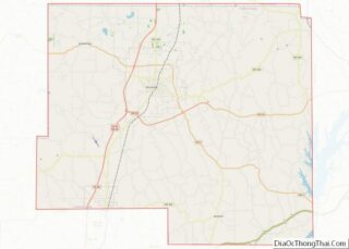
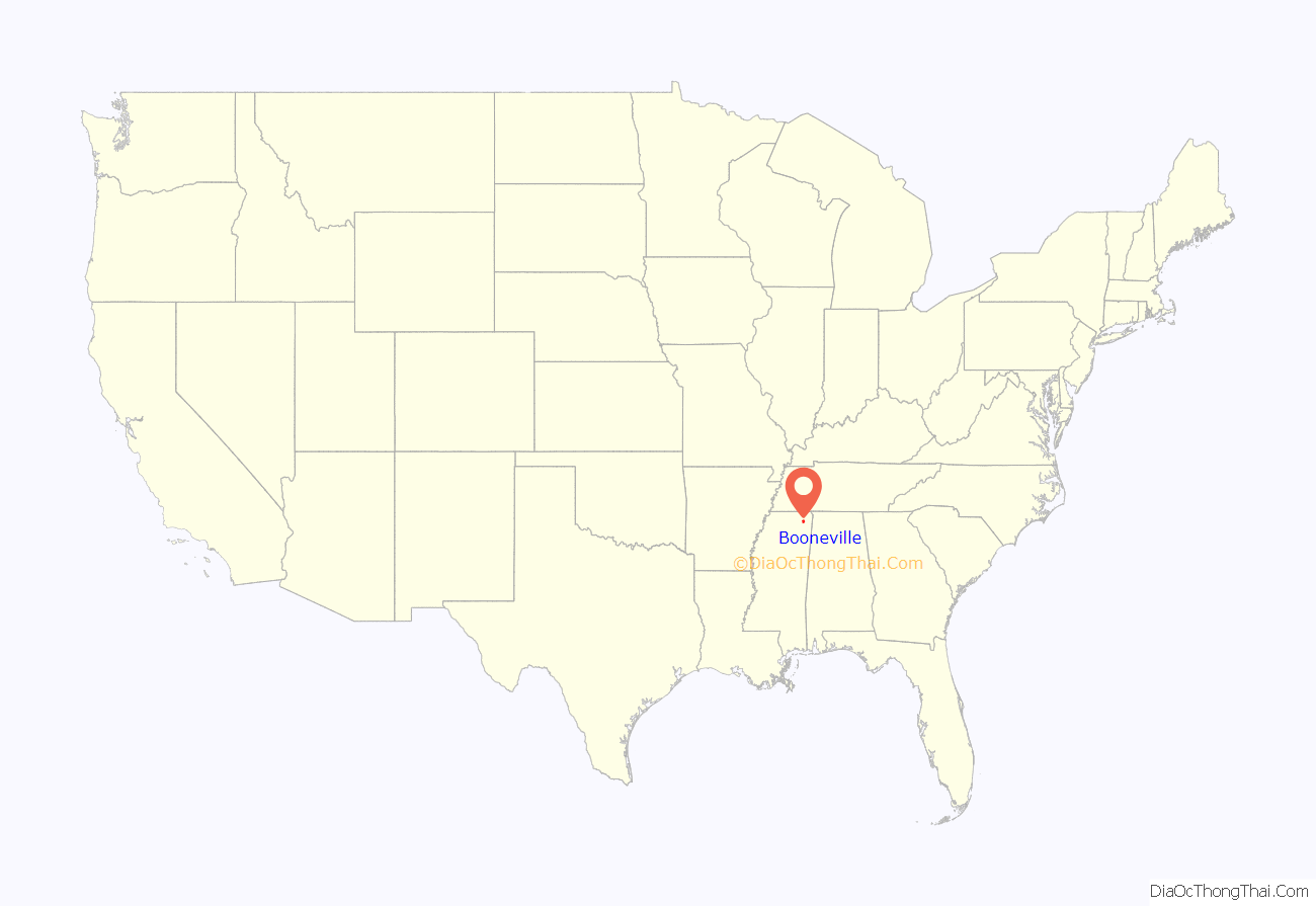
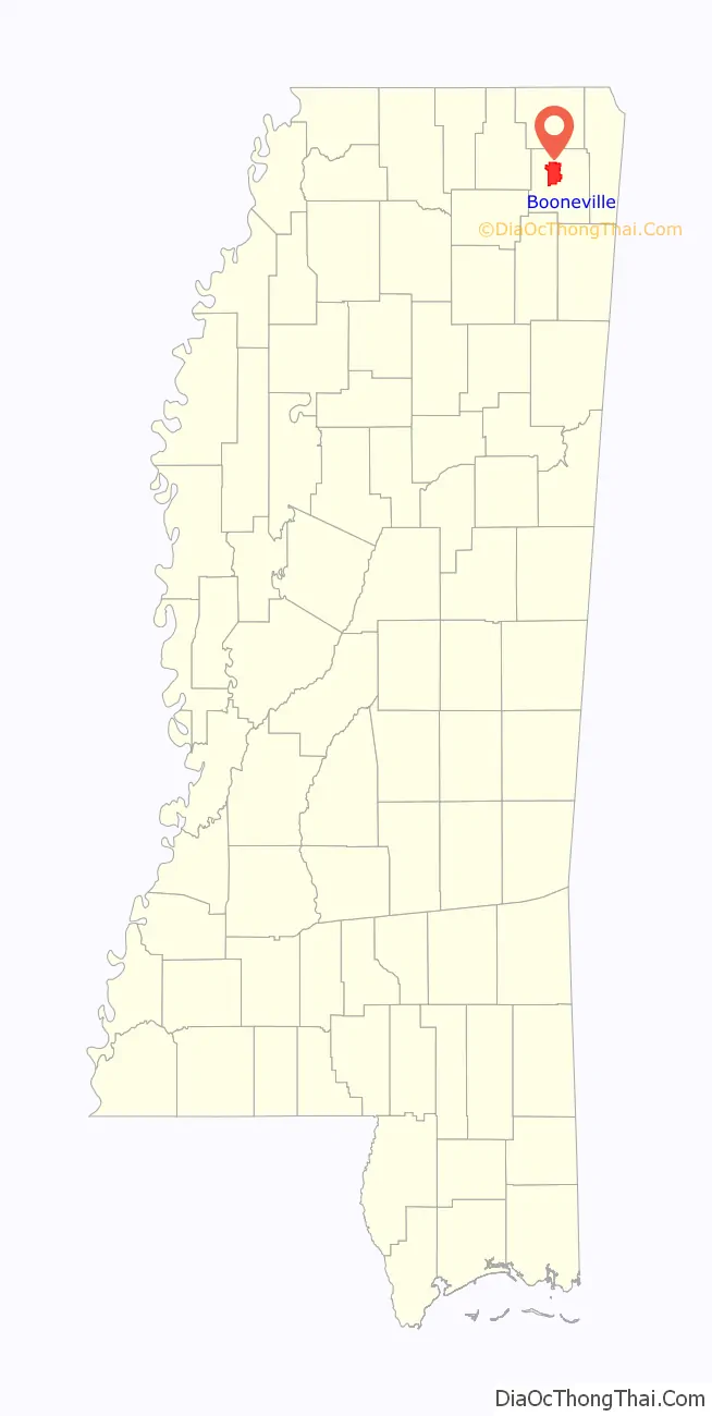
Booneville location map. Where is Booneville city?
History
The land of Booneville was bought by B.B. Boone, G.W. Williams, and W.P. Curlee from the Chickasaw tribesman Le-Ho-Yea. The community was named for settler Colonel Reuben Holman Boone, a relative of Daniel Boone, the early American pioneer. The city was initially planned in 1848 as part of the construction on the Mobile and Ohio Railroad. While the settlement grew rapidly in its early years, the American Civil War began just as the city incorporated in 1861 and slowed the city’s progress.
Civil War
The Mobile and Ohio Railroad that ran through Booneville was completed shortly before the Civil War began. It was converted to military use and became a critical military target. 184 miles of the line from Union City, Tennessee to Okolona, Mississippi would be totally destroyed by 1866, causing severe financial strain for the railroad even after it was eventually rebuilt.
On May 30, 1862, Col. Washington Lafayette Elliott of the 2nd Iowa Cavalry Regiment led a Union brigade to Booneville, where they destroyed the local depot and a large train loaded with munitions and captured 2,000 sick and wounded Confederates.
On June 28, 1862, Col. Philip Sheridan of the Union fortified a position in Booneville after hearing that the Confederates intended to move from Tupelo to Corinth in an attempt to recapture the rail junction there. Brig. Gen. James R. Chalmers of the Confederacy led 4,700 troops in an assault that pushed the Union troops to withdraw to a backup position 2 miles (3.2 km) closer to the town. The bulk of the Union force stayed on the defensive while Sheridan sent the 2nd Michigan Cavalry under Capt. Russell Alexander and the 2nd Iowa Cavalry under Lt. Col. Edward Hatch to attack the Confederate rear and left flank. It is estimated 65 of Chalmers’ men were killed; Federal casualties were one dead, 24 wounded, and 16 missing.
Korean War
On December 22, 1950, an explosion and fire at the Booneville Armory killed seven members of Company B, 198th Tank Battalion, a Mississippi Army National Guard unit. Their deaths are considered the first domestic casualties of the Korean War.
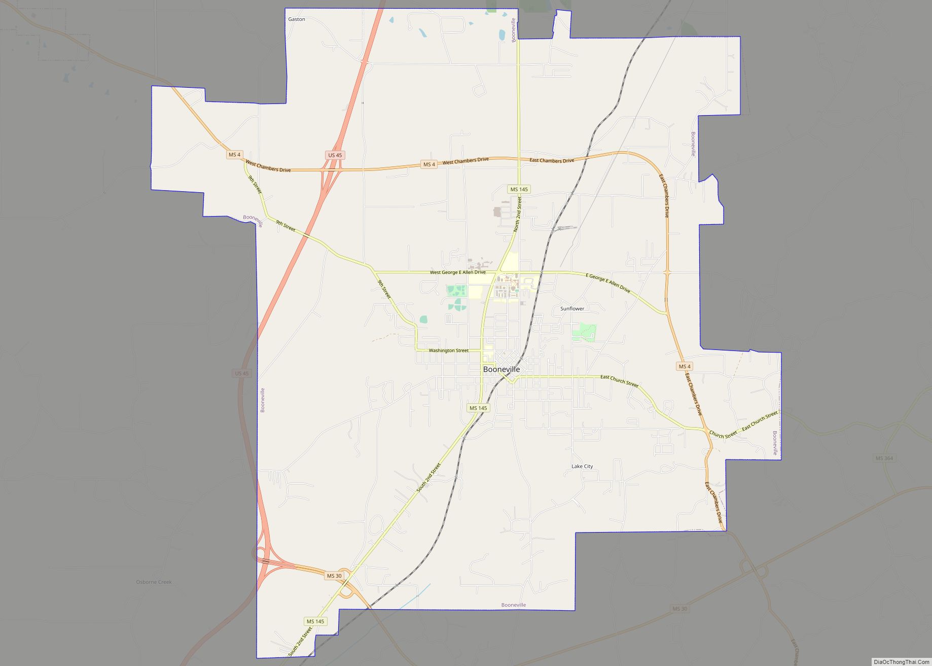
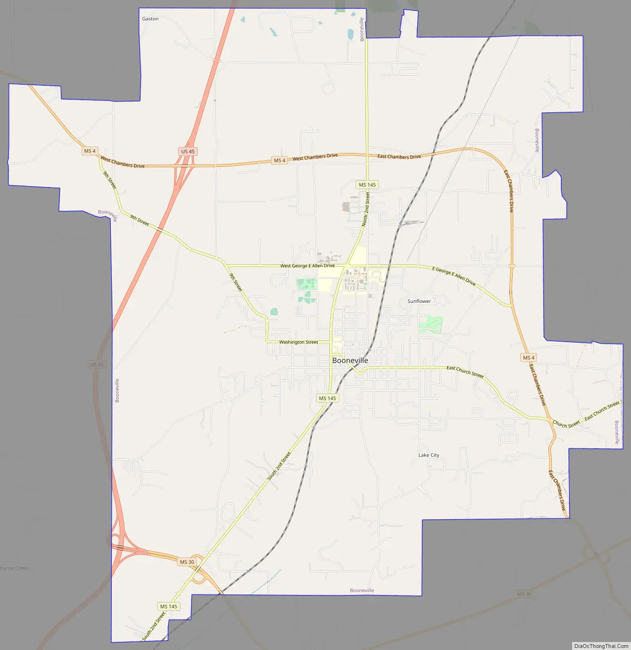
Booneville Road Map
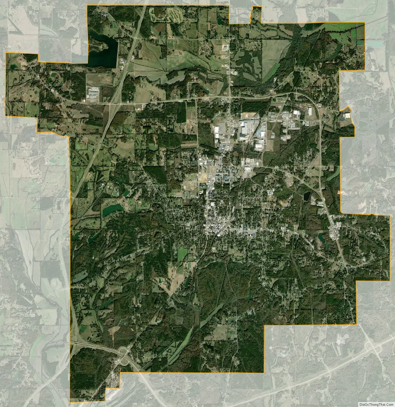
Booneville city Satellite Map
Geography
According to the United States Census Bureau, the city has a total area of 25.7 square miles (67 km), of which 25.7 square miles (67 km) is land and 0.04 square miles (0.10 km) (0.16%) is water. The city is concentrated along Mississippi Highway 145 between its intersections with Mississippi Highway 30 to the south and Mississippi Highway 4 to the north. U.S. Route 45 passes through western Booneville, connecting the city with Corinth and Tupelo.
Climate
Climate is characterized by relatively high temperatures and evenly distributed precipitation throughout the year. The Köppen Climate Classification subtype for this climate is “Cfa” (Humid Subtropical Climate).
See also
Map of Mississippi State and its subdivision:- Adams
- Alcorn
- Amite
- Attala
- Benton
- Bolivar
- Calhoun
- Carroll
- Chickasaw
- Choctaw
- Claiborne
- Clarke
- Clay
- Coahoma
- Copiah
- Covington
- Desoto
- Forrest
- Franklin
- George
- Greene
- Grenada
- Hancock
- Harrison
- Hinds
- Holmes
- Humphreys
- Issaquena
- Itawamba
- Jackson
- Jasper
- Jefferson
- Jefferson Davis
- Jones
- Kemper
- Lafayette
- Lamar
- Lauderdale
- Lawrence
- Leake
- Lee
- Leflore
- Lincoln
- Lowndes
- Madison
- Marion
- Marshall
- Monroe
- Montgomery
- Neshoba
- Newton
- Noxubee
- Oktibbeha
- Panola
- Pearl River
- Perry
- Pike
- Pontotoc
- Prentiss
- Quitman
- Rankin
- Scott
- Sharkey
- Simpson
- Smith
- Stone
- Sunflower
- Tallahatchie
- Tate
- Tippah
- Tishomingo
- Tunica
- Union
- Walthall
- Warren
- Washington
- Wayne
- Webster
- Wilkinson
- Winston
- Yalobusha
- Yazoo
- Alabama
- Alaska
- Arizona
- Arkansas
- California
- Colorado
- Connecticut
- Delaware
- District of Columbia
- Florida
- Georgia
- Hawaii
- Idaho
- Illinois
- Indiana
- Iowa
- Kansas
- Kentucky
- Louisiana
- Maine
- Maryland
- Massachusetts
- Michigan
- Minnesota
- Mississippi
- Missouri
- Montana
- Nebraska
- Nevada
- New Hampshire
- New Jersey
- New Mexico
- New York
- North Carolina
- North Dakota
- Ohio
- Oklahoma
- Oregon
- Pennsylvania
- Rhode Island
- South Carolina
- South Dakota
- Tennessee
- Texas
- Utah
- Vermont
- Virginia
- Washington
- West Virginia
- Wisconsin
- Wyoming