Map of Chamois city

Map of Chamois city

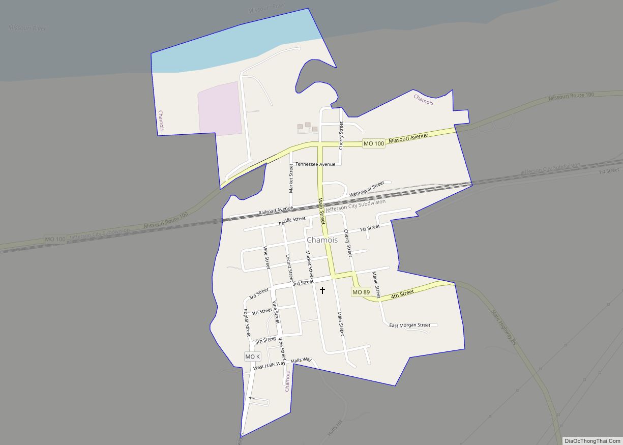
Chamois is a city in Osage County, Missouri, United States. The population was 377 at the 2020 census. It is part of the Jefferson City, Missouri Metropolitan Statistical Area. Chamois city overview: Name: Chamois city LSAD Code: 25 LSAD Description: city (suffix) State: Missouri County: Osage County Founded: 1856 Elevation: 535 ft (163 m) Total Area: 0.40 sq mi … Read more

Map of Chain of Rocks village

Map of Chain of Rocks village

Chain of Rocks is a village in Lincoln County, Missouri, United States. The population was 93 at the 2010 census. Chain of Rocks village overview: Name: Chain of Rocks village LSAD Code: 47 LSAD Description: village (suffix) State: Missouri County: Lincoln County Elevation: 479 ft (146 m) Total Area: 0.19 sq mi (0.49 km²) Land Area: 0.18 sq mi (0.48 km²) Water Area: … Read more

Map of Charmwood town

Map of Charmwood town

Charmwood is a town in Franklin County, Missouri, United States. The population was estimated at 31 in 2019. The town was incorporated as a result of issues with the Charmwood Subdivision’s water and sewer systems. Incorporation allowed the new town to apply for grants from the USDA to upgrade these systems. Charmwood town overview: Name: … Read more

Map of Charleston city, Missouri

Map of Charleston city, Missouri

Charleston is a city in Mississippi County, Missouri, United States. The population was 5,056 at the 2020 census. It is the county seat of Mississippi County. It is a home to a local correctional facility. Charleston city overview: Name: Charleston city LSAD Code: 25 LSAD Description: city (suffix) State: Missouri County: Mississippi County Elevation: 322 ft … Read more

Map of Charlack city

Map of Charlack city

Charlack is a city in St. Louis County, Missouri, United States. The population was 1,304 at the 2020 census. Charlack city overview: Name: Charlack city LSAD Code: 25 LSAD Description: city (suffix) State: Missouri County: St. Louis County Elevation: 600 ft (200 m) Total Area: 0.27 sq mi (0.70 km²) Land Area: 0.27 sq mi (0.70 km²) Water Area: 0.00 sq mi (0.00 km²) Total Population: … Read more

Map of Chesterfield city, Missouri

Map of Chesterfield city, Missouri

Chesterfield is a city in St. Louis County, Missouri, United States. It is a western suburb of St. Louis. As of the 2020 census, the population was 49,999, making it the state’s fourteenth-largest city. The broader valley of Chesterfield was originally referred to as “Gumbo Flats”, derived from its soil, which though very rich and … Read more

Map of Chesapeake CDP

Map of Chesapeake CDP, Missouri

Chesapeake is an unincorporated community and census-designated place in Lawrence County, Missouri, United States. It is located on Route 174, approximately five miles east of Mount Vernon. Chesapeake currently houses a fish hatchery, operated by the Missouri Department of Conservation. A post office called Chesapeake was established in 1850, and remained in operation until 1914. … Read more

Map of Cherokee Pass CDP

Map of Cherokee Pass CDP

Cherokee Pass is an unincorporated community and census-designated place in Madison County, Missouri, United States. Cherokee Pass is located on U.S. Route 67, approximately four miles south of Fredericktown. Cherokee Pass CDP overview: Name: Cherokee Pass CDP LSAD Code: 57 LSAD Description: CDP (suffix) State: Missouri County: Madison County Elevation: 955 ft (291 m) Total Area: 2.09 sq mi … Read more

Map of Chula city

Map of Chula city

Chula is a city in Livingston County, Missouri, United States. The population was 195 at the 2020 census. Chula city overview: Name: Chula city LSAD Code: 25 LSAD Description: city (suffix) State: Missouri County: Livingston County Elevation: 761 ft (232 m) Total Area: 0.18 sq mi (0.46 km²) Land Area: 0.18 sq mi (0.46 km²) Water Area: 0.00 sq mi (0.00 km²) Total Population: 195 Population … Read more

Map of Chillicothe city, Missouri

Map of Chillicothe city, Missouri

Chillicothe is a city in the state of Missouri and the county seat of Livingston County, Missouri, United States. The population was 9,107 at the 2020 census. The name “Chillicothe” is Shawnee for “big town”, and was named after their principal town Chillicothe, located since 1774 about a mile from the present-day city of Chillicothe, … Read more

Map of Chilhowee town

Map of Chilhowee town

Chilhowee is a village in south central Johnson County, Missouri, United States. It is situated along Missouri Route 2. The population was 325 at the 2010 census. Chilhowee town overview: Name: Chilhowee town LSAD Code: 43 LSAD Description: town (suffix) State: Missouri County: Johnson County Elevation: 922 ft (281 m) Total Area: 0.36 sq mi (0.93 km²) Land Area: 0.36 sq mi … Read more

Map of Clarksburg city, Missouri

Map of Clarksburg city, Missouri

Clarksburg is a city in Moniteau County, Missouri, United States. The population was 334 at the 2010 census. It is part of the Jefferson City, Missouri Metropolitan Statistical Area. Clarksburg city overview: Name: Clarksburg city LSAD Code: 25 LSAD Description: city (suffix) State: Missouri County: Moniteau County Founded: 1884 Elevation: 906 ft (276 m) Total Area: 0.58 sq mi … Read more