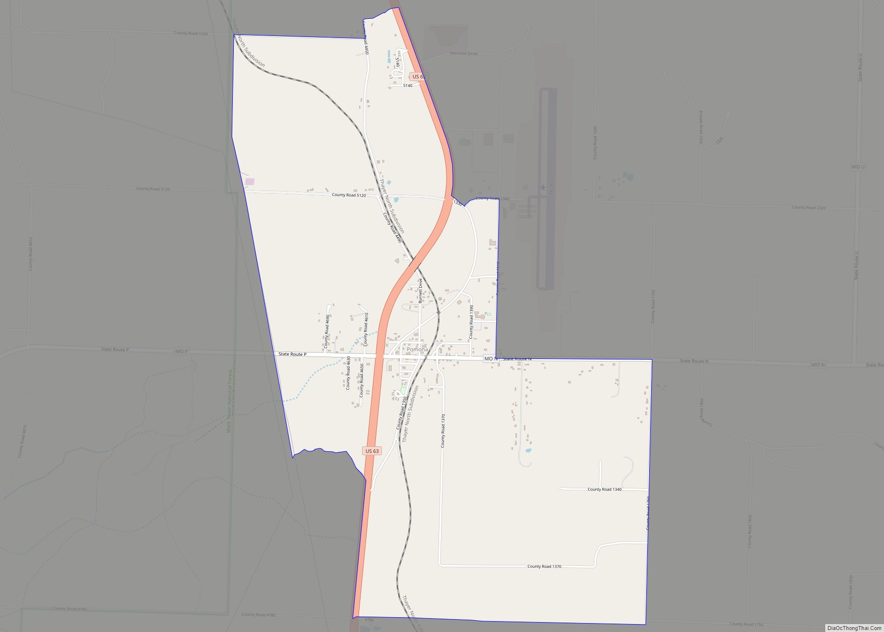
Map of Polo city, Missouri

Map of Polo city, Missouri

Polo is a city in southwest Caldwell County, Missouri, and is part of the Kansas City metropolitan area with the United States. The population was 509 at the 2020 census. Polo city overview: Name: Polo city LSAD Code: 25 LSAD Description: city (suffix) State: Missouri County: Caldwell County Elevation: 1,004 ft (306 m) Total Area: 0.62 sq mi (1.61 km²) … Read more

Map of Pontiac CDP, Missouri

Map of Pontiac CDP, Missouri

Pontiac is a census-designated place in southern Ozark County, Missouri, United States. It lies six miles south of Isabella and 18.5 miles southwest of Gainesville, on the northeast shore of Bull Shoals Lake. A post office called Pontiac has been in operation since 1887. The community was named in honor of the Ottawa Indian chief … Read more

Map of Portageville city

Map of Portageville city

Portageville is a city in New Madrid and Pemiscot counties in the U.S. state of Missouri. The population was 2,942 according to the 2020 Census. Portageville city overview: Name: Portageville city LSAD Code: 25 LSAD Description: city (suffix) State: Missouri County: New Madrid County, Pemiscot County Elevation: 282 ft (86 m) Total Area: 2.04 sq mi (5.28 km²) Land Area: … Read more

Map of Portage Des Sioux city

Map of Portage Des Sioux city

Portage Des Sioux is a city in St. Charles County, Missouri, United States. The town sits on the Mississippi River roughly opposite Elsah, Illinois, and is the home of the riverside shrine of Our Lady of the Rivers. The population was 328 at the 2010 census. The city was founded in 1799 by Spanish Lt. … Read more

Map of Poplar Bluff city

Map of Poplar Bluff city

Poplar Bluff is a city in Butler County in Southeast Missouri, United States. It is the county seat of Butler County and is known as “The Gateway to the Ozarks” among other names. The population was 16,225 at the 2020 census. The Poplar Bluff Micropolitan Statistical Area consists of all of Butler County. The city … Read more

Map of Prairie Home city

Map of Prairie Home city

Prairie Home is a town, with legal status as a city, in Cooper County, Missouri, United States. The population was 280 at the 2010 census. Prairie Home city overview: Name: Prairie Home city LSAD Code: 25 LSAD Description: city (suffix) State: Missouri County: Cooper County Elevation: 892 ft (272 m) Total Area: 0.39 sq mi (1.00 km²) Land Area: 0.39 sq mi … Read more

Map of Powersville village

Map of Powersville village

Powersville is a village in northwest Putnam County, Missouri, United States. The population was 42 at the 2020 census. Powersville village overview: Name: Powersville village LSAD Code: 47 LSAD Description: village (suffix) State: Missouri County: Putnam County Elevation: 1,014 ft (309 m) Total Area: 0.57 sq mi (1.47 km²) Land Area: 0.56 sq mi (1.46 km²) Water Area: 0.00 sq mi (0.00 km²) Total Population: 42 … Read more

Map of Potosi city

Map of Potosi city, Missouri

Potosi is a city in Washington County, Missouri, United States. Potosi is seventy-two miles southwest of St. Louis. The population was 2,660 as of the 2010 census. It is the county seat of Washington County. Located in the Lead Belt, the city was founded in 1763 by French colonists as ” Mine à Breton” or … Read more

Map of Princeton city, Missouri

Map of Princeton city, Missouri

Princeton is the county seat and largest city of Mercer County, Missouri, United States. The population was 1,007 at the 2020 census, down from the 2010 census, which counted 1,166 people. Princeton, Missouri was also the birthplace of the famous frontierswoman Calamity Jane. Princeton city overview: Name: Princeton city LSAD Code: 25 LSAD Description: city … Read more

Map of Preston village, Missouri

Map of Preston village, Missouri

Preston is a village in Hickory County, Missouri, United States. The population was 157 at the 2020 census. Preston village overview: Name: Preston village LSAD Code: 47 LSAD Description: village (suffix) State: Missouri County: Hickory County Elevation: 1,066 ft (325 m) Total Area: 0.75 sq mi (1.95 km²) Land Area: 0.75 sq mi (1.95 km²) Water Area: 0.00 sq mi (0.00 km²) Total Population: 157 Population … Read more

Map of Prathersville village

Map of Prathersville village

Prathersville is a village in Clay County, Missouri, United States. The population was 121 at the 2020 census. It is part of the Kansas City metropolitan area. Prathersville village overview: Name: Prathersville village LSAD Code: 47 LSAD Description: village (suffix) State: Missouri County: Clay County Elevation: 768 ft (234 m) Total Area: 2.25 sq mi (5.83 km²) Land Area: 2.25 sq mi … Read more

Map of Purdy city

Map of Purdy city, Missouri

Purdy is a city in Purdy Township, Barry County, Missouri, United States, on the foothills of the Ozarks, eight miles south of Monett and twelve miles north of Cassville along Highway 37. The population was 1,098 at the 2010 census. Purdy city overview: Name: Purdy city LSAD Code: 25 LSAD Description: city (suffix) State: Missouri … Read more