Potosi is a city in Washington County, Missouri, United States. Potosi is seventy-two miles southwest of St. Louis. The population was 2,660 as of the 2010 census. It is the county seat of Washington County.
Located in the Lead Belt, the city was founded in 1763 by French colonists as ” Mine à Breton” or Mine au Breton.” After the United States acquired this area, American Moses Austin renamed the community for the Bolivian silver-mining city of Potosí. He was involved in lead mining.
| Name: | Potosi city |
|---|---|
| LSAD Code: | 25 |
| LSAD Description: | city (suffix) |
| State: | Missouri |
| County: | Washington County |
| Incorporated: | 1826 |
| Elevation: | 991 ft (302 m) |
| Total Area: | 2.33 sq mi (6.03 km²) |
| Land Area: | 2.33 sq mi (6.03 km²) |
| Water Area: | 0.00 sq mi (0.00 km²) |
| Total Population: | 2,538 |
| Population Density: | 1,090.21/sq mi (420.86/km²) |
| ZIP code: | 63664 |
| Area code: | 573 |
| FIPS code: | 2959330 |
| GNISfeature ID: | 2396262 |
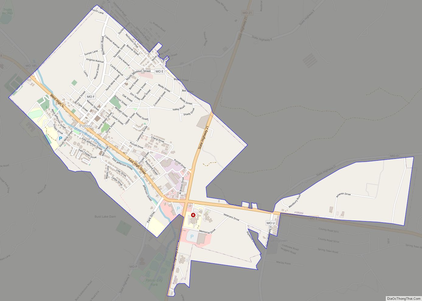
Online Interactive Map
Click on ![]() to view map in "full screen" mode.
to view map in "full screen" mode.
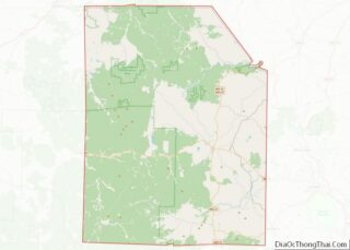
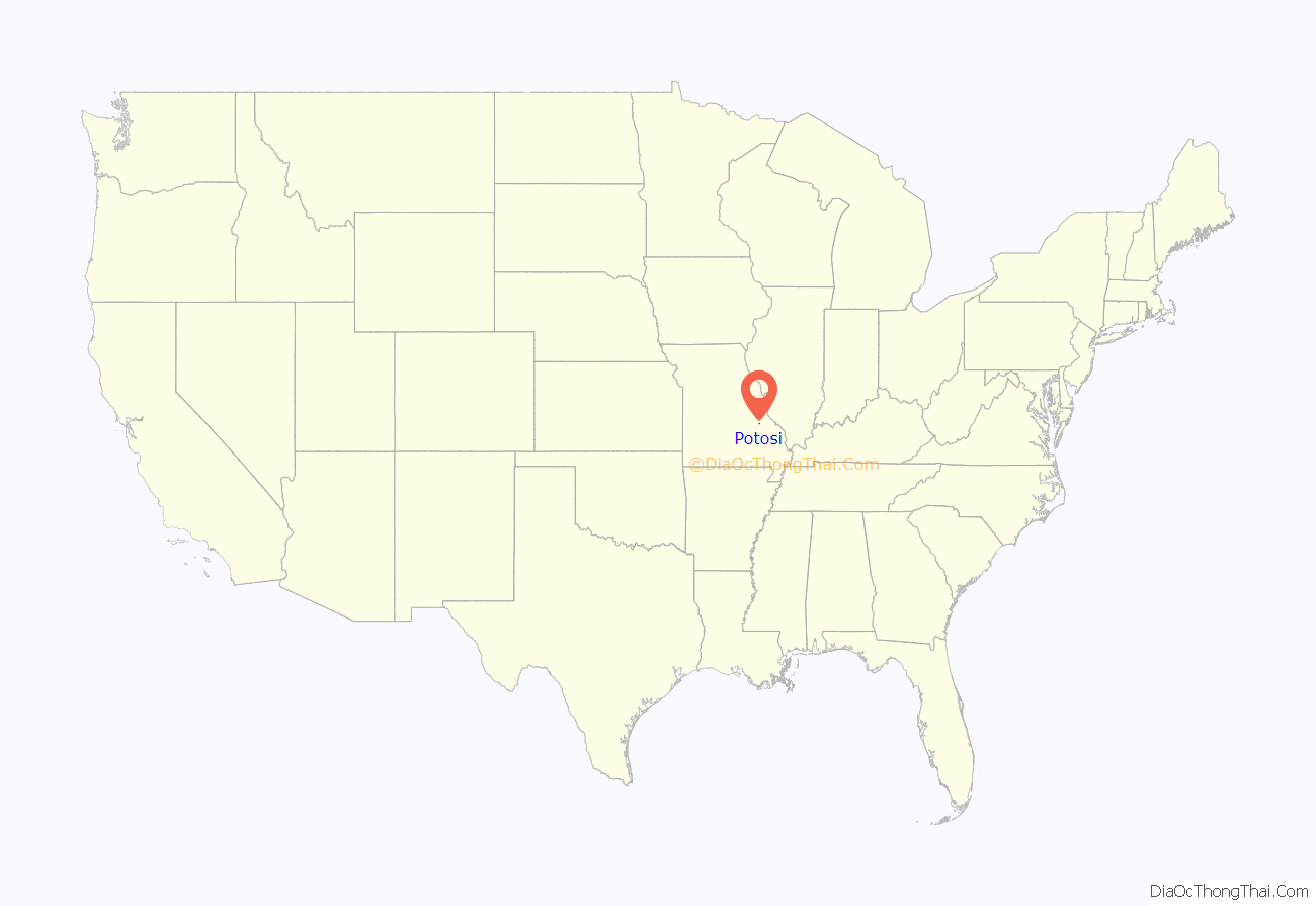
Potosi location map. Where is Potosi city?
History
A lead mining settlement at this spot, “Mine à Breton” or Mine au Breton, was founded between 1760 and 1780 by Francis Azor, of Brittany, France. Moses Austin came here in 1798 with his family, including his son Stephen F. Austin. Moses obtained a grant of 7,153 arpents of land from the Spanish Empire and started large-scale mining operations, building his town to support it. Moses named the town after Potosí in Bolivia, which was famous for its vast silver mines. Austin’s tomb and the foundation of his home Durham Hall can still be seen. Another mining entrepreneur in Potosi at the time of Moses Austin was James Bryan. Firmin Rene Desloge, who emigrated from Nantes, France in 1822 as the progenitor of the Desloge Family in America, located in Potosi and established a mercantile, distillery, fur trading and lead smelting business. The Desloge lead mining business Desloge Lead Company and later Desloge Consolidated Lead Company was later relocated to Bonne Terre, MO and also Desloge, MO by his son Firmin V. Desloge.
Potosi was designated county seat in 1814.
Potosi Is also home to the oldest standing Presbyterian church west of the Mississippi River. It is located on West Breton Street, also home to the graveyard that contains the tomb of Moses Austin and his wife Maria Brown Austin.
The Potosi Correctional Center, which opened in 1989, housed Missouri’s death row and the state’s executions were handled at the prison until 2005. The Potosi Center conducted all but one of the 62 Missouri executions between 1989 when capital punishment was reinstated and 2005 when executions were moved 25 miles east to the Eastern Reception, Diagnostic and Correctional Center in Bonne Terre, Missouri.
Woodcut artist Tom Huck grew up in Potosi, where he has taken inspiration from many of the region’s local legends and folk tales. In 1998, Huck released “2 Weeks in August: 14 Rural Absurdities”, a suite of 14 woodcut prints based on bizarre tales from the town’s history.
The George Cresswell Furnace, Palmer Historic Mining District, Washington County Courthouse, and Washington State Park CCC Historic District are listed on the National Register of Historic Places.
Potosi Road Map
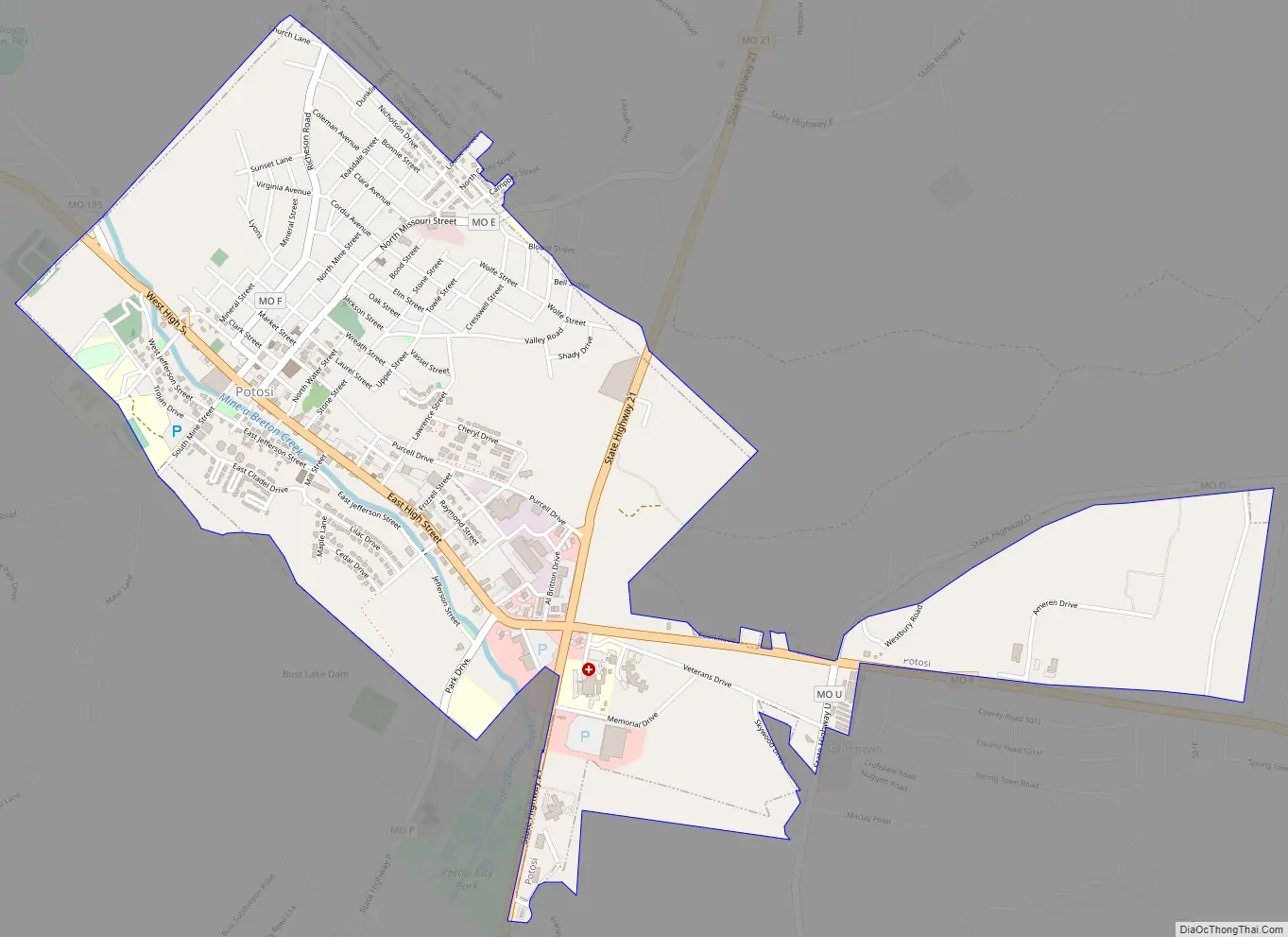
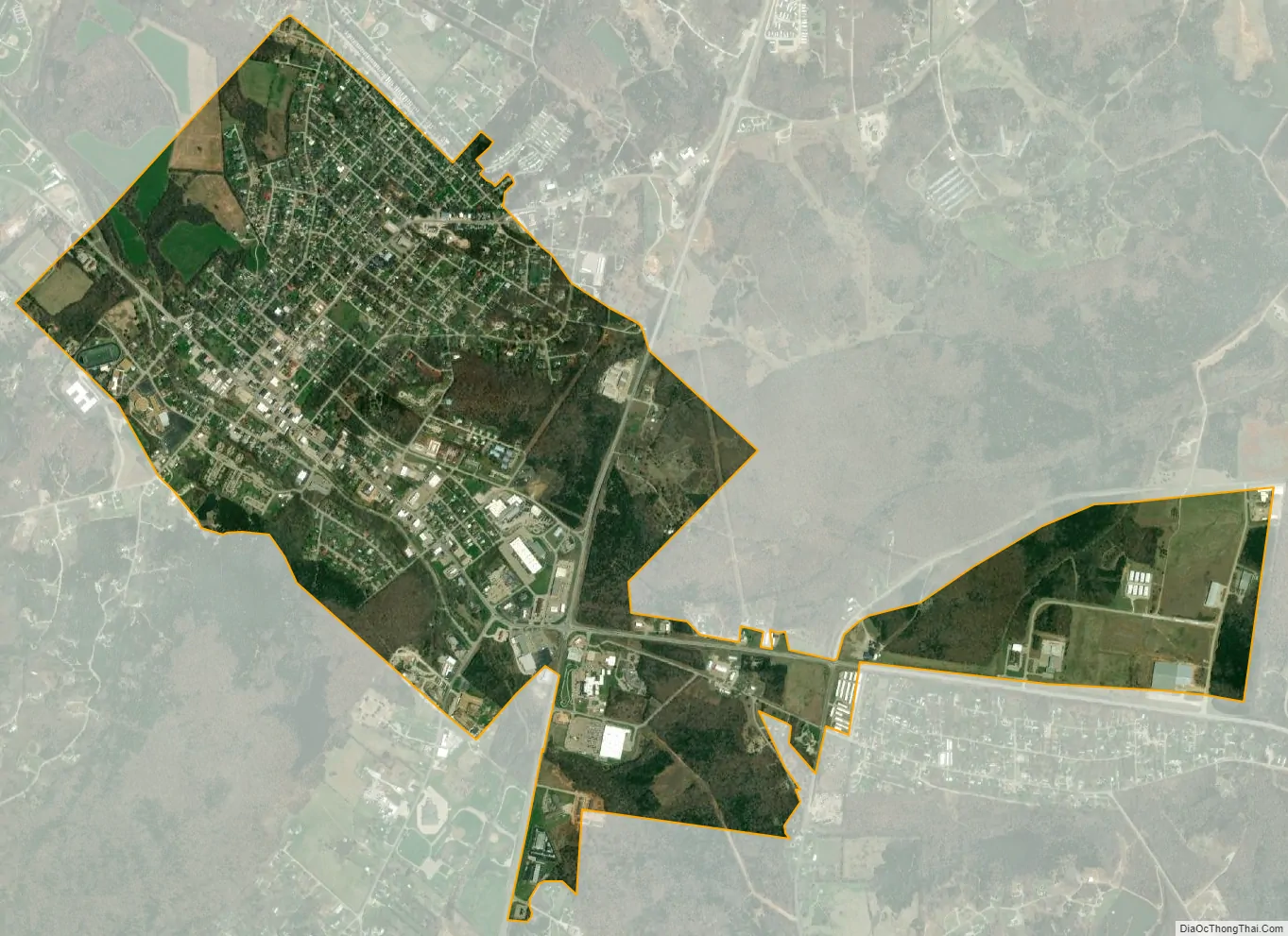
Potosi city Satellite Map
Geography
According to the United States Census Bureau, the city has a total area of 2.33 square miles (6.03 km), all land.
Potosi is located in the Lead Belt region of Missouri, as such, it has mining operations in the area. It is also geographically considered part of the St. Francois Mountain Range, meaning it has hilly terrain typical of the region.
The city is within close proximity to many nature areas including Mark Twain National Forest and Washington State Park.
Climate
See also
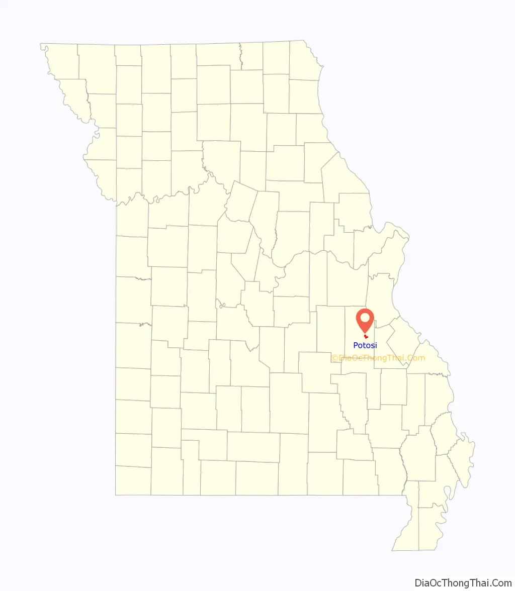
Map of Missouri State and its subdivision:- Adair
- Andrew
- Atchison
- Audrain
- Barry
- Barton
- Bates
- Benton
- Bollinger
- Boone
- Buchanan
- Butler
- Caldwell
- Callaway
- Camden
- Cape Girardeau
- Carroll
- Carter
- Cass
- Cedar
- Chariton
- Christian
- Clark
- Clay
- Clinton
- Cole
- Cooper
- Crawford
- Dade
- Dallas
- Daviess
- De Kalb
- Dent
- Douglas
- Dunklin
- Franklin
- Gasconade
- Gentry
- Greene
- Grundy
- Harrison
- Henry
- Hickory
- Holt
- Howard
- Howell
- Iron
- Jackson
- Jasper
- Jefferson
- Johnson
- Knox
- Laclede
- Lafayette
- Lawrence
- Lewis
- Lincoln
- Linn
- Livingston
- Macon
- Madison
- Maries
- Marion
- McDonald
- Mercer
- Miller
- Mississippi
- Moniteau
- Monroe
- Montgomery
- Morgan
- New Madrid
- Newton
- Nodaway
- Oregon
- Osage
- Ozark
- Pemiscot
- Perry
- Pettis
- Phelps
- Pike
- Platte
- Polk
- Pulaski
- Putnam
- Ralls
- Randolph
- Ray
- Reynolds
- Ripley
- Saint Charles
- Saint Clair
- Saint Francois
- Saint Louis
- Sainte Genevieve
- Saline
- Schuyler
- Scotland
- Scott
- Shannon
- Shelby
- Stoddard
- Stone
- Sullivan
- Taney
- Texas
- Vernon
- Warren
- Washington
- Wayne
- Webster
- Worth
- Wright
- Alabama
- Alaska
- Arizona
- Arkansas
- California
- Colorado
- Connecticut
- Delaware
- District of Columbia
- Florida
- Georgia
- Hawaii
- Idaho
- Illinois
- Indiana
- Iowa
- Kansas
- Kentucky
- Louisiana
- Maine
- Maryland
- Massachusetts
- Michigan
- Minnesota
- Mississippi
- Missouri
- Montana
- Nebraska
- Nevada
- New Hampshire
- New Jersey
- New Mexico
- New York
- North Carolina
- North Dakota
- Ohio
- Oklahoma
- Oregon
- Pennsylvania
- Rhode Island
- South Carolina
- South Dakota
- Tennessee
- Texas
- Utah
- Vermont
- Virginia
- Washington
- West Virginia
- Wisconsin
- Wyoming