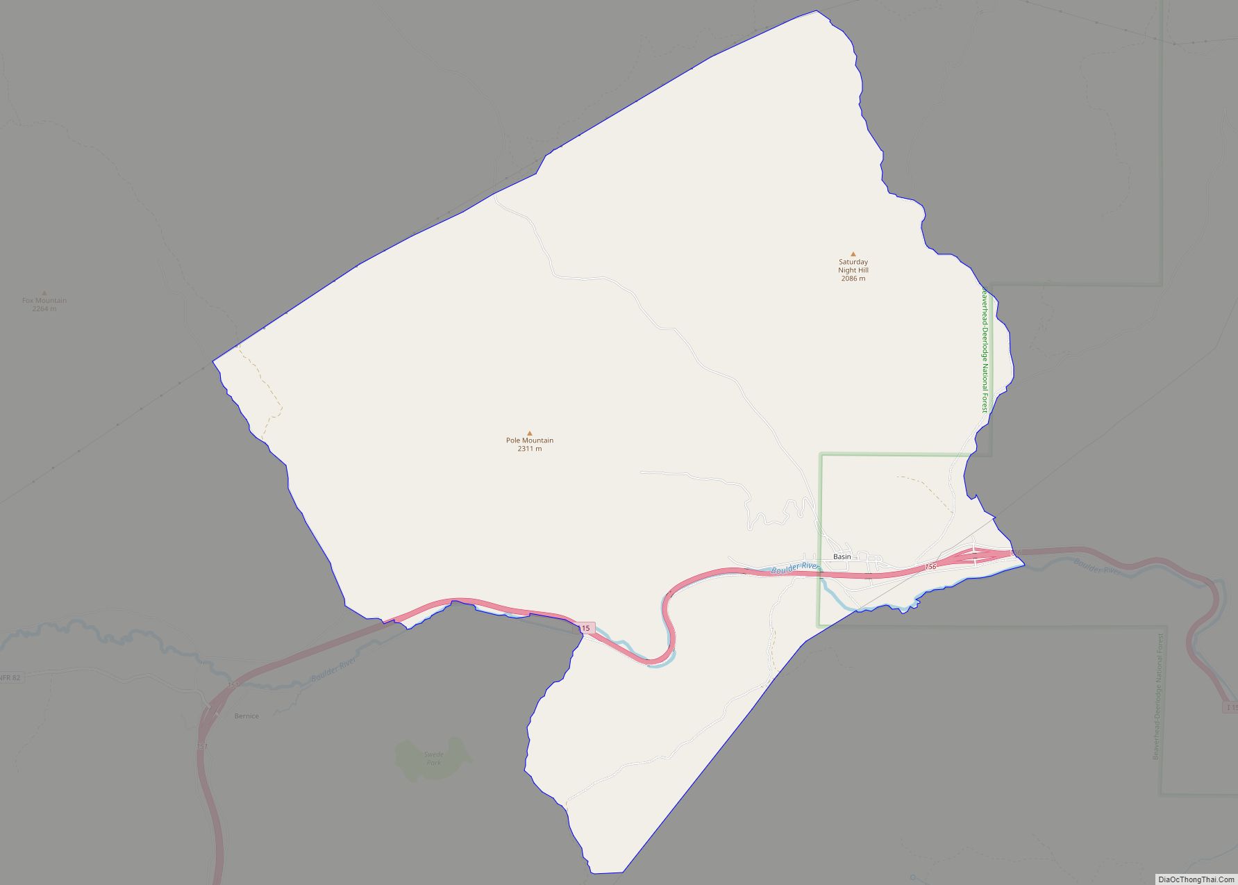
Map of Batavia CDP, Montana
Batavia is a census-designated place (CDP) in Flathead County, Montana, United States. The population was 385 at the 2010 census. U.S. Route 2 passes through town. It is 6 miles from Kalispell. Nearby is the Batavia Waterfowl Production Area. Batavia CDP overview: Name: Batavia CDP LSAD Code: 57 LSAD Description: CDP (suffix) State: Montana County: ... Read more
Map of Batavia CDP, Montana
Map of Belt town
Belt is a town in Cascade County, Montana, United States. The population was 510 according to the 2020 census. It is part of the Great Falls, Montana metropolitan area. Belt town overview: Name: Belt town LSAD Code: 43 LSAD Description: town (suffix) State: Montana County: Cascade County Elevation: 3,511 ft (1,070 m) Total Area: 0.34 sq mi (0.88 km²) Land ... Read more
Map of Belt town
Map of Belknap CDP, Montana
Belknap is a census-designated place (CDP) in Sanders County, Montana United States. The population was 158 at the 2010 census. Belknap CDP overview: Name: Belknap CDP LSAD Code: 57 LSAD Description: CDP (suffix) State: Montana County: Sanders County Elevation: 3,593 ft (1,095 m) Total Area: 4.76 sq mi (12.33 km²) Land Area: 4.76 sq mi (12.33 km²) Water Area: 0.00 sq mi (0.00 km²) Total Population: ... Read more
Map of Belknap CDP, Montana
Map of Belgrade city, Montana
Belgrade is a city in Gallatin County, Montana, United States. The population was 10,460 at the 2020 census. It is the largest city in Montana that is not a county seat. Belgrade and surrounding areas are experiencing significant population growth. The 59714 ZIP Code that includes the city and surrounding commercial and residential developments had ... Read more
Map of Belgrade city, Montana
Map of Belfry CDP, Montana
Belfry is a census-designated place (CDP) in Carbon County, Montana, United States. It is part of the Billings, Montana Metropolitan Statistical Area. The population was 218 at the 2010 census. It is located approximately 11 miles (18 km) from the Wyoming border, roughly halfway between Billings, Montana and Cody, Wyoming. Belfry is predominantly an agricultural community. ... Read more
Map of Belfry CDP, Montana
Map of Beaver Creek CDP, Montana
Beaver Creek is a census-designated place (CDP) in Hill County, Montana, United States. The population was 271 at the 2010 census. Beaver Creek CDP overview: Name: Beaver Creek CDP LSAD Code: 57 LSAD Description: CDP (suffix) State: Montana County: Hill County Elevation: 2,579 ft (786 m) Total Area: 4.59 sq mi (11.88 km²) Land Area: 4.59 sq mi (11.88 km²) Water Area: 0.00 sq mi ... Read more
Map of Beaver Creek CDP, Montana
Map of Big Timber city
Big Timber is a city in, and the county seat of Sweet Grass County, Montana, United States. The population was 1,650 at the 2020 census. Big Timber takes its name from Big Timber Creek, which was named by William Clark because of the large cottonwood trees. The post office was established in 1880, closed, then ... Read more
Map of Big Timber city
Map of Big Sky CDP
Big Sky is an unincorporated census-designated place (CDP) in Gallatin and Madison counties in southwestern Montana, United States. As of the 2010 census it had a population of 2,308. It is 45 miles (72 km) southwest of Bozeman. This unincorporated community straddles both counties, is not considered a town, and does not have a town government. ... Read more
Map of Big Sky CDP
Map of Big Sandy town, Montana
Big Sandy is a town in Chouteau County, Montana, United States. The population was 605 at the 2020 census. Big Bud 747, the largest farm tractor in the world, was located here from 1997 until 2009, and returned in 2020. The Lewis and Clark Trail, following U.S. Route 87, goes through Big Sandy and in ... Read more
Map of Big Sandy town, Montana
Map of Big Arm CDP
Big Arm is a census-designated place (CDP) in Lake County, Montana, United States. The population was 177 at the 2010 census, up from 131 in 2000. The town is situated on the south side of Big Arm, a large bay on Flathead Lake, hence its name. The name was used by the Kootenai people, who ... Read more
Map of Big Arm CDP
Map of Biddle CDP
Biddle is a village in southeastern Powder River County, Montana, United States, near the Little Powder River. It lies along Highway 59, south of the town of Broadus, the county seat of Powder River County. Its elevation is 3,337 feet (1,017 m). It offers basic services not only to the community, but those that are passing through ... Read more
Map of Biddle CDP
Map of Black Eagle CDP
Black Eagle is a census-designated place (CDP) in Cascade County, Montana, United States. The population was 904 at the 2010 census. It is a suburb of Great Falls. Black Eagle CDP overview: Name: Black Eagle CDP LSAD Code: 57 LSAD Description: CDP (suffix) State: Montana County: Cascade County Elevation: 3,379 ft (1,030 m) Total Area: 1.73 sq mi (4.48 km²) ... Read more
Map of Black Eagle CDP