Big Timber is a city in, and the county seat of Sweet Grass County, Montana, United States. The population was 1,650 at the 2020 census.
Big Timber takes its name from Big Timber Creek, which was named by William Clark because of the large cottonwood trees. The post office was established in 1880, closed, then reopened in 1882 with Ella Burns as postmaster. As a stop on the Northern Pacific Railroad, Big Timber became a major wool-shipping depot. It became the county seat in 1895. A fire in 1908 destroyed half the commercial buildings and a third of the residential homes.
| Name: | Big Timber city |
|---|---|
| LSAD Code: | 25 |
| LSAD Description: | city (suffix) |
| State: | Montana |
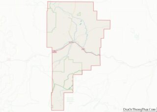
| County: | Sweet Grass County |
| Elevation: | 4,091 ft (1,247 m) |
| Total Area: | 0.98 sq mi (2.53 km²) |
| Land Area: | 0.98 sq mi (2.53 km²) |
| Water Area: | 0.00 sq mi (0.00 km²) |
| Total Population: | 1,650 |
| Population Density: | 1,688.84/sq mi (651.84/km²) |
| ZIP code: | 59011 |
| Area code: | 406 |
| FIPS code: | 3006475 |
| GNISfeature ID: | 0802032 |
| Website: | www.cityofbigtimber.com |
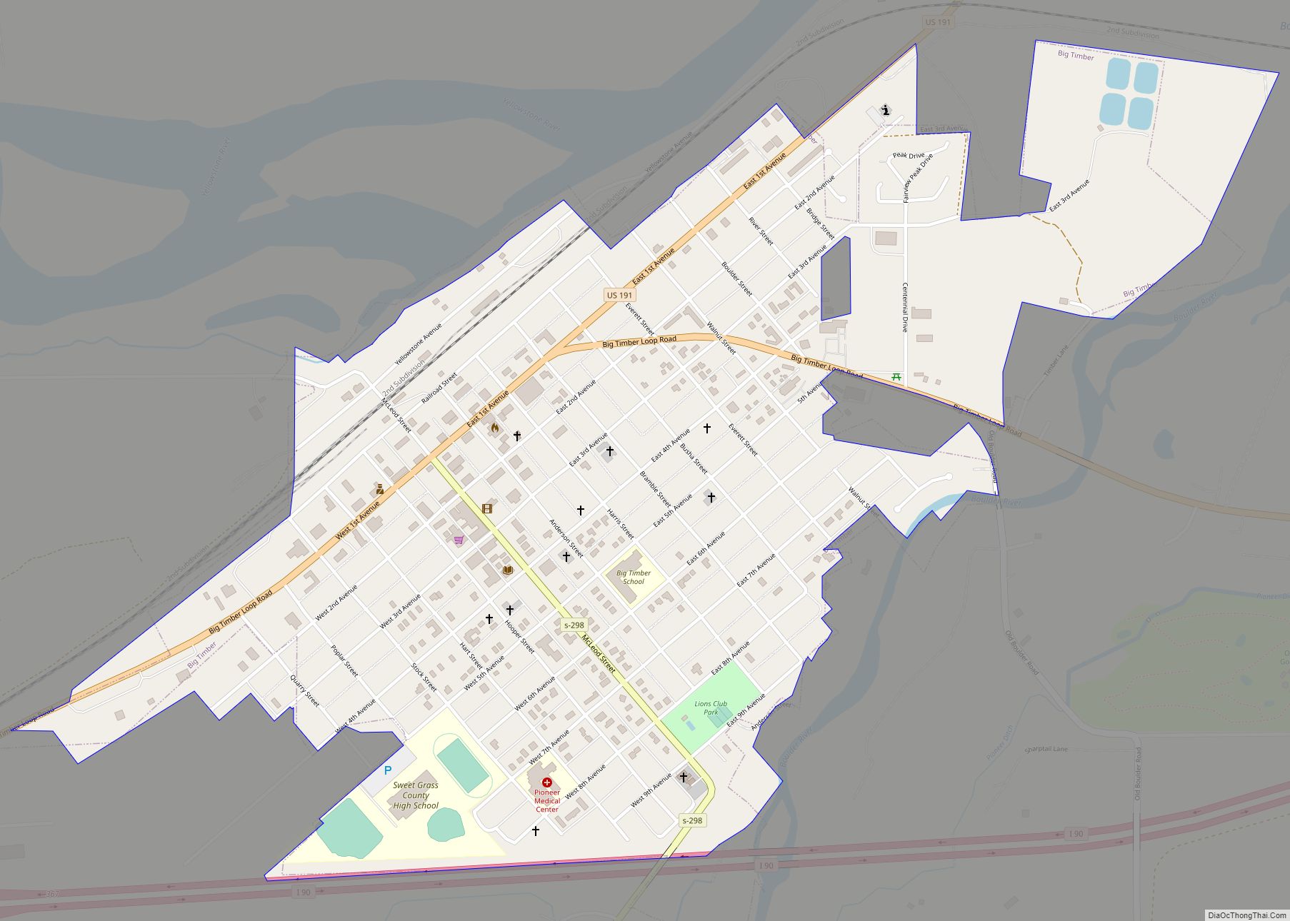
Online Interactive Map
Click on ![]() to view map in "full screen" mode.
to view map in "full screen" mode.
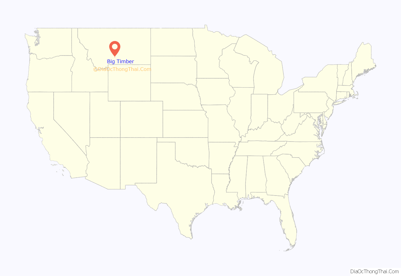
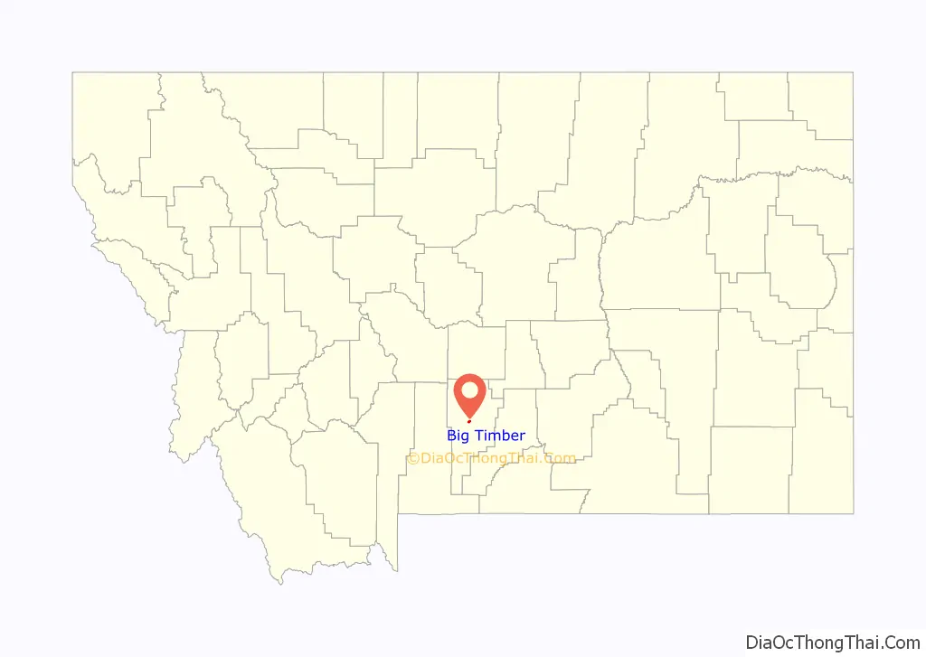
Big Timber location map. Where is Big Timber city?
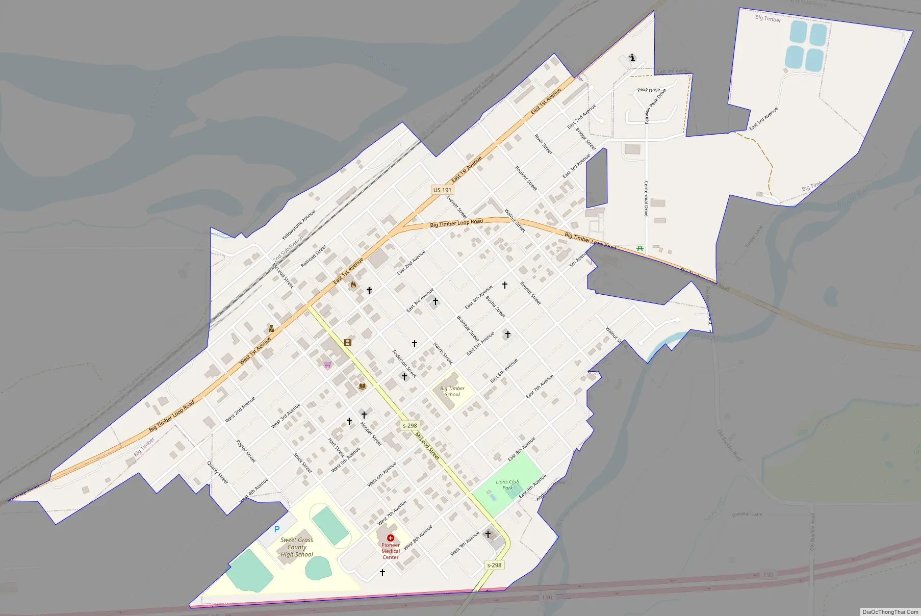
Big Timber Road Map
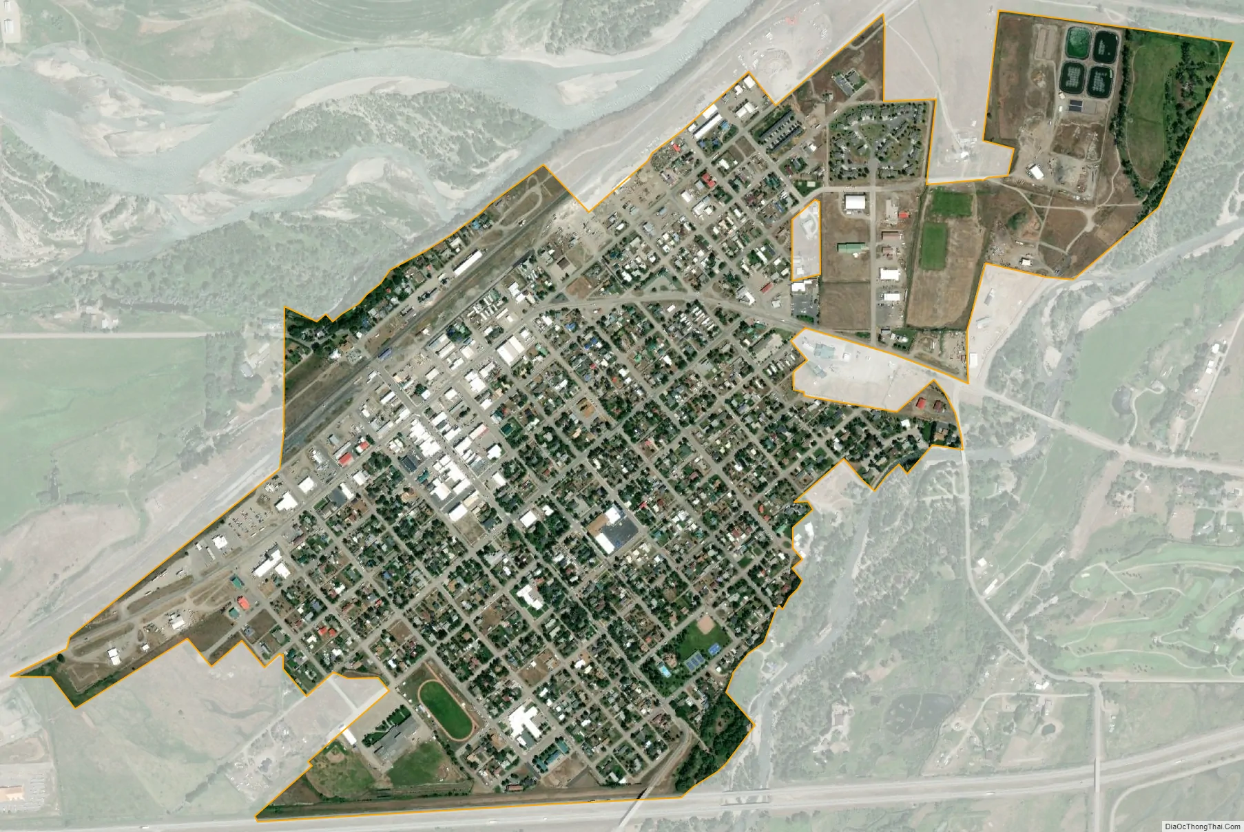
Big Timber city Satellite Map
Geography
Big Timber is located at 45°50′0″N 109°57′1″W / 45.83333°N 109.95028°W / 45.83333; -109.95028 (45.833224, -109.950361).
According to the United States Census Bureau, the city has a total area of 0.95 square miles (2.46 km), of which 0.92 square miles (2.38 km) is land and 0.03 square miles (0.08 km) is water.
Climate
Big Timber has a cool semi-arid climate (Köppen BSk) bordering on a humid continental climate (Dfb). Although winters can be frigid, frequent chinook winds will raise temperatures above 50 °F or 10 °C on an average twenty days between December and February, and have raised them to or above 68 °F or 20 °C on ten occasions during these months since 1894. The chinooks mean Big Timber’s 31.3 days per year failing to top freezing is among the fewest in Montana, with the average window for such maxima being from November 11 to March 18. In the absence of chinooks, temperatures fall to 0 °F or −17.8 °C on seventeen mornings during an average winter, although such temperatures were reached just once in 1999/2000 but as many as thirty-four times during the very cold winters of 1935/1936 and 1978/1979. The average window for zero temperatures is from December 4 to February 25. The coldest temperature in Big Timber has been −47 °F (−43.9 °C) during the notorious 1936 cold wave on February 15, whilst February 1936 was also the coldest month on record at 5.0 °F or −15.0 °C, shading January 1916 which averaged 5.5 °F or −14.7 °C.
Spring is typically windy with temperatures nearly so variable as in winter: the last frost typically arrives on May 19, but temperatures have reached 80 °F or 26.7 °C as early as March 22 of 1928 and have fallen to zero Fahrenheit as late as April 13, 1928 and April 12, 1997. Late in spring thunderstorms increase in frequency and during late spring and early summer these provide most of Big Timber’s annual precipitation. The wettest calendar year since 1894 has been 1957 with 25.71 inches (653.0 mm) and the driest 1939 with 9.38 inches (238.3 mm), whilst the wettest single month has been May 1981 with 7.69 inches (195.3 mm)
During the summer, days can be very hot, with maxima of 90 °F or 32.2 °C on 28.5 afternoons and over 100 °F or 37.8 °C on 1.1, although mornings very rarely stay above 65 °F or 18.3 °C. The record hottest temperature is 110 °F (43.3 °C) on July 21, 1931 and the hottest morning 73 °F (22.8 °C) on July 31 of 1936.
The fall season is usually short and variable, with snow occasionally falling in September, but at other times hot weather can extend into October or even November.
See also
Map of Montana State and its subdivision:- Beaverhead
- Big Horn
- Blaine
- Broadwater
- Carbon
- Carter
- Cascade
- Chouteau
- Custer
- Daniels
- Dawson
- Deer Lodge
- Fallon
- Fergus
- Flathead
- Gallatin
- Garfield
- Glacier
- Golden Valley
- Granite
- Hill
- Jefferson
- Judith Basin
- Lake
- Lewis and Clark
- Liberty
- Lincoln
- Madison
- McCone
- Meagher
- Mineral
- Missoula
- Musselshell
- Park
- Petroleum
- Phillips
- Pondera
- Powder River
- Powell
- Prairie
- Ravalli
- Richland
- Roosevelt
- Rosebud
- Sanders
- Sheridan
- Silver Bow
- Stillwater
- Sweet Grass
- Teton
- Toole
- Treasure
- Valley
- Wheatland
- Wibaux
- Yellowstone
- Alabama
- Alaska
- Arizona
- Arkansas
- California
- Colorado
- Connecticut
- Delaware
- District of Columbia
- Florida
- Georgia
- Hawaii
- Idaho
- Illinois
- Indiana
- Iowa
- Kansas
- Kentucky
- Louisiana
- Maine
- Maryland
- Massachusetts
- Michigan
- Minnesota
- Mississippi
- Missouri
- Montana
- Nebraska
- Nevada
- New Hampshire
- New Jersey
- New Mexico
- New York
- North Carolina
- North Dakota
- Ohio
- Oklahoma
- Oregon
- Pennsylvania
- Rhode Island
- South Carolina
- South Dakota
- Tennessee
- Texas
- Utah
- Vermont
- Virginia
- Washington
- West Virginia
- Wisconsin
- Wyoming