Map of Boneau CDP

Map of Boneau CDP

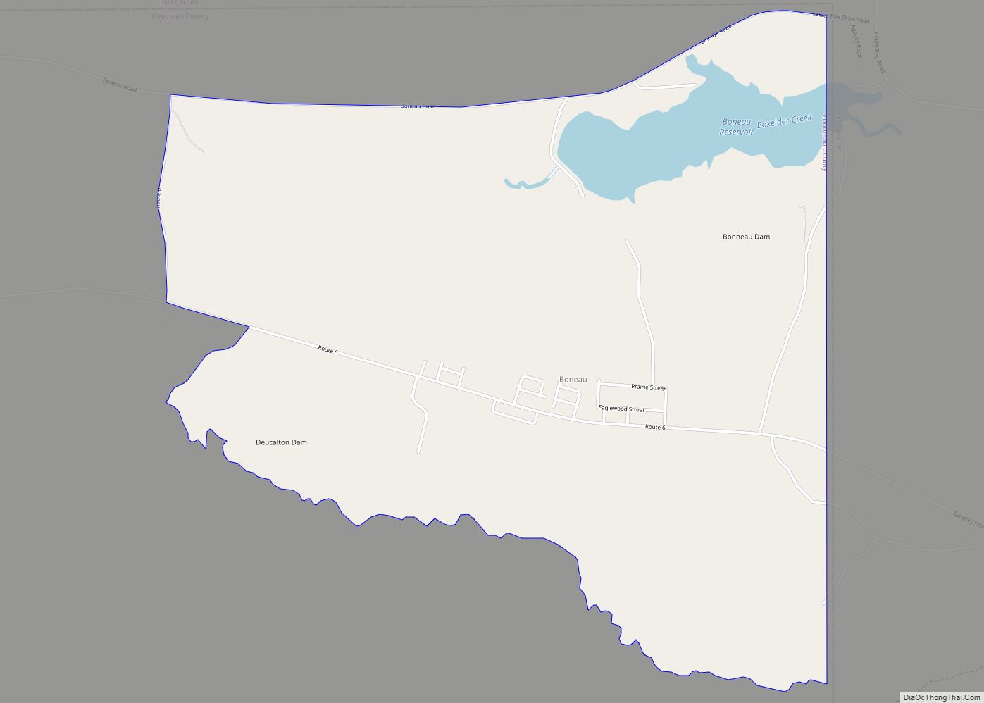
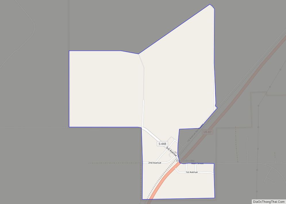
Boneau is a census-designated place (CDP) in Chouteau County, Montana, United States. The population was 380 at the 2010 census, up from 190 in 2000. Boneau CDP overview: Name: Boneau CDP LSAD Code: 57 LSAD Description: CDP (suffix) State: Montana County: Chouteau County Elevation: 3,317 ft (1,011 m) Total Area: 2.47 sq mi (6.41 km²) Land Area: 2.37 sq mi (6.15 km²) Water … Read more

Map of Black Eagle CDP

Map of Black Eagle CDP

Black Eagle is a census-designated place (CDP) in Cascade County, Montana, United States. The population was 904 at the 2010 census. It is a suburb of Great Falls. Black Eagle CDP overview: Name: Black Eagle CDP LSAD Code: 57 LSAD Description: CDP (suffix) State: Montana County: Cascade County Elevation: 3,379 ft (1,030 m) Total Area: 1.73 sq mi (4.48 km²) … Read more

Map of Birney CDP

Map of Birney CDP

Birney is a census-designated place (CDP) in Rosebud County, Montana, United States. The population was 108 at the 2000 census. The post office was established in 1886. Birney CDP overview: Name: Birney CDP LSAD Code: 57 LSAD Description: CDP (suffix) State: Montana County: Rosebud County Elevation: 3,124 ft (952 m) Total Area: 15.09 sq mi (39.07 km²) Land Area: 15.09 sq mi … Read more

Map of Bigfork CDP, Montana

Map of Bigfork CDP, Montana

Bigfork is a census-designated place (CDP) in Flathead County, Montana, United States. It is within Montana’s Rocky Mountains. The population was 4,270 at the 2010 census, up from 1,421 in 2000. Bigfork CDP overview: Name: Bigfork CDP LSAD Code: 57 LSAD Description: CDP (suffix) State: Montana County: Flathead County Elevation: 2,989 ft (911 m) Total Area: 37.31 sq mi … Read more

Map of Bridger CDP

Map of Bridger CDP

Bridger is a census-designated place (CDP) in Gallatin County, Montana, United States. It comprises the Bridger Bowl Ski Area and some nearby residences on the eastern side of the Bridger Range in southwestern Montana. As of the 2010 census the Bridger CDP had a population of 30. Montana Highway 86 forms the eastern edge of … Read more

Map of Brady CDP

Map of Brady CDP, Montana

Brady is a census-designated place and unincorporated community in Pondera County, Montana, United States. Its population was 140 as of the 2010 census. Brady has a post office with ZIP code 59416. The community is located along Interstate 15. The post office was established in 1910. The town is likely named after the Brady brothers. … Read more

Map of Boyd CDP, Montana

Map of Boyd CDP, Montana

Boyd is a census-designated place and unincorporated community in Carbon County, Montana, United States. As of the 2010 census it had a population of 35. Boyd was a stop on the Northern Pacific Railway en route to Red Lodge. A post office was first established at Boyd on March 12, 1909 with Roland N. Doughty … Read more

Map of Box Elder CDP

Map of Box Elder CDP, Montana

Box Elder is an unincorporated community and census-designated place (CDP) in Hill County in the U.S. state of Montana. The population was 87 at the 2010 census. The population was 794 at the 2000 census, but before 2010 the Box Elder CDP was split into the current much-smaller Box Elder CDP, while most of the … Read more

Map of Boulder city, Montana

Map of Boulder city, Montana

Boulder is a town in and the county seat of Jefferson County, Montana, United States. It is on the north bank of the Boulder River between Butte and Helena, slightly east of the Continental Divide, at the intersection of Interstate 15 and Montana Highway 69. The population was 1,201 at the 2020 census. It is part … Read more

Map of Busby CDP

Map of Busby CDP

Busby is a census-designated place (CDP) in Big Horn County, Montana, United States. It is on the Northern Cheyenne reservation. The population was 745 at the 2010 census. Busby CDP overview: Name: Busby CDP LSAD Code: 57 LSAD Description: CDP (suffix) State: Montana County: Big Horn County Elevation: 3,435 ft (1,047 m) Total Area: 14.35 sq mi (37.17 km²) Land … Read more

Map of Browning town, Montana

Map of Browning town, Montana

Browning is a former town in Glacier County, Montana, United States. It is the headquarters for the Blackfeet Indian Reservation and was the only incorporated town on the Reservation. The population was 1,018 at the 2020 census. The town was named in 1885 for Commissioner of Indian Affairs Daniel M. Browning. The post office was … Read more

Map of Brockton CDP, Montana

Map of Brockton CDP, Montana

Brockton CDP overview: Name: Brockton CDP LSAD Code: 57 LSAD Description: CDP (suffix) State: Montana County: Roosevelt County FIPS code: 3010000 Online Interactive Map Brockton online map. Source: Basemap layers from Google Map, Open Street Map (OSM), Arcgisonline, Wmflabs. Boundary Data from Database of Global Administrative Areas. Brockton location map. Where is Brockton CDP? Brockton … Read more