Map of Charlos Heights CDP

Map of Charlos Heights CDP

Charlos Heights or Charlo’s Heights (Salish: nkʷalíʔps ) is a census-designated place (CDP) in Ravalli County, Montana, United States. The population was 120 at the 2010 census. Charlos Heights CDP overview: Name: Charlos Heights CDP LSAD Code: 57 LSAD Description: CDP (suffix) State: Montana County: Ravalli County Elevation: 3,740 ft (1,140 m) Total Area: 1.21 sq mi (3.13 km²) Land … Read more

Map of Churchill CDP

Map of Churchill CDP, Montana

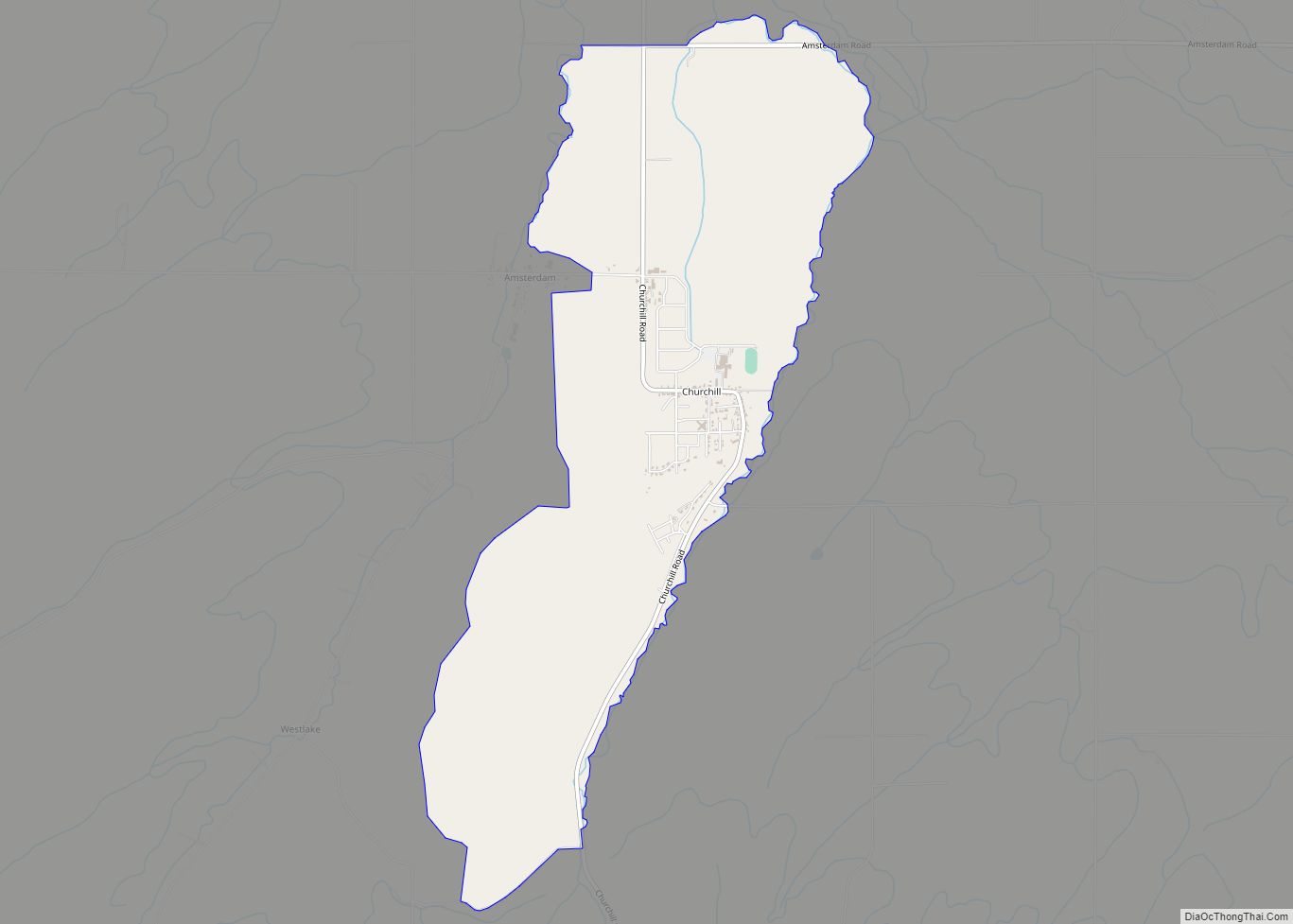
Churchill is a census-designated place (CDP) in Gallatin County, Montana, United States. The population was 902 at the 2010 census. It is part of the Bozeman, MT Micropolitan Statistical Area. It was formerly part of the Amsterdam-Churchill CDP. Churchill CDP overview: Name: Churchill CDP LSAD Code: 57 LSAD Description: CDP (suffix) State: Montana County: Gallatin … Read more

Map of Choteau city

Map of Choteau city

Choteau is a city in and the county seat of Teton County, Montana, United States. It lies along U.S. Routes 89 and 287, (the latter terminating at the former in this city) approximately 20 miles (32 km) east of the Rocky Mountains, near Flathead National Forest, the Rocky Mountain Division of Lewis and Clark National Forest, … Read more

Map of Chinook city

Map of Chinook city, Montana

Chinook is a city in and the county seat of Blaine County, Montana, United States. The population was 1,185 at the 2020 census. Points of interest are the Bear Paw Battlefield Museum located in the small town’s center and the Bear Paw Battlefield, located twenty miles south of Chinook. Chinook city overview: Name: Chinook city … Read more

Map of Chester town, Montana

Map of Chester town, Montana

Chester is a town in and the county seat of Liberty County, Montana, United States. The population was 847 at the time of both the 2010 and 2020 U.S. Census. Chester town overview: Name: Chester town LSAD Code: 43 LSAD Description: town (suffix) State: Montana County: Liberty County Elevation: 3,133 ft (955 m) Total Area: 0.49 sq mi (1.26 km²) … Read more

Map of Colstrip city

Map of Colstrip city

Colstrip is a city in Rosebud County, Montana, United States. The population was 2,096 at the 2020 census. Established in 1924 and incorporated as a city in 1998, Colstrip is the largest city in Rosebud County with 25.2% of the total population. Colstrip’s primary industries are coal mining and electricity production. In 2005, Sports Illustrated’s … Read more

Map of Clyde Park town

Map of Clyde Park town

Clyde Park is a town in Park County, Montana, United States. The population was 332 at the 2020 census. Originally known as Sunnyside, the town was renamed in the 1890s. Clyde Park town overview: Name: Clyde Park town LSAD Code: 43 LSAD Description: town (suffix) State: Montana County: Park County Elevation: 4,865 ft (1,483 m) Total Area: … Read more

Map of Clinton CDP, Montana

Map of Clinton CDP, Montana

Clinton is a census-designated place (CDP) in Missoula County, Montana, United States. It is part of the ‘Missoula, Montana Metropolitan Statistical Area’. The CDP was named for General Sir Henry Clinton. The population was 1,052 at the 2010 census, an increase from its population of 549 in 2000. Originally established in 1883 as a stage … Read more

Map of Clancy CDP

Map of Clancy CDP

Clancy is an unincorporated community and census-designated place (CDP) in Jefferson County, Montana, United States. The population was 1,661 at the 2010 census, up from 1,406 in 2000. It is part of the Helena Micropolitan Statistical Area. The town was founded in 1873 as a gold camp and named for prospector William Clancey. A fire … Read more

Map of Circle town, Montana

Map of Circle town, Montana

Circle is a town in and the county seat of McCone County, Montana, United States. The population was 591 at the 2020 census. The community was so named because a rancher there branded his cattle with the image of a circle. Circle town overview: Name: Circle town LSAD Code: 43 LSAD Description: town (suffix) State: … Read more

Map of Conrad city, Montana

Map of Conrad city, Montana

Conrad is a city in and the county seat of Pondera County, Montana, United States. The population was 2,318 at the 2020 census. Each June, the Whoop Up Days, a town wide celebration that includes a parade and rodeo, takes place in Conrad. The town incorporated in 1908. Conrad city overview: Name: Conrad city LSAD … Read more

Map of Conner CDP

Map of Conner CDP

Conner (Salish: epɫmsáwíʔ) is a census-designated place (CDP) in Ravalli County, Montana, United States. The population was 216 at the 2010 census. The town was named in 1906 for the first homesteader, Aaron Conner. Conner CDP overview: Name: Conner CDP LSAD Code: 57 LSAD Description: CDP (suffix) State: Montana County: Ravalli County Elevation: 4,032 ft (1,229 m) … Read more