Chester is a town in and the county seat of Liberty County, Montana, United States. The population was 847 at the time of both the 2010 and 2020 U.S. Census.
| Name: | Chester town |
|---|---|
| LSAD Code: | 43 |
| LSAD Description: | town (suffix) |
| State: | Montana |
| County: | Liberty County |
| Elevation: | 3,133 ft (955 m) |
| Total Area: | 0.49 sq mi (1.26 km²) |
| Land Area: | 0.49 sq mi (1.26 km²) |
| Water Area: | 0.00 sq mi (0.00 km²) |
| Total Population: | 847 |
| Population Density: | 1,739.22/sq mi (671.48/km²) |
| ZIP code: | 59522 |
| Area code: | 406 |
| FIPS code: | 3014200 |
| Website: | chester-montana.com |
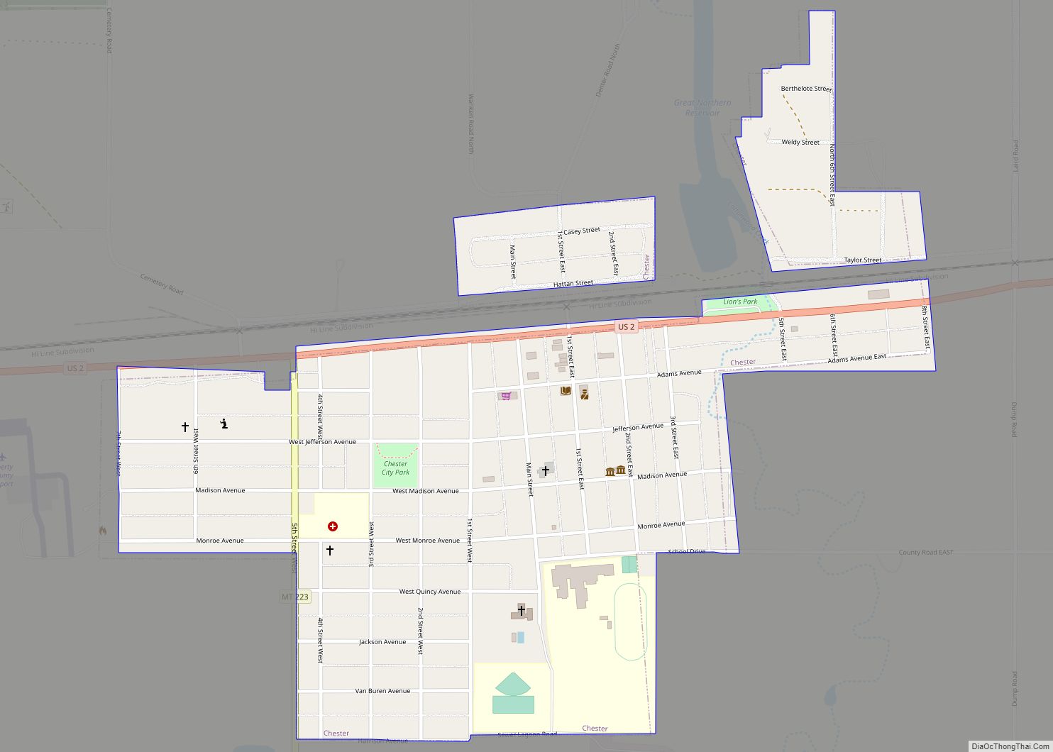
Online Interactive Map
Click on ![]() to view map in "full screen" mode.
to view map in "full screen" mode.
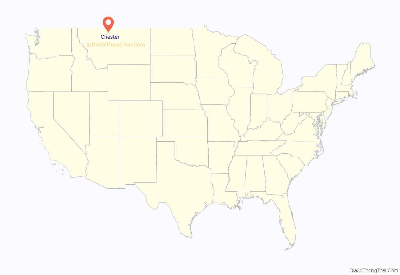
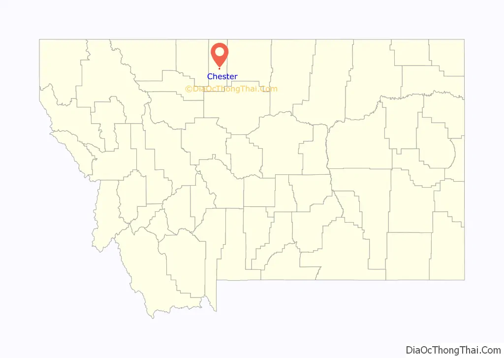
Chester location map. Where is Chester town?
History
The name “Chester” was chosen by the first telegraph operator here and named in honor of his hometown in Pennsylvania. It was incorporated in 1910.
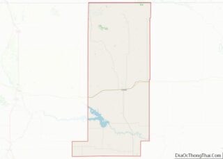
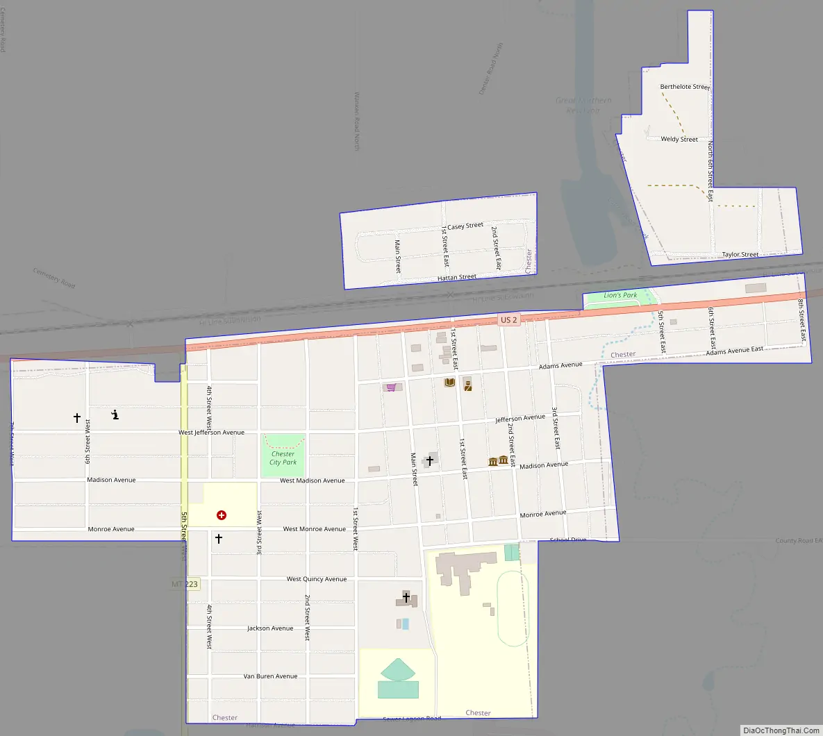
Chester Road Map
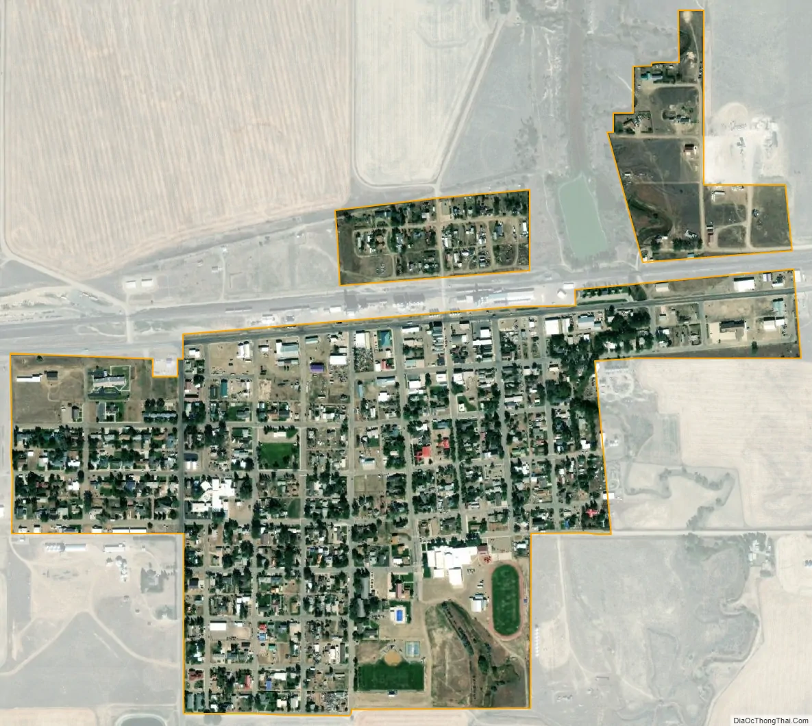
Chester city Satellite Map
Geography
Chester is located at 48°30′40″N 110°58′2″W / 48.51111°N 110.96722°W / 48.51111; -110.96722 (48.511105, -110.967126).
According to the United States Census Bureau, the town has a total area of 0.48 square miles (1.24 km), all land.
See also
Map of Montana State and its subdivision:- Beaverhead
- Big Horn
- Blaine
- Broadwater
- Carbon
- Carter
- Cascade
- Chouteau
- Custer
- Daniels
- Dawson
- Deer Lodge
- Fallon
- Fergus
- Flathead
- Gallatin
- Garfield
- Glacier
- Golden Valley
- Granite
- Hill
- Jefferson
- Judith Basin
- Lake
- Lewis and Clark
- Liberty
- Lincoln
- Madison
- McCone
- Meagher
- Mineral
- Missoula
- Musselshell
- Park
- Petroleum
- Phillips
- Pondera
- Powder River
- Powell
- Prairie
- Ravalli
- Richland
- Roosevelt
- Rosebud
- Sanders
- Sheridan
- Silver Bow
- Stillwater
- Sweet Grass
- Teton
- Toole
- Treasure
- Valley
- Wheatland
- Wibaux
- Yellowstone
- Alabama
- Alaska
- Arizona
- Arkansas
- California
- Colorado
- Connecticut
- Delaware
- District of Columbia
- Florida
- Georgia
- Hawaii
- Idaho
- Illinois
- Indiana
- Iowa
- Kansas
- Kentucky
- Louisiana
- Maine
- Maryland
- Massachusetts
- Michigan
- Minnesota
- Mississippi
- Missouri
- Montana
- Nebraska
- Nevada
- New Hampshire
- New Jersey
- New Mexico
- New York
- North Carolina
- North Dakota
- Ohio
- Oklahoma
- Oregon
- Pennsylvania
- Rhode Island
- South Carolina
- South Dakota
- Tennessee
- Texas
- Utah
- Vermont
- Virginia
- Washington
- West Virginia
- Wisconsin
- Wyoming