Map of Crane CDP, Montana
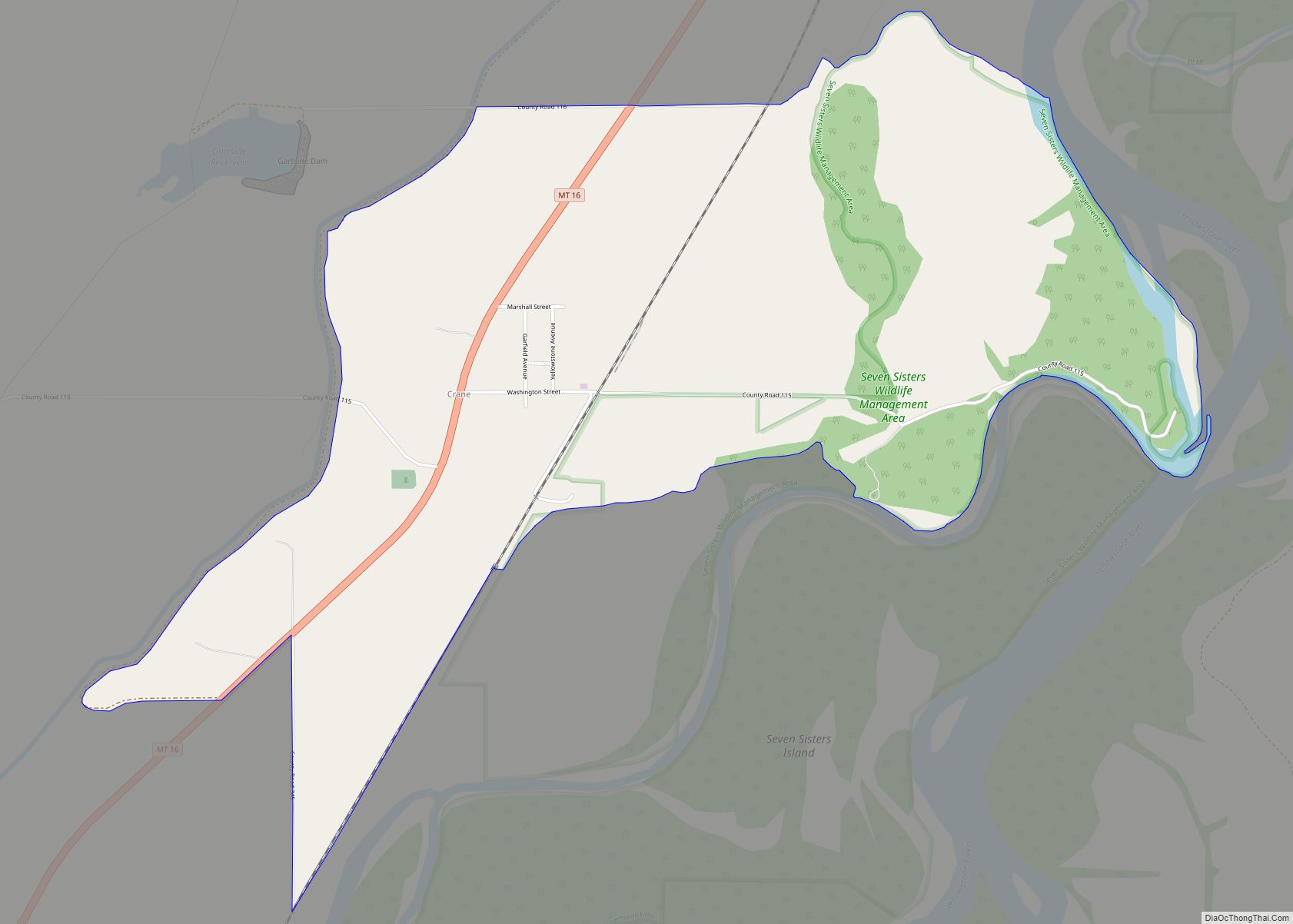
Crane is a census-designated place and unincorporated community in Richland County, Montana, United States. Its population was 102 according to the 2010 census. Crane has a post office with the ZIP code 59217. Montana Highway 16 passes through Crane. The town was named for trapper Jimmy Crain when the post office opened in 1910. Crane ... Read more
Map of Crane CDP, Montana
Map of Denton town, Montana
Denton is a town in Fergus County, Montana, United States. The population was 205 at the 2020 census. Central Montana Rail, Inc. is headquartered in Denton. Denton town overview: Name: Denton town LSAD Code: 43 LSAD Description: town (suffix) State: Montana County: Fergus County Elevation: 3,599 ft (1,097 m) Total Area: 0.71 sq mi (1.85 km²) Land Area: 0.71 sq mi (1.85 km²) ... Read more
Map of Denton town, Montana
Map of Deer Lodge city
Deer Lodge is a city in and the county seat of Powell County, Montana, United States. The population was 2,938 at the 2020 census. Deer Lodge city overview: Name: Deer Lodge city LSAD Code: 25 LSAD Description: city (suffix) State: Montana County: Powell County Elevation: 4,567 ft (1,392 m) Total Area: 1.55 sq mi (4.01 km²) Land Area: 1.55 sq mi (4.01 km²) ... Read more
Map of Deer Lodge city
Map of De Borgia CDP
De Borgia is a census-designated place (CDP) in Mineral County, Montana, United States. The population was 69 at the 2000 census. The town was named for the nearby river, which was named after Saint Regis DeBorgia, a Catholic missionary. The post office was established in 1900. De Borgia CDP overview: Name: De Borgia CDP LSAD ... Read more
Map of De Borgia CDP
Map of Dayton CDP, Montana
Dayton (Kalispel-Pend d’Oreille: iʔɫixʷ, Kutenai: aki¢qa) is an unincorporated community and census-designated place (CDP) in Lake County, Montana, United States. The population was 84 at the 2010 census. Dayton CDP overview: Name: Dayton CDP LSAD Code: 57 LSAD Description: CDP (suffix) State: Montana County: Lake County Elevation: 2,910 ft (887 m) Total Area: 0.56 sq mi (1.44 km²) Land Area: ... Read more
Map of Dayton CDP, Montana
Map of Darby town, Montana
Darby (Salish: snk̓ʷɫxʷexʷem̓i, “Place Where They Would Lift Something”) is a town in Ravalli County, Montana, United States. The population was 783 at the 2020 census. Darby is located near the southwestern border of Montana and Idaho, along the Continental Divide. Officially established in 1889, the town was named after James W. Darby who signed ... Read more
Map of Darby town, Montana
Map of Dillon city, Montana
Dillon is a city in and the county seat of Beaverhead County, Montana, United States. The population was 3,880 at the 2020 census. The city was named for Sidney Dillon (1812–1892), president of Union Pacific Railroad. Dillon city overview: Name: Dillon city LSAD Code: 25 LSAD Description: city (suffix) State: Montana County: Beaverhead County Elevation: ... Read more
Map of Dillon city, Montana
Map of Dupuyer CDP
Dupuyer (/dəpuːˈjər/) is a census-designated place and unincorporated community in Pondera County, Montana, United States. Its population was 86 as of the 2010 census. The community is located along U.S. Route 89 and Dupuyer Creek. Dupuyer has a post office with ZIP code 59432. The town takes its name from Dupuyer Creek, which borders the ... Read more
Map of Dupuyer CDP
Map of Drummond town, Montana
Drummond is a town in Granite County, Montana, United States. The population was 272 at the 2020 census. Drummond town overview: Name: Drummond town LSAD Code: 43 LSAD Description: town (suffix) State: Montana County: Granite County Elevation: 3,954 ft (1,205 m) Total Area: 0.54 sq mi (1.40 km²) Land Area: 0.54 sq mi (1.40 km²) Water Area: 0.00 sq mi (0.00 km²) Total Population: 272 Population ... Read more
Map of Drummond town, Montana
Map of Dodson town, Montana
Dodson is a town in Phillips County, Montana, United States. The population was 125 at the 2020 census. Dodson town overview: Name: Dodson town LSAD Code: 43 LSAD Description: town (suffix) State: Montana County: Phillips County Elevation: 2,287 ft (697 m) Total Area: 0.17 sq mi (0.43 km²) Land Area: 0.17 sq mi (0.43 km²) Water Area: 0.00 sq mi (0.00 km²) Total Population: 125 Population ... Read more
Map of Dodson town, Montana
Map of Dixon CDP, Montana
Dixon is a census-designated place (CDP) in Sanders County, Montana, United States. The population was 216 at the 2000 census. The town is named for Joseph M. Dixon, a Montana politician. The town sits adjacent to the lower Flathead River near the Bison Range. Dixon CDP overview: Name: Dixon CDP LSAD Code: 57 LSAD Description: ... Read more
Map of Dixon CDP, Montana
Map of Edgar CDP, Montana
Edgar is a census-designated place and unincorporated community in Carbon County, Montana, United States. As of the 2010 census it had a population of 114. Edgar has a post office with a ZIP code 59026. The post office was established May 28, 1909 with John J. Thornton as its first postmaster. Thornton named the town ... Read more
Map of Edgar CDP, Montana