Dillon is a city in and the county seat of Beaverhead County, Montana, United States. The population was 3,880 at the 2020 census. The city was named for Sidney Dillon (1812–1892), president of Union Pacific Railroad.
| Name: | Dillon city |
|---|---|
| LSAD Code: | 25 |
| LSAD Description: | city (suffix) |
| State: | Montana |
| County: | Beaverhead County |
| Elevation: | 5,240 ft (1,600 m) |
| Total Area: | 1.90 sq mi (4.92 km²) |
| Land Area: | 1.90 sq mi (4.92 km²) |
| Water Area: | 0.00 sq mi (0.00 km²) |
| Total Population: | 3,880 |
| Population Density: | 2,044.26/sq mi (789.25/km²) |
| ZIP code: | 59725 |
| Area code: | 406 |
| FIPS code: | 3020800 |
| GNISfeature ID: | 0770653 |
| Website: | www.dillonmt.org |
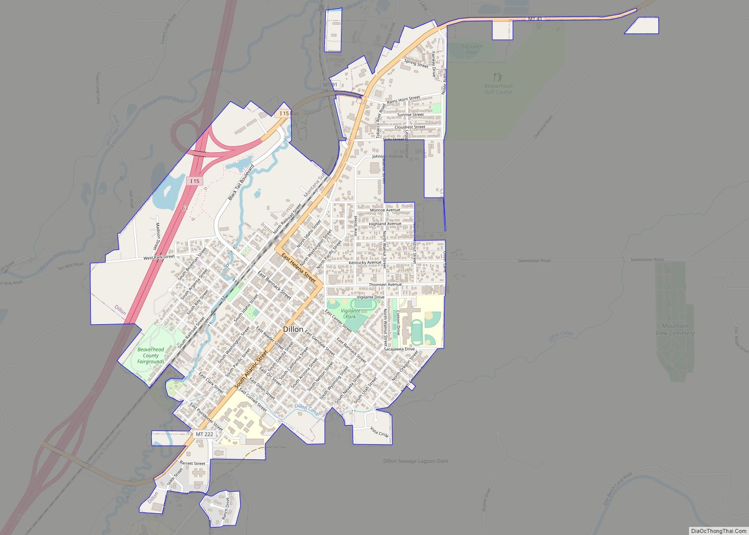
Online Interactive Map
Click on ![]() to view map in "full screen" mode.
to view map in "full screen" mode.
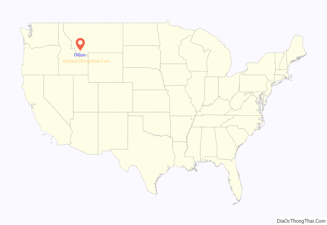
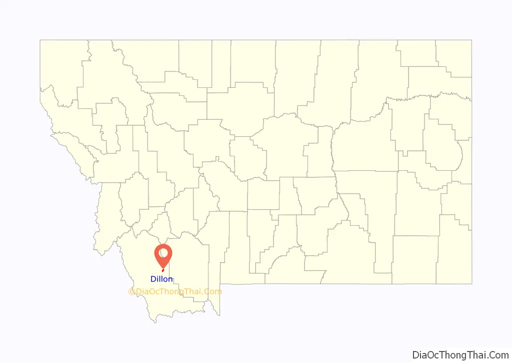
Dillon location map. Where is Dillon city?
History
Dillon was founded in the Beaverhead Valley as a railroad town in 1880. Originally named “Terminus” as it was temporarily the northernmost stop on the Utah and Northern Railway while it was under construction, in 1881, the community was renamed for Union Pacific Railroad President Sidney Dillon, who had directed the project of bringing the railroad through to Butte, Montana. The town’s location was selected by the railroad in part because of its proximity to gold mines in the area.
The first ore discovered in the Dillon area was silver. Gold was first discovered at Grasshopper Creek in 1862, precipitating a flood of immigration to the area. The last real gold rush in the area occurred near Argenta in 1920 and lasted for 30 years.
Dillon served as a central location for transporting goods to nearby boomtowns such as Bannack, Argenta, Glen, and Virginia City. In 1881, Dillon became part of a contentious battle with Bannack to become the county seat of Beaverhead County. The first brick building in Dillon was built in 1882. In 1884, Dillon became an incorporated town and began building sidewalks and permanent dwellings for the residents.
While many of the gold mining towns around Dillon died, Dillon was able to thrive due to the railroad and talc mining in the area. A cattle industry was established in 1865. The agriculturally rich Beaverhead Valley became an ideal location for sheep ranching, introduced in 1869. Dillon was once the largest exporter of sheep wool in Montana.
The Montana Normal College was established as a teaching college in 1892, and is still functioning today, renowned for its Education program. A circus elephant named Old Pitt was struck by lightning in 1943 and is buried at the Dillon fairgrounds. Captain Joel Rude of the Montana National Guard crashed his F-106 into a grain elevator and died during a Labor Day Parade on September 3, 1979. A plaque in his honor is part of the Southwest Montana Veterans Memorial park in Dillon.
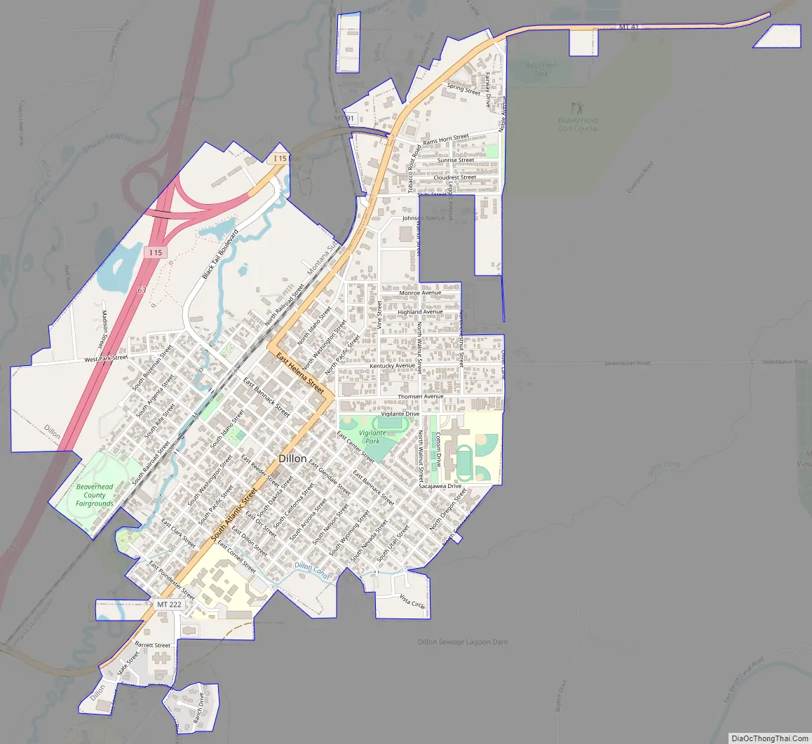
Dillon Road Map
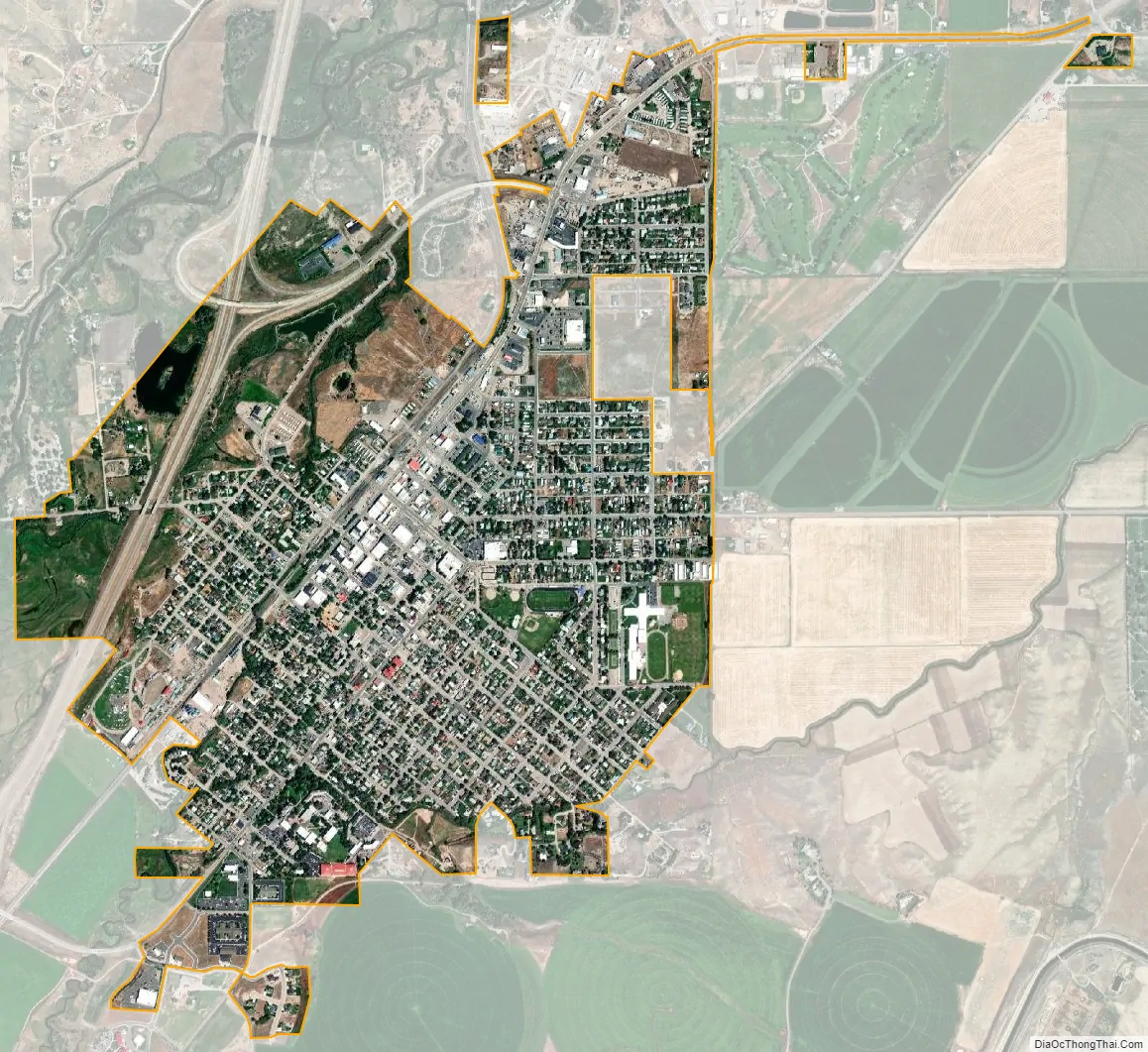
Dillon city Satellite Map
Geography
Dillon is located at 45°12′57″N 112°38′3″W / 45.21583°N 112.63417°W / 45.21583; -112.63417 (45.215735, -112.634055), approximately 40 miles (64 km) east of the Continental Divide. It lies at an elevation of 5,102 feet (1,555 m).
According to the United States Census Bureau, the city has a total area of 1.76 square miles (4.56 km), all land. Dillon is situated on the Beaverhead River.
See also
Map of Montana State and its subdivision:- Beaverhead
- Big Horn
- Blaine
- Broadwater
- Carbon
- Carter
- Cascade
- Chouteau
- Custer
- Daniels
- Dawson
- Deer Lodge
- Fallon
- Fergus
- Flathead
- Gallatin
- Garfield
- Glacier
- Golden Valley
- Granite
- Hill
- Jefferson
- Judith Basin
- Lake
- Lewis and Clark
- Liberty
- Lincoln
- Madison
- McCone
- Meagher
- Mineral
- Missoula
- Musselshell
- Park
- Petroleum
- Phillips
- Pondera
- Powder River
- Powell
- Prairie
- Ravalli
- Richland
- Roosevelt
- Rosebud
- Sanders
- Sheridan
- Silver Bow
- Stillwater
- Sweet Grass
- Teton
- Toole
- Treasure
- Valley
- Wheatland
- Wibaux
- Yellowstone
- Alabama
- Alaska
- Arizona
- Arkansas
- California
- Colorado
- Connecticut
- Delaware
- District of Columbia
- Florida
- Georgia
- Hawaii
- Idaho
- Illinois
- Indiana
- Iowa
- Kansas
- Kentucky
- Louisiana
- Maine
- Maryland
- Massachusetts
- Michigan
- Minnesota
- Mississippi
- Missouri
- Montana
- Nebraska
- Nevada
- New Hampshire
- New Jersey
- New Mexico
- New York
- North Carolina
- North Dakota
- Ohio
- Oklahoma
- Oregon
- Pennsylvania
- Rhode Island
- South Carolina
- South Dakota
- Tennessee
- Texas
- Utah
- Vermont
- Virginia
- Washington
- West Virginia
- Wisconsin
- Wyoming