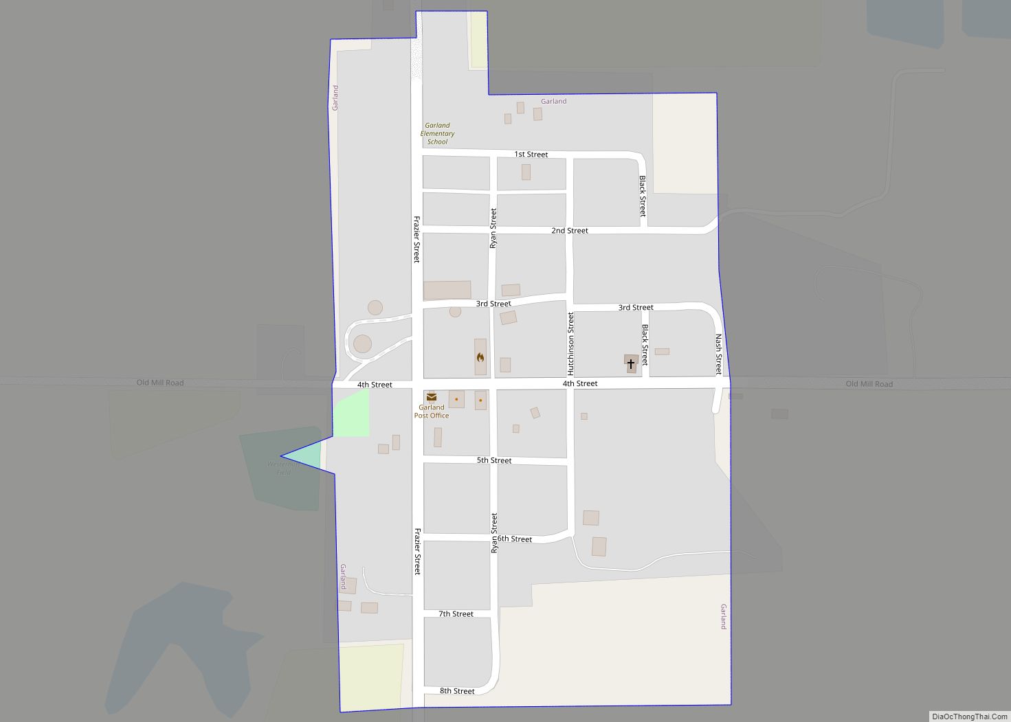
Map of Gandy village
Gandy is a village in Logan County, Nebraska, United States. It is part of the North Platte, Nebraska Micropolitan Statistical Area. The population was 34 at the 2020 census. Gandy village overview: Name: Gandy village LSAD Code: 47 LSAD Description: village (suffix) State: Nebraska County: Logan County Elevation: 2,897 ft (883 m) Total Area: 0.25 sq mi (0.64 km²) Land ... Read more
Map of Gandy village
Map of Funk village
Funk is a village in Phelps County, Nebraska, United States. The population was 194 at the 2010 census. Funk village overview: Name: Funk village LSAD Code: 47 LSAD Description: village (suffix) State: Nebraska County: Phelps County Elevation: 2,247 ft (685 m) Total Area: 0.26 sq mi (0.68 km²) Land Area: 0.26 sq mi (0.68 km²) Water Area: 0.00 sq mi (0.00 km²) Total Population: 175 Population ... Read more
Map of Funk village
Map of Fullerton city, Nebraska
Fullerton is a city in, and the county seat of, Nance County, Nebraska, United States. The population was 1,307 as of the 2010 Census. Fullerton city overview: Name: Fullerton city LSAD Code: 25 LSAD Description: city (suffix) State: Nebraska County: Nance County Elevation: 1,647 ft (502 m) Total Area: 1.37 sq mi (3.54 km²) Land Area: 1.34 sq mi (3.47 km²) Water Area: ... Read more
Map of Fullerton city, Nebraska
Map of Friend city
Friend is a city in Saline County, Nebraska, United States. As of the 2020 census, the city population was 954. Friend city overview: Name: Friend city LSAD Code: 25 LSAD Description: city (suffix) State: Nebraska County: Saline County Elevation: 1,558 ft (475 m) Total Area: 0.83 sq mi (2.14 km²) Land Area: 0.83 sq mi (2.14 km²) Water Area: 0.00 sq mi (0.00 km²) Total Population: ... Read more
Map of Friend city
Map of Fremont city, Nebraska
Fremont is a city and county seat of Dodge County in the eastern portion of the state of Nebraska in the Midwestern United States. The population was 27,141 at the 2020 census. Fremont is the home of Midland University. Fremont city overview: Name: Fremont city LSAD Code: 25 LSAD Description: city (suffix) State: Nebraska County: ... Read more
Map of Fremont city, Nebraska
Map of Franklin city, Nebraska
Franklin is a city in Franklin County, Nebraska, United States. The population was 1,000 at the 2010 census. It is the county seat of Franklin County. Franklin city overview: Name: Franklin city LSAD Code: 25 LSAD Description: city (suffix) State: Nebraska County: Franklin County Elevation: 1,864 ft (568 m) Total Area: 0.99 sq mi (2.57 km²) Land Area: 0.99 sq mi (2.57 km²) ... Read more
Map of Franklin city, Nebraska
Map of Glenvil village
Glenvil is a village in Clay County, Nebraska, United States. The settlement has formerly also been known as Glenville. The population was 267 at the 2020 census. It is part of the Hastings, Nebraska Micropolitan Statistical Area. Glenvil village overview: Name: Glenvil village LSAD Code: 47 LSAD Description: village (suffix) State: Nebraska County: Clay County ... Read more
Map of Glenvil village
Map of Giltner village
Giltner is a village in Hamilton County, Nebraska, United States. The population was 352 at the 2010 census. Giltner village overview: Name: Giltner village LSAD Code: 47 LSAD Description: village (suffix) State: Nebraska County: Hamilton County Elevation: 1,834 ft (559 m) Total Area: 0.39 sq mi (1.01 km²) Land Area: 0.39 sq mi (1.00 km²) Water Area: 0.00 sq mi (0.01 km²) Total Population: 406 Population ... Read more
Map of Giltner village
Map of Gilead village
Gilead is a village in Thayer County, Nebraska, United States. The population was 32 at the 2020 census. Gilead village overview: Name: Gilead village LSAD Code: 47 LSAD Description: village (suffix) State: Nebraska County: Thayer County Elevation: 1,539 ft (469 m) Total Area: 0.07 sq mi (0.18 km²) Land Area: 0.07 sq mi (0.18 km²) Water Area: 0.00 sq mi (0.00 km²) Total Population: 32 Population ... Read more
Map of Gilead village
Map of Gibbon city, Nebraska
Gibbon is a city in Buffalo County, Nebraska, United States. It is part of the Kearney, Nebraska Micropolitan Statistical Area. The population was 1,833 at the 2010 census. Gibbon city overview: Name: Gibbon city LSAD Code: 25 LSAD Description: city (suffix) State: Nebraska County: Buffalo County Elevation: 2,060 ft (628 m) Total Area: 0.87 sq mi (2.25 km²) Land Area: ... Read more
Map of Gibbon city, Nebraska
Map of Gering city
Gering is a city in and the county seat of Scotts Bluff County, in the Panhandle region of Nebraska, United States. The population was 8,564 at the 2020 census. Gering city overview: Name: Gering city LSAD Code: 25 LSAD Description: city (suffix) State: Nebraska County: Scotts Bluff County Founded: 1887 Elevation: 3,911 ft (1,192 m) Total Area: ... Read more
Map of Gering city
Map of Grafton village, Nebraska
Grafton is a village in Fillmore County, Nebraska, United States. The population was 107 at the 2020 census. Grafton village overview: Name: Grafton village LSAD Code: 47 LSAD Description: village (suffix) State: Nebraska County: Fillmore County Elevation: 1,690 ft (515 m) Total Area: 0.35 sq mi (0.90 km²) Land Area: 0.35 sq mi (0.90 km²) Water Area: 0.00 sq mi (0.00 km²) Total Population: 107 Population ... Read more
Map of Grafton village, Nebraska