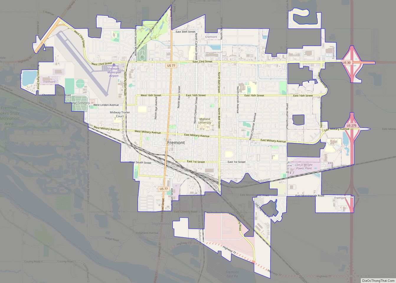
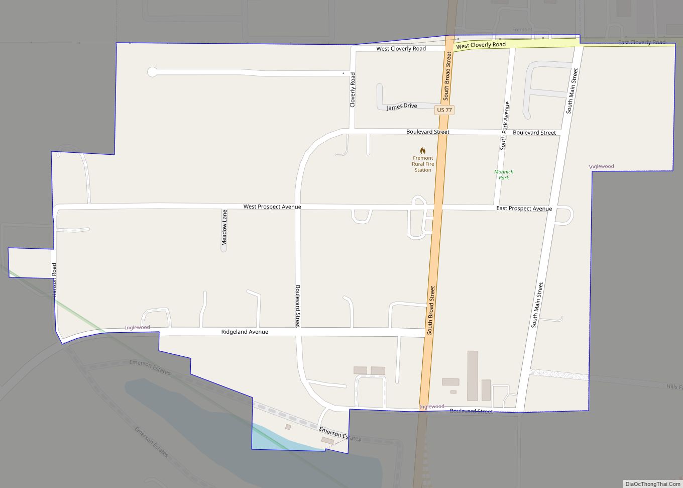
Fremont is a city and county seat of Dodge County in the eastern portion of the state of Nebraska in the Midwestern United States. The population was 27,141 at the 2020 census. Fremont is the home of Midland University.
| Name: | Fremont city |
|---|---|
| LSAD Code: | 25 |
| LSAD Description: | city (suffix) |
| State: | Nebraska |
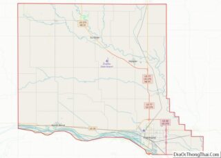
| County: | Dodge County |
| Founded: | 1856 |
| Incorporated: | June 17, 1871 |
| Elevation: | 1,203 ft (366 m) |
| Total Area: | 10.86 sq mi (28.12 km²) |
| Land Area: | 10.79 sq mi (27.96 km²) |
| Water Area: | 0.06 sq mi (0.16 km²) |
| Total Population: | 27,141 |
| Population Density: | 2,514.22/sq mi (970.75/km²) |
| ZIP code: | 68025-68026 |
| Area code: | 402 |
| FIPS code: | 3117670 |
| GNISfeature ID: | 0829408 |
| Website: | fremontne.gov |
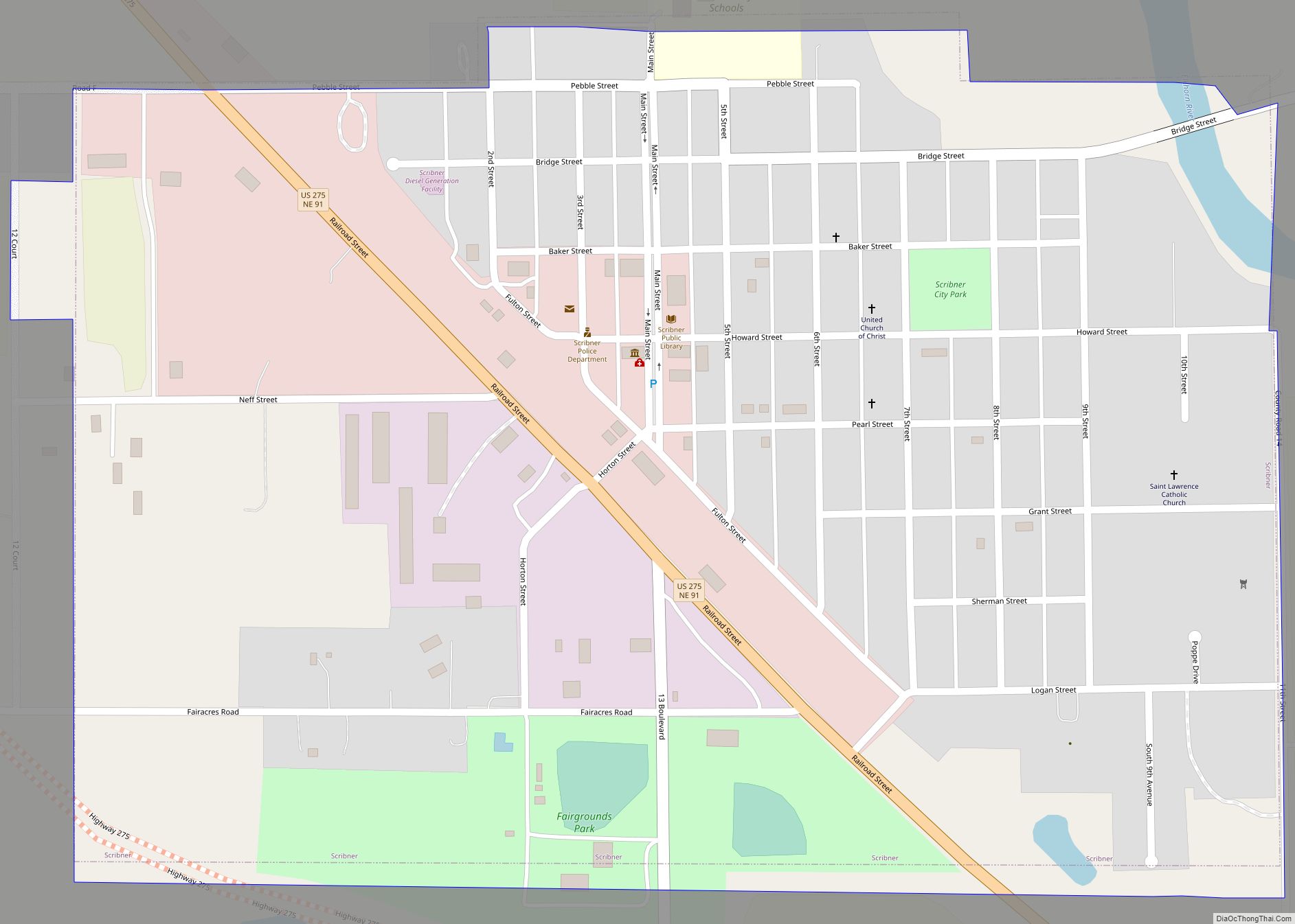
Online Interactive Map
Click on ![]() to view map in "full screen" mode.
to view map in "full screen" mode.
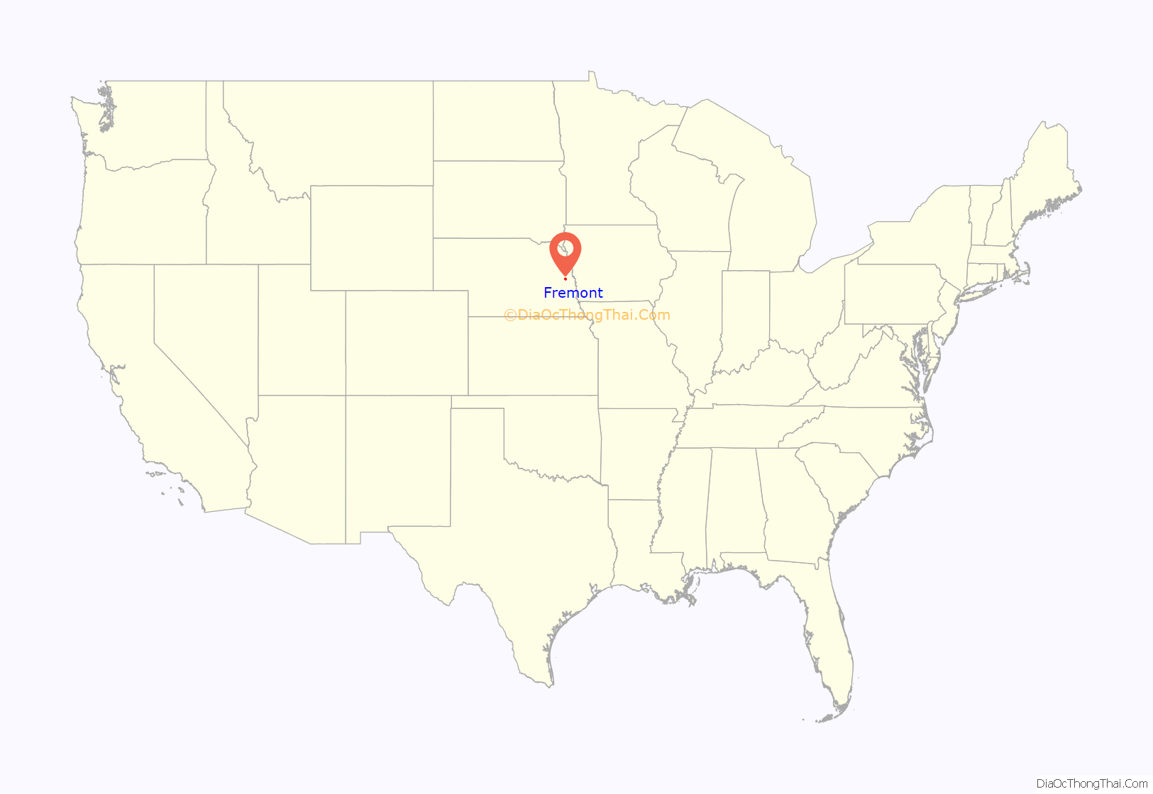
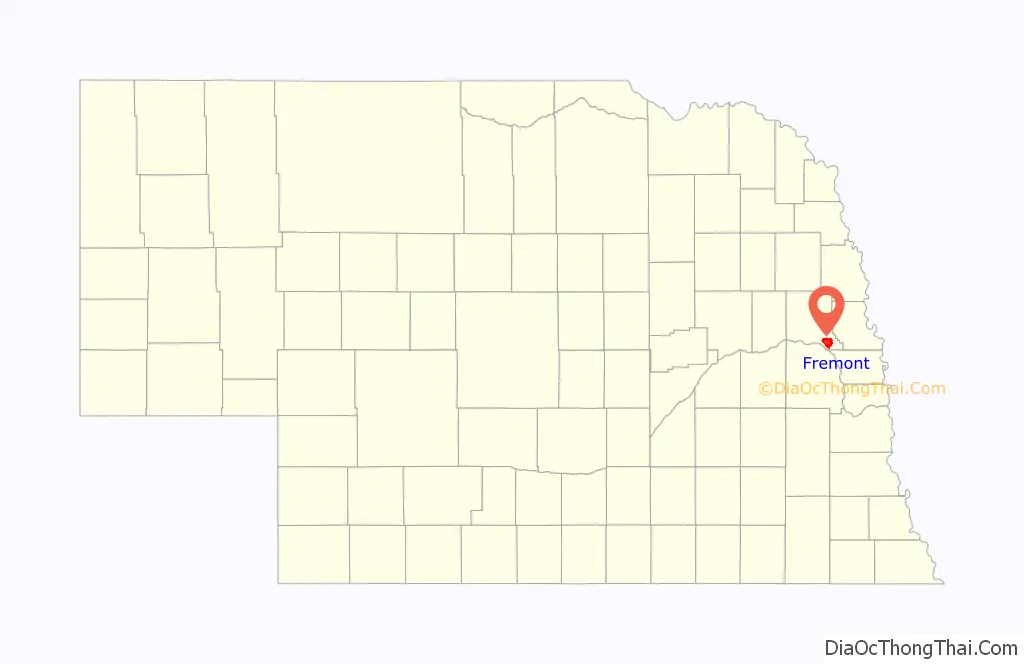
Fremont location map. Where is Fremont city?
History
From the 1830s to the 1860s, the area saw a great deal of traffic due to the Mormon Trail, which passed along the north bank of the Platte River. A ferry connected the two banks of the Elkhorn River near Fremont. It was a major overland route for emigrant settlers going to the West, the military and hunters.
Fremont was laid out in 1856 in anticipation that the railroad would be extended to that site. It was named after the American explorer, politician and military official General John C. Frémont. By 1857, there were 13 log houses in the town. The Union Pacific Railroad reached the town in December 1865 becoming the first railroad into the future rail hub. Sioux City and Pacific Railroad completed track into the town in 1868 with the Elkhorn Valley Railroad arriving in 1869.
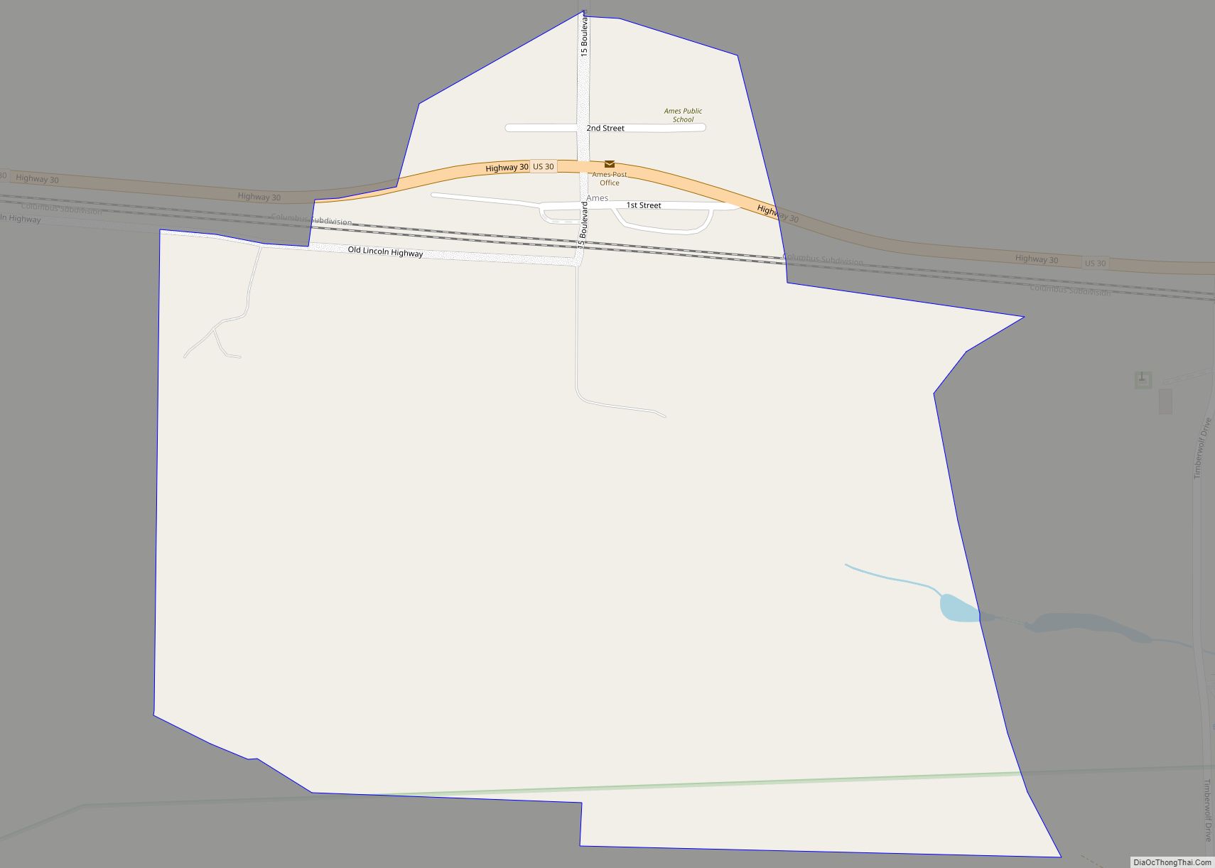
Due to the town’s geographically central location, the First Transcontinental Telegraph line (1861), railroad (1865) and highway (1913) passed through or very near Fremont. Original brick portions of the “Old Lincoln Highway” are located east of Fremont, on the way to Omaha.
Fremont is the namesake for the Fremont neighborhood in Seattle, which was settled by Luther H. Griffith and Edward Blewett from Fremont.
On January 10, 1976, in downtown Fremont, the Pathfinder Hotel exploded due to a natural gas leak in the basement. At the time the hotel was being used as apartments, mostly occupied by senior citizens. It also was a meeting place for philanthropic and business organizations, and had a drug store on the northwest corner. The explosion shattered windows around the city, and the ensuing fire killed 23 people and destroyed most of the city block of the hotel.
Fremont gained national attention in 2010 when residents approved a referendum that would ban illegal immigrants from renting and working in the town.
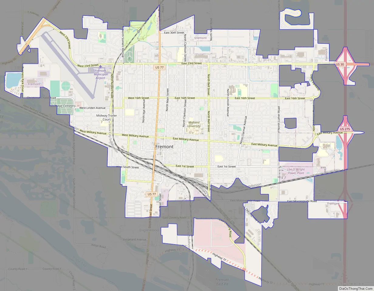
Fremont Road Map
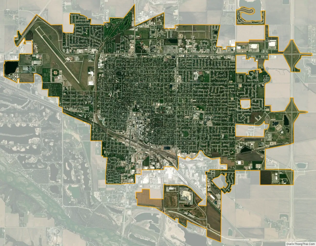
Fremont city Satellite Map
Geography
Fremont is located along the Platte River, approximately 35 miles (56 km) northwest of the largest city in the area, Omaha, and 50 miles (80 km) northeast of the state capitol, Lincoln.
According to the United States Census Bureau, the city has a total area of 8.85 square miles (22.92 km), of which 8.80 square miles (22.79 km) is land and 0.05 square miles (0.13 km) is water. Fremont lies in the river plain between the Platte and Elkhorn rivers, at an elevation of approximately 366 meters (1,203 ft) above sea level.
Climate
See also
Map of Nebraska State and its subdivision:- Adams
- Antelope
- Arthur
- Banner
- Blaine
- Boone
- Box Butte
- Boyd
- Brown
- Buffalo
- Burt
- Butler
- Cass
- Cedar
- Chase
- Cherry
- Cheyenne
- Clay
- Colfax
- Cuming
- Custer
- Dakota
- Dawes
- Dawson
- Deuel
- Dixon
- Dodge
- Douglas
- Dundy
- Fillmore
- Franklin
- Frontier
- Furnas
- Gage
- Garden
- Garfield
- Gosper
- Grant
- Greeley
- Hall
- Hamilton
- Harlan
- Hayes
- Hitchcock
- Holt
- Hooker
- Howard
- Jefferson
- Johnson
- Kearney
- Keith
- Keya Paha
- Kimball
- Knox
- Lancaster
- Lincoln
- Logan
- Loup
- Madison
- McPherson
- Merrick
- Morrill
- Nance
- Nemaha
- Nuckolls
- Otoe
- Pawnee
- Perkins
- Phelps
- Pierce
- Platte
- Polk
- Red Willow
- Richardson
- Rock
- Saline
- Sarpy
- Saunders
- Scotts Bluff
- Seward
- Sheridan
- Sherman
- Sioux
- Stanton
- Thayer
- Thomas
- Thurston
- Valley
- Washington
- Wayne
- Webster
- Wheeler
- York
- Alabama
- Alaska
- Arizona
- Arkansas
- California
- Colorado
- Connecticut
- Delaware
- District of Columbia
- Florida
- Georgia
- Hawaii
- Idaho
- Illinois
- Indiana
- Iowa
- Kansas
- Kentucky
- Louisiana
- Maine
- Maryland
- Massachusetts
- Michigan
- Minnesota
- Mississippi
- Missouri
- Montana
- Nebraska
- Nevada
- New Hampshire
- New Jersey
- New Mexico
- New York
- North Carolina
- North Dakota
- Ohio
- Oklahoma
- Oregon
- Pennsylvania
- Rhode Island
- South Carolina
- South Dakota
- Tennessee
- Texas
- Utah
- Vermont
- Virginia
- Washington
- West Virginia
- Wisconsin
- Wyoming