Map of White Clay CDP
White Clay CDP overview: Name: White Clay CDP LSAD Code: 57 LSAD Description: CDP (suffix) State: Nebraska County: Sheridan County FIPS code: 3152855 Online Interactive Map White Clay online map. Source: Basemap layers from Google Map, Open Street Map (OSM), Arcgisonline, Wmflabs. Boundary Data from Database of Global Administrative Areas. White Clay location map. Where ... Read more
Map of White Clay CDP
Map of Weston village, Nebraska
Weston is a village in Saunders County, Nebraska, United States. The population was 250 at the 2020 census. Weston village overview: Name: Weston village LSAD Code: 47 LSAD Description: village (suffix) State: Nebraska County: Saunders County Elevation: 1,250 ft (380 m) Total Area: 0.22 sq mi (0.58 km²) Land Area: 0.22 sq mi (0.58 km²) Water Area: 0.00 sq mi (0.00 km²) Total Population: 250 Population ... Read more
Map of Weston village, Nebraska
Map of Westerville CDP, Nebraska
Westerville is an unincorporated community and census-designated place in Custer County, Nebraska, United States. It is located at the intersection of U.S. Route 183 and Nebraska Highway 70. As of the 2010 census it had a population of 39. Westerville CDP overview: Name: Westerville CDP LSAD Code: 57 LSAD Description: CDP (suffix) State: Nebraska County: ... Read more
Map of Westerville CDP, Nebraska
Map of Western village
Western is a village in Saline County, Nebraska, United States. The population was 224 at the 2020 census. Western village overview: Name: Western village LSAD Code: 47 LSAD Description: village (suffix) State: Nebraska County: Saline County Elevation: 1,493 ft (455 m) Total Area: 0.49 sq mi (1.26 km²) Land Area: 0.49 sq mi (1.26 km²) Water Area: 0.00 sq mi (0.00 km²) Total Population: 224 Population ... Read more
Map of Western village
Map of West Point city, Nebraska
West Point is a city in and the county seat of Cuming County, Nebraska, United States. The population was 3,504 at the 2020 census. West Point city overview: Name: West Point city LSAD Code: 25 LSAD Description: city (suffix) State: Nebraska County: Cuming County Elevation: 1,348 ft (411 m) Total Area: 2.85 sq mi (7.39 km²) Land Area: 2.84 sq mi (7.35 km²) ... Read more
Map of West Point city, Nebraska
Map of Wellfleet village
Wellfleet is a village in Lincoln County, Nebraska, United States. It is part of the North Platte, Nebraska Micropolitan Statistical Area. The population was 78 at the 2010 census. Wellfleet village overview: Name: Wellfleet village LSAD Code: 47 LSAD Description: village (suffix) State: Nebraska County: Lincoln County Elevation: 2,818 ft (859 m) Total Area: 0.27 sq mi (0.70 km²) Land ... Read more
Map of Wellfleet village
Map of Weeping Water city
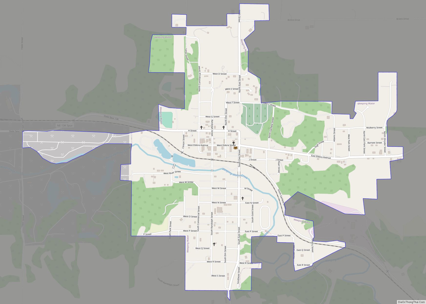
Weeping Water is a city in Cass County, Nebraska, United States. The population was 1,029 at the 2020 census. Weeping Water city overview: Name: Weeping Water city LSAD Code: 25 LSAD Description: city (suffix) State: Nebraska County: Cass County Elevation: 1,083 ft (330 m) Total Area: 0.99 sq mi (2.56 km²) Land Area: 0.99 sq mi (2.56 km²) Water Area: 0.00 sq mi (0.00 km²) Total ... Read more
Map of Weeping Water city
Map of Wayne city, Nebraska
Wayne is a city in Wayne County, Nebraska, United States. The population was 5,660 at the 2010 census. It is the county seat of Wayne County and the home of Wayne State College. Wayne city overview: Name: Wayne city LSAD Code: 25 LSAD Description: city (suffix) State: Nebraska County: Wayne County Founded: 1881 Elevation: 1,453 ft ... Read more
Map of Wayne city, Nebraska
Map of Winside village
Winside is a village in Wayne County, Nebraska, United States. The population was 381 at the 2020 census. Winside village overview: Name: Winside village LSAD Code: 47 LSAD Description: village (suffix) State: Nebraska County: Wayne County Elevation: 1,578 ft (481 m) Total Area: 0.26 sq mi (0.68 km²) Land Area: 0.26 sq mi (0.68 km²) Water Area: 0.00 sq mi (0.00 km²) Total Population: 381 Population ... Read more
Map of Winside village
Map of Winnetoon village
Winnetoon is a village in Knox County, Nebraska, United States. The population was 68 at the 2010 census. Winnetoon village overview: Name: Winnetoon village LSAD Code: 47 LSAD Description: village (suffix) State: Nebraska County: Knox County Elevation: 1,660 ft (506 m) Total Area: 0.29 sq mi (0.75 km²) Land Area: 0.29 sq mi (0.75 km²) Water Area: 0.00 sq mi (0.00 km²) Total Population: 54 Population ... Read more
Map of Winnetoon village
Map of Winnebago village, Nebraska
Winnebago is a village in Thurston County, Nebraska, United States. The population was 916 at the 2020 census. Winnebago village overview: Name: Winnebago village LSAD Code: 47 LSAD Description: village (suffix) State: Nebraska County: Thurston County Elevation: 1,165 ft (355 m) Total Area: 0.32 sq mi (0.83 km²) Land Area: 0.32 sq mi (0.83 km²) Water Area: 0.00 sq mi (0.00 km²) Total Population: 916 Population ... Read more
Map of Winnebago village, Nebraska
Map of Wilsonville village, Nebraska
Wilsonville is a village in Furnas County, Nebraska, United States. The population was 93 at the 2010 census. Wilsonville village overview: Name: Wilsonville village LSAD Code: 47 LSAD Description: village (suffix) State: Nebraska County: Furnas County Elevation: 2,303 ft (702 m) Total Area: 0.27 sq mi (0.69 km²) Land Area: 0.27 sq mi (0.69 km²) Water Area: 0.00 sq mi (0.00 km²) Total Population: 75 Population ... Read more
Map of Wilsonville village, Nebraska