Wisner is a city in northwestern Cuming County, Nebraska, United States. The population was 1,170 at the 2010 census.
| Name: | Wisner city |
|---|---|
| LSAD Code: | 25 |
| LSAD Description: | city (suffix) |
| State: | Nebraska |
| County: | Cuming County |
| Elevation: | 1,388 ft (423 m) |
| Total Area: | 1.28 sq mi (3.31 km²) |
| Land Area: | 1.25 sq mi (3.24 km²) |
| Water Area: | 0.03 sq mi (0.07 km²) |
| Total Population: | 1,239 |
| Population Density: | 990.41/sq mi (382.55/km²) |
| ZIP code: | 68791 |
| Area code: | 402 |
| FIPS code: | 3153450 |
| GNISfeature ID: | 0834832 |
| Website: | ci.wisner.ne.us |
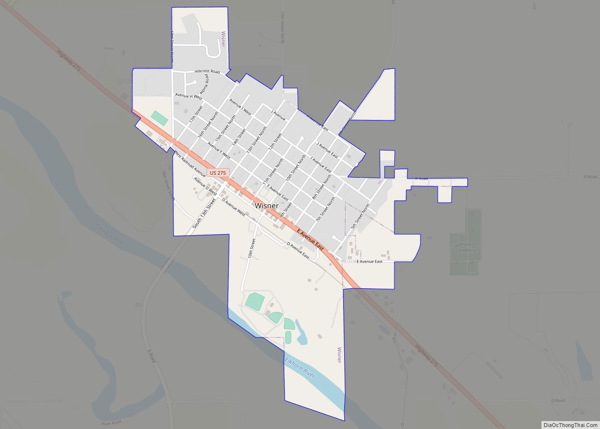
Online Interactive Map
Click on ![]() to view map in "full screen" mode.
to view map in "full screen" mode.
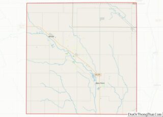
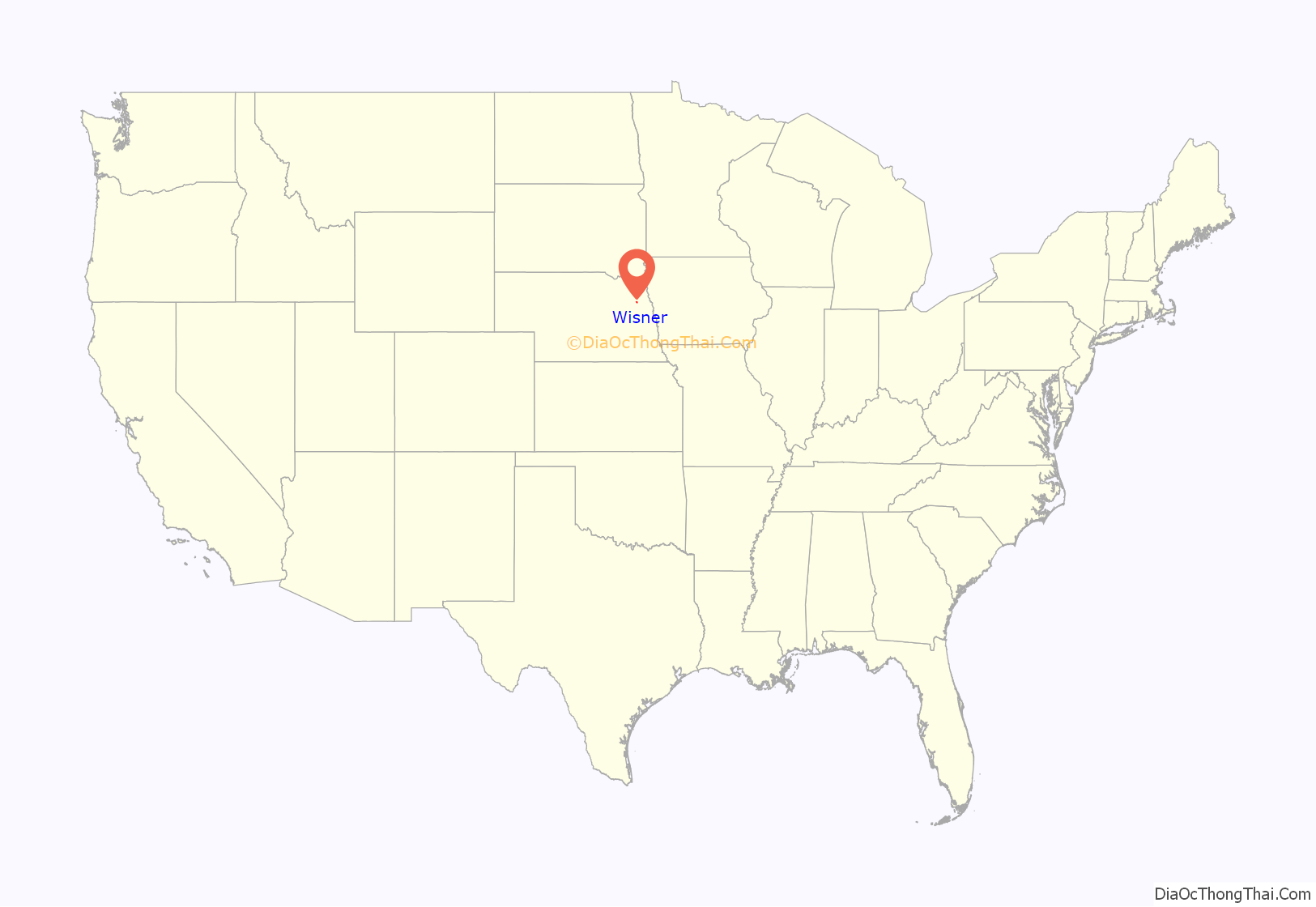
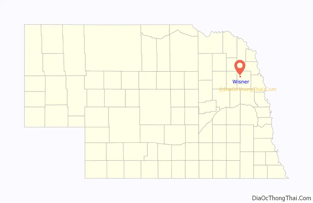
Wisner location map. Where is Wisner city?
History
Wisner was platted in 1871 shortly before the railroad was extended to that point. It was named for Samuel P. Wisner, a railroad official for the Sioux City & Pacific Railroad. The Chicago & North Western ended railroad service in the spring of 1982, after years of declining freight traffic volumes (which had been happening since the mid-1970s) & flooding damaged many sections of the track & abandonment was applied for. The tracks were removed a few years later.
Wisner Road Map
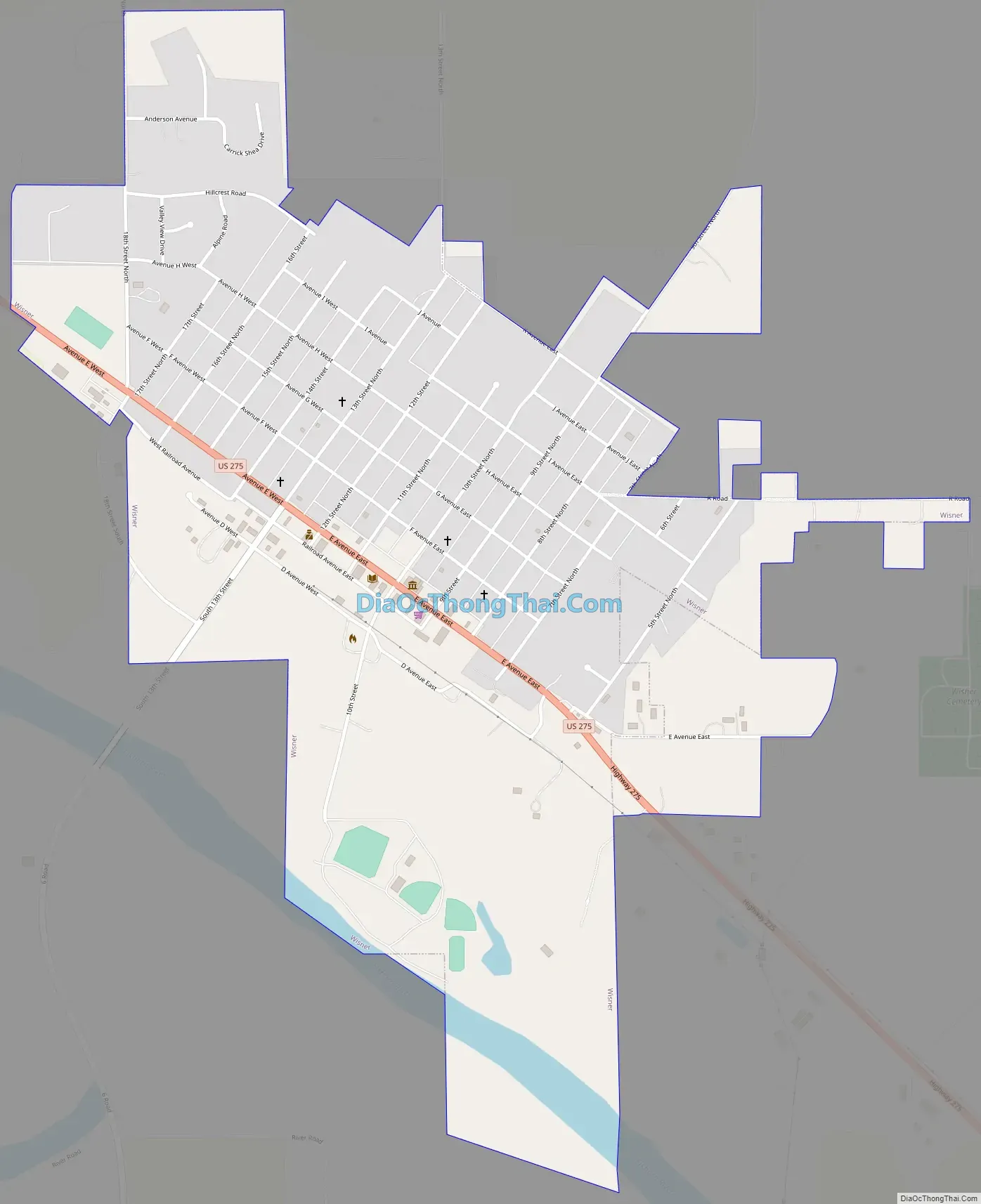
Wisner city Satellite Map

Geography
Wisner is located at 41°59′22″N 96°54′52″W / 41.98944°N 96.91444°W / 41.98944; -96.91444 (41.989498, -96.914532).
According to the United States Census Bureau, the city has a total area of 1.06 square miles (2.75 km), of which 1.03 square miles (2.67 km) is land and 0.03 square miles (0.08 km) is water.
See also
Map of Nebraska State and its subdivision:- Adams
- Antelope
- Arthur
- Banner
- Blaine
- Boone
- Box Butte
- Boyd
- Brown
- Buffalo
- Burt
- Butler
- Cass
- Cedar
- Chase
- Cherry
- Cheyenne
- Clay
- Colfax
- Cuming
- Custer
- Dakota
- Dawes
- Dawson
- Deuel
- Dixon
- Dodge
- Douglas
- Dundy
- Fillmore
- Franklin
- Frontier
- Furnas
- Gage
- Garden
- Garfield
- Gosper
- Grant
- Greeley
- Hall
- Hamilton
- Harlan
- Hayes
- Hitchcock
- Holt
- Hooker
- Howard
- Jefferson
- Johnson
- Kearney
- Keith
- Keya Paha
- Kimball
- Knox
- Lancaster
- Lincoln
- Logan
- Loup
- Madison
- McPherson
- Merrick
- Morrill
- Nance
- Nemaha
- Nuckolls
- Otoe
- Pawnee
- Perkins
- Phelps
- Pierce
- Platte
- Polk
- Red Willow
- Richardson
- Rock
- Saline
- Sarpy
- Saunders
- Scotts Bluff
- Seward
- Sheridan
- Sherman
- Sioux
- Stanton
- Thayer
- Thomas
- Thurston
- Valley
- Washington
- Wayne
- Webster
- Wheeler
- York
- Alabama
- Alaska
- Arizona
- Arkansas
- California
- Colorado
- Connecticut
- Delaware
- District of Columbia
- Florida
- Georgia
- Hawaii
- Idaho
- Illinois
- Indiana
- Iowa
- Kansas
- Kentucky
- Louisiana
- Maine
- Maryland
- Massachusetts
- Michigan
- Minnesota
- Mississippi
- Missouri
- Montana
- Nebraska
- Nevada
- New Hampshire
- New Jersey
- New Mexico
- New York
- North Carolina
- North Dakota
- Ohio
- Oklahoma
- Oregon
- Pennsylvania
- Rhode Island
- South Carolina
- South Dakota
- Tennessee
- Texas
- Utah
- Vermont
- Virginia
- Washington
- West Virginia
- Wisconsin
- Wyoming