Beaverdam is a census-designated place in Lincoln County, Nevada, United States. As of the 2010 census it had a population of 44. Beaverdam CDP overview: Name: Beaverdam CDP LSAD Code: 57 LSAD Description: CDP (suffix) State: Nevada County: Lincoln County Elevation: 4,600 ft (1,400 m) Total Area: 0.69 sq mi (1.78 km²) Land Area: 0.69 sq mi (1.78 km²) Water Area: 0.00 sq mi (0.00 km²) ... Read more
Nevada Cities and Places
Beatty (/ˈbeɪti/ BAYT-ee) is an unincorporated town along the Amargosa River in Nye County in the U.S. state of Nevada. U.S. Route 95 runs through the town, which lies between Tonopah, about 90 miles (140 km) to the north and Las Vegas, about 120 miles (190 km) to the southeast. State Route 374 connects Beatty to Death ... Read more
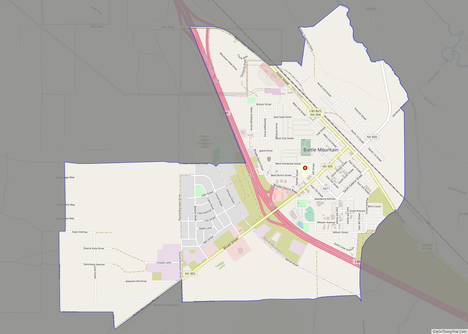
Battle Mountain is an unincorporated town in and the county seat of Lander County, Nevada, United States. The population was 3,635 at the 2010 census. Its primary economic base is gold mining and, to a lesser extent, legalized gambling. The town is located on Interstate 80 between Winnemucca and Elko. Battle Mountain CDP overview: Name: ... Read more
Baker is a census-designated place in southeastern White Pine County, Nevada, United States. It is located 5 miles (8.0 km) east of the main entrance of Great Basin National Park at the junction of State Routes 487 and 488. The town is named after an early settler, George W. Baker. Its population at the 2010 census ... Read more
Dayton is an unincorporated community and census-designated place (CDP) in Lyon County, Nevada, United States. The population was 15,153 at the 2020 census. Dayton is the second oldest Nevada settlement. It is home to the oldest hotel in Nevada. Dayton CDP overview: Name: Dayton CDP LSAD Code: 57 LSAD Description: CDP (suffix) State: Nevada County: ... Read more
Crystal Bay is a census-designated place (CDP) on the north shore of Lake Tahoe in Washoe County, Nevada, United States. The population was 305 at the 2010 census. It is part of the Reno−Sparks Metropolitan Statistical Area. Prior to 2010, it was listed by the U.S. Census Bureau within the Incline Village–Crystal Bay CDP. Crystal ... Read more
Crescent Valley is a census-designated place (CDP) in Eureka County, Nevada, United States, directly off Nevada State Route 306. It is the site of Crescent Valley Elementary School, Crescent Valley Fair Grounds, and Crescent Valley Community Park. The census-designated place (CDP) of Crescent Valley had a population of 483 as of the 2020 census. Crescent ... Read more
Cold Springs is a census-designated place (CDP) in Washoe County, Nevada, United States. It is known as Eitse’ihpaa or Eitse’ippaa (literally “cold water” or “cold spring”) in Shoshoni. It is located just off U.S. Route 395 in the northwestern part of the Reno–Sparks Metropolitan Statistical Area, adjacent to the California state line. The population was ... Read more
Carter Springs is a census-designated place (CDP) in Douglas County, Nevada, United States. The population was 553 at the 2010 census. Carter Springs CDP overview: Name: Carter Springs CDP LSAD Code: 57 LSAD Description: CDP (suffix) State: Nevada County: Douglas County Elevation: 5,522 ft (1,683 m) Total Area: 2.80 sq mi (7.25 km²) Land Area: 2.80 sq mi (7.25 km²) Water Area: 0.00 sq mi ... Read more
Carlin is a small city located near the western border of Elko County in northeast Nevada, 23 miles (37 km) west of the city of Elko. It is part of the Elko Micropolitan Statistical Area. Carlin sits along Interstate 80 at an elevation of approximately 4,900 feet (1,500 m). As of the 2010 census, its population was ... Read more
Caliente /kæliˈɛni/, /kæliˈɛnti/, formerly known as Culverwell and Calientes, is a city in Lincoln County, Nevada, United States. Its elevation is 4,300 feet (1,300 m). The population was 1,130 at the 2010 census, making it the least populated incorporated city in Nevada. The city’s name originated from the nearby hot springs, as “caliente” is the Spanish ... Read more
Cal-Nev-Ari is a census-designated place on U.S. Route 95 in Clark County, Nevada, United States, near the state’s southernmost point. As of the 2010 census, the town had a population of 244. The town’s name is a syllabic abbreviation of California, Nevada and Arizona. Cal-Nev-Ari was created in the mid-1960s by Nancy and Everette “Slim” ... Read more