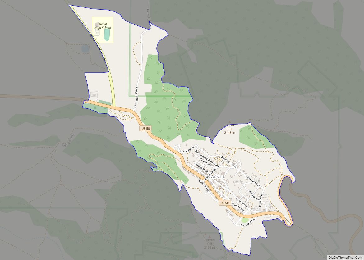
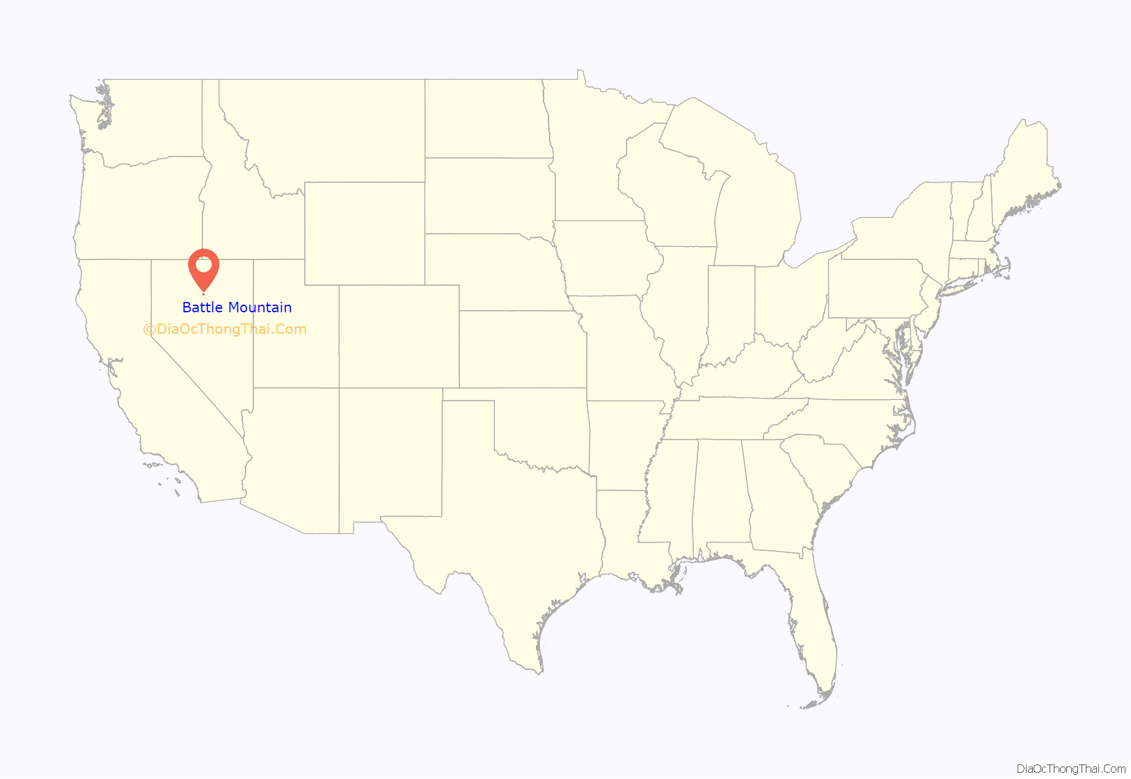
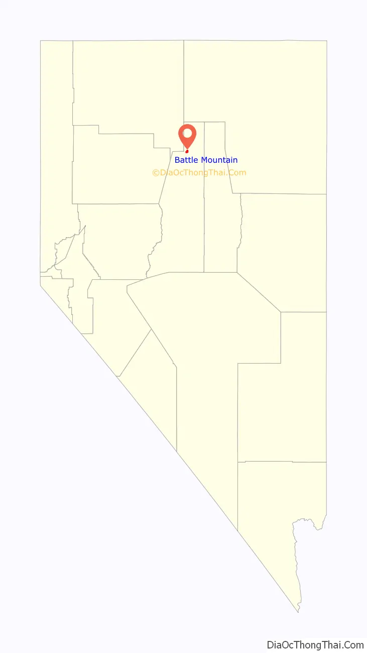
Battle Mountain is an unincorporated town in and the county seat of Lander County, Nevada, United States. The population was 3,635 at the 2010 census. Its primary economic base is gold mining and, to a lesser extent, legalized gambling.
The town is located on Interstate 80 between Winnemucca and Elko.
| Name: | Battle Mountain CDP |
|---|---|
| LSAD Code: | 57 |
| LSAD Description: | CDP (suffix) |
| State: | Nevada |
| County: | Lander County |
| Elevation: | 4,511 ft (1,375 m) |
| Total Area: | 6.12 sq mi (15.84 km²) |
| Land Area: | 6.11 sq mi (15.83 km²) |
| Water Area: | 0.00 sq mi (0.01 km²) |
| Total Population: | 3,705 |
| Population Density: | 606.09/sq mi (234.02/km²) |
| ZIP code: | 89820 |
| Area code: | 775 |
| FIPS code: | 3204900 |
| GNISfeature ID: | 0838652 |
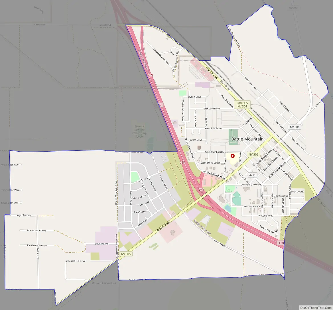
Online Interactive Map
Click on ![]() to view map in "full screen" mode.
to view map in "full screen" mode.
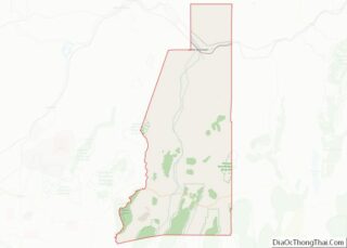
Battle Mountain location map. Where is Battle Mountain CDP?
History
The Battle Mountain area was home to the Northern Paiute and Shoshone peoples. The area was noted by fur trappers in the 1820s and ’30s. It served as a waypoint for westward-bound travel on the Emigrant Trail along the Humboldt River by 1845. According to local legends, the name stems from confrontations between Native Americans and early settlers during the 1850s.
When copper ore was discovered and mining began in 1866, the Central Pacific Railroad started a station to support the mining activity. As of 2009, the same railway is still in use. In 1870, the railroad moved the Argenta station to Battle Mountain and established a townsite to serve the Battle Mountain copper and gold mining district.
In 1874, the Nevada Legislature overrode the governor’s veto and approved a railroad from Austin to Battle Mountain. The Nevada Central Railroad from Battle Mountain to Austin was completed in 1880. The rail line was constructed to connect the silver mines around Austin to the Central Pacific line at Battle Mountain. The rail line served the Austin area until it was abandoned in 1938.
Ulysses S. Grant spoke in the town in 1879 during his western speaking tour.
President Woodrow Wilson established Battle Mountain Indian Colony by executive order (Lander) in 1917. In 1919, Nevada’s Red Scare Miners held a ten-day strike at the Battle Mountain Copper Mines.
On May 15, 1979, the voters of Lander County approved the move of the county seat from Austin to Battle Mountain in a special election. In a subsequent ruling, the Nevada Supreme Court affirmed this decision.
Chiefs Frank Temoke and Frank Brady refused the government’s offer of a payoff under the 1863 Treaty of Ruby Valley at Battle Mountain on December 11, 1992.
The 2008 Wells, Nevada, earthquake of 6.3 magnitude that affected the northeastern part of the state severely damaged one of the city’s oldest historical buildings, the Lemaire Building, which was condemned.
Battle Mountain Road Map
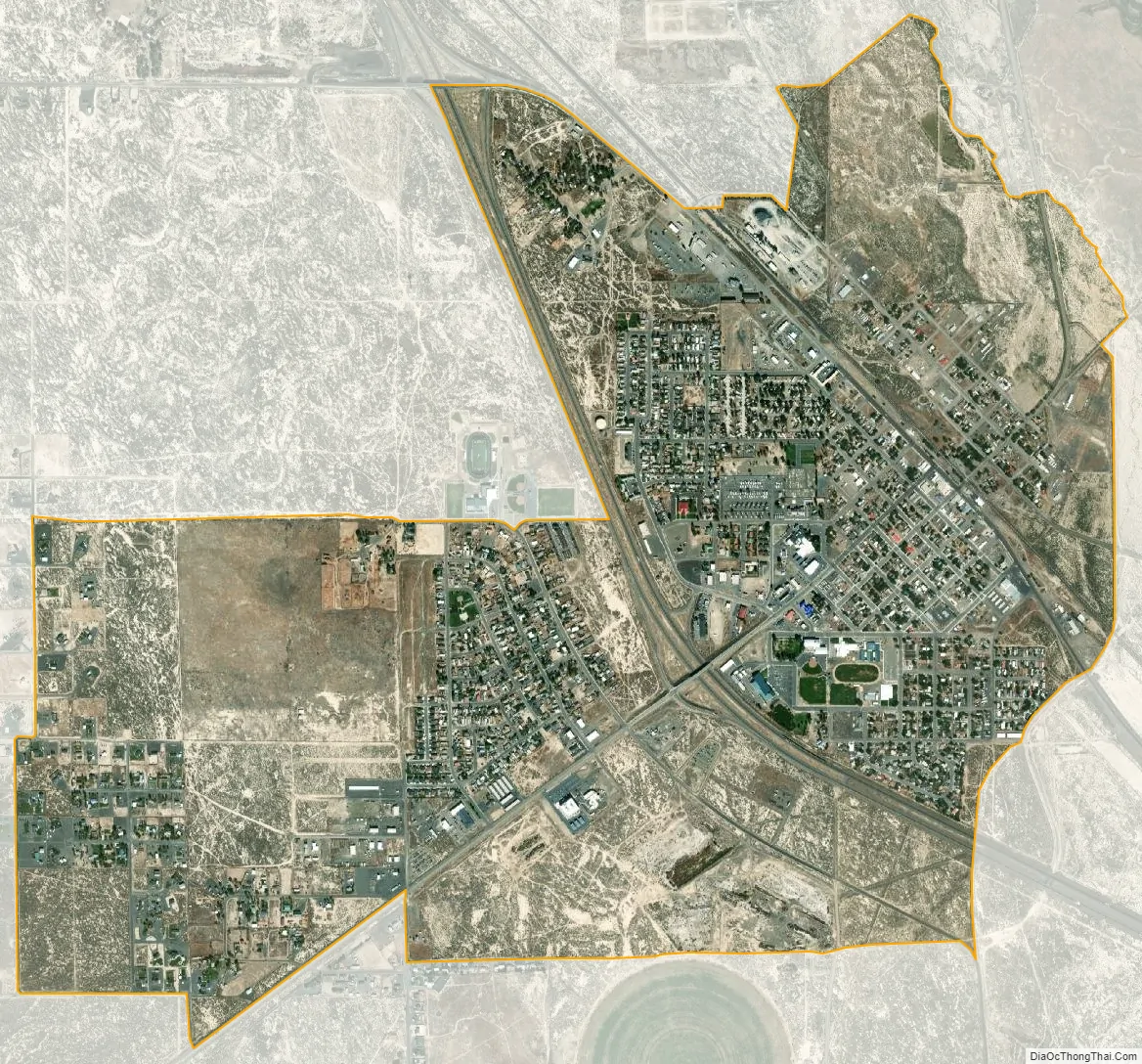
Battle Mountain city Satellite Map
Geography
Battle Mountain is located at the confluence of two rivers, the Humboldt and the Reese. The town is in the Humboldt valley between the Shoshone Range to the southeast, the Battle Mountains to the southwest and the Sheep Creek Range across the Humboldt to the north.
According to the United States Census Bureau, the community has a total area of 3.6 square miles or 9.3 square kilometres, all land.
Geology
Copper mining started in 1866 and the Copper Canyon Mine operated from 1917 until 1955. The Tomboy-Minnie ore deposits were developed after the depletion of the West ore body, which was developed after the depletion of the East ore body. Open-pit mining started in 1967. Placer gold was discovered in 1912. Mining switched from the copper-gold-silver ores to gold-silver ores in 1979. The Fortitude gold-silver skarn body was discovered in 1981. The Surprise gold deposit was discovered in 1986.
The economic geologic zone is primarily in the Antler Sequence, consisting of the Middle Pennsylvanian Battle Formation, the Pennsylvanian to Permian Antler Peak Limestone, and the Permian Edna Mountain Formation. These Paleozoic rocks were intruded in the Tertiary by a granodiorite porphyry which generated the ore bodies as zones of disseminated sulfide minerals. These zones include copper-gold-silver next to the granodiorite, followed by a gold-silver zone, then a lead-zinc-silver zone.
Gold and copper mines in the Battle Mountain Mining District. As of 2019, the mines are operated by Newmont Goldcorp as the Phoenix Mine.
Battle Mountain Geology Map
Battle Mountain Geology Map Index
Battle Mountain meteorite
A meteorite fall was reported on 22 Aug 2012 on Battle Mountain at coordinates 40°40′05″N 117°11′21″W / 40.66813°N 117.18913°W / 40.66813; -117.18913. It was classified as an ordinary chondrite, and a 1.4-pound (630-gram) fragment was sent to NASA’s Jet Propulsion Laboratory for analysis.
Climate
Battle Mountain’s climate is cool semi-arid (Köppen climate classification BSk), receiving just enough precipitation to avoid arid classification. Due to aridity and high elevation, the area commonly experiences large diurnal temperature variation, particularly in summer, when it averages almost 45 °F or 25 °C. The monthly daily average temperature ranges from 29.8 °F or −1.2 °C in January to 73.6 °F or 23.1 °C in July. There are, on average, fourteen afternoons of 100 °F or 37.8 °C or hotter maxima, 74 afternoons of 90 °F or 32.2 °C or hotter maxima, eleven afternoons where the high does not rise above freezing, and seven mornings falling to or below 0 °F or −17.8 °C annually; the average window for freezing temperatures is September 16 to May 29. By far the coldest recorded month has been January 1949, with a mean of 4.6 °F (−15.2 °C) and a mean minimum of −12.0 °F (−24.4 °C) – between January 2 and February 3, the temperature did not reach freezing, whereas during the winter of 2011/2012 every single day topped freezing. The hottest month has been July 2013, with a mean of 79.9 °F (26.6 °C) and a mean maximum of 100.1 °F (37.8 °C), although July 2007’s maximum was even hotter at 100.8 °F (38.2 °C).
With a period of record only dating back to 1944, extremes range from −39 °F (−39.4 °C) on December 22, 1990, up to 112 °F (44.4 °C) on July 12, 2002.
The mean seasonal snowfall of 19.1 inches or 0.49 metres on average occurs from November 25 to April 2, with half the annual snow falling during December and January alone. The snowiest season has been from July 1992 to June 1993, with a total of 53.2 inches (1.35 m), whereas only 2.2 inches or 0.06 metres fell from July 2014 and June 2015. Total seasonal precipitation has ranged from 15.87 inches or 403.1 millimetres between July 1997 and June 1998, down to only 2.97 inches or 75.4 millimetres between July 1958 and June 1959.
See also
Map of Nevada State and its subdivision: Map of other states:- Alabama
- Alaska
- Arizona
- Arkansas
- California
- Colorado
- Connecticut
- Delaware
- District of Columbia
- Florida
- Georgia
- Hawaii
- Idaho
- Illinois
- Indiana
- Iowa
- Kansas
- Kentucky
- Louisiana
- Maine
- Maryland
- Massachusetts
- Michigan
- Minnesota
- Mississippi
- Missouri
- Montana
- Nebraska
- Nevada
- New Hampshire
- New Jersey
- New Mexico
- New York
- North Carolina
- North Dakota
- Ohio
- Oklahoma
- Oregon
- Pennsylvania
- Rhode Island
- South Carolina
- South Dakota
- Tennessee
- Texas
- Utah
- Vermont
- Virginia
- Washington
- West Virginia
- Wisconsin
- Wyoming