Map of Juliustown CDP

Map of Juliustown CDP

Juliustown is an unincorporated community and census-designated place (CDP) located within Springfield Township, in Burlington County, in the U.S. state of New Jersey, that was established as part of the 2010 United States census. As of the 2010 Census, the CDP’s population was 429. Juliustown CDP overview: Name: Juliustown CDP LSAD Code: 57 LSAD Description: … Read more

Map of Johnsonburg CDP

Map of Johnsonburg CDP, New Jersey

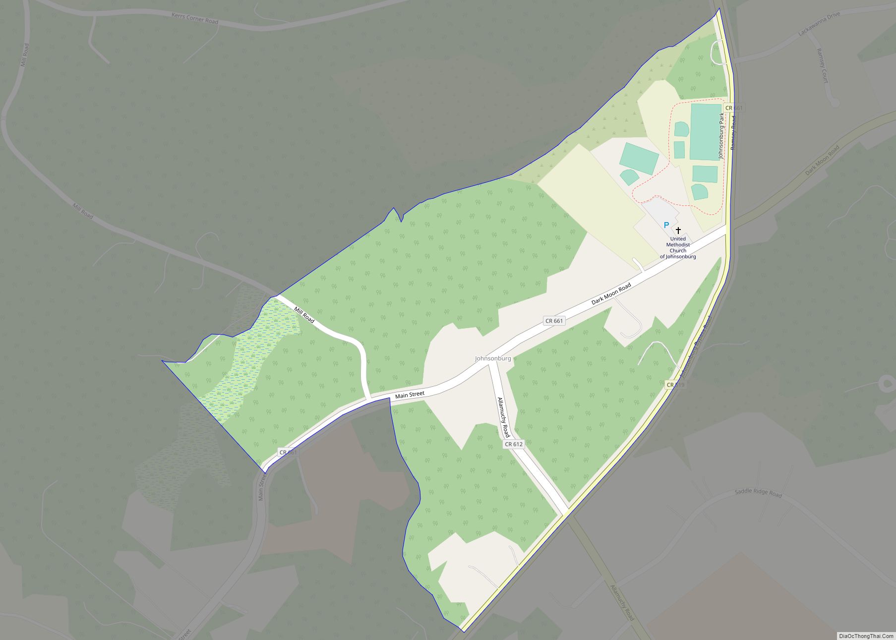
Johnsonburg is an unincorporated community and census-designated place (CDP) located within Frelinghuysen Township in Warren County, New Jersey, United States, that was created as part of the 2010 United States Census. As of the 2020 Census, the CDP’s population was 381, up from 101 in the 2010 Census. Johnsonburg CDP overview: Name: Johnsonburg CDP LSAD … Read more

Map of Jamesburg borough

Map of Jamesburg borough

Jamesburg is a borough in Middlesex County, in the U.S. state of New Jersey. As of the 2020 United States census, the borough’s population was 5,783, a decrease of 132 (−2.2%) from the 2010 census count of 5,915, which in turn reflected a decline of 110 (−1.8%) from the 6,025 counted at the 2000 census. … Read more

Map of Island Heights borough

Map of Island Heights borough

Island Heights is a borough in Ocean County, in the U.S. state of New Jersey. As of the 2020 United States census, the borough’s population was 1,650, a decrease of 23 (−1.4%) from the 2010 census count of 1,673, which in turn reflected a decline of 78 (−4.5%) from the 1,751 counted in the 2000 … Read more

Map of Iselin CDP

Map of Iselin CDP

Iselin /ˈɪzˈlɪn/ is an unincorporated community and census-designated place (CDP) located within Woodbridge Township, in Middlesex County, in the U.S. state of New Jersey. As of the 2010 United States census, Iselin’s population was 18,695. Previously known as Perrytown and Unionville, Iselin received its current name after New York City investment banker and philanthropist Adrian … Read more

Map of Interlaken borough, New Jersey

Map of Interlaken borough, New Jersey

Interlaken is a borough situated in the Jersey Shore region, within Monmouth County, in the U.S. state of New Jersey. As of the 2020 United States census, the borough’s population was 828, an increase of 8 (+1.0%) from the 2010 census count of 820, which in turn had reflected a decline of 80 (−8.9%) from … Read more

Map of Hutchinson CDP, New Jersey

Map of Hutchinson CDP, New Jersey

Hutchinson is an unincorporated community and census-designated place (CDP) located within Harmony Township in Warren County, New Jersey, United States, that was defined as part of the 2010 United States Census. As of the 2010 Census, the CDP’s population was 135. Hutchinson CDP overview: Name: Hutchinson CDP LSAD Code: 57 LSAD Description: CDP (suffix) State: … Read more

Map of Hopewell borough, New Jersey

Map of Hopewell borough, New Jersey

Hopewell borough overview: Name: Hopewell borough LSAD Code: 21 LSAD Description: borough (suffix) State: New Jersey County: Mercer County FIPS code: 3433150 Online Interactive Map Hopewell online map. Source: Basemap layers from Google Map, Open Street Map (OSM), Arcgisonline, Wmflabs. Boundary Data from Database of Global Administrative Areas. Hopewell location map. Where is Hopewell borough? … Read more

Map of Lake Telemark CDP

Map of Lake Telemark CDP

Lake Telemark is an unincorporated community and census-designated place (CDP) located within Rockaway Township, in Morris County, New Jersey, United States. As of the 2010 United States Census, the CDP’s population was 1,255. Lake Telemark CDP overview: Name: Lake Telemark CDP LSAD Code: 57 LSAD Description: CDP (suffix) State: New Jersey County: Morris County Elevation: … Read more

Map of Lake Mohawk CDP

Map of Lake Mohawk CDP, New Jersey

Lake Mohawk is an unincorporated residential development and census-designated place (CDP) split between Byram Township and Sparta Township, in Sussex County, New Jersey, United States. As of the 2010 United States census, the CDP’s population was 9,916, of which 1,824 were in Byram Township and 8,092 in Sparta Township. Lake Mohawk CDP overview: Name: Lake … Read more

Map of Lake Como borough

Map of Lake Como borough

Lake Como is a borough located in the Jersey Shore region, within Monmouth County, in the U.S. state of New Jersey. As of the 2020 United States census, the borough’s population was 1,697, a decrease of 62 (−3.5%) from the 2010 census count of 1,759, which in turn reflected a decline of 47 (−2.6%) from … Read more

Map of Kinnelon borough

Map of Kinnelon borough

Kinnelon (/kɪnˌəlɒn/) is a borough in Morris County, in the U.S. state of New Jersey, located approximately 33 miles (53 km) west of New York City. As of the 2020 United States census, the borough’s population was 9,966, a decrease of 282 (−2.8%) from the 2010 census count of 10,248, which in turn reflected an increase … Read more