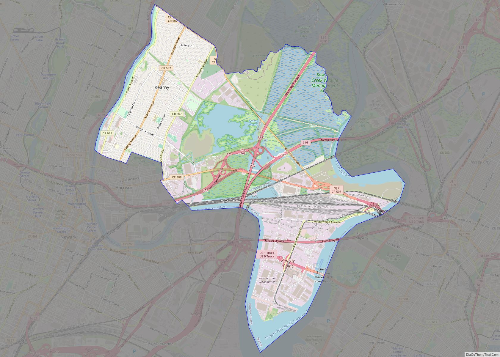
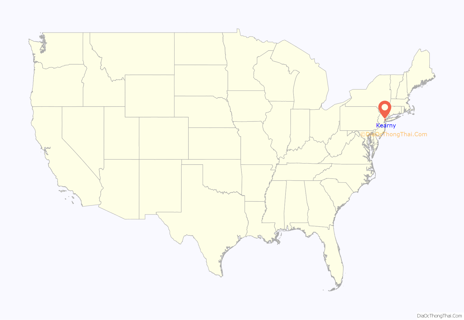
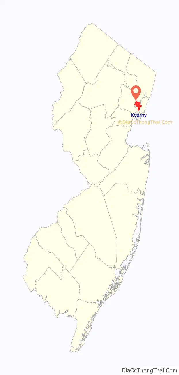
Kearny (/ˈkɑːrni/ KAR-nee) is a town in the western part of Hudson County, in the U.S. state of New Jersey, and a suburb of Newark. As of the 2020 United States census, the town’s population was 41,999, an increase of 1,315 (+3.2%) from the 2010 census count of 40,684, which in turn reflected an increase of 171 (+0.4%) from the 40,513 counted in the 2000 Census.
Kearny is named after Civil War general Philip Kearny. It began as a township formed by an act of the New Jersey Legislature on April 8, 1867, from portions of Harrison Township. Portions of the township were taken on July 3, 1895, to form East Newark. Kearny was incorporated as a town on January 19, 1899, based on the results of a referendum held two days earlier. The Arlington section of town was named for Arlington Station on the Erie Railroad at the Arlington Mill plant, owned by Arlington Mills of Lawrence, Massachusetts.
| Name: | Kearny town |
|---|---|
| LSAD Code: | 43 |
| LSAD Description: | town (suffix) |
| State: | New Jersey |
| County: | Hudson County |
| Incorporated: | April 8, 1867 |
| Elevation: | 7 ft (2 m) |
| Total Area: | 10.27 sq mi (26.61 km²) |
| Land Area: | 8.84 sq mi (22.91 km²) |
| Water Area: | 1.43 sq mi (3.70 km²) 13.91% |
| Total Population: | 41,999 |
| Population Density: | 4,748.9/sq mi (1,833.6/km²) |
| Area code: | 201 and 973 |
| FIPS code: | 3436510 |
| GNISfeature ID: | 0885266 |
| Website: | www.kearnynj.org |
Online Interactive Map
Click on ![]() to view map in "full screen" mode.
to view map in "full screen" mode.
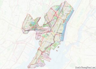
Kearny location map. Where is Kearny town?
History
Colonial roots
The area of Kearny Township, created in 1867, had been part of the original Crown Grant of 30,000 acres (120 km) obtained by Major William Sandford of Barbados on July 4, 1668. Major Sandford named it New Barbadoes Neck after his old home. As was the custom of the time, the Major paid 20 pounds sterling to Chief Tantaqua of the Hackensack tribe for all their reserve rights and titles.
Sanford’s Uncle, Major Nathaniel Kingsland acquired the property in 1708 and sold the upper western tract of the Grant for 300 pounds sterling to Captain Arent Schuyler two years later. The new purchase included present-day Kearny, North Arlington, Lyndhurst and Kingsland.
Shortly after Schuyler’s purchase of his new homestead, a peculiar green stone was uncovered. It was sent to England for analysis and he learned that it contained 80% copper. His opening of a copper mine brought the first steam engine to America from England; it was used to pump out the deep mine shaft. The engine was secretly delivered by its engineer, Josiah Hornblower. The engine and mines were destroyed by fire in 1772 and remained idle for some years.
Schuyler Mansion played a role during the American Revolutionary War Era. When Lord Howe of England took possession of New York Harbor, the proximity of Schuyler Mansion drew many of his officers. They generally traveled over a road that today is referred to as the Belleville Turnpike, which was originally constructed in 1759 using cedar logs from the nearby swamps.
During September 1777, General Henry Clinton, head of the British Expeditionary Forces in America, selected Schuyler Mansion for his headquarters during one of his more important raiding operations, which included the famed Battle of Second River. The Mansion stood until 1924, a period of 214 years, when it was torn-down by a land development company, despite the company’s offers to transfer the land to an organization that would be able to pay to maintain the property.
19th century
In the middle 19th century, Kearny was the upper, or northern, section of the Township of Harrison. A prominent citizen and resident of the upper section, General N. M. Halsted, felt it was impossible under these political conditions for his section to obtain proper recognition. He engaged an energetic campaign for an independent township. He succeeded when the NJ Legislature of 1867 on March 14, adopted “an act creating the Township of Kearny”. The town was named to honor Major General Philip Kearny, Commander of the New Jersey Forces in the Civil War and the owner of the mansion known as Belle Grove (or Belgrove), locally called “Kearny Castle”.
On April 8, 1867, the first election of town officers was held. General N. M. Halsted was elected Chairman. The first official seat of Government was three rooms in the old Lodi Hotel, on the northeast corner of Schuyler and Harrison Avenues.
In the early 1870s, Kearny erected its first Town Hall, on the corner of Kearny and Woodland Avenues, the present site of the Knox Presbyterian Church Parish Hall. This served as a Town Hall, Court House, and Schoolhouse. The Minute Book of the Township states on August 16, 1870, the first step toward establishing Kearny’s present public school system was taken. The first schoolhouse was housed in the Town Hall built at Kearny and Woodland Avenues in 1873.
The Highland Hose No. 4 firehouse, listed on the National Register of Historic Places, was built in 1895.
The town’s nickname, “Soccer Town, U.S.A.” is derived from a soccer tradition that originated in the mid-1870s, when thousands of Scottish and Irish immigrants settled in the town, after two Scottish companies, Clark Thread Company and Nairn Linoleum, opened two local mills and a factory.
When the town’s growth demanded larger quarters, the present Kearny Town Hall, built of Indiana limestone, was erected in 1909.
Factory town
The early influx and development of industry in Kearny dates back to 1875 when the Clark Thread Company of Paisley in Scotland extended its activities to the United States by erecting two large mills in Kearny, and adding two others in 1890. These mills brought to Kearny thousands of Scots immigrants. Many of them would play on Kearny’s soccer teams in National Association Football League. Many are buried at Arlington Memorial Park in the Kearny Uplands.
In 1876, the Mile End Thread Mills started operating, giving employment to several hundred operators.
In 1883, the Marshall Flax Spinning Company of England erected a large plant in Kearny, known as the Linen Thread Company. Their need for experienced flax spinners brought an influx of workers from other sections of the British Isles. Families of those early textile workers were the nucleus of Kearny’s present population.
The Puraline Manufacturing Company, later called the Arlington Company, which became a subsidiary of E. I. DuPont de Nemours Company, had purchased a large tract of land east of the Arlington Station on the Erie Railroad extending well out, north of the railroad embankment, into the meadowland.
In 1887, Sir Michael Nairn established the Nairn Linoleum Company of Kirkcaldy in Scotland, now the Congoleum Nairn Company of Kearny, giving further impetus to local industrial growth. This also led to the growth in the Scottish American population which in the 1960s was about 21,000, accounting for more than half of the town’s residents.
In 1902, the Lovell–Dressel Company, manufacturers of marine and railway lamps and fixtures, located in Kearny adjacent to the Erie Railroad.
Other industries which located in Kearny include: Swift & Company, Koppers Company, Theobald Industries, Standard Tool & Manufacturing, Wilkata Box Company, Harris Steel Company and L & R Manufacturing.
Cargo ships were built at Kearny Yards during World War I, and warships during World War II.
Kearny Works
Between 1926 and 1986, the Kearny Works of Western Electric employed as many as 24,000 in producing a variety of hardware and supplies for the Bell System and was the home of the “Kearny Standard” for tools and equipment. It was sold by AT&T in 1984, by which time the plant had 4,000 employees who earned a total of $128 million a year, making it one of the county’s largest employers. Henry J. Hill, the mayor of Kearny at the time of the AT&T Kearny Works closure, had himself worked 41 years at the facility as a manufacturing manager and retired three years prior to the closure.
Movie and television filming
In 1982, filming occurred in Kearny at a railroad bridge previously owned by Conrail until closure in 1977. The abandoned bridge, located at the Passaic River is called the NX Bridge and it was used for the motion picture, Annie. Several scenes were done with the bridge in its open position. Locals call this bridge the “Annie Bridge” and has not had freight operations since the closure.
Scenes from the HBO drama series The Sopranos were filmed in Kearny. One of its buildings, used for Satriale’s Pork Store, was later razed to prepare for a parking lot. An Irish pub now resides where Satriale’s was located.
The film Spinning Gold, which had been delayed during the pandemic for completion, had scenes filmed in Kearny.
The 2022 horror movie, Smile had a scene filmed at Jersey Oil located at 926 Passaic Avenue. The film is attributed as entirely filmed in New Jersey.
Kearny Point has two studios that are part of the film and television industry. Kearny Mayor Al Santos confirmed, “…our vision for Kearny Point as a hub for film and television production. This investment will create employment opportunities and bring increased economic activity to our community.”
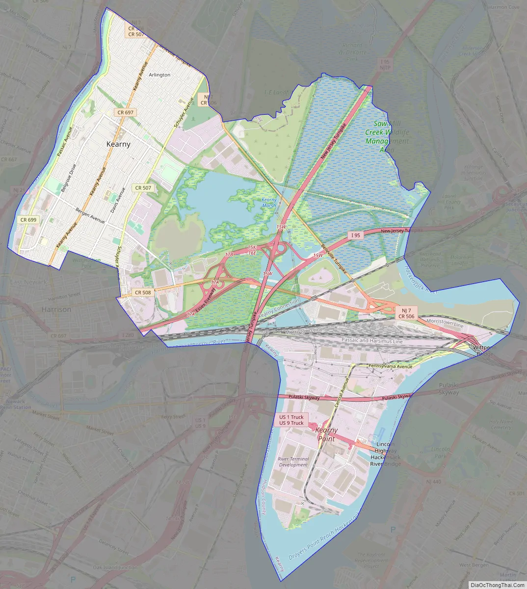
Kearny Road Map
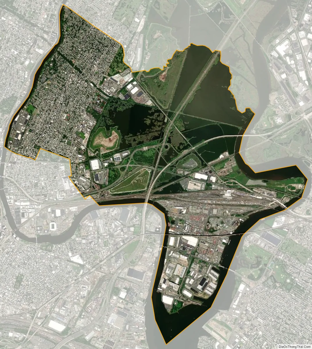
Kearny city Satellite Map
Geography
According to the United States Census Bureau, the town had a total area of 10.27 square miles (26.61 km), including 8.84 square miles (22.91 km) of land and 1.43 square miles (3.70 km) of water (13.91%).
Unincorporated communities, localities and place names located partially or completely within the town include Arlington, New Jersey, Schuylers Corner and West Arlington.
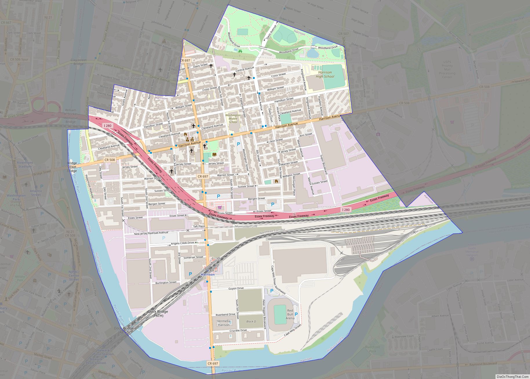
The town is bordered by East Newark and Harrison in Hudson County, and by Lyndhurst and North Arlington in Bergen County. The Passaic River separates the town from Newark and Belleville, both located in Essex County. The Hackensack River separates it from Secaucus and Jersey City.
The town is varied in topography and roughly divided into three parts: the Kearny Uplands, the Kearny Meadows and South Kearny, where the Hackensack and Passaic rivers meet. Main thoroughfares include the eponymous Kearny Avenue (the local segment of Ridge Road / Frank E. Rodgers Boulevard), Bergen Avenue, Midland Avenue, Schuyler Avenue and Passaic Avenue.
A number of small parks running along the Passaic River are collectively called Riverbank Park. The largest, located on the colloquial “Bunnyland Hill”, is a gift from Kearny’s veterans. It is named after a small zoo named Bunnyland, which was maintained by the local Kiwanis Club, that occupied part of the present Bunnyland Hill in the 20th century. During Kearny’s Fourth of July celebrations (which include a fireworks display), Bunnyland Hill is the primary gathering spot for celebrants and observers. The largest park is West Hudson Park, shared with Harrison, which contains a variety of sports fields, recreational areas, and an artificial pond. The second largest recreational zone is the Kearny Playground at Gunnel Oval.
See also
Map of New Jersey State and its subdivision: Map of other states:- Alabama
- Alaska
- Arizona
- Arkansas
- California
- Colorado
- Connecticut
- Delaware
- District of Columbia
- Florida
- Georgia
- Hawaii
- Idaho
- Illinois
- Indiana
- Iowa
- Kansas
- Kentucky
- Louisiana
- Maine
- Maryland
- Massachusetts
- Michigan
- Minnesota
- Mississippi
- Missouri
- Montana
- Nebraska
- Nevada
- New Hampshire
- New Jersey
- New Mexico
- New York
- North Carolina
- North Dakota
- Ohio
- Oklahoma
- Oregon
- Pennsylvania
- Rhode Island
- South Carolina
- South Dakota
- Tennessee
- Texas
- Utah
- Vermont
- Virginia
- Washington
- West Virginia
- Wisconsin
- Wyoming