Map of Lake Mohawk CDP, New Jersey
Lake Mohawk is an unincorporated residential development and census-designated place (CDP) split between Byram Township and Sparta Township, in Sussex County, New Jersey, United States. As of the 2010 United States census, the CDP’s population was 9,916, of which 1,824 were in Byram Township and 8,092 in Sparta Township. Lake Mohawk CDP overview: Name: Lake ... Read more
Map of Lake Mohawk CDP, New Jersey
Map of Lake Como borough
Lake Como is a borough located in the Jersey Shore region, within Monmouth County, in the U.S. state of New Jersey. As of the 2020 United States census, the borough’s population was 1,697, a decrease of 62 (−3.5%) from the 2010 census count of 1,759, which in turn reflected a decline of 47 (−2.6%) from ... Read more
Map of Lake Como borough
Map of Kinnelon borough
Kinnelon (/kɪnˌəlɒn/) is a borough in Morris County, in the U.S. state of New Jersey, located approximately 33 miles (53 km) west of New York City. As of the 2020 United States census, the borough’s population was 9,966, a decrease of 282 (−2.8%) from the 2010 census count of 10,248, which in turn reflected an increase ... Read more
Map of Kinnelon borough
Map of Kingston CDP, New Jersey
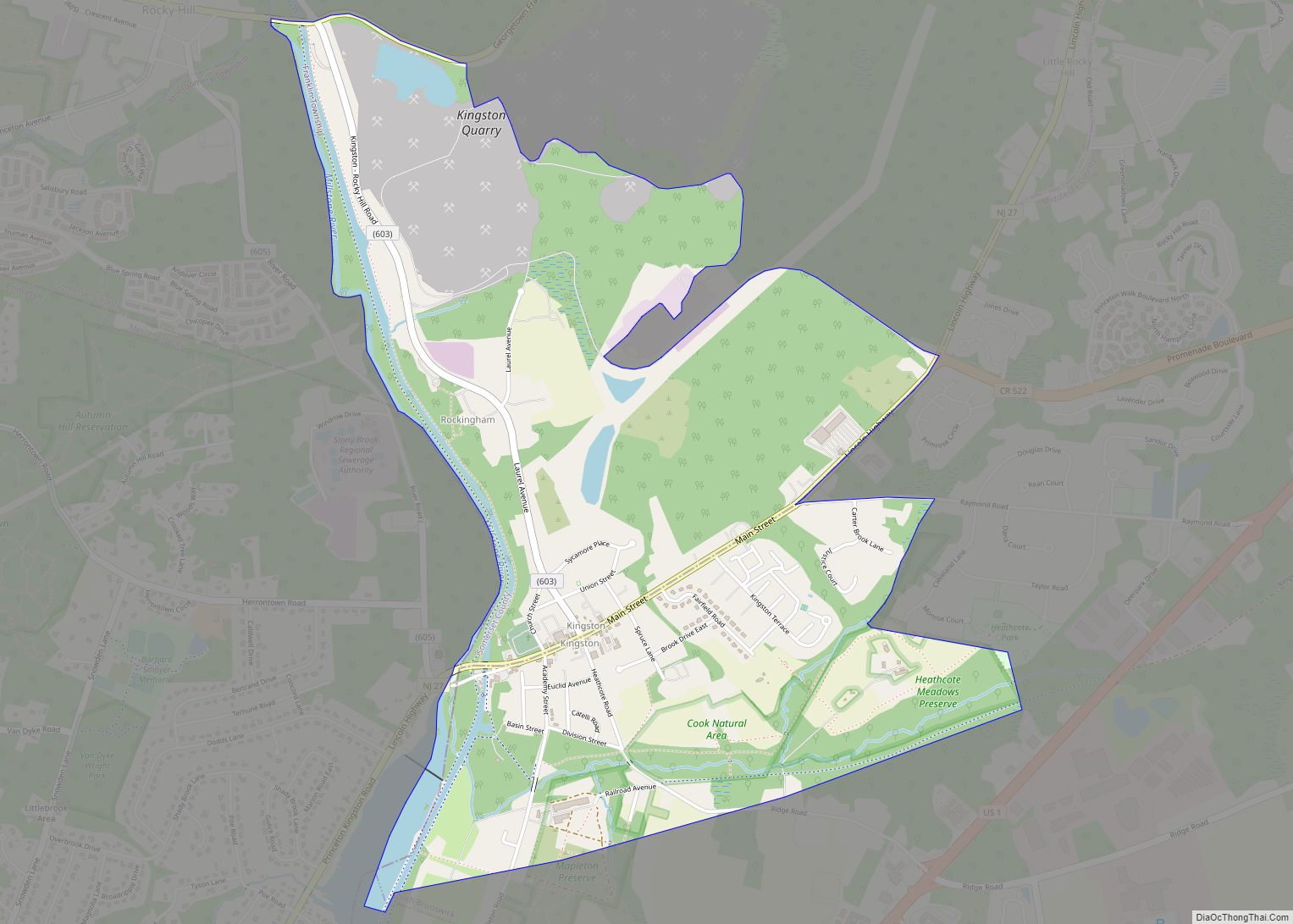
Kingston is an unincorporated community and census designated place (CDP) along the border of South Brunswick Township in Middlesex County and Franklin Township in Somerset County, and also located relatively near Princeton in Mercer County in New Jersey, United States. The historic settlement is in the Raritan Valley region, located along the course of the ... Read more
Map of Kingston CDP, New Jersey
Map of Kingston Estates CDP
Kingston Estates is an unincorporated community and census-designated place (CDP) located within Cherry Hill, in Camden County, New Jersey, United States, that had been part of the Barclay-Kingston CDP until the 2000 Census, which was split to form the CDPs of Barclay and Kingston Estates as of the 2010 Census. As of the 2010 United ... Read more
Map of Kingston Estates CDP
Map of Keyport borough, New Jersey
Keyport is a borough in northern Monmouth County, in the U.S. state of New Jersey. A waterfront community located on the Raritan Bay in the Raritan Valley region, the borough is a commuter town of New York City in the New York metropolitan area. As of the 2020 United States census, the borough’s population was ... Read more
Map of Keyport borough, New Jersey
Map of Lawrenceville CDP, New Jersey
Lawrenceville is an unincorporated community and census-designated place (CDP) and a major commercial hub within Lawrence Township in Mercer County, New Jersey, United States. The community is situated roughly halfway between Princeton and Trenton, Although Lawrenceville constitutes part of the New York metropolitan area, the CDP actually is located approximately 15 miles closer to Philadelphia ... Read more
Map of Lawrenceville CDP, New Jersey
Map of Lawnside borough
Lawnside is a borough in Camden County, in the U.S. state of New Jersey. Lawnside was developed in 1840 and incorporated in 1926 as the first independent, self-governing black municipality north of the Mason–Dixon line. The United Parcel Service has a large depot in the borough. As of the 2020 United States census, the borough’s ... Read more
Map of Lawnside borough
Map of Lavallette borough
Lavallette is a borough situated on the Jersey Shore, in Ocean County, New Jersey, United States. As of the 2020 United States census, the borough’s population was 1,787, a decrease of 88 (−4.7%) from the 2010 census count of 1,875, which in turn had reflected a decline of 790 (−29.6%) from the 2,665 counted at ... Read more
Map of Lavallette borough
Map of Laurence Harbor CDP
Laurence Harbor is an unincorporated community and census-designated place (CDP) located on the Raritan Bay within Old Bridge Township, in Middlesex County, New Jersey, United States. As of the 2020 United States census, the CDP’s population was 6,635, an increase of 99 (+1.5%) from the 6,536 recorded at the 2010 census, which in turn had ... Read more
Map of Laurence Harbor CDP
Map of Laurel Springs borough
Laurel Springs is a borough in Camden County, in the U.S. state of New Jersey. As of the 2020 United States census, the borough’s population was 1,978, an increase of 70 (+3.7%) from the 2010 census count of 1,908, which in turn reflected a decline of 62 (−3.1%) from the 1,970 counted in the 2000 ... Read more
Map of Laurel Springs borough
Map of Laurel Lake CDP
Laurel Lake is an unincorporated community and census-designated place (CDP) located within Commercial Township, in Cumberland County, New Jersey, United States. It is part of the Vineland–Millville–Bridgeton Primary Metropolitan Statistical Area for statistical purposes. As of the 2010 United States Census, the CDP’s population was 2,989. Laurel Lake CDP overview: Name: Laurel Lake CDP LSAD ... Read more
Map of Laurel Lake CDP