Map of Brainards CDP
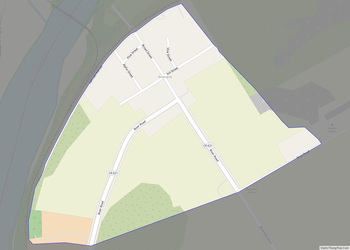
Brainards is an unincorporated community and census-designated place (CDP) located within Harmony Township, in Warren County, New Jersey, United States, that was created as part of the 2010 United States Census. As of the 2010 United States Census, the CDP’s population was 202. It was formerly known as Martin’s Creek. Brainards CDP overview: Name: Brainards ... Read more
Map of Brainards CDP
Map of Bradley Gardens CDP
Bradley Gardens is an unincorporated community and census-designated place (CDP) located within Bridgewater Township, in Somerset County, New Jersey, United States. As of the 2010 United States Census, the CDP’s population was 14,206. Bradley Gardens CDP overview: Name: Bradley Gardens CDP LSAD Code: 57 LSAD Description: CDP (suffix) State: New Jersey County: Somerset County Elevation: ... Read more
Map of Bradley Gardens CDP
Map of Bradley Beach borough
Bradley Beach is a borough in Monmouth County, in the U.S. state of New Jersey. As of the 2020 United States census, the borough’s population was 4,282, a decrease of 16 (−0.4%) from the 2010 census count of 4,298, which in turn reflected a decrease of 495 (−10.3%) from the 4,793 counted at the 2000 ... Read more
Map of Bradley Beach borough
Map of Bound Brook borough
Bound Brook is a borough in Somerset County, in the U.S. state of New Jersey, located along the Raritan River. As of the 2020 United States census, the borough’s population was 11,988, an increase of 1,586 (+15.2%) from the 2010 census count of 10,402, which in turn reflected an increase of 247 (+2.4%) from the ... Read more
Map of Bound Brook borough
Map of Bordentown city
Bordentown city overview: Name: Bordentown city LSAD Code: 25 LSAD Description: city (suffix) State: New Jersey County: Burlington County FIPS code: 3406670 Online Interactive Map Bordentown online map. Source: Basemap layers from Google Map, Open Street Map (OSM), Arcgisonline, Wmflabs. Boundary Data from Database of Global Administrative Areas. Bordentown location map. Where is Bordentown city? ... Read more
Map of Bordentown city
Map of Boonton town
Boonton town overview: Name: Boonton town LSAD Code: 43 LSAD Description: town (suffix) State: New Jersey County: Morris County FIPS code: 3406610 Online Interactive Map Boonton online map. Source: Basemap layers from Google Map, Open Street Map (OSM), Arcgisonline, Wmflabs. Boundary Data from Database of Global Administrative Areas. Boonton location map. Where is Boonton town? ... Read more
Map of Boonton town
Map of Brookdale CDP, New Jersey
Brookdale is an unincorporated community and census-designated place (CDP) in Bloomfield Township, located within Essex County, in the U.S. state of New Jersey. It is generally considered to be the part of Bloomfield north of Bay Avenue, As of the 2010 United States Census, the CDP’s total population was 9,239. Brookdale CDP overview: Name: Brookdale ... Read more
Map of Brookdale CDP, New Jersey
Map of Broadway CDP, New Jersey
Broadway is an unincorporated community and census-designated place (CDP) located within Franklin Township, in Warren County, New Jersey, United States, that was created as part of the 2010 United States Census. As of the 2010 Census, the CDP’s population was 244. Broadway CDP overview: Name: Broadway CDP LSAD Code: 57 LSAD Description: CDP (suffix) State: ... Read more
Map of Broadway CDP, New Jersey
Map of Brigantine city
Brigantine (or simply The Island) is a city in Atlantic County in the U.S. state of New Jersey. As of the 2020 United States Census, the city’s population was 7,716, a decrease of 1,734 (−18.3%) from the 2010 census count of 9,450, which in turn reflected a decline of 3,144 (−25.0%) from the 12,594 counted ... Read more
Map of Brigantine city
Map of Brielle borough
Brielle is a borough located in southern Monmouth County, in the U.S. state of New Jersey, along the Manasquan River. As of the 2020 United States census, the borough’s population was 4,982, its highest decennial count ever and an increase of 208 (+4.4%) from the 2010 census count of 4,774, which in turn reflected a ... Read more
Map of Brielle borough
Map of Buena borough, New Jersey
Buena (/ˈbjuːnə/ BEW-nə) is a borough in Atlantic County, in the U.S. state of New Jersey. The borough, and all of Atlantic County, is part of South Jersey and the Atlantic City–Hammonton metropolitan statistical area, which in turn is included in the Philadelphia–Reading–Camden combined statistical area and the Delaware Valley. As of the 2020 United ... Read more
Map of Buena borough, New Jersey
Map of Budd Lake CDP
Budd Lake is an unincorporated community and census-designated place (CDP) located within Mount Olive Township, in Morris County, New Jersey, United States. As of the 2020 United States census, the CDP’s population was 9,784, its highest decennial census count ever and an increase of 816 (+9.1%) from the 8,968 enumerated at the 2010 census, which ... Read more
Map of Budd Lake CDP