Map of Albuquerque city
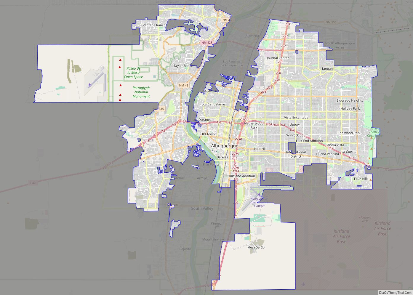
Albuquerque (/ˈælbəˌkɜːrki/ (listen) AL-bə-kur-kee; Spanish: [alβuˈkeɾke]), abbreviated ABQ, is the most populous city in the U.S. state of New Mexico. Its nicknames, The Duke City and Burque, both reference its founding in 1706 as La Villa de Alburquerque by Nuevo México governor Francisco Cuervo y Valdés. Named in honor of the Viceroy of New Spain, the ... Read more
Map of Albuquerque city
Map of Las Cruces city
Las Cruces (/lɑːsˈkrusɪs/; Spanish: [las ‘kruses] “the crosses”) is the second-largest city in the U.S. state of New Mexico and the seat of Doña Ana County. As of the 2020 census the population was 111,385. Las Cruces is the largest city in both Doña Ana County and southern New Mexico. The Las Cruces metropolitan area had ... Read more
Map of Las Cruces city
Map of Rio Rancho city
Rio Rancho (Spanish: Río Rancho) is the most populous and only city in Sandoval County, part of the expansive Albuquerque metropolitan area, in the U.S. state of New Mexico. A small portion of the city extends into northern Bernalillo County. It is the third-largest city in New Mexico, and one of the most rapidly growing. ... Read more
Map of Rio Rancho city
Map of Santa Fe city, New Mexico
Santa Fe (/ˌsæntə ˈfeɪ, ˈsæntə feɪ/ SAN-tə FAY, -⁠ fay; Spanish: [santaˈfe], Spanish for ‘Holy Faith’; Tewa: Oghá P’o’oge, Tewa for ‘white shell water place’; Northern Tiwa: Hulp’ó’ona; Navajo: Yootó, Navajo for ‘bead + water place’) is the capital of the U.S. state of New Mexico. The name “Santa Fe” means ‘Holy Faith’ in Spanish, and ... Read more
Map of Santa Fe city, New Mexico
Map of Roswell city, New Mexico
Roswell (/ˈrɒzwɛl/) is a city in, and the seat of, Chaves County in the U.S. state of New Mexico. Chaves County forms the entirety of the Roswell micropolitan area. As of the 2020 census it had a population of 48,422, making it the fifth-largest city in New Mexico. It is home of the New Mexico ... Read more
Map of Roswell city, New Mexico
Map of Acomita Lake CDP
Acomita Lake is a census-designated place (CDP) in Cibola County, New Mexico, United States. The population was 416 at the 2010 census. Acomita Lake CDP overview: Name: Acomita Lake CDP LSAD Code: 57 LSAD Description: CDP (suffix) State: New Mexico County: Cibola County Elevation: 6,119 ft (1,865 m) Total Area: 4.04 sq mi (10.45 km²) Land Area: 3.92 sq mi (10.14 km²) Water ... Read more
Map of Acomita Lake CDP
Map of Abiquiu CDP
Abiquiu CDP overview: Name: Abiquiu CDP LSAD Code: 57 LSAD Description: CDP (suffix) State: New Mexico County: Rio Arriba County FIPS code: 3500310 Online Interactive Map Abiquiu online map. Source: Basemap layers from Google Map, Open Street Map (OSM), Arcgisonline, Wmflabs. Boundary Data from Database of Global Administrative Areas. Abiquiu location map. Where is Abiquiu ... Read more
Map of Abiquiu CDP
Map of Abeytas CDP
Abeytas is a census-designated place in Socorro County, New Mexico, United States. Its population was 56 as of the 2010 census. In 1950 it had a population of 10. Abeytas CDP overview: Name: Abeytas CDP LSAD Code: 57 LSAD Description: CDP (suffix) State: New Mexico County: Socorro County Elevation: 4,751 ft (1,448 m) Total Area: 1.23 sq mi (3.19 km²) ... Read more
Map of Abeytas CDP
Map of Anthony city, New Mexico
Anthony is a city in Doña Ana County, New Mexico, United States. The population was 9,360 at the 2010 census. It is located on the New Mexico–Texas state line in the Upper Mesilla Valley (immediately north of Anthony, Texas), and on Interstate 10, 24 miles south of Las Cruces and 18 miles north of El ... Read more
Map of Anthony city, New Mexico
Map of Animas CDP, New Mexico
Animas is an unincorporated community and census-designated place (CDP) in west-central Hidalgo County, New Mexico, United States, in the southwestern corner of the state. As of the 2010 census it had a population of 237. It lies at the intersection of State Roads 9 and 338, at an elevation of 4,406 feet (1,343 m) approximately 30 ... Read more
Map of Animas CDP, New Mexico
Map of Angel Fire village
Angel Fire is a village in Colfax County, New Mexico, United States. The population was 1,216 at the 2010 census. It is a popular ski resort destination, with over 500 acres (2.0 km) of slopes. Angel Fire and nearby communities experience cold winter temperatures and mild temperatures in the summer. To the north, off U.S. Route ... Read more
Map of Angel Fire village
Map of Algodones CDP
Algodones is a census-designated place (CDP) in Sandoval County, New Mexico, United States. The population was 814 at the 2010 census. It is part of the Albuquerque Metropolitan Statistical Area. Algodones CDP overview: Name: Algodones CDP LSAD Code: 57 LSAD Description: CDP (suffix) State: New Mexico County: Sandoval County Elevation: 5,112 ft (1,558 m) Total Area: 7.41 sq mi ... Read more
Map of Algodones CDP