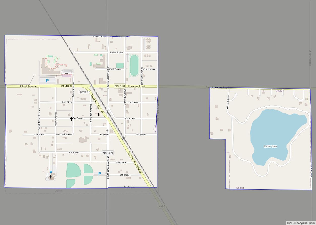
Roswell (/ˈrɒzwɛl/) is a city in, and the seat of, Chaves County in the U.S. state of New Mexico. Chaves County forms the entirety of the Roswell micropolitan area. As of the 2020 census it had a population of 48,422, making it the fifth-largest city in New Mexico. It is home of the New Mexico Military Institute (NMMI), founded in 1891. The city is also the location of an Eastern New Mexico University campus. Bitter Lake National Wildlife Refuge is located a few miles northeast of the city on the Pecos River. Bottomless Lakes State Park is located 12 miles (19 km) east of Roswell on US 380.
The Roswell incident was named after the town, though the crash site of the alleged UFO was some 75 miles (121 km) from Roswell and closer to Corona. The investigation and debris recovery was handled by the local Roswell Army Air Field. On the 50th anniversary of the Roswell incident, an annual UFO Festival was started.
In the 1930s, Roswell was a site for much of Robert H. Goddard’s early rocketry work. The Roswell Museum and Art Center maintains an exhibit that includes a recreation of Goddard’s rocket engine development workshop, and Goddard High School is named after him.
Roswell’s tourism industry is based on aerospace engineering and ufology museums and businesses, as well as alien-themed and spacecraft-themed iconography. The city also relies on New Mexico and Americana related tourism. New Mexican cuisine restaurants, such as Martin’s Capitol Café, are located near downtown on Main Street, near the International UFO Museum and Research Center. Local American folk and New Mexico music performances occur near Pioneer Plaza and in parks around the city. It is a center for acequia-like irrigated farming, dairying, and ranching; it is also the location of several manufacturing, distribution, and petroleum related facilities. This regional pride has resulted in Roswell receiving the All-America City Award multiple times, in 1978–79 and 2002.
Roswell has a history of minor league baseball.
| Name: | Roswell city |
|---|---|
| LSAD Code: | 25 |
| LSAD Description: | city (suffix) |
| State: | New Mexico |
| County: | Chaves County |
| Elevation: | 3,573 ft (1,089 m) |
| Total Area: | 29.78 sq mi (77.12 km²) |
| Land Area: | 29.72 sq mi (76.96 km²) |
| Water Area: | 0.06 sq mi (0.16 km²) |
| Total Population: | 48,422 |
| Population Density: | 1,629.49/sq mi (629.14/km²) |
| Area code: | 575 |
| FIPS code: | 3564930 |
| GNISfeature ID: | 0894171 |
| Website: | www.roswell-nm.gov |
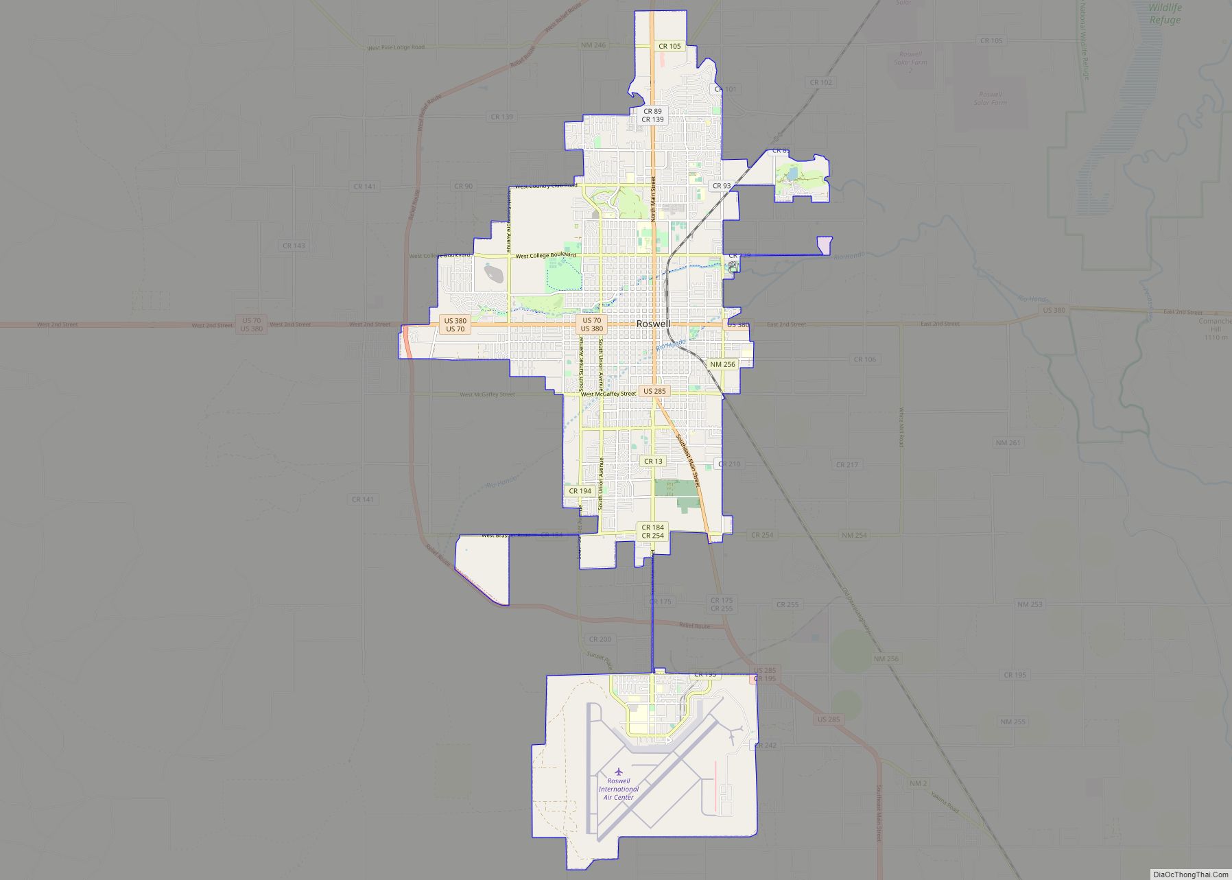
Online Interactive Map
Click on ![]() to view map in "full screen" mode.
to view map in "full screen" mode.
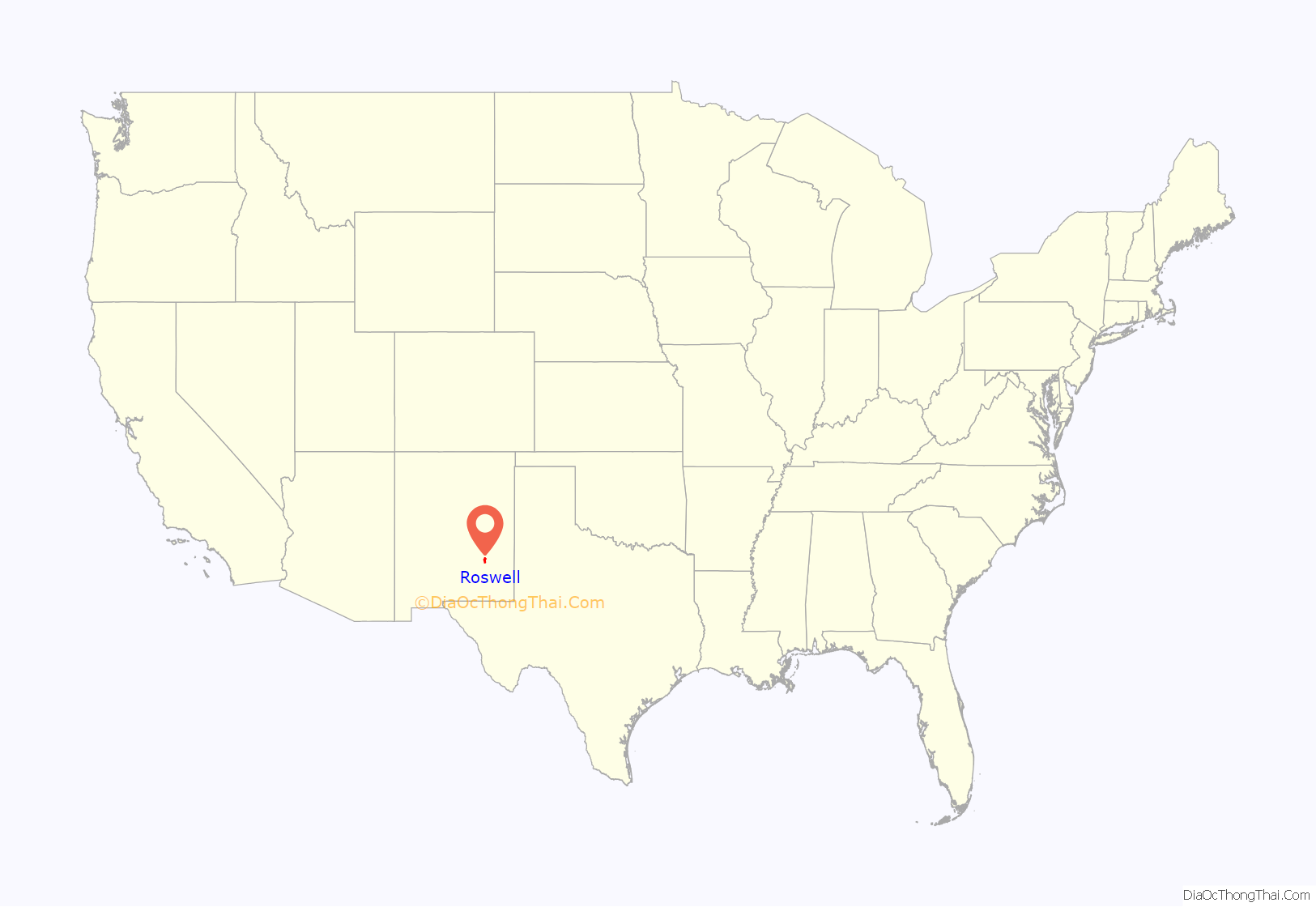
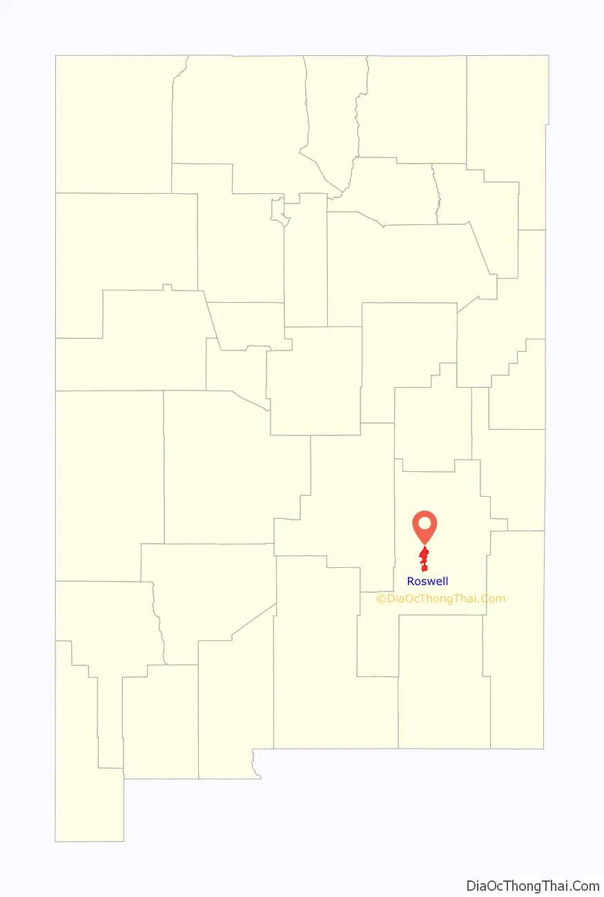
Roswell location map. Where is Roswell city?
History
The first non-indigenous settlers of the area around Roswell were a group of pioneers from Missouri, who attempted to start a settlement 15 miles (24 km) southwest of what is now Roswell in 1865, but were forced to abandon the site because of a lack of water. It was called Missouri Plaza. It also had many Hispanic people from Lincoln, New Mexico. John Chisum had his famous Jingle Bob Ranch about 5 miles (8 km) from the center of Roswell, at South Spring Acres. At the time, it was the largest ranch in the United States.
Van C. Smith, a businessman from Omaha, Nebraska, and his partner, Aaron Wilburn, constructed two adobe buildings in 1869 that began what is now Roswell. The two buildings became the settlement’s general store, post office, and sleeping quarters for paying guests. In 1871, Smith filed a claim with the federal government for the land around the buildings, and on August 20, 1873, he became the town’s first postmaster. Smith was the son of Roswell Smith, a prominent lawyer in Lafayette, Indiana, and Annie Ellsworth, daughter of U.S. Patent Commissioner Henry Leavitt Ellsworth. He called the town Roswell, after his father’s first name.
In 1877, Captain Joseph Calloway Lea and his family bought out Smith and Wilburn’s claim and became the owners of most of the land of Roswell and the area surrounding it. The town was relatively quiet during the Lincoln County War (1877–1879). A major aquifer was discovered when merchant Nathan Jaffa had a well drilled in his back yard on Richardson Avenue in 1890, resulting in the area’s first major growth and development spurt. The growth continued when the Pecos Valley Railroad arrived in 1892.
During World War II, a prisoner-of-war camp was located in nearby Orchard Park. The German prisoners of war were used to do major infrastructure work in Roswell, such as paving the banks of the North Spring River. Some POWs used rocks of different sizes to create the outline of an iron cross among the stones covering the north bank. Later, the iron cross was covered with a thin layer of concrete. In the 1980s, a crew cleaning the river bed cleared off the concrete and revealed the outline once more. The small park just south of the cross was then known as Iron Cross Park. On November 11, 1996, the park was renamed POW/MIA Park. The park displays a piece of the Berlin Wall, presented to the city of Roswell by the German Air Force.
Roswell was a location of military importance from 1941 to 1967. In 1967, the Walker Air Force Base was decommissioned. After the closure of the base, Roswell capitalized on its pleasant climate and reinvented itself as a retirement community.
Roswell has benefited from interest in the alleged UFO incident of 1947. It was the report of an object that crashed in the general vicinity in June or July 1947, allegedly an extraterrestrial spacecraft and its alien occupants. Since the late 1970s, the incident has been the subject of intense controversy and of a conspiracy theory regarding a classified program named “Project Mogul”. Many UFO proponents maintain that an alien craft was found and its occupants were captured, and that the military then engaged in a cover-up. In recent times, the business community has deliberately sought out tourists interested in UFOs, science fiction, and aliens.
Roswell hosted the record-breaking skydive by Felix Baumgartner on October 14, 2012.
Roswell Road Map
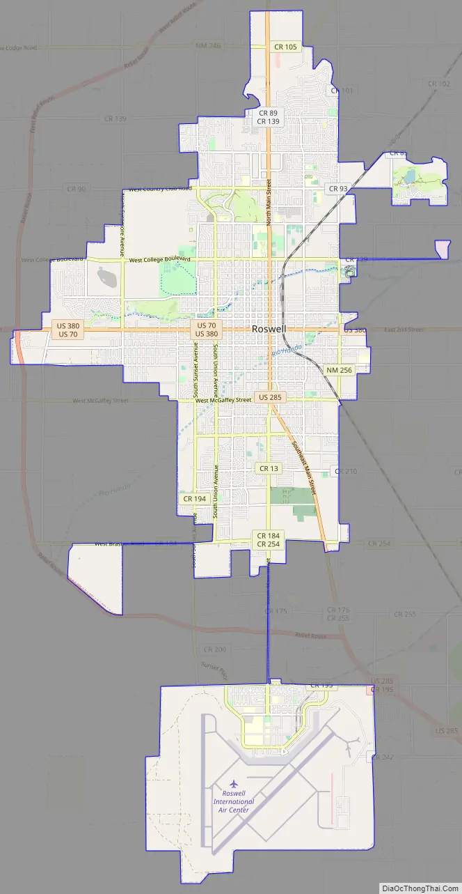
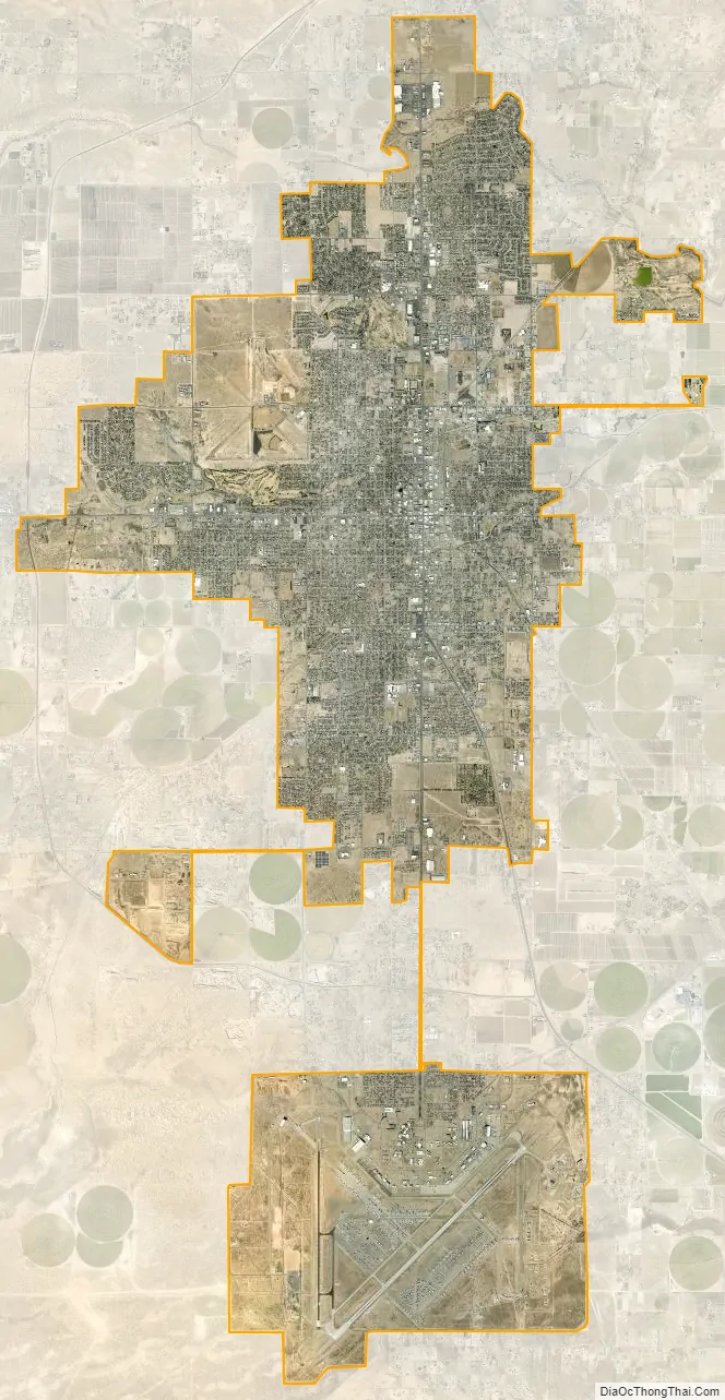
Roswell city Satellite Map
Geography
Roswell is located in the High Great Plains of southeastern New Mexico, approximately 7 mi (11 km) west of the Pecos River and some 40 mi (64 km) east of highlands that rise to the Sierra Blanca range. U.S. Routes 70, 285 and 380 intersect in the city. US 70 leads northeast 111 mi (179 km) to Clovis and 117 mi (188 km) west to Alamogordo; US 285 leads north 192 mi (309 km) to Santa Fe and south 76 mi (122 km) to Carlsbad; and US 380 leads east 134 mi (216 km) to Brownfield, Texas, and west 164 mi (264 km) to Socorro.
According to the United States Census Bureau, Roswell has a total area of 29.9 square miles (77.5 km), of which 29.8 square miles (77.3 km) is land and 0.04 square miles (0.1 km), or 0.19%, is covered by water.
Climate
Roswell is located in both the High Plains and the Chihuahuan Desert and has four very distinct seasons, giving it a cold semi-arid climate (BSk) according to the Köppen climate classification. Winters are cool, but usually sunny, and snowfall can occur. Spring is mild and usually warm, but can still be cold on occasion. Summers are very hot (as is common with the High Plains of New Mexico and Colorado) and averages around 30 days per year when the temperature rises above 100 °F (38 °C), which can be unpleasant. The North American monsoon occurs during the summer, and can bring torrential downpours, severe thunderstorms (with high winds and hail) and sometimes even tornadoes. The rain can provide a cooling relief from the scorching great plains heat. Fall is usually warm and pleasant, but can be cold late in the season. Snow is possible in October and November.
The record low in Roswell is −24 °F (−31 °C) on January 11, 1962, and February 8, 1933. The record high is 114 °F (46 °C) on June 27, 1994.
See also
Map of New Mexico State and its subdivision: Map of other states:- Alabama
- Alaska
- Arizona
- Arkansas
- California
- Colorado
- Connecticut
- Delaware
- District of Columbia
- Florida
- Georgia
- Hawaii
- Idaho
- Illinois
- Indiana
- Iowa
- Kansas
- Kentucky
- Louisiana
- Maine
- Maryland
- Massachusetts
- Michigan
- Minnesota
- Mississippi
- Missouri
- Montana
- Nebraska
- Nevada
- New Hampshire
- New Jersey
- New Mexico
- New York
- North Carolina
- North Dakota
- Ohio
- Oklahoma
- Oregon
- Pennsylvania
- Rhode Island
- South Carolina
- South Dakota
- Tennessee
- Texas
- Utah
- Vermont
- Virginia
- Washington
- West Virginia
- Wisconsin
- Wyoming