Map of Alcalde CDP
Alcalde (Spanish for mayor) is a census-designated place (CDP) in Rio Arriba County, New Mexico, United States. The population was 285 at the 2010 census. Alcalde CDP overview: Name: Alcalde CDP LSAD Code: 57 LSAD Description: CDP (suffix) State: New Mexico County: Rio Arriba County Elevation: 5,712 ft (1,741 m) Total Area: 0.52 sq mi (1.34 km²) Land Area: 0.52 sq mi ... Read more
Map of Alcalde CDP
Map of Alamogordo city
Alamogordo (/ˌæləməˈɡɔːrdoʊ/) is the seat of Otero County, New Mexico, United States. A city in the Tularosa Basin of the Chihuahuan Desert, it is bordered on the east by the Sacramento Mountains and to the west by Holloman Air Force Base. The population was 31,384 as of the 2020 census. Alamogordo is known for its ... Read more
Map of Alamogordo city
Map of Alamo CDP, New Mexico
Alamo (Navajo: Tʼiistoh) is a census-designated place (CDP) in Socorro County, New Mexico, United States. The population was 1,085 at the 2010 census. It is the largest community on the Alamo Navajo Indian Reservation. Alamo CDP overview: Name: Alamo CDP LSAD Code: 57 LSAD Description: CDP (suffix) State: New Mexico County: Socorro County Elevation: 6,184 ft ... Read more
Map of Alamo CDP, New Mexico
Map of Alamillo CDP
Alamillo is an unincorporated community and census-designated place in Socorro County, New Mexico, United States. Its population was 102 as of the 2010 census. Interstate 25 passes through the community. Alamillo CDP overview: Name: Alamillo CDP LSAD Code: 57 LSAD Description: CDP (suffix) State: New Mexico County: Socorro County Elevation: 4,678 ft (1,426 m) Total Area: 1.20 sq mi ... Read more
Map of Alamillo CDP
Map of Agua Fria CDP
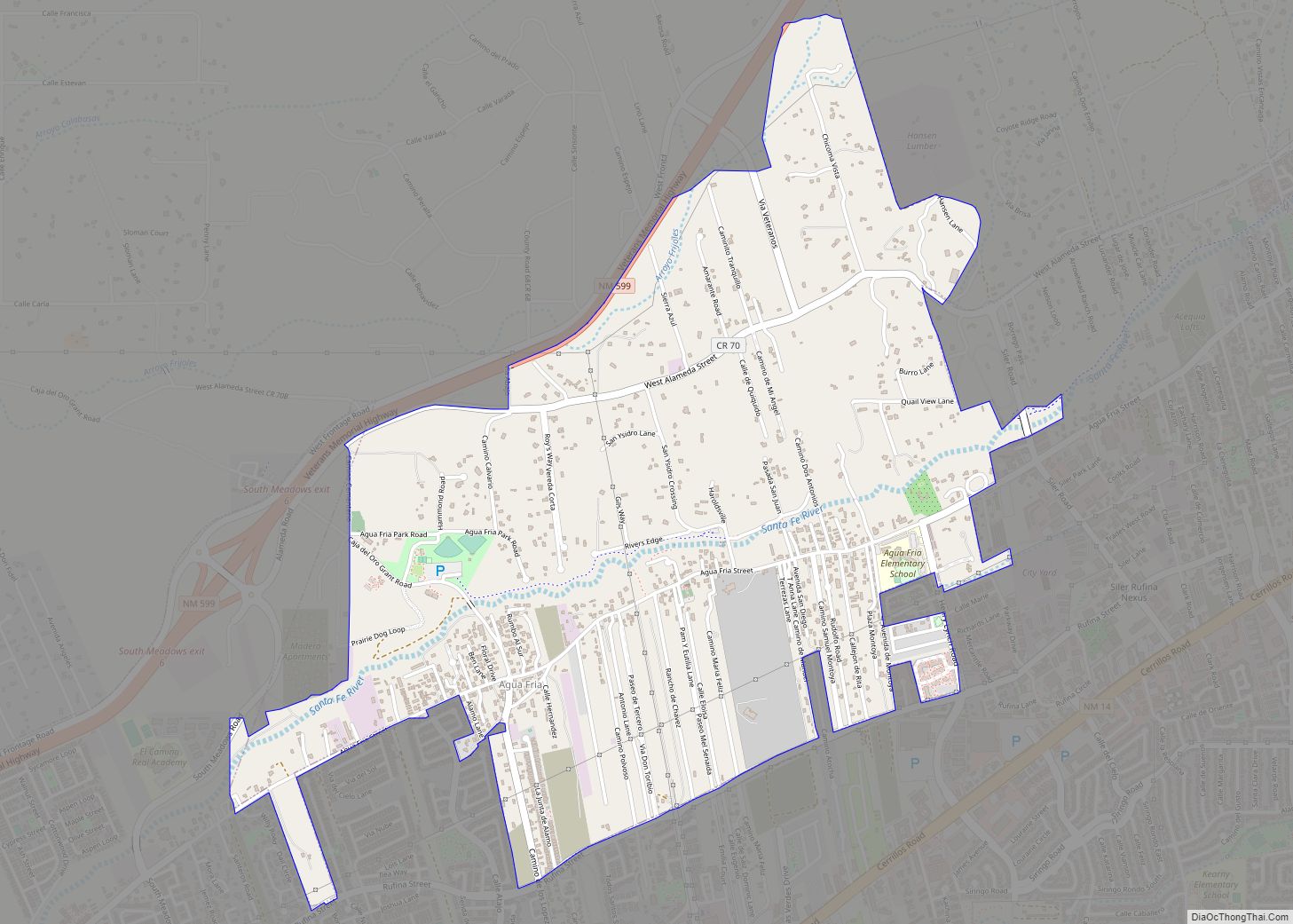
Agua Fria (Spanish for “cold water”) is a census-designated place (CDP) in Santa Fe County, New Mexico, United States. It is part of the Santa Fe, New Mexico Metropolitan Statistical Area. The population was 2,800 at the 2010 census. Agua Fria Village is a “Traditional Historic Community” (THC) as designated by the Santa Fe Board ... Read more
Map of Agua Fria CDP
Map of Adelino CDP
Adelino is a census-designated place in Valencia County, New Mexico, United States. Its population was 783 as of the 2020 census. The Adelino CDP was first made in the 2010 census when it had a population of 823. Prior to 2010, the community was part of the Tome-Adelino CDP. Adelino contains the historic Miguel E. ... Read more
Map of Adelino CDP
Map of Arrey CDP
Arrey is a census-designated place in Sierra County, New Mexico, United States. It lies about 22 miles (35.4 km) south of Truth or Consequences. As of the 2010 census, its population was 232. In 1890, the town was founded as Bonito when several Hispanic families made a deal with a cattle agent to settle here. ... Read more
Map of Arrey CDP
Map of Arenas Valley CDP
Arenas Valley is a census-designated place in Grant County, New Mexico, United States. Its population was 1,522 as of the 2010 census. Arenas Valley had a post office from December 20, 1944, to April 20, 1987; it still has its own ZIP code, 88022. It was named because it was in the valley of the ... Read more
Map of Arenas Valley CDP
Map of Aragon CDP, New Mexico
Aragon is a census-designated place on the Tularosa River in Catron County, New Mexico, United States. As of the 2010 census it had a population of 94. It is located at an altitude of 7,135 feet (2,175 m), 7 miles (11 km) northeast of Apache Creek. The latitude is 33.88 N, longitude 108.54 W. Aragon CDP overview: ... Read more
Map of Aragon CDP, New Mexico
Map of Apache Creek CDP
Apache Creek is a census-designated place in Catron County, New Mexico, United States. As of the 2010 census it had a population of 67. Located 3 miles (5 km) northeast of Cruzville, it is situated at the confluence of Apache Creek and the Tularosa River. The Apache Creek Pueblo, also called the “Apache Creek Ruin”, is ... Read more
Map of Apache Creek CDP
Map of Anzac Village CDP
Anzac Village is a census-designated place (CDP) in Cibola County, New Mexico, United States. The population was 54 at the 2010 census. Anzac Village CDP overview: Name: Anzac Village CDP LSAD Code: 57 LSAD Description: CDP (suffix) State: New Mexico County: Cibola County Elevation: 6,320 ft (1,930 m) Total Area: 0.97 sq mi (2.53 km²) Land Area: 0.97 sq mi (2.53 km²) Water ... Read more
Map of Anzac Village CDP
Map of Anton Chico CDP
Anton Chico, or Anton Chico Abajo or Anton Chico de Abajo, is a census-designated place in Guadalupe County, New Mexico, United States. Its population was 188 as of the 2010 census, of which 167 were Hispanic in origin. Anton Chico has a post office with ZIP code 87711. New Mexico State Road 386 passes through ... Read more
Map of Anton Chico CDP