Map of Santa Teresa CDP

Map of Santa Teresa CDP

Santa Teresa is a census-designated place (CDP) in Dona Ana County, New Mexico, United States. It is home to the Santa Teresa Port of Entry and is part of the Las Cruces Metropolitan Statistical Area, although geographically it is considerably closer to El Paso, Texas than to Las Cruces. While the United States Census Bureau … Read more

Map of Santa Rosa city, New Mexico

Map of Santa Rosa city, New Mexico

Santa Rosa is a city in and the county seat of Guadalupe County, New Mexico, United States. The population was 2,848 at the 2010 census. It lies between Albuquerque and Tucumcari, situated on the Pecos River at the intersection of Interstate 40 and U.S. Route 54 and 84. The city is located on the western … Read more

Map of Santa Cruz CDP, New Mexico

Map of Santa Cruz CDP, New Mexico

Santa Cruz is a census-designated place (CDP) in Santa Fe County, New Mexico, United States. It is part of the Santa Fe, New Mexico Metropolitan Statistical Area. The population was 423 at the 2000 census. Santa Cruz CDP overview: Name: Santa Cruz CDP LSAD Code: 57 LSAD Description: CDP (suffix) State: New Mexico County: Santa … Read more

Map of Santa Clara village, New Mexico

Map of Santa Clara village, New Mexico

Santa Clara is a village in Grant County, New Mexico, United States. The population was 1,686 at the 2010 census, down from 1,944 in 2000. Today it is a bedroom community for nearby Silver City. Santa Clara village overview: Name: Santa Clara village LSAD Code: 47 LSAD Description: village (suffix) State: New Mexico County: Grant … Read more

Map of Sena CDP

Map of Sena CDP

Sena is an unincorporated community and census-designated place in San Miguel County, New Mexico, United States. It is located along the Pecos River and New Mexico State Highway 3. Sena CDP overview: Name: Sena CDP LSAD Code: 57 LSAD Description: CDP (suffix) State: New Mexico County: San Miguel County Elevation: 5,876 ft (1,791 m) Total Area: 2.13 sq mi … Read more

Map of Sedillo CDP

Map of Sedillo CDP

Sedillo is a census-designated place in Bernalillo County, New Mexico, United States. Its population was 802 as of the 2010 census. The community is located along Interstate 40. Sedillo CDP overview: Name: Sedillo CDP LSAD Code: 57 LSAD Description: CDP (suffix) State: New Mexico County: Bernalillo County Elevation: 6,955 ft (2,120 m) Total Area: 2.75 sq mi (7.11 km²) Land … Read more

Map of Seboyeta CDP

Map of Seboyeta CDP

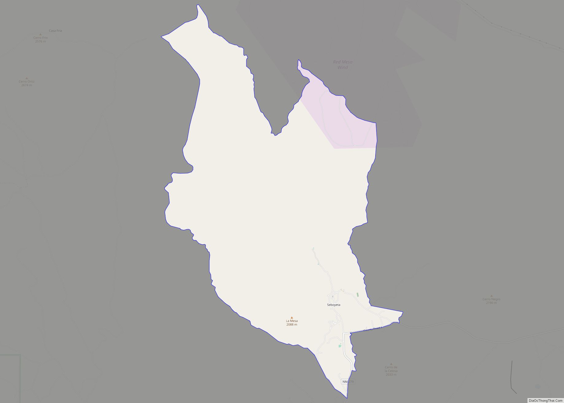
Seboyeta is a census-designated place in Cibola County, New Mexico, United States. Its population was 179 as of the 2010 census. Seboyeta had a post office from February 5, 1885, to January 7, 1995. In 1746, Padre Juan Menchero persuaded several hundred members of the Navajo Tribe to settle at Cebolleta. A mission was established … Read more

Map of Seama CDP

Map of Seama CDP

Seama is a census-designated place (CDP) in Cibola County, New Mexico, United States. The population was 465 at the 2010 census. Seama CDP overview: Name: Seama CDP LSAD Code: 57 LSAD Description: CDP (suffix) State: New Mexico County: Cibola County Elevation: 5,978 ft (1,822 m) Total Area: 6.49 sq mi (16.81 km²) Land Area: 6.49 sq mi (16.80 km²) Water Area: 0.01 sq mi (0.01 km²) … Read more

Map of Spencerville CDP, New Mexico

Map of Spencerville CDP, New Mexico

Spencerville is a census-designated place in San Juan County, New Mexico, United States. Its population was 1,258 as of the 2010 census. Spencerville CDP overview: Name: Spencerville CDP LSAD Code: 57 LSAD Description: CDP (suffix) State: New Mexico County: San Juan County Elevation: 5,669 ft (1,728 m) Total Area: 5.31 sq mi (13.74 km²) Land Area: 5.25 sq mi (13.61 km²) Water Area: … Read more

Map of South Valley CDP

Map of South Valley CDP

South Valley is a census-designated place (CDP) and town in Bernalillo County, New Mexico, United States. The population was 40,976 at the 2010 Census. It is part of the Albuquerque Metropolitan Statistical Area. The U.S. Postal Service uses “Albuquerque” for all South Valley addresses (ZIP code 87105). South Valley CDP overview: Name: South Valley CDP … Read more

Map of South Acomita Village CDP

Map of South Acomita Village CDP

South Acomita Village is a census designated place (CDP) in Cibola County, New Mexico, United States. The population was 105 at the 2010 census. South Acomita Village CDP overview: Name: South Acomita Village CDP LSAD Code: 57 LSAD Description: CDP (suffix) State: New Mexico County: Cibola County Elevation: 6,030 ft (1,840 m) Total Area: 1.17 sq mi (3.02 km²) Land … Read more

Map of Sombrillo CDP

Map of Sombrillo CDP

Sombrillo is a census-designated place (CDP) in Santa Fe County, New Mexico, United States. It is part of the Santa Fe, New Mexico Metropolitan Statistical Area. The population was 493 at the 2000 census. Sombrillo CDP overview: Name: Sombrillo CDP LSAD Code: 57 LSAD Description: CDP (suffix) State: New Mexico County: Santa Fe County Elevation: … Read more