Silver City is a town in Grant County, New Mexico, United States. It is the county seat and the home of Western New Mexico University. As of the 2010 census the population was 10,315. As of the 2020 census, the population was 9,704.
| Name: | Silver City town |
|---|---|
| LSAD Code: | 43 |
| LSAD Description: | town (suffix) |
| State: | New Mexico |
| County: | Grant County |
| Incorporated: | January 14, 1876 |
| Elevation: | 5,895 ft (1,797 m) |
| Total Area: | 10.14 sq mi (26.26 km²) |
| Land Area: | 10.12 sq mi (26.21 km²) |
| Water Area: | 0.02 sq mi (0.05 km²) |
| Total Population: | 9,704 |
| Population Density: | 958.99/sq mi (370.27/km²) |
| Area code: | 575 |
| FIPS code: | 3573260 |
| GNISfeature ID: | 0920706 |
| Website: | www.townofsilvercity.org |
Online Interactive Map
Click on ![]() to view map in "full screen" mode.
to view map in "full screen" mode.
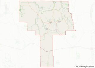
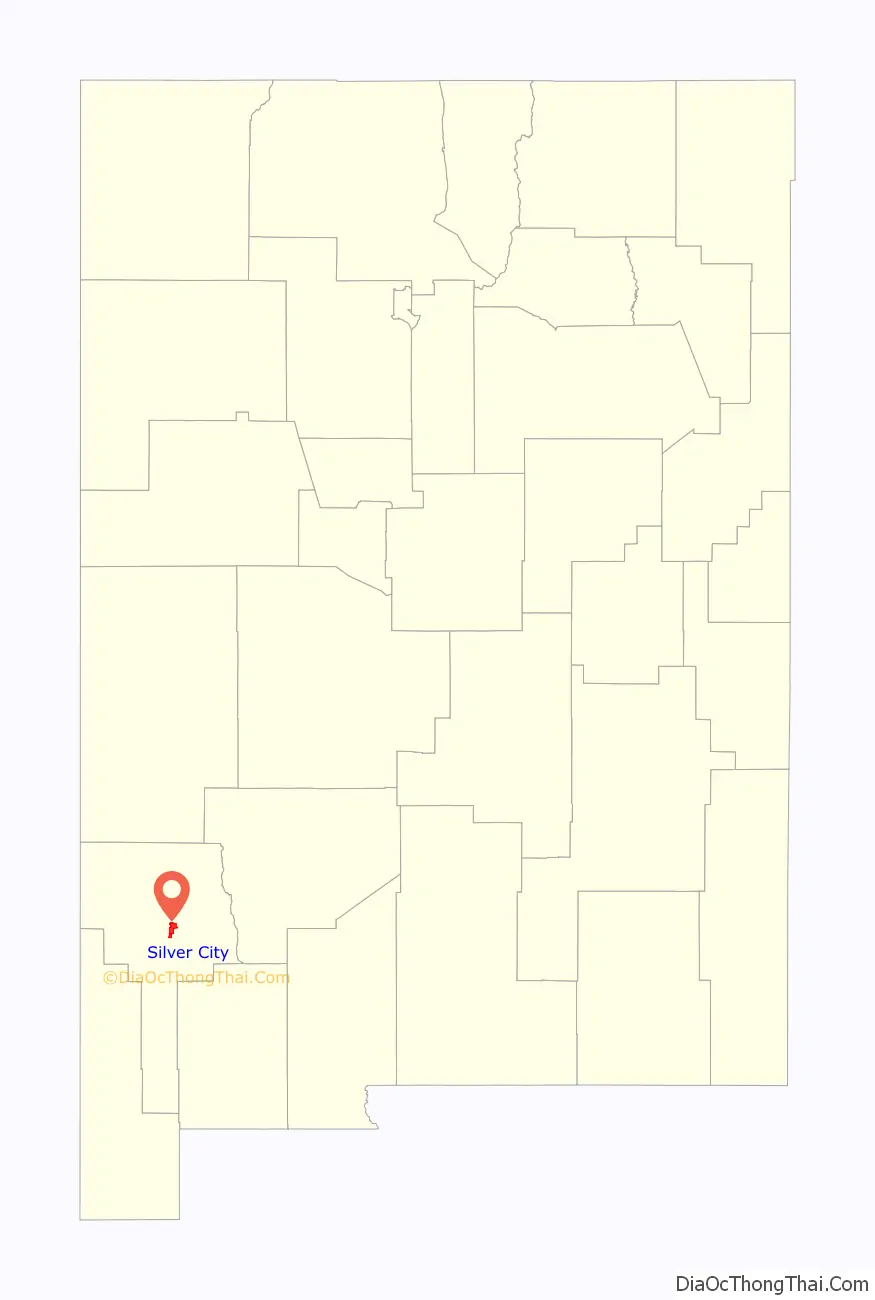
Silver City location map. Where is Silver City town?

History
The valley that is now the site of Silver City once served as an Apache campsite. With the arrival of the Spaniards, the area became known for its copper mining. After the American Civil War, a settlement developed and became known as “La Ciénega de San Vicente” (the Oasis of St. Vincent). With a wave of American prospectors, the pace of change increased, and Silver City was founded in the summer of 1870. The founding of the town occurred shortly after the discovery of silver ore deposits at Chloride Flat, on the hill just west of the farm of Captain John M. Bullard and his brother James. Following the silver strike, Captain Bullard laid out the streets of Silver City, and a bustling tent city quickly sprang to life. Although the trajectory of Silver City’s development was to be different from the hundreds of other mining boom towns established during the same period, Captain Bullard himself never lived to see even the beginnings of permanence, as he was killed in a confrontation with Apache less than a year later, on February 23, 1871.
The town’s violent crime rate was substantial during the 1870s. However, Grant County Sheriff Harvey Whitehill was elected in 1874, and gained a sizable reputation for his abilities at controlling trouble. In 1875, Whitehill became the first lawman to arrest Billy the Kid, known at the time under the alias of Henry Antrim. Whitehill arrested him twice, both times for theft in Silver City (Sheriff Whitehill testified to the Justice of the Peace that he believed Henry Antrim did not do the actual stealing the second time arrested, but assisted in the hiding of the property stolen by Sombrero Jack. Whitehill would later claim that the young man was a likeable kid, whose stealing was a result more of necessity than criminality. His mother is buried in the town cemetery. In 1878, the town hired its first town marshal, “Dangerous Dan” Tucker, who had been working as a deputy for Whitehill since 1875. Butch Cassidy and his Wild Bunch were also reported to frequent the Silver City saloons in the late 1800s.
Mrs. Lettie B. Morrill, in a talk given to the Daughters of the American Revolution chapter in Silver City on September 19, 1908, stated, “John Bullard was placed in the first grave dug in Silver City, having been killed while punishing the Indians for an attack upon the new town; the brothers were prospectors about the country for many years. The last one left for the old home about 1885, saying, ‘It is only a matter of time until the Indians get me if I stay here.'” Silver City was also the starting point for many expeditions hunting treasures, such as the Lost Adams Diggings.
The communities of Silver City and Pinos Altos developed as 19th century miners recovered easily extracted copper, gold and silver from ore deposits of the area. Standard-gauge Santa Fe Railroad reached Silver City in 1886, and Silver City, Pinos Altos and Mogollon Railroad was incorporated in 1889 to build a railway north to Mogollon. Construction was limited to 5 miles (8.0 km) of grading until Wisconsin-based Comanche Mining and Smelting purchased the railroad in 1903 after horse-drawn ore transport became uneconomical. The Silver City smelter burned shortly after purchase, but was rebuilt with three blast furnaces and a reverberatory furnace to handle 225 tons of ore per day. Regular SC, PA&M steam service was brief running from 1907 to 1913.
In 1893, New Mexico Normal School was established. It was later known as New Mexico Western State Teachers College. In 1963, it was renamed Western New Mexico University. Today, WNMU offers eight graduate degrees, 41 baccalaureate degrees, and 18 associate degree and certificate programs. The WNMU’s mascot is referred to as the Mustangs. Recognition for the university includes the 2003 Zia Award, the 2005 Best Practice Award (for the School of Education), the 2006 Chamber of Commerce Large Business of the Year Award, the 2008 Piñon Award, and the 2008 Compañero Award.
The town had originally been designed with the streets running north to south. It was also built without adequate planning for storm water runoff. Businesses sprang up, and people learned to deal with the inconveniences of the summer rain. Silver City was built with high sidewalks in the downtown area to accommodate high flood waters. However, uncontrolled grazing and deforestation over time in the surrounding area contributed to higher levels of runoff. During the night of July 21, 1895, a heavy wall of water rushed through the downtown business district, leaving a trail of destruction. A ditch 55 feet (17 m) lower than the original street level was created in what was once known as Main Street. Businesses on Main Street began using their back doors on Bullard Street as main entrances and eventually, were permanently used as the new front entrances. To this day, the incorrect odd/even addressing conventions on the east side of Bullard Street are a reminder that the buildings were addressed on Main Street originally, not Bullard Street. Main Street now ends near the back of the Silver City Police Station, where the Big Ditch Park begins.
The Mimbres Mogollon Indians (A.D. 200–A.D. 1140/50) once lived in the area, along with other prehistoric groups, including the Salado. Mimbres archaeological sites are located throughout Silver City and surrounding communities on federal, state, municipal, and private property. Collecting of Mimbres pottery by landowners and others is documented as far back as the late 1870s. Collecting was something that occurred during a Sunday picnic in the late 19th and early 20th centuries. Some individuals maintained collections that can now be seen in the Smithsonian, and other museums, who sent individuals out to acquire collections in the nearby Mimbres Valley during the early 1900s. Others dug into the ancient sites and used the pottery they found for target practice—something that occurred into the 1930s according to oral histories. Collecting, and the looting, of Mimbres Mogollon sites did not stop with archaeological research conducted on private lands during the 1920s, 1930s, and 1970s, nor with the passage of the New Mexico “Burial Law” in 1989. Sadly, unlawful looting continues to this day, and many prehistoric sites have been badly damaged or obliterated.
The Apaches occupied areas in the vicinity of Silver City beginning in the late 1500s to early 1600s, based on archaeological evidence.
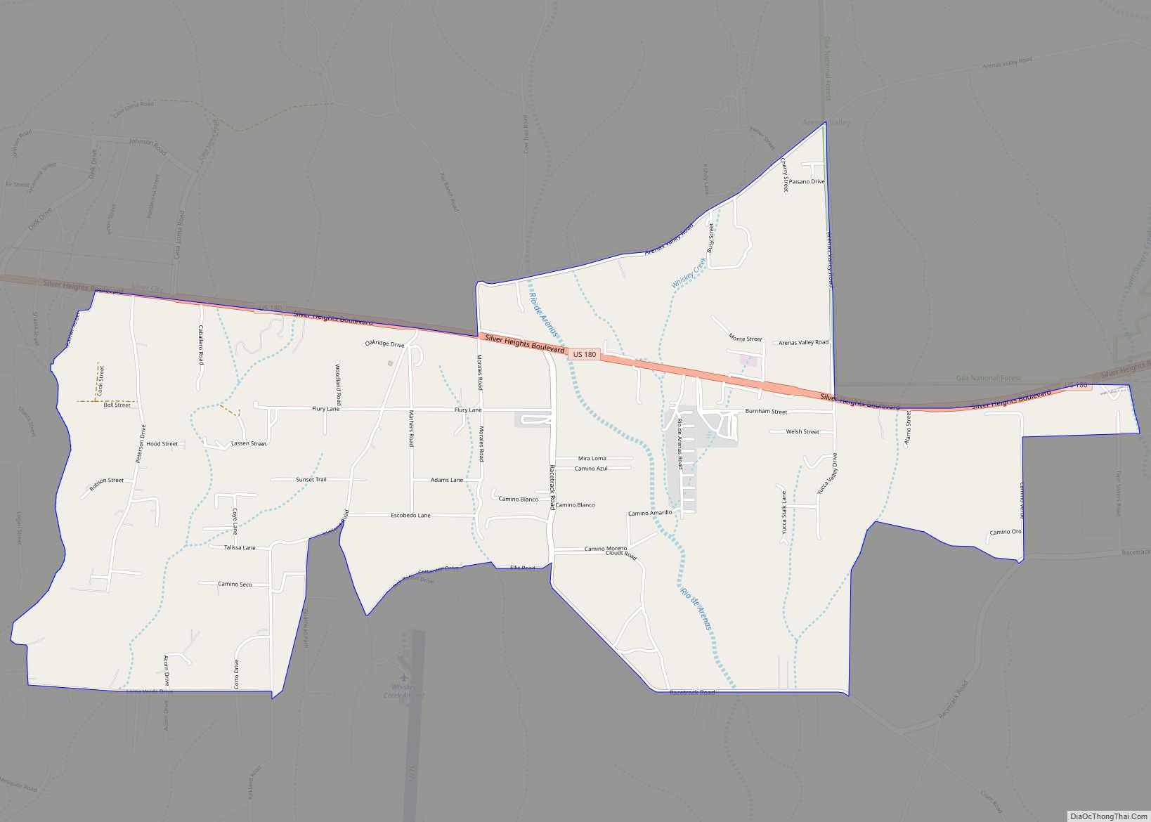
Silver City Road Map
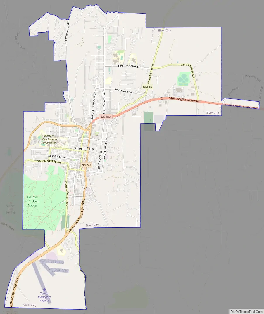
Silver City city Satellite Map

Geography
Silver City is located near the center of Grant County, at the southern foot of the Pinos Altos Range of the Mogollon Mountains. The town is 3 miles (5 km) east of the Continental Divide, in the valley of San Vicente Arroyo, a south-flowing tributary of the Mimbres River.
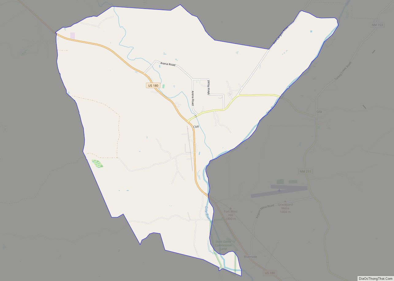
U.S. Route 180 passes through the northern part of the town, leading east 10 miles (16 km) to Bayard and northwest 29 miles (47 km) to Cliff. New Mexico State Road 90 (Hudson Street) leads southwest 45 miles (72 km) to Lordsburg and Interstate 10, and State Road 15 leads north 44 miles (71 km) to Gila Cliff Dwellings National Monument.
According to the U.S. Census Bureau, Silver City has a total area of 10.2 square miles (26.3 km), of which 0.02 square miles (0.04 km), or 0.17%, is water.
See also
Map of New Mexico State and its subdivision: Map of other states:- Alabama
- Alaska
- Arizona
- Arkansas
- California
- Colorado
- Connecticut
- Delaware
- District of Columbia
- Florida
- Georgia
- Hawaii
- Idaho
- Illinois
- Indiana
- Iowa
- Kansas
- Kentucky
- Louisiana
- Maine
- Maryland
- Massachusetts
- Michigan
- Minnesota
- Mississippi
- Missouri
- Montana
- Nebraska
- Nevada
- New Hampshire
- New Jersey
- New Mexico
- New York
- North Carolina
- North Dakota
- Ohio
- Oklahoma
- Oregon
- Pennsylvania
- Rhode Island
- South Carolina
- South Dakota
- Tennessee
- Texas
- Utah
- Vermont
- Virginia
- Washington
- West Virginia
- Wisconsin
- Wyoming