Map of Gowanda village
Gowanda is a village in western New York, United States. It lies partly in Erie County and partly in Cattaraugus County. The population was 2,512 at the 2020 census. The name is derived from a local Seneca language term meaning “almost surrounded by hills” or “a valley among the hills”. The Erie County portion of ... Read more
Map of Gowanda village
Map of Gouverneur village
Gouverneur is a village in St. Lawrence County, New York, United States. The population was 3,949 at the 2010 census. The village is named after Gouverneur Morris, one of the authors of the Constitution of the United States, as well as a prominent landowner and part-time resident of the area. The Village of Gouverneur is ... Read more
Map of Gouverneur village
Map of Goshen village, New York
Goshen is a village in and the county seat of Orange County, New York, United States. The population was 5,777 at the 2020 census. It is part of the Poughkeepsie–Newburgh–Middletown metropolitan area as well as the larger New York metropolitan area. The village is within the town of Goshen, some fifty miles northwest of New ... Read more
Map of Goshen village, New York
Map of Gorham CDP, New York
Gorham is a hamlet (and census-designated place) within the Town of Gorham, in Ontario County, New York, United States. It is located along New York State Route 245. Gorham is situated around Flint Creek. Gorham is a large hamlet with several businesses, including public library and a post office with a zip code of 14461. ... Read more
Map of Gorham CDP, New York
Map of Gordon Heights CDP
Gordon Heights is a hamlet and census-designated place (CDP) in the Town of Brookhaven, Suffolk County, Long Island, New York, United States. The population was 3,981 at the 2020 census. Gordon Heights CDP overview: Name: Gordon Heights CDP LSAD Code: 57 LSAD Description: CDP (suffix) State: New York County: Suffolk County Elevation: 154 ft (47 m) Total ... Read more
Map of Gordon Heights CDP
Map of Golden’s Bridge CDP
Goldens Bridge is a hamlet and census-designated place (CDP) in the town of Lewisboro in Westchester County, New York, United States. The population was 1,630 at the 2010 census. Goldens Bridge is in the western part of the town, adjacent to Interstate 684 and the Croton River. Goldens Bridge is a suburb of New York ... Read more
Map of Golden’s Bridge CDP
Map of Gloversville city
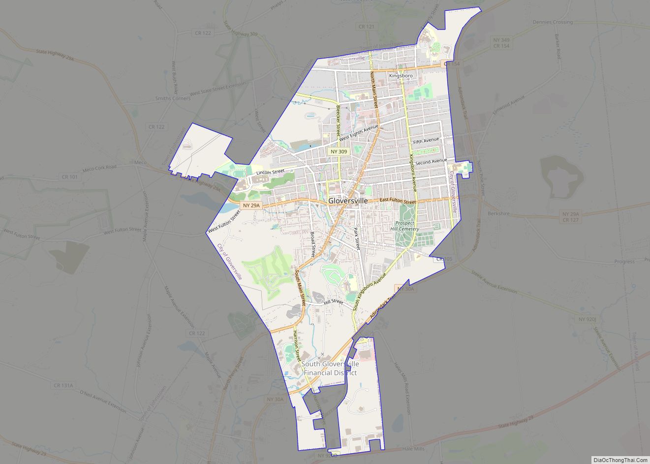
Gloversville is a city in the Mohawk Valley region of Upstate New York, United States. The most populous city in Fulton County, Gloversville was once the hub of the United States’ glovemaking industry, with over two hundred manufacturers in Gloversville and the adjacent city of Johnstown. In 2020, Gloversville had a population of 15,131. Gloversville ... Read more
Map of Gloversville city
Map of Great River CDP
Great River is a suburban hamlet and CDP in the Town of Islip in Suffolk County, New York, United States. It is situated approximately 50 miles (80 km) (55 mi driving) east of New York City on the South Shore of Long Island, adjoining the Great South Bay, protected from the Atlantic Ocean by Fire Island. Great ... Read more
Map of Great River CDP
Map of Great Neck village
Great Neck is a village in the town of North Hempstead in Nassau County, on the North Shore of Long Island, in New York, United States. The population was 9,989 at the 2010 census. The term Great Neck is also commonly applied to the entire peninsula on the north shore and an area extending south ... Read more
Map of Great Neck village
Map of Great Neck Plaza village
Great Neck Plaza is a village on the Great Neck Peninsula in the Town of North Hempstead, in Nassau County, on the North Shore of Long Island, in New York, United States. The population was 6,707 at the 2010 census. Great Neck Plaza village overview: Name: Great Neck Plaza village LSAD Code: 47 LSAD Description: ... Read more
Map of Great Neck Plaza village
Map of Great Neck Gardens CDP
Great Neck Gardens (also known as Allenwood) is a hamlet and census-designated place (CDP) located on the Great Neck Peninsula in Nassau County, on the North Shore of Long Island, New York, United States. The population was 1,186 at the 2010 census. As an unincorporated hamlet, it is governed by the Town of North Hempstead. ... Read more
Map of Great Neck Gardens CDP
Map of Great Neck Estates village
Great Neck Estates is a village on the Great Neck Peninsula in the Town of North Hempstead, in Nassau County, on the North Shore of Long Island, in New York, United States. The population was 2,761 at the 2010 census. Great Neck Estates village overview: Name: Great Neck Estates village LSAD Code: 47 LSAD Description: ... Read more
Map of Great Neck Estates village