Map of Middleport village

Map of Middleport village, New York

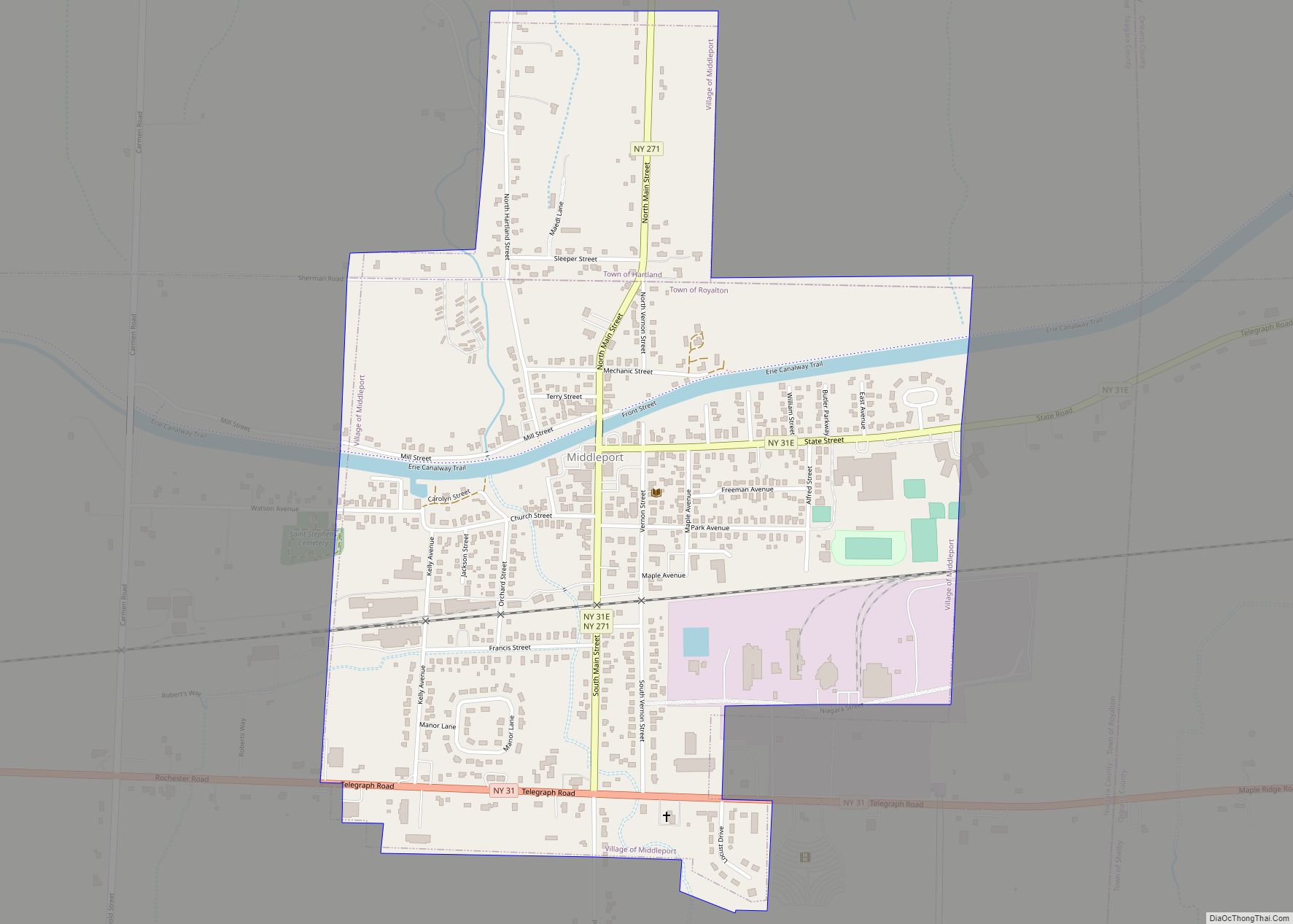
Middleport is a village in Niagara County, New York, United States. The population was 1,840 at the 2010 census. The mail ZIP code is 14105. It is part of the Buffalo–Niagara Falls Metropolitan Statistical Area. The Village of Middleport lies on the eastern edge of Niagara County, mostly inside the boundaries of the Town of … Read more

Map of Middleburgh village

Map of Middleburgh village

Middleburgh is a village in Schoharie County, New York, United States. The population was 1,500 at the 2010 census. The Village of Middleburgh is in the southwestern part of the Town of Middleburgh and is west of Albany. Middleburgh village overview: Name: Middleburgh village LSAD Code: 47 LSAD Description: village (suffix) State: New York County: … Read more

Map of Middle Island CDP

Map of Middle Island CDP

Middle Island is a hamlet and census-designated place (CDP) in the Town of Brookhaven, Suffolk County, New York, United States. The population was 10,483 at the 2010 census. It is situated between the hamlets of Coram and Ridge, to the west and east, respectively, and Rocky Point and Yaphank to the north and south. The … Read more

Map of Millerton village, New York

Map of Millerton village, New York

Millerton is a village in Dutchess County, New York, United States with a population of 903 at the 2020 census. The village was named after Sidney Miller, a rail contractor who helped bring the railroad to that area. Millerton is part of the Poughkeepsie-Newburgh-Middletown Metropolitan Statistical Area of New York as well as the larger … Read more

Map of Miller Place CDP

Map of Miller Place CDP

Miller Place is a hamlet and census-designated place (CDP) in the Town of Brookhaven, Suffolk County, New York, United States, on the North Shore of Long Island. Miller Place has been inhabited since the 17th century and is named for the Miller family that included many of its initial settlers. For most of its history, … Read more

Map of Montauk CDP

Map of Montauk CDP

Montauk (/ˈmɒntɔːk/ MON-tawk) is a hamlet and census-designated place (CDP) in the Town of East Hampton in Suffolk County, New York, on the eastern end of the South Shore of Long Island. As of the 2020 United States census, the CDP’s population was 4,318. The CDP encompasses an area that stretches approximately 13 miles (21 km) … Read more

Map of Monsey CDP

Map of Monsey CDP

Monsey (/ˈmʌnsi/, Yiddish: מאנסי, romanized: Monsi) is a hamlet and census-designated place in the town of Ramapo, Rockland County, New York, United States, located north of Airmont, east of Viola, south of New Hempstead, and west of Spring Valley. The village of Kaser is surrounded by the hamlet of Monsey. The 2020 census listed the population … Read more

Map of Monroe village, New York

Map of Monroe village, New York

Monroe is a village in Orange County, New York, United States. The population was 9,343 at the 2020 census. It is part of the Poughkeepsie–Newburgh–Middletown, NY Metropolitan Statistical Area as well as the larger New York–Newark–Bridgeport, NY-NJ–CT–PA Combined Statistical Area. The community is named not after President James Monroe; rather its name is taken from … Read more

Map of Mohawk village

Map of Mohawk village

Mohawk is a village in Herkimer County, New York, United States. The population was 2,731 at the 2010 census. The village was named after the adjacent Mohawk River. The village is at the northern border of the town of German Flatts and adjacent to the Erie Canal. Mohawk is southeast of Utica. Mohawk village overview: … Read more

Map of Minoa village

Map of Minoa village

Minoa is a village in Onondaga County, New York, United States. As of the 2020 census, the population was 3,657. Minoa is in the northern part of the town of Manlius and is east of Syracuse. Minoa village overview: Name: Minoa village LSAD Code: 47 LSAD Description: village (suffix) State: New York County: Onondaga County … Read more

Map of Mineville CDP

Map of Mineville CDP

Mineville is a hamlet and census-designated place (CDP) in the town of Moriah in Essex County, New York. The population was 1,269 at the 2010 census. Prior to the 2010 census, it was part of the Mineville-Witherbee, New York census-designated place. Mineville and Witherbee are located in the northern part of Moriah, northwest of Port … Read more

Map of Minetto CDP

Map of Minetto CDP

Minetto is a hamlet (and census-designated place) in Oswego County, New York, United States. The population was 1,069 at the 2010 census. Minetto is located in the Town of Minetto at the southern city line of Oswego. It is the only settlement in the town. Minetto CDP overview: Name: Minetto CDP LSAD Code: 57 LSAD … Read more