Middletown is the largest city in Orange County, New York, United States. It lies in New York’s Hudson Valley region, near the Wallkill River and the foothills of the Shawangunk Mountains. Middletown is situated between Port Jervis and Newburgh, New York. At the 2020 United States census, the city’s population was 30,345, reflecting an increase of 2,259 from the 28,086 counted in the 2010 census. The zip code is 10940. Middletown falls within the Poughkeepsie–Newburgh–Middletown Metropolitan Statistical Area, which belongs to the larger New York–Newark–Bridgeport, NY-NJ-CT-PA Combined Statistical Area.
Middletown was incorporated as a city in 1888. It grew in the 19th and early 20th centuries as a stop on several lower New York State railroads, attracting several small manufacturing businesses. The surrounding area is partly devoted to small dairy farms. Mediacom Communications Corp, the Galleria at Crystal Run, SUNY Orange, Walmart, Touro College of Osteopathic Medicine and the Times Herald-Record are major employers in Middletown.
| Name: | Middletown city |
|---|---|
| LSAD Code: | 25 |
| LSAD Description: | city (suffix) |
| State: | New York |
| County: | Orange County |
| Elevation: | 520 ft (160 m) |
| Total Area: | 5.33 sq mi (13.81 km²) |
| Land Area: | 5.31 sq mi (13.74 km²) |
| Water Area: | 0.03 sq mi (0.07 km²) |
| Total Population: | 30,345 |
| Population Density: | 5,719.00/sq mi (2,208.31/km²) |
| ZIP code: | 10940 |
| FIPS code: | 3647042 |
| Website: | www.middletown-ny.com |
Online Interactive Map
Click on ![]() to view map in "full screen" mode.
to view map in "full screen" mode.
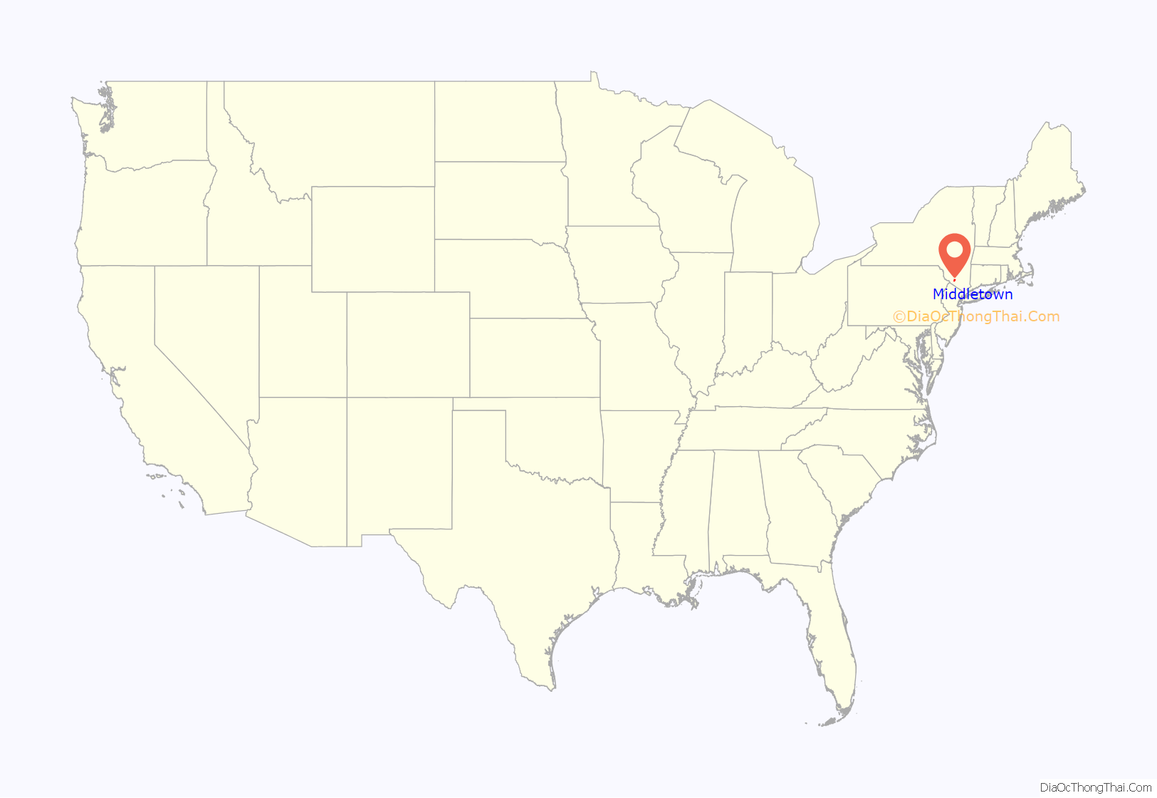
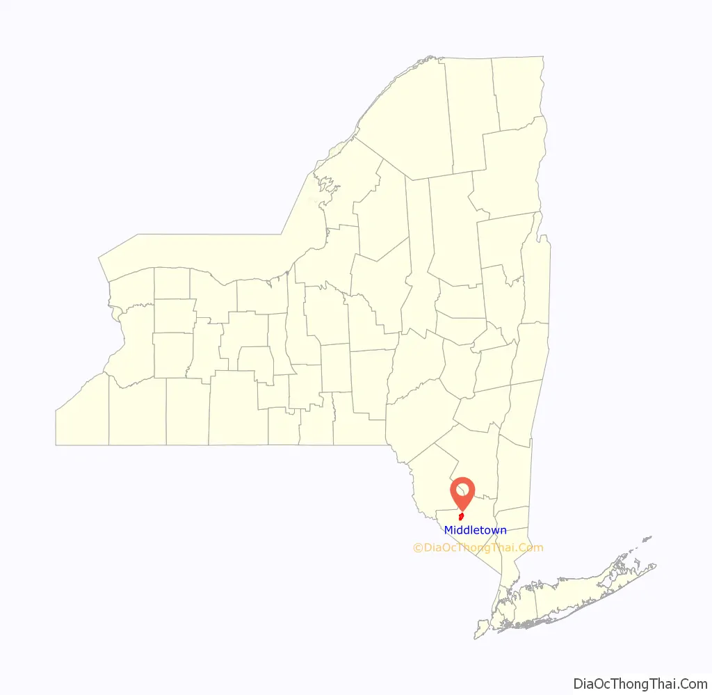
Middletown location map. Where is Middletown city?
History
Early history
John Green purchased land from the DeLancey patent and probably settled the area around 1744. Due to its location between other settlements, residents adopted the name of Middletown, changing it later to South Middletown to avoid confusion with a nearby location. Eventually they dropped the word “south”, using the current name when the community became a village in 1848. The village was incorporated as a city in 1888.
The First Congregational Church of Middletown, established in 1785, has the highest spire downtown. Construction of its first building was a sign of Middletown becoming established as a village. Its current church building was constructed in 1872.
Growth of Middletown
Middletown grew through the 19th century, stimulated by construction of the Erie Railroad and the New York, Ontario and Western Railway (among others). The city was industrialized, developing factories for various industries, such as shoes, lawnmower blades, and furniture. These did well through the World War II era.
The Webb Horton mansion and adjoining 18 acres were donated to establish Orange County Community College in 1950.
Due to industrial restructuring, most of the old manufacturing businesses had closed by the 1960s. In 1968, Middletown annexed the adjacent Village of Amchir. In the 1970s, the economy of Middletown and surrounding communities suffered additional blows due to the closing of a large Ford Motor Company plant in Mahwah, New Jersey, and the downsizing of IBM operations in the area.
Responding to higher housing costs in New York City, from the 1970s, New York City police officers, firefighters and other workers began to move to the area, as local housing offered better value. These commuters, who drove two hours each way, helped to bolster the economy of the area. After 1986, however, New York City required its municipal employees to reside in the city, and Middletown lost this source of residential development. The only railroad left in town is the Middletown and New Jersey Railway, a freight line. The population has continued to grow into the 21st century, while the economy has shifted largely to service and retail, with a regional medical center a major employer in the area.
Modern Middletown
The downtown business district of Middletown suffered from suburbanization that drew off retail businesses. The “Miracle Mile” shopping strip and Lloyd’s Supermarket were developed in the late 1960s and two later shopping malls, all located at the eastern edge of town along Route 211, near Route 17 and Interstate 84. The Orange Plaza mall drew several of the downtown shops into it by the mid-1970s, weakening downtown. To the East across Route 17, the Galleria at Crystal Run opened in the early 1990s. A Wal-Mart Supercenter replaced the Orange Plaza mall in 2001. Some of the buildings downtown are abandoned or underused. But there has long been an active downtown bar and restaurant scene.
The downtown area has several historic churches. The Middletown City Hall and City Court are located on James Street. Prosperous neighborhoods include Presidential Heights. Highland Avenue is lined with large Victorian houses, some of the largest of which are now used as nursing homes. Other neighborhoods show the effects of loss of jobs and decline in the economy. The surrounding countryside was devoted partly to small dairy farms, but family farming has waned since the 1980s.
Middletown is the main business address for the newspaper Times Herald-Record and its owner, Local Media Group. Mediacom Communications Corp, a cable and other pay TV company, is headquartered outside the city in the Town of Wallkill. It is also a manufacturing location for Bell Flavors & Fragrances.
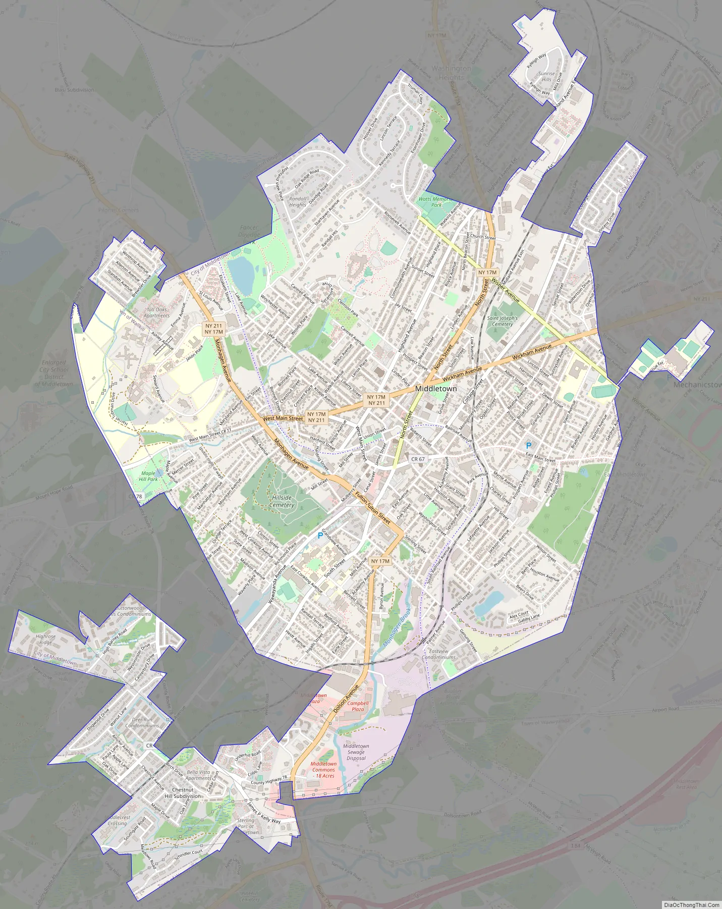
Middletown Road Map
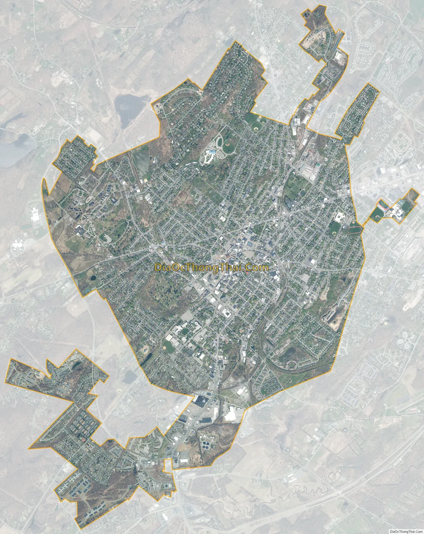
Middletown city Satellite Map
Geography
Middletown is located at 41°27′N 74°25′W / 41.450°N 74.417°W / 41.450; -74.417 (41.4458, -74.4221) in Orange County. The city is nearly surrounded by the town of Wallkill, except for its southernmost section, which is in the town of Wawayanda.
According to the United States Census Bureau, the city has a total area of 5.2 square miles (13.3 km), of which 5.1 square miles (13.3 km) is land and 0.19% is water. The city is drained by Monhagen Brook and the Wallkill River.
Climate
See also
Map of New York State and its subdivision:- Albany
- Allegany
- Bronx
- Broome
- Cattaraugus
- Cayuga
- Chautauqua
- Chemung
- Chenango
- Clinton
- Columbia
- Cortland
- Delaware
- Dutchess
- Erie
- Essex
- Franklin
- Fulton
- Genesee
- Greene
- Hamilton
- Herkimer
- Jefferson
- Kings
- Lake Ontario
- Lewis
- Livingston
- Madison
- Monroe
- Montgomery
- Nassau
- New York
- Niagara
- Oneida
- Onondaga
- Ontario
- Orange
- Orleans
- Oswego
- Otsego
- Putnam
- Queens
- Rensselaer
- Richmond
- Rockland
- Saint Lawrence
- Saratoga
- Schenectady
- Schoharie
- Schuyler
- Seneca
- Steuben
- Suffolk
- Sullivan
- Tioga
- Tompkins
- Ulster
- Warren
- Washington
- Wayne
- Westchester
- Wyoming
- Yates
- Alabama
- Alaska
- Arizona
- Arkansas
- California
- Colorado
- Connecticut
- Delaware
- District of Columbia
- Florida
- Georgia
- Hawaii
- Idaho
- Illinois
- Indiana
- Iowa
- Kansas
- Kentucky
- Louisiana
- Maine
- Maryland
- Massachusetts
- Michigan
- Minnesota
- Mississippi
- Missouri
- Montana
- Nebraska
- Nevada
- New Hampshire
- New Jersey
- New Mexico
- New York
- North Carolina
- North Dakota
- Ohio
- Oklahoma
- Oregon
- Pennsylvania
- Rhode Island
- South Carolina
- South Dakota
- Tennessee
- Texas
- Utah
- Vermont
- Virginia
- Washington
- West Virginia
- Wisconsin
- Wyoming


