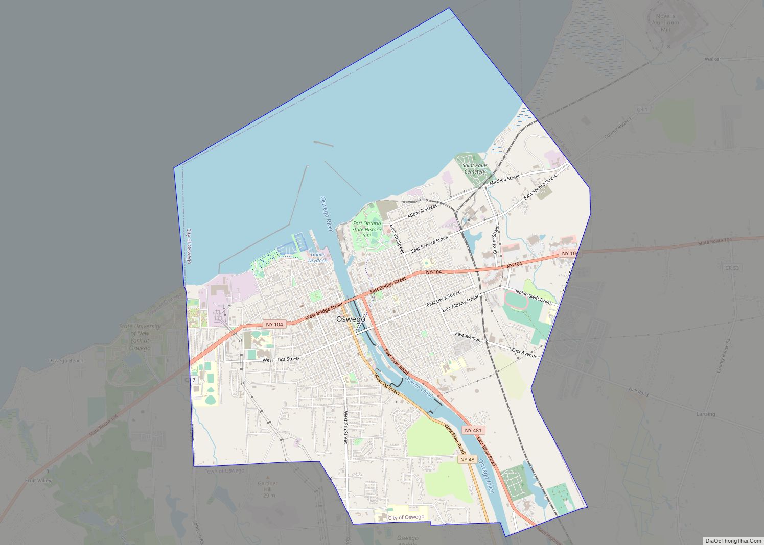
Map of Oyster Bay CDP

Map of Oyster Bay CDP

Oyster Bay is a hamlet and census-designated place (CDP) within the town of Oyster Bay on the North Shore of Long Island in Nassau County in the state of New York, United States. The hamlet is also the site of a station on the Oyster Bay Branch of the Long Island Rail Road and the … Read more

Map of Paul Smiths CDP

Map of Paul Smiths CDP

Paul Smiths is a hamlet and census-designated place (CDP) in the Town of Brighton in Franklin County, New York, United States. It is located on Lower Saint Regis Lake in the Adirondacks, 12 miles (19 km) northwest of Saranac Lake, located at 44°26′ North 74°15′ West. The population of the CDP was 671 at the 2010 … Read more

Map of Patchogue village

Map of Patchogue village

Patchogue (/ˈpætʃɒɡ/, PATCH-awg) is a village in Suffolk County, New York. The population was 11,798 at the time of the 2010 census. Patchogue is part of the town of Brookhaven, on the south shore of Long Island, adjoining Great South Bay. It is officially known as the Incorporated Village of Patchogue. Patchogue village overview: Name: … Read more

Map of Parishville CDP

Map of Parishville CDP

Parishville is the primary hamlet and a census-designated place (CDP) in the town of Parishville in St. Lawrence County, New York, United States. As of the 2010 census, it had a population of 647, out of 2,153 in the entire town of Parishville. The community is in eastern St. Lawrence County, on the eastern side … Read more

Map of Parish village

Map of Parish village

Parish is a village located in the town of Parish, in Oswego County, New York, United States. This village is part of the Syracuse metropolitan area. Its population was 447 as of the census of 2020. Parish village overview: Name: Parish village LSAD Code: 47 LSAD Description: village (suffix) State: New York County: Oswego County … Read more

Map of Parc CDP

Map of Parc CDP

Parc is a location and census-designated place in Clinton County, New York, United States. The name “Parc” is derived from the official name for the 3,447-acre (13.95 km) industrial site, which is PARC, an acronym for the Plattsburgh Airbase Redevelopment Corporation. PARC was established for the purpose of redeveloping the Plattsburgh Air Force Base after it … Read more

Map of Panama village, New York

Map of Panama village, New York

Panama is a village in Chautauqua County, New York, United States. The population was 465 at the 2020 census. Panama is in the northwest part of the town of Harmony, at the junction of State Route 474 (Main Street) and County Route 33. The village is named after Panama Rocks, a large rock formation south … Read more

Map of Pamelia Center CDP

Map of Pamelia Center CDP

Pamelia Center is a hamlet and census-designated place (CDP) in Jefferson County, New York, United States. Its population was 264 as of the 2010 census. The community is located at the junction of New York State Route 37 and New York State Route 342. Pamelia Center CDP overview: Name: Pamelia Center CDP LSAD Code: 57 … Read more

Map of Palmyra village, New York

Map of Palmyra village, New York

Palmyra (/ˌpælˈmaɪrə/) is a village in Wayne County, New York, United States. The population was 3,536 at the 2010 census. The village, along with the town, is named after Palmyra in present-day Syria. The village is in the Town of Palmyra. The village is east of Rochester. Palmyra village overview: Name: Palmyra village LSAD Code: … Read more

Map of Palenville CDP

Map of Palenville CDP

Palenville is a hamlet and census-designated place (CDP) in Greene County, New York, United States. The population was 1,002 at the 2020 census. Palenville is in the southwestern part of the town of Catskill, located at the junction of Routes 23A and 32A. It lies at the foot of Kaaterskill Clove, at the base of … Read more

Map of Palatine Bridge village

Map of Palatine Bridge village

Palatine Bridge is a village in Montgomery County, New York, United States. The population was 737 at the 2010 census. The basis of the name is the community’s location in a region settled by Palatine Germans. The Village of Palatine Bridge is in the Town of Palatine. The community is in the western part of … Read more

Map of Pearl River CDP, New York

Map of Pearl River CDP, New York

Pearl River is a hamlet and census-designated place in the town of Orangetown, Rockland County, New York, United States. It is east of Chestnut Ridge, south of Nanuet, west of Blauvelt, New York, and north of Montvale and Old Tappan, New Jersey. The population was 15,876 at the 2010 census. Pearl River is 20 miles … Read more