Oswego (/ɒsˈwiːɡoʊ/) is a city in Oswego County, New York, United States. The population was 16,921 at the 2020 census. Oswego is located on Lake Ontario in Upstate New York, about 35 miles (55km) northwest of Syracuse. It promotes itself as “The Port City of Central New York.” It is the county seat of Oswego County.
The city of Oswego is bordered by the towns of Oswego, Minetto, and Scriba to the west, south, and east, respectively, and by Lake Ontario to the north. Oswego Speedway is a nationally known automobile racing facility. The State University of New York at Oswego is located just outside the city on Lake Ontario.
| Name: | Oswego city |
|---|---|
| LSAD Code: | 25 |
| LSAD Description: | city (suffix) |
| State: | New York |
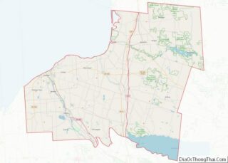
| County: | Oswego County |
| Elevation: | 285 ft (87 m) |
| Total Area: | 11.23 sq mi (29.08 km²) |
| Land Area: | 7.61 sq mi (19.72 km²) |
| Water Area: | 3.61 sq mi (9.36 km²) 31% |
| Total Population: | 16,921 |
| Population Density: | 2,222.35/sq mi (858.06/km²) |
| ZIP code: | 13126 |
| Area code: | 315 |
| FIPS code: | 3655574 |
| GNISfeature ID: | 0959525 |
| Website: | www.oswegony.org |
Online Interactive Map
Click on ![]() to view map in "full screen" mode.
to view map in "full screen" mode.
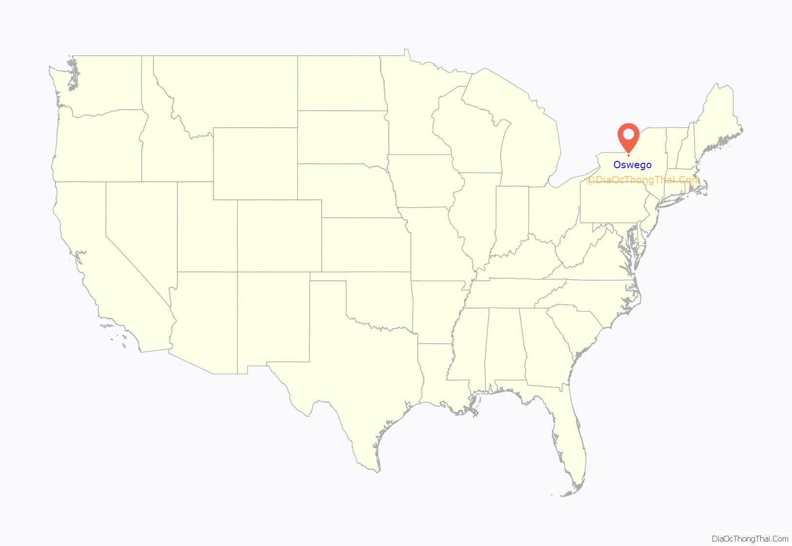
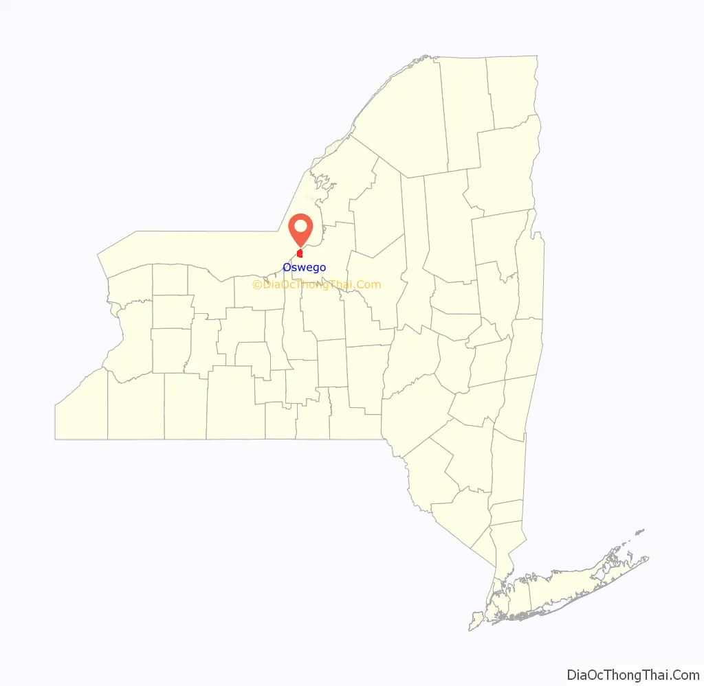
Oswego location map. Where is Oswego city?
History
Early history
The British established a trading post in the area in 1722 and fortified it with a log palisade later called Fort Oswego, named after the native Iroquois place name “os-we-go” meaning “pouring out place.” The first fortification on the site of the current Fort Ontario was built by the British in 1755 and called the “Fort of the Six Nations.”
Military base
Fort Ontario was destroyed by the French upon capturing it in the Battle of Fort Ontario, during the French and Indian War. Construction of a second British fort began on the same site in 1759, but Fort Ontario was only used as a cannon emplacement. During the American Revolution, the British abandoned the Fort, and in 1778, American troops destroyed it. In 1782, the British reoccupied Fort Ontario, and didn’t forfeit it to the U.S. until 1796, thirteen years after the cessation of hostilities in the Revolution.
During the War of 1812, a weaker American garrison at Fort Ontario was overwhelmed by superior British forces in order to stem the flow of supplies from the interior of New York state, but were later defeated near Oswego later that month. Throughout the 19th Century, the U.S. military maintained a presence at Fort Ontario.
Growth
Oswego was incorporated as a village on March 14, 1828, and the Oswego Canal, a branch of the Erie Canal, reached the area in 1829. The city was incorporated in 1848. When the city incorporated, its area and population were removed from the figures reported for the towns.
In the 1850s, at the height of a popular water-cure movement occurring in the United States, in turn stimulating growth, Oswego was the home of the Oswego Water Cure establishment, which Stonewall Jackson reportedly visited in August 1850.
Railroads’ role in growth
Oswego is home to the Port of Oswego and once was a hub for several major railroads: the New York Central Railroad (NYC), the Delaware, Lackawanna and Western Railroad (DL&W) and the New York, Ontario and Western Railway (O&W). Railways operated a coal trestle for fueling steamships at the Port of Oswego. Into the mid-1940s, the DL&W had daily passenger service from Hoboken, through Binghamton, to Syracuse ending in Oswego. The New York Central last had passenger service between Oswego, Fulton and Syracuse in 1951. Former NYC and DL&W passenger stations remain, as does a NYC freight station. Nothing remains of the O&W, which was abandoned in its entirety on March 30, 1957. The tunnel from the former O&W is used as a rail trail.
Fort Ontario
Fort Ontario was built between 1839 and 1844. Major masonry improvements to the forts outer wall were undertaken, but left incomplete when Congress canceled its funding in 1872. By 1901, the old fort was abandoned.
The 2nd Brigade of the U.S. 1st Infantry Division called Fort Ontario home until the brigade was deactivated on June 1, 1940. During World War II it was used for interning Jewish refugees from Europe (see section below).
In 1946, the fort was transferred to the state of New York. At that time, it was used to house veterans and their families during the post-war period. Development of the fort as a historic site began in 1949, which included the “Safe Haven Museum.”
Today, Fort Ontario is being restored to its 1867–1872 appearance. Costumed interpreters recreate the lives of the officers, men, and civilians who garrisoned the fort in 1868–1869.
WWII refugee camp
In 1944 amidst World War II, President Franklin D. Roosevelt established a camp at the fort for survivors of the Holocaust.
The fort was used as Fort Ontario Emergency Refugee Shelter also known as “Safe Haven,” home to approximately 982 Jewish refugees, survivors of the Nazi Holocaust, from August 1944 to February 1946. This was the only attempt by the United States government to shelter Jewish refugees during the war.
Approximately 1,000 refugees were transferred to the fort from the Ferramonti di Tarsia, a concentration camp in Cosenza, Calabria, Italy. The refugees came from 18 different European countries.
The refugees were placed behind barbed wire, and given no official status, having been required to sign papers accepting their eventual return to their home countries in Europe at the end of the war. Due to political pressure, President Harry S. Truman allowed them to apply for citizenship.
The camp comprised 200 buildings of converted army barracks. The site is now the Safe Haven Museum.
Oswego Road Map
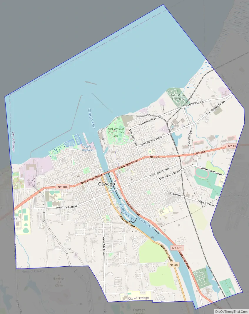
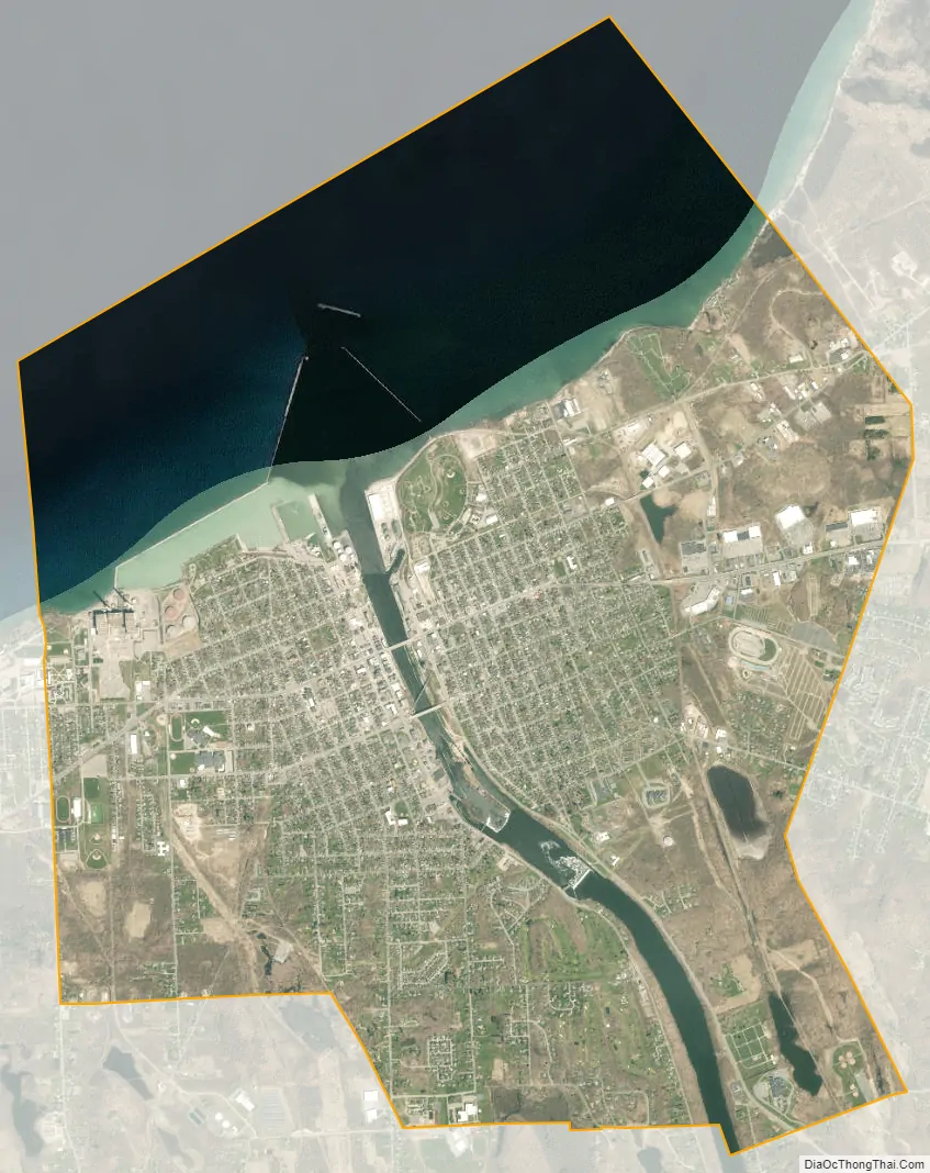
Oswego city Satellite Map
Geography
According to the United States Census Bureau, the city has a total area of 11.2 square miles (29.1 km), of which 7.7 square miles (19.8 km) is land and 3.6 square miles (9.2 km) (31.76%) is water.
Oswego is located on the southeastern shore of Lake Ontario at the mouth of the Oswego River, approximately 35 miles north of Syracuse and 69 miles east of Rochester. The elevation is 298 feet above sea level. The nearest city is Fulton, located south of Oswego and north of Syracuse.
As Oswego is located on the eastern shore of Lake Ontario, in the center of the Snowbelt, the region often sees prodigious lake effect snow accumulations. Oswego is one of the snowiest towns in America, with some winters totaling over 300 inches. In 2007, Oswego gained national attention when approximately 130″ (slightly less than 11 feet) of snow fell in a two-week timespan. This broke the record of the Blizzard of 1966, which blanketed the city with 102″ of snow. As a result of this storm, the school district closed all facilities for a week, effectively shifting the planned winter holiday.
Locations and communities near Oswego
- Oswego: the town of Oswego
- Minetto: the town of Minetto south of the city
- Scriba: the town of Scriba east of the city
- Southwest Oswego: a hamlet located west of the city
- Fruit Valley: a hamlet located west of the city
Climate
Oswego has a humid continental climate (Köppen Dfb/Dfa), typical of the Interior Northeast. The city experiences four distinct seasons, and is located in USDA hardiness zone 6a. The region typically experiences cold and relatively wet winters, and with its location in the Great Lakes Snowbelt, frequently receives heavy snowfall.
See also
Map of New York State and its subdivision:- Albany
- Allegany
- Bronx
- Broome
- Cattaraugus
- Cayuga
- Chautauqua
- Chemung
- Chenango
- Clinton
- Columbia
- Cortland
- Delaware
- Dutchess
- Erie
- Essex
- Franklin
- Fulton
- Genesee
- Greene
- Hamilton
- Herkimer
- Jefferson
- Kings
- Lake Ontario
- Lewis
- Livingston
- Madison
- Monroe
- Montgomery
- Nassau
- New York
- Niagara
- Oneida
- Onondaga
- Ontario
- Orange
- Orleans
- Oswego
- Otsego
- Putnam
- Queens
- Rensselaer
- Richmond
- Rockland
- Saint Lawrence
- Saratoga
- Schenectady
- Schoharie
- Schuyler
- Seneca
- Steuben
- Suffolk
- Sullivan
- Tioga
- Tompkins
- Ulster
- Warren
- Washington
- Wayne
- Westchester
- Wyoming
- Yates
- Alabama
- Alaska
- Arizona
- Arkansas
- California
- Colorado
- Connecticut
- Delaware
- District of Columbia
- Florida
- Georgia
- Hawaii
- Idaho
- Illinois
- Indiana
- Iowa
- Kansas
- Kentucky
- Louisiana
- Maine
- Maryland
- Massachusetts
- Michigan
- Minnesota
- Mississippi
- Missouri
- Montana
- Nebraska
- Nevada
- New Hampshire
- New Jersey
- New Mexico
- New York
- North Carolina
- North Dakota
- Ohio
- Oklahoma
- Oregon
- Pennsylvania
- Rhode Island
- South Carolina
- South Dakota
- Tennessee
- Texas
- Utah
- Vermont
- Virginia
- Washington
- West Virginia
- Wisconsin
- Wyoming