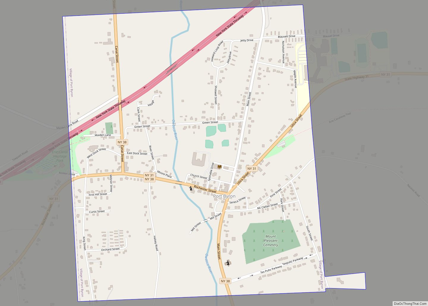
Map of Port Henry CDP

Map of Port Henry CDP

Port Henry is a hamlet (and census-designated place) in Essex County, New York, United States. The population was 1,194 at the 2010 census. Port Henry lies on the eastern side of the town of Moriah and is approximately one hour’s drive (52 miles or 84 km) south of Plattsburgh. It is 44 miles (71 km) by road … Read more

Map of Prattsville CDP, New York

Map of Prattsville CDP, New York

Prattsville is a hamlet and census-designated place (CDP) in the town of Prattsville, Greene County, New York, United States. The population of the CDP was 355 at the 2010 census, out of a total population of 700 in the town. Prattsville CDP overview: Name: Prattsville CDP LSAD Code: 57 LSAD Description: CDP (suffix) State: New … Read more

Map of Prattsburgh CDP

Map of Prattsburgh CDP

Prattsburgh is the primary hamlet and a census-designated place (CDP) in the town of Prattsburgh in Steuben County, New York, United States. As of the 2010 census, it had a population of 656, out of 2,085 in the entire town of Prattsburgh. The community was incorporated as a village in 1848 but was disincorporated in … Read more

Map of Poughkeepsie city

Map of Poughkeepsie city

Poughkeepsie (/pəˈkɪpsi/ pə-KIP-see), officially the City of Poughkeepsie, separate from the Town of Poughkeepsie around it) is a city in the U.S. state of New York. It is the county seat of Dutchess County, with a 2020 census population of 31,577. Poughkeepsie is in the Hudson River Valley region, midway between the core of the … Read more

Map of Pottersville CDP

Map of Pottersville CDP

Pottersville is a hamlet and census-designated place in Chester, Warren County, New York, United States. In the census of 2010, the population was 424. The town is located in Adirondack Park on U.S. Route 9. Pottersville is home to the largest marble cave entrance in the eastern United States. (“Natural Stone Bridge and Caves”, Web). … Read more

Map of Potsdam village

Map of Potsdam village, New York

Potsdam is a village located in the Town of Potsdam in St. Lawrence County, New York, United States. The population was 8,312 at the 2020 census. The Village of Potsdam is in the eastern part of the town and is northeast of Canton, the county seat. The village is the locale of the State University … Read more

Map of Portville village

Map of Portville village

Portville is a village in Cattaraugus County, New York, United States. It is in the southern part of the town of Portville and southeast of Olean. The village population was 916 at the 2020 census, out of a population of 3,730 in the entire town of Portville. Portville village overview: Name: Portville village LSAD Code: … Read more

Map of Port Washington CDP

Map of Port Washington CDP, New York

Port Washington is a hamlet and census-designated place (CDP) on the Cow Neck Peninsula in the Town of North Hempstead, in Nassau County, on the North Shore of Long Island, in New York. The hamlet is the anchor community of the Greater Port Washington area. The population was 16,753 at the 2020 census. Port Washington … Read more

Map of Port Washington North village

Map of Port Washington North village

Port Washington North is a village in Nassau County, on the North Shore of Long Island, in New York, United States. It is considered part of the Greater Port Washington area, which is anchored by Port Washington. The population was 3,154 at the 2010 census. The Incorporated Village of Port Washington North is located on … Read more

Map of Port Leyden village

Map of Port Leyden village

Port Leyden is a village in Lewis County, New York, United States. The population was 672 at the 2010 census. The name is derived from the village’s early history as a port on the Black River Canal. The village of Port Leyden is mostly in the town of Leyden, but a portion of the village … Read more

Map of Port Jervis city

Map of Port Jervis city

Port Jervis is a city located at the confluence of the Neversink and Delaware rivers in western Orange County, New York, United States, north of the Delaware Water Gap. Its population was 8,775 at the 2020 census. The communities of Deerpark, Huguenot, Sparrowbush, and Greenville are adjacent to Port Jervis. Matamoras, Pennsylvania, is across the … Read more

Map of Pulaski village, New York

Map of Pulaski village, New York

Pulaski (/pəˈlæskaɪ/) is a village in Oswego County, New York, United States. The population was 2,365 at the 2010 census. The Village of Pulaski is within the Town of Richland, and lies between the eastern shore of Lake Ontario and the Tug Hill region. The village is located on U.S. Route 11 and is adjacent … Read more