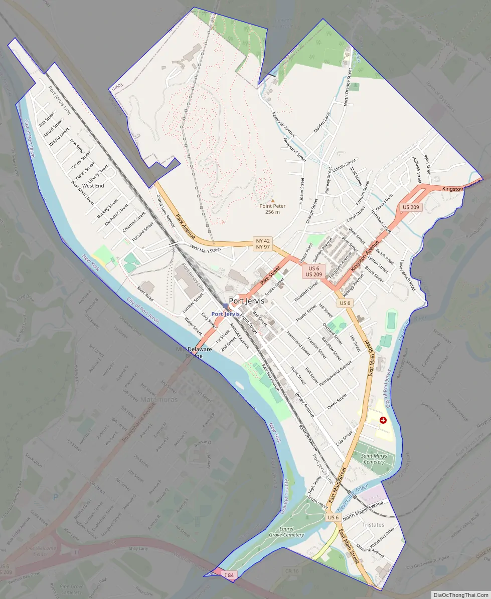
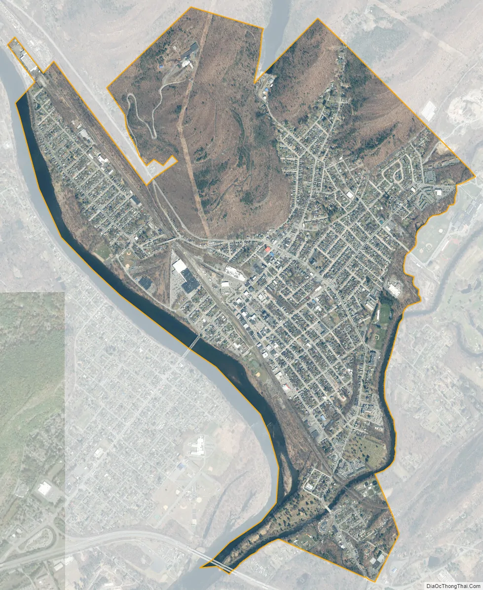
Port Jervis is a city located at the confluence of the Neversink and Delaware rivers in western Orange County, New York, United States, north of the Delaware Water Gap. Its population was 8,775 at the 2020 census. The communities of Deerpark, Huguenot, Sparrowbush, and Greenville are adjacent to Port Jervis. Matamoras, Pennsylvania, is across the river and connected by the Mid-Delaware Bridge. Montague Township, New Jersey, also borders the city. The Tri-States Monument, marking the tripoint between New York, New Jersey, and Pennsylvania, lies at the southwestern corner of the city.
Port Jervis was part of early industrial history, a point for shipping coal to major markets to the southeast by canal and later by railroads. Its residents had long-distance passenger service by railroad until 1970. The restructuring of railroads resulted in a decline in the city’s business and economy.
In the 21st century, from late spring to early fall, many thousands of travelers and tourists pass through Port Jervis on their way to enjoying rafting, kayaking, canoeing and other activities in the Delaware Water Gap National Recreation Area and the Upper Delaware Scenic and Recreational River and the surrounding area.
Port Jervis is part of the Poughkeepsie–Newburgh–Middletown metropolitan area as well as the larger New York metropolitan area. In August 2008, Port Jervis was named one of “Ten Coolest Small Towns” by Budget Travel magazine.
| Name: | Port Jervis city |
|---|---|
| LSAD Code: | 25 |
| LSAD Description: | city (suffix) |
| State: | New York |
| County: | Orange County |
| Elevation: | 400 ft (122 m) |
| Total Area: | 2.70 sq mi (7.00 km²) |
| Land Area: | 2.53 sq mi (6.55 km²) |
| Water Area: | 0.17 sq mi (0.44 km²) 6.64% |
| Total Population: | 8,775 |
| Population Density: | 3,468.38/sq mi (1,339.24/km²) |
| ZIP code: | 12771 |
| Area code: | 845 |
| FIPS code: | 3659388 |
| GNISfeature ID: | 0960971 |
| Website: | www.portjervisny.gov |
Online Interactive Map
Click on ![]() to view map in "full screen" mode.
to view map in "full screen" mode.
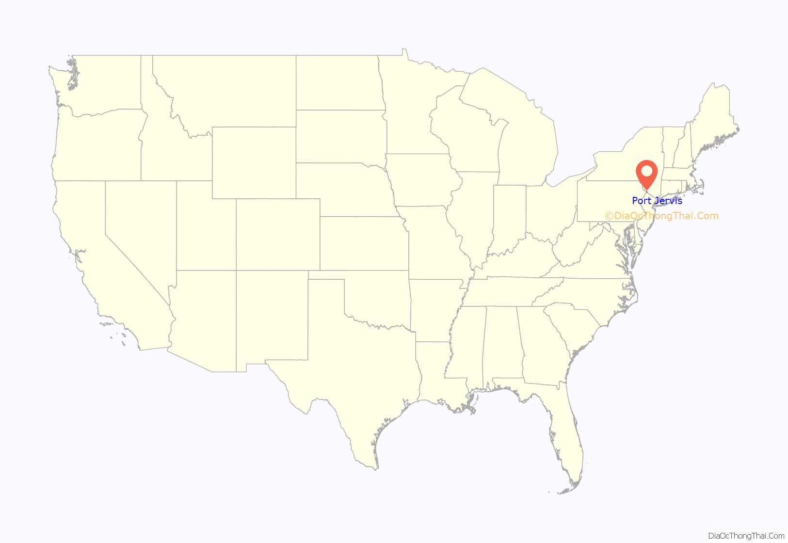
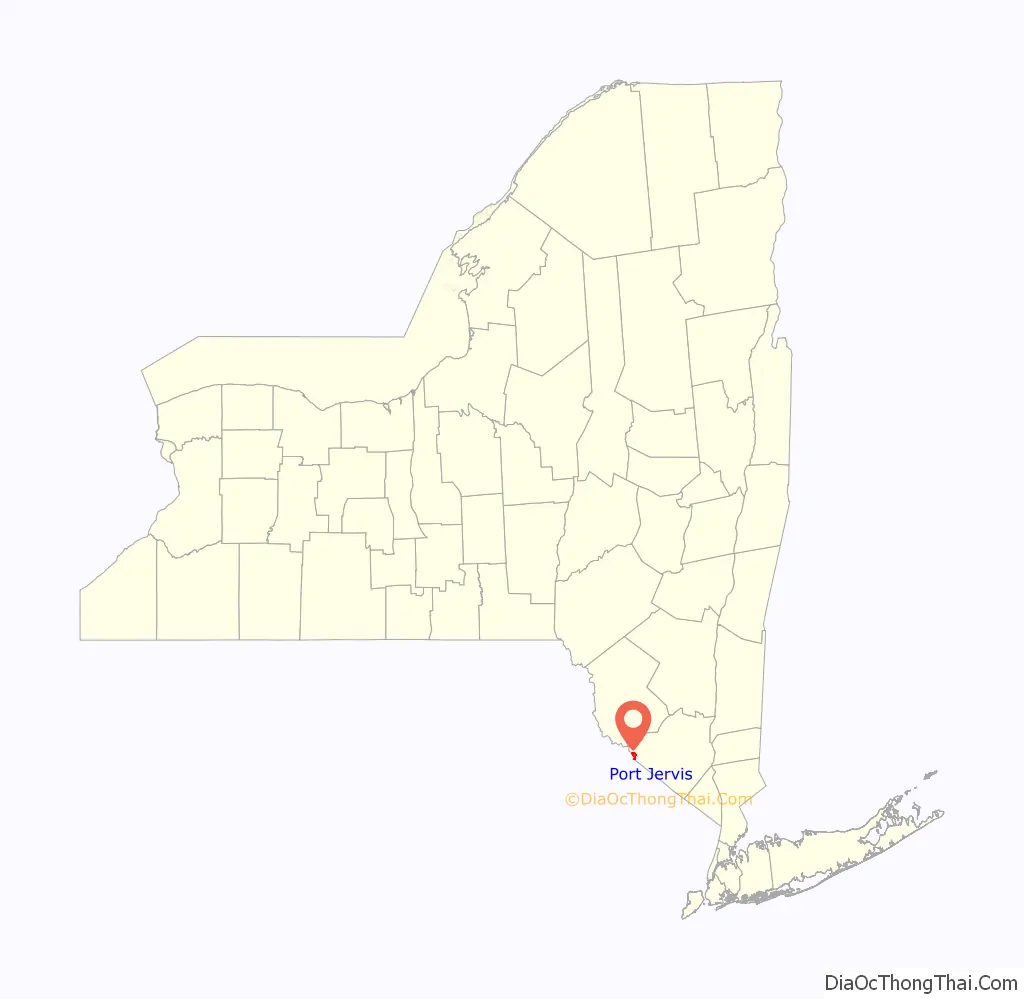
Port Jervis location map. Where is Port Jervis city?
History
The first fully developed European settlement in the area was established by Dutch and English colonists c.1690, and a land grant of 1,200 acres (490 ha) was formalized on October 14, 1697. The settlement was originally known as Mahackamack, after a Lenape word. It was raided and burned in 1779 during the American Revolutionary War, by British and Mohawk forces under the command of Mohawk leader Joseph Brant before the Battle of Minisink. Over the next two decades, residents rebuilt the settlement. They developed more roadways to better connect Mahackamack with the eastern parts of Orange County.
After the Delaware and Hudson Canal was opened in 1828, providing transportation of coal from northeastern Pennsylvania to New York and New England via the Hudson River, trade attracted money and further development to the area. A village was incorporated on May 11, 1853. It was renamed as Port Jervis in the mid-19th century, after John Bloomfield Jervis, chief engineer of the D&H Canal. Port Jervis grew steadily into the 1900s, and on July 26, 1907, it became a city.
Coming of the railroad
The first rail line to run through Port Jervis was the New York & Erie Railroad, which in 1832 was chartered to run from Piermont, New York, on the Hudson River in Rockland County, to Lake Erie. Ground was broken in 1835, but construction was delayed by a nationwide financial panic, and did not start again until 1838. The line was completed in 1851, and the first passenger train – with President Millard Fillmore and former United States Senator Daniel Webster on board – came through the city on May 14. The railroad went through a number of name changes, becoming the Erie Railroad in 1897.
A second railroad, the Port Jervis and Monticello Railroad, later leased to the New York, Ontario and Western Railway (O&W), opened in 1868, running northeast out of the city, and eventually connecting to Kingston, New York, Weehawken, New Jersey and eastern connections.
Like the D&H Canal, the railroads brought new prosperity to Port Jervis in the form of increased trade and investment in the community from the outside. However, the competition by the railroad, which could deliver products faster, hastened the decline of the canal, which ceased operation in 1898. The railroads were the basis of the city’s economy for the coming decades. Port Jervis became Erie’s division center between Jersey City, New Jersey and Susquehanna, Pennsylvania, and by 1922, 20 passenger trains went through the city every day. More than 2,500 Erie RR employees made their homes there.
The railroads began to decline after the Great Depression. A shift in transportation accelerated after World War II with the federal subsidy of the Interstate Highway System and increased competition from trucking companies. One of the first Class I railroads to shut down was the O&W, on March 29, 1957, leaving Port Jervis totally reliant on the Erie. A few years later, in 1960, the Erie, also on a shaky financial footing, merged with Delaware, Lackawanna and Western Railroad to become the Erie Lackawanna. Railroad restructuring continued and in 1976, the Erie Lackawana became part of Conrail, along with a number of other struggling railroads, such as the Penn Central. Since the breakup of Conrail, the trackage around Port Jervis has been controlled by Norfolk Southern. The decline of the railroads was an economic blow to Port Jervis. The city has struggled to find a new economic basis.
Racial incidents
On June 2, 1892, Robert Lewis, an African American, was lynched, hanged on Main Street in Port Jervis by a mob after being accused of participation in an assault on a white woman. A grand jury indicted nine people for assault and rioting rather than Lewis’s lynching. Some literary critics argue that this event influenced Stephen Crane’s 1898 novella The Monster. Crane lived in Port Jervis from 1878 until 1883 and frequently visited the area from 1891 to 1897.
In the mid-1920s some residents in the area formed a Ku Klux Klan chapter, in the period of the KKK’s early 20th-century revival. They burned crosses on Point Peter, the mountain peak that overlooks the city.
Recent history
The city’s location at the confluence of the Delaware and Neversink rivers has made it subject to occasional flooding. There was flooding during the 1955 Hurricane Diane, and a flood-related rumor started a panic in the population. This incident was studied and a 1958 report issued by the National Research Council: “The Effects of a Threatening Rumor on a Disaster-Stricken Community”.
In addition to the rivers having flooded during periods of heavy rainfall, at times ice jams have effectively dammed the Delaware, also causing flooding. In 1875 ice floes destroyed the bridge to Matamoras, Pennsylvania. In 1981 a large ice floe resulted in the highest water crest measured to date at the National Weather Service’s Matamoras river gauge 26.6 feet (8.1 m).
Port Jervis Road Map
Port Jervis city Satellite Map
Geography
Port Jervis is located on the north bank of the Delaware River at the confluence where the Neversink River – the Delaware’s largest tributary – empties into the larger river. Port Jervis is connected by the Mid-Delaware Bridge across the Delaware to Matamoras, Pennsylvania.
From here the Delaware flows to the southwest, running parallel to Kittatinny Ridge until reaching the Delaware Water Gap. It heads southeastward, continuing past New Hope, Pennsylvania and Lambertville, New Jersey; and the New Jersey capital, Trenton; to Philadelphia, and the Delaware Bay.
Port Jervis is also home to the tri-point between New York,Pennsylvania and New Jersey.
According to the United States Census Bureau, the city has a total area of 2.7 square miles (7.0 km), of which 2.5 square miles (6.5 km) is land and 0.2 square miles (0.52 km) (6.64%) is water.
Climate
Port Jervis has a Humid Continental Climate (Köppen Dfb) with relatively hot summers and cold winters. It revives approximately 47.18 inches (1,198 mm) of precipitation per year, most of which occurs in the late spring in early summer. Extremes range from −26 °F (−32 °C) on January 14, 1912, to 105 °F (40.5 °C) on July 9, 1936.
See also
Map of New York State and its subdivision:- Albany
- Allegany
- Bronx
- Broome
- Cattaraugus
- Cayuga
- Chautauqua
- Chemung
- Chenango
- Clinton
- Columbia
- Cortland
- Delaware
- Dutchess
- Erie
- Essex
- Franklin
- Fulton
- Genesee
- Greene
- Hamilton
- Herkimer
- Jefferson
- Kings
- Lake Ontario
- Lewis
- Livingston
- Madison
- Monroe
- Montgomery
- Nassau
- New York
- Niagara
- Oneida
- Onondaga
- Ontario
- Orange
- Orleans
- Oswego
- Otsego
- Putnam
- Queens
- Rensselaer
- Richmond
- Rockland
- Saint Lawrence
- Saratoga
- Schenectady
- Schoharie
- Schuyler
- Seneca
- Steuben
- Suffolk
- Sullivan
- Tioga
- Tompkins
- Ulster
- Warren
- Washington
- Wayne
- Westchester
- Wyoming
- Yates
- Alabama
- Alaska
- Arizona
- Arkansas
- California
- Colorado
- Connecticut
- Delaware
- District of Columbia
- Florida
- Georgia
- Hawaii
- Idaho
- Illinois
- Indiana
- Iowa
- Kansas
- Kentucky
- Louisiana
- Maine
- Maryland
- Massachusetts
- Michigan
- Minnesota
- Mississippi
- Missouri
- Montana
- Nebraska
- Nevada
- New Hampshire
- New Jersey
- New Mexico
- New York
- North Carolina
- North Dakota
- Ohio
- Oklahoma
- Oregon
- Pennsylvania
- Rhode Island
- South Carolina
- South Dakota
- Tennessee
- Texas
- Utah
- Vermont
- Virginia
- Washington
- West Virginia
- Wisconsin
- Wyoming


