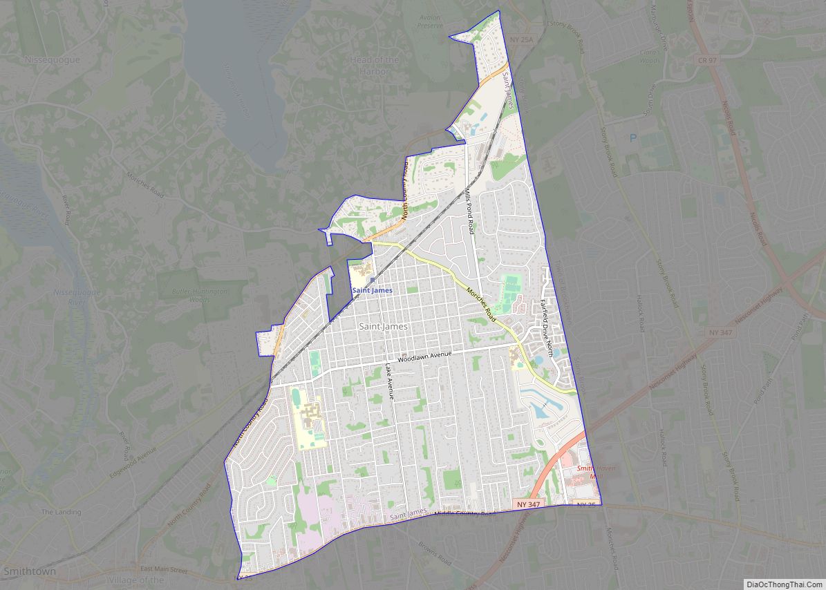
Map of Springwater Hamlet CDP

Map of Springwater Hamlet CDP

Springwater Hamlet CDP overview: Name: Springwater Hamlet CDP LSAD Code: 57 LSAD Description: CDP (suffix) State: New York County: Livingston County FIPS code: 3670477 Online Interactive Map Springwater Hamlet online map. Source: Basemap layers from Google Map, Open Street Map (OSM), Arcgisonline, Wmflabs. Boundary Data from Database of Global Administrative Areas. Springwater Hamlet location map. … Read more

Map of Stewart Manor village

Map of Stewart Manor village

Stewart Manor is a village in the Town of Hempstead in Nassau County, on Long Island, in New York, United States. The population was 1,896 at the 2010 census. Stewart Manor village overview: Name: Stewart Manor village LSAD Code: 47 LSAD Description: village (suffix) State: New York County: Nassau County Incorporated: 1927 Elevation: 85 ft (26 m) … Read more

Map of Star Lake CDP

Map of Star Lake CDP

Star Lake is a hamlet (and census-designated place) in the Adirondack Mountains of St. Lawrence County, New York, United States. The population was 809 at the 2010 census. Star Lake is in the Town of Clifton, but part of the community is in the Town of Fine. The community is located east of a very … Read more

Map of SUNY Oswego CDP

Map of SUNY Oswego CDP

SUNY Oswego CDP is a census-designated place (CDP) covering the State University of New York at Oswego campus in Oswego County, New York, United States. It covers the permanent resident population of the campus and is not reflective of either the student body or include students who list their permanent residency elsewhere. Per the 2020 … Read more

Map of Sunset Bay CDP

Map of Sunset Bay CDP

Sunset Bay is a hamlet and census-designated place (CDP) in the town of Hanover in Chautauqua County, New York, United States. The population was 660 at the 2010 census. Sunset Bay is adjacent to the Cattaraugus Indian Reservation. On the reservation, adjacent to Sunset Bay, was previously home to a community of approximately 80 non-native … Read more

Map of Suffern village

Map of Suffern village

Suffern is a village that was incorporated in 1796 in the town of Ramapo in Rockland County, New York. Suffern is located 31 miles northwest of Manhattan. As of the 2010 census, Suffern’s population was 10,723. Suffern village overview: Name: Suffern village LSAD Code: 47 LSAD Description: village (suffix) State: New York County: Rockland County … Read more

Map of Strykersville CDP

Map of Strykersville CDP

Strykersville is a hamlet (and census-designated place) located within the town of Sheldon, with a small southern portion in the Town of Java, in the western part of Wyoming County, New York, United States. The population was 647 people in the 2010 census. It is located on New York State Route 78. Strykersville CDP overview: … Read more

Map of Stottville CDP

Map of Stottville CDP

Stottville is a hamlet and census-designated place (CDP) in Columbia County, New York, United States. The population was 1,375 at the 2010 census. Stottville is in the southern part of the town of Stockport, south of Stockport Creek, and in the northern section of the town of Greenport. Stottville CDP overview: Name: Stottville CDP LSAD … Read more

Map of Stony Point CDP, New York

Map of Stony Point CDP, New York

Stony Point is a hamlet and census-designated place in the town of Stony Point, Rockland County, New York, United States. It is located north of West Haverstraw, east of Harriman State Park, south of Tomkins Cove, and west of the Hudson River. The population was 12,147 at the 2010 census. The community is in the … Read more

Map of Stony Brook CDP

Map of Stony Brook CDP

Stony Brook is a hamlet and census-designated place (CDP) in the Town of Brookhaven in Suffolk County, New York, United States, on the North Shore of Long Island. Begun in the colonial era as an agricultural enclave, the hamlet experienced growth first as a resort town and then to its current state as one of … Read more

Map of Stony Brook University CDP

Map of Stony Brook University CDP

Stony Brook University CDP is a census-designated place (CDP) covering the Stony Brook University campus in Suffolk County, on Long Island, in New York, United States. It covers the permanent resident population of the campus and is not reflective of either the student body or include students who list their permanent residency elsewhere. The population … Read more

Map of Stone Ridge CDP

Map of Stone Ridge CDP, New York

Stone Ridge is a hamlet (and census-designated place) in Ulster County, New York, United States. The population was 1,234 at the 2020 census. Stone Ridge is located in the Town of Marbletown, along US 209 where it overlaps NY 213. Stone Ridge CDP overview: Name: Stone Ridge CDP LSAD Code: 57 LSAD Description: CDP (suffix) … Read more