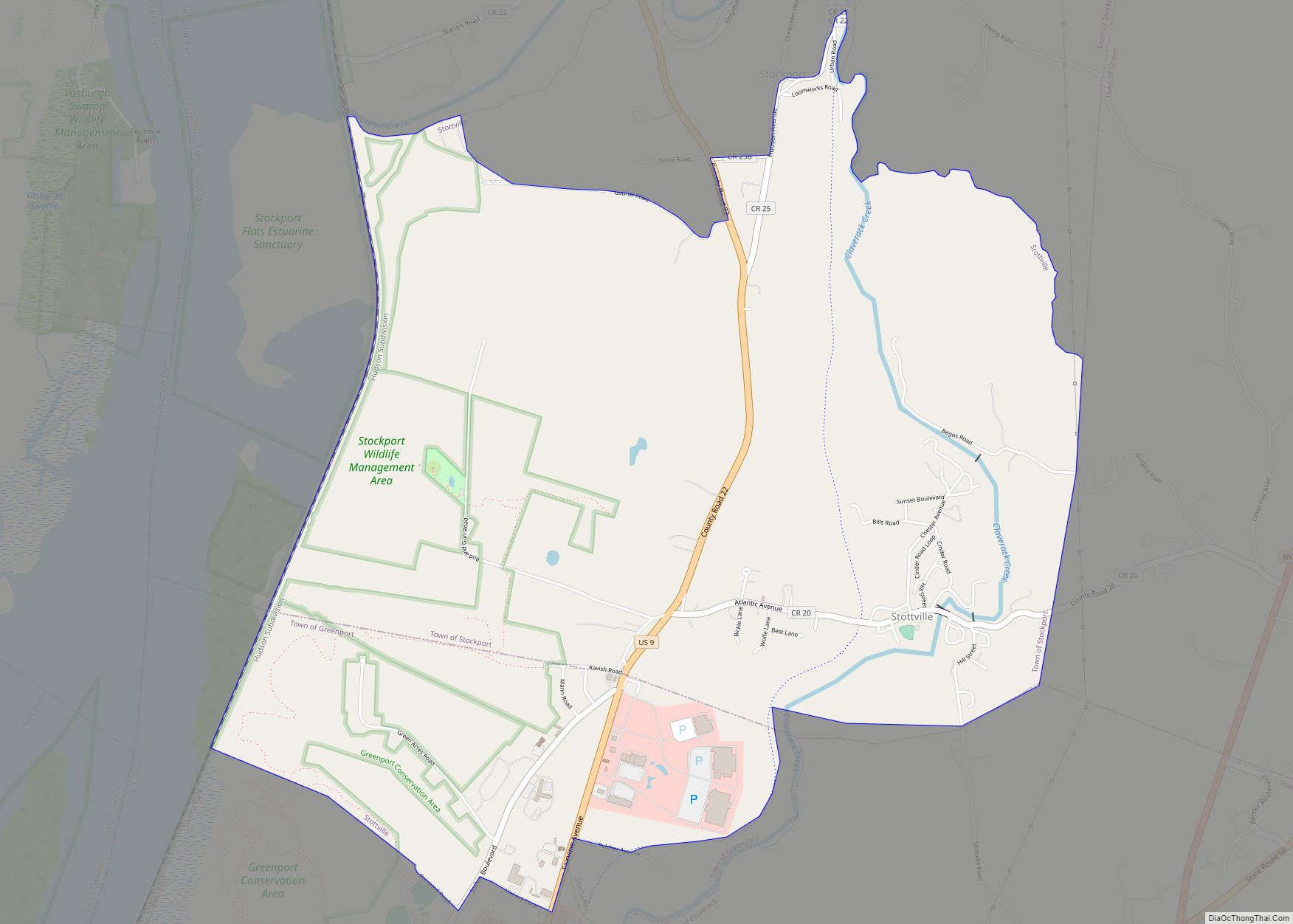
Map of Stony Point CDP, New York

Map of Stony Point CDP, New York

Stony Point is a hamlet and census-designated place in the town of Stony Point, Rockland County, New York, United States. It is located north of West Haverstraw, east of Harriman State Park, south of Tomkins Cove, and west of the Hudson River. The population was 12,147 at the 2010 census. The community is in the … Read more

Map of Thiells CDP

Map of Thiells CDP

Thiells, known as Thiell’s Corner in the 1850s, is a hamlet and census-designated place (CDP) in the town of Haverstraw, Rockland County, New York, United States. It is located north of Mount Ivy, east of Pomona, south of Tomkins Cove, and west of Garnerville. The population was 5,240 as of the 2020 census. During the … Read more

Map of Theresa village

Map of Theresa village, New York

Theresa (/θɜːrˈiːsə/, thur-EE-sə) is a village in the town of Theresa in Jefferson County, New York, United States. The population was 863 at the 2010 census. The village is northeast of Watertown. Theresa village overview: Name: Theresa village LSAD Code: 47 LSAD Description: village (suffix) State: New York County: Jefferson County Elevation: 407 ft (124 m) Total … Read more

Map of Thendara CDP

Map of Thendara CDP

Thendara is a hamlet and census-designated place (CDP) in Herkimer County, New York, United States. Thendara is located in the Adirondack Park, in the southern part of the town of Webb, west of Old Forge on Route 28. Thendara is a station on the Adirondack Railroad; it is the current terminus of most northbound trains … Read more

Map of Terryville CDP, New York

Map of Terryville CDP, New York

Terryville is a census-designated place (CDP) in the Town of Brookhaven, Suffolk County, New York, United States. The population was 11,849 at the 2010 census. Terryville CDP overview: Name: Terryville CDP LSAD Code: 57 LSAD Description: CDP (suffix) State: New York County: Suffolk County Total Area: 3.15 sq mi (8.17 km²) Land Area: 3.15 sq mi (8.17 km²) Water Area: 0.00 sq mi … Read more

Map of Tarrytown village, New York

Map of Tarrytown village, New York

Tarrytown is a village in the town of Greenburgh in Westchester County, New York. It is located on the eastern bank of the Hudson River, approximately 25 miles (40 km) north of Midtown Manhattan in New York City, and is served by a stop on the Metro-North Hudson Line. To the north of Tarrytown is the … Read more

Map of Tappan CDP

Map of Tappan CDP

Tappan (/təˈpæn/ tə-PAN) is a hamlet and census-designated place in the town of Orangetown, Rockland County, New York. It is located northwest of Alpine, New Jersey, north of Northvale, New Jersey and Rockleigh, New Jersey, northeast of Old Tappan, New Jersey, east/southeast of Nauraushaun and Pearl River, south of Orangeburg, southwest of Sparkill, and west … Read more

Map of Tannersville village

Map of Tannersville village

Tannersville is a village in Greene County, New York, United States. The village is in the north-central part of the town of Hunter on Route 23A. The population was 539 at the 2010 census, up from 448 in 2000. Tannersville village overview: Name: Tannersville village LSAD Code: 47 LSAD Description: village (suffix) State: New York … Read more

Map of Taconic Shores CDP

Map of Taconic Shores CDP

Taconic Shores is a residential development and census-designated place (CDP) in Columbia County, New York, United States. The hamlet is near the geographic center of the town of Copake and surrounds Robinson Pond, a water body on the Roeliff Jansen Kill. The CDP was designated after the 2010 census, so no population figure is yet … Read more

Map of Syosset CDP

Map of Syosset CDP

Syosset /saɪˈɒsɪt/ (also known as Little East Woods or Locust Grove) is a hamlet and census-designated place in the Town of Oyster Bay, in Nassau County, on the North Shore of Long Island, in New York, United States. The population was 19,259 at the 2020 census. Syosset is served by the Syosset LIRR station, the … Read more

Map of Sylvan Beach village

Map of Sylvan Beach village

Sylvan Beach is a village in Oneida County, New York, United States; in the southeastern end of the Town of Vienna. It is twenty-two miles west of Rome. At the 2010 census, the population of Sylvan Beach was 897. Sylvan Beach village overview: Name: Sylvan Beach village LSAD Code: 47 LSAD Description: village (suffix) State: … Read more

Map of Town Line CDP

Map of Town Line CDP

Town Line is a hamlet and census-designated place (CDP) in Erie County, New York, United States. The population was 2,367 at the 2010 census. It is part of the Buffalo–Niagara Falls Metropolitan Statistical Area. The community is located on the boundary between the towns of Lancaster and Alden. Town Line is notable for having held … Read more