Map of Blauvelt CDP

Map of Blauvelt CDP

Blauvelt is a hamlet and census-designated place, formerly known as Greenbush and then Blauveltville, in the town of Orangetown, Rockland County, New York, United States. It is located north of Tappan, east of Nauraushaun and Pearl River, south of Central Nyack, and west of Orangeburg. As of the 2010 census, the CDP had a population … Read more

Map of Blasdell village

Map of Blasdell village

Blasdell is a village in Erie County, New York, United States. The population was 2,553 according to the 2010 Census. The name is derived from Herman Blasdell, the first station master of the Erie and Pennsylvania railroad depot. It is part of the Buffalo–Niagara Falls Metropolitan Statistical Area. Blasdell is in the northern part of … Read more

Map of Black River village

Map of Black River village

Black River is a village in Jefferson County, New York, United States. The population was 1,348 at the 2010 census. The village is on the border of the towns of Le Ray and Rutland, east of Watertown. Black River village overview: Name: Black River village LSAD Code: 47 LSAD Description: village (suffix) State: New York … Read more

Map of Bohemia CDP

Map of Bohemia CDP

Bohemia /boʊhiːmiːə/ is a hamlet (and census-designated place) in Suffolk County, New York, United States. The population was 10,180 at the 2010 census. It is situated along the South Shore of Long Island in the Town of Islip, approximately 50 miles from New York City. A portion of Long Island MacArthur Airport is located within … Read more

Map of Blue Point CDP

Map of Blue Point CDP

Blue Point is a hamlet and census-designated place in Suffolk County on Long Island, New York, United States. The population was 5,156 at the 2020 census. Blue Point is in the Town of Brookhaven. Blue Point CDP overview: Name: Blue Point CDP LSAD Code: 57 LSAD Description: CDP (suffix) State: New York County: Suffolk County … Read more

Map of Bloomville CDP

Map of Bloomville CDP, New York

Bloomville is a hamlet and census-designated place (CDP) in the town of Kortright, Delaware County, New York, United States. The population was 213 at the 2010 census. Bloomville CDP overview: Name: Bloomville CDP LSAD Code: 57 LSAD Description: CDP (suffix) State: New York County: Delaware County Elevation: 1,455 ft (443 m) Total Area: 1.32 sq mi (3.43 km²) Land Area: … Read more

Map of Bloomingburg village

Map of Bloomingburg village, New York

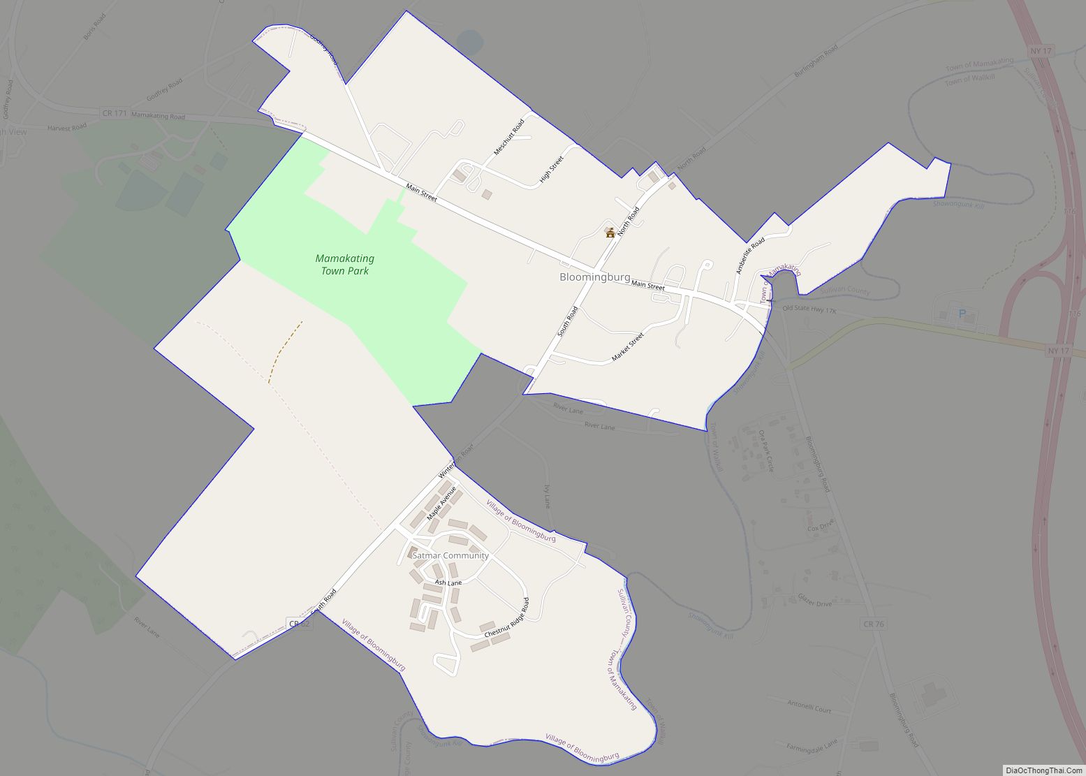
Bloomingburg, previously Bloomingburgh, is a village in the Sullivan County town of Mamakating, New York, United States. The population was 1,032 at the 2020 census. Bloomingburg village overview: Name: Bloomingburg village LSAD Code: 47 LSAD Description: village (suffix) State: New York County: Sullivan County Founded: 1833 Elevation: 515 ft (157 m) Total Area: 0.69 sq mi (1.78 km²) Land Area: … Read more

Map of Briarcliff Manor village

Map of Briarcliff Manor village

Briarcliff Manor (/ˈbraɪ.ərklɪf/) is a suburban village in Westchester County, New York, 30 miles (50 km) north of New York City. It is on 5.9 square miles (15 km) of land on the east bank of the Hudson River, geographically shared by the towns of Mount Pleasant and Ossining. Briarcliff Manor includes the communities of Scarborough and … Read more

Map of Brewster village, New York

Map of Brewster village, New York

Brewster is a village and the principal settlement within the town of Southeast in Putnam County, New York. Brewster’s population was 2,508 at the time of the 2020 census. The village, which is the most densely populated portion of the county, was named for two early farmer landowners, Walter and James Brewster, who donated land … Read more

Map of Brewster Hill CDP

Map of Brewster Hill CDP

Brewster Hill is a hamlet (and census-designated place) located in the town of Southeast in Putnam County, New York, United States. As of the 2010 census, the population was 2,089. Brewster Hill is located on the eastern side of Tonetta Lake and is east of Interstate 84. Brewster Hill CDP overview: Name: Brewster Hill CDP … Read more

Map of Brewerton CDP

Map of Brewerton CDP

Brewerton is a census-designated place (CDP) in the town of Cicero in Onondaga County and the town of Hastings in Oswego County in the U.S. state of New York. It lies at the west end of Oneida Lake at its outlet into the Oneida River. The population was 4,029 at the 2010 census. Maps of … Read more

Map of Brentwood CDP, New York

Map of Brentwood CDP, New York

Brentwood is a hamlet in the Town of Islip in Suffolk County, on Long Island, in New York, United States. The population was 62,387 at the 2020 Census, making it the most populous in Suffolk County and on all of Long Island outside of New York City. Brentwood CDP overview: Name: Brentwood CDP LSAD Code: … Read more