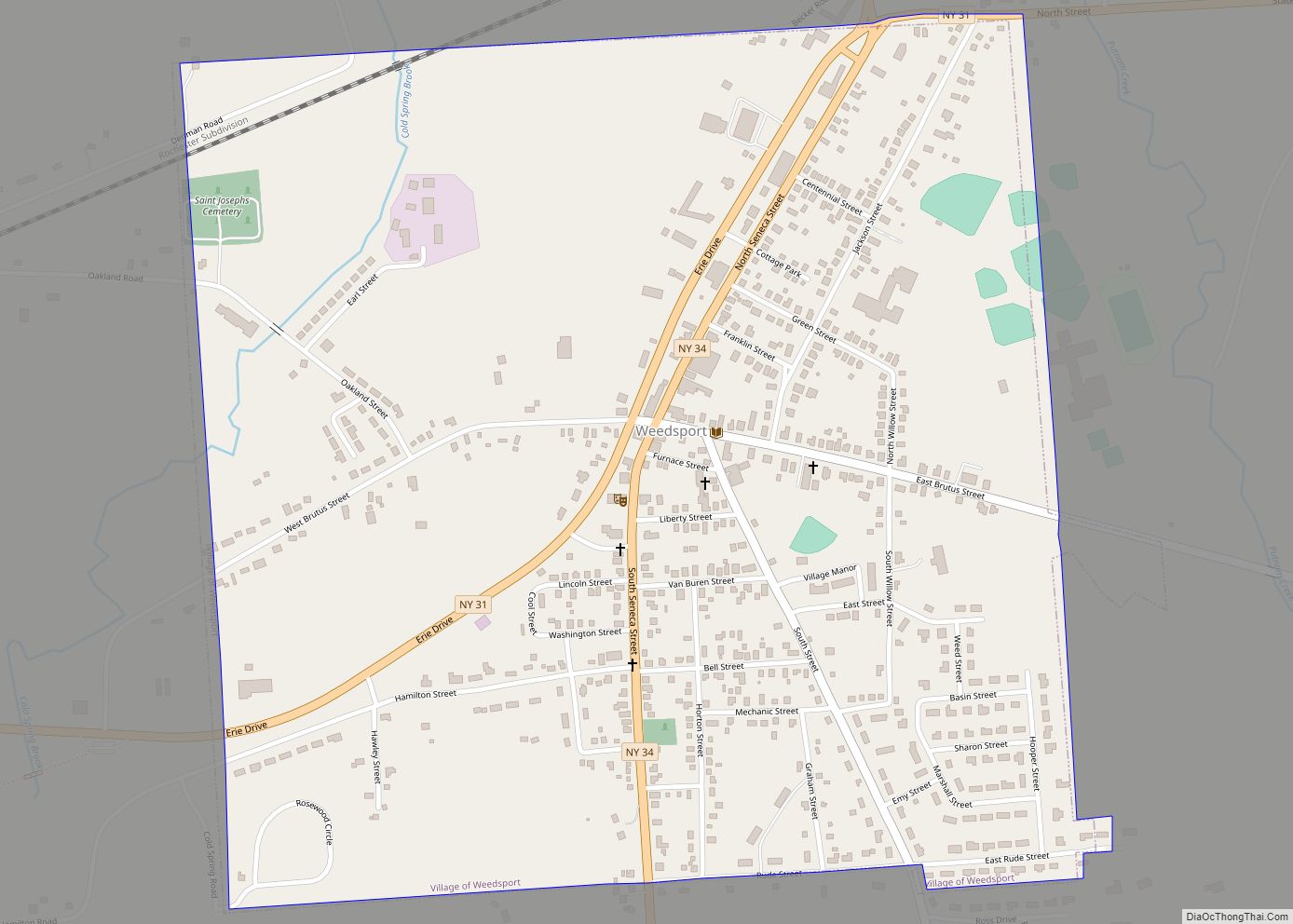
Map of Wayland village, New York

Map of Wayland village, New York

Wayland is a village in Steuben County, New York, United States. The population was 1,865 at the 2010 census. The Village of Wayland is in the northern part of the Town of Wayland, near the northern border of Steuben County. Wayland village overview: Name: Wayland village LSAD Code: 47 LSAD Description: village (suffix) State: New … Read more

Map of Waverly village, New York

Map of Waverly village, New York

Waverly is the largest village in Tioga County, New York, United States. According to the 2010 U.S. Census, Waverly had a population of 4,177. It is located southeast of Elmira in the Southern Tier region. This village was incorporated as the southwest part of the town of Barton in 1854. The village name is attributed … Read more

Map of Watkins Glen village

Map of Watkins Glen village

Watkins Glen is a village and census-designated place in and the county seat of Schuyler County, New York, United States. As of the 2020 census, the population was 1,829. Watkins Glen lies within the towns of Dix and Reading. To the southwest of the village is the Watkins Glen International race track, which hosts annual … Read more

Map of Watervliet city, New York

Map of Watervliet city, New York

Watervliet (/wɔːtərˈvliːt/ waw-tər-VLEET or /wɔːtərvəˈliːt/ waw-tər-və-LEET) is a city in northeastern Albany County, in the U.S. state of New York. The population was 10,375 as of the 2020 census. Watervliet is north of Albany, the capital of the state, and is bordered on the north, west, and south by the town of Colonie. The city … Read more

Map of Wellsville village, New York

Map of Wellsville village, New York

Wellsville is a village in Allegany County, New York, United States. Located in south-central wooded and rural Allegany County, it is the largest population and business center in a 30-mile (48 km) radius. The population was 4,679 at the 2010 census. The village’s name is not, as some suppose, derived from the oil wells that became … Read more

Map of Wellsburg village, New York

Map of Wellsburg village, New York

Wellsburg is a village in Chemung County, New York, United States. The population was 580 at the 2010 census. The village is named after the pioneer family of Abner Wells (1737–1797) who came from Southold on Long Island. Wellsburg is located in the southeast part of the town of Ashland. It is southeast of the … Read more

Map of Wells CDP, New York

Map of Wells CDP, New York

Wells is a census-designated place (CDP) in the town of Wells, Hamilton County, New York, United States. It is within the Adirondack Park. Wells CDP overview: Name: Wells CDP LSAD Code: 57 LSAD Description: CDP (suffix) State: New York County: Hamilton County Elevation: 1,003.3 ft (305.8 m) Total Area: 8.35 sq mi (21.61 km²) Land Area: 7.72 sq mi (20.00 km²) Water Area: … Read more

Map of West Haverstraw village

Map of West Haverstraw village

West Haverstraw is a village incorporated in 1883 in the town of Haverstraw, Rockland County, New York, United States. It is located northwest of Haverstraw village, east of Thiells, south of the hamlet of Stony Point, and west of the Hudson River. The population was 10,165 at the 2010 census. The majority of the hamlet … Read more

Map of West Hampton Dunes village

Map of West Hampton Dunes village

West Hampton Dunes is an incorporated village in the Town of Southampton on Westhampton Island, in Suffolk County, in New York, United States, off the South Shore of Long Island. The population was 55 at the 2010 census. West Hampton Dunes village overview: Name: West Hampton Dunes village LSAD Code: 47 LSAD Description: village (suffix) … Read more

Map of West Glens Falls CDP

Map of West Glens Falls CDP

West Glens Falls is a census-designated place (CDP) and hamlet in Warren County, New York, United States. The population was 6,721 at the 2000 census. It is part of the Glens Falls Metropolitan Statistical Area. West Glens Falls is a suburban community, lying west of the city of Glens Falls. It is located in the … Read more

Map of West End CDP

Map of West End CDP

West End is an unincorporated suburban community (and census-designated place) in Otsego County, New York, United States. The population was 1,940 at the 2010 census. West End is in the town of Oneonta, directly northwest of the city of Oneonta. West End CDP overview: Name: West End CDP LSAD Code: 57 LSAD Description: CDP (suffix) … Read more

Map of West Elmira CDP

Map of West Elmira CDP

West Elmira is a suburban census-designated place (CDP) in Chemung County, New York, United States. The population was 4,967 at the 2010 census. It is adjacent to the city of Elmira on its west side. West Elmira is in the southwest part of the town of Elmira. It is part of the Elmira Metropolitan Statistical … Read more