Watkins Glen is a village and census-designated place in and the county seat of Schuyler County, New York, United States. As of the 2020 census, the population was 1,829. Watkins Glen lies within the towns of Dix and Reading. To the southwest of the village is the Watkins Glen International race track, which hosts annual NASCAR Cup Series and WeatherTech SportsCar Championship races, and formerly hosted the Formula One United States Grand Prix and various IndyCar races.
| Name: | Watkins Glen village |
|---|---|
| LSAD Code: | 47 |
| LSAD Description: | village (suffix) |
| State: | New York |
| County: | Schuyler County |
| Elevation: | 463 ft (141 m) |
| Total Area: | 1.94 sq mi (5.03 km²) |
| Land Area: | 1.56 sq mi (4.04 km²) |
| Water Area: | 0.38 sq mi (0.99 km²) |
| Population Density: | 1,194.23/sq mi (461.05/km²) |
| ZIP code: | 14891 |
| Area code: | 607 |
| FIPS code: | 3678696 |
| GNISfeature ID: | 0974082 |
| Website: | www.watkinsglen.us |
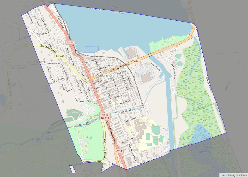
Online Interactive Map
Click on ![]() to view map in "full screen" mode.
to view map in "full screen" mode.
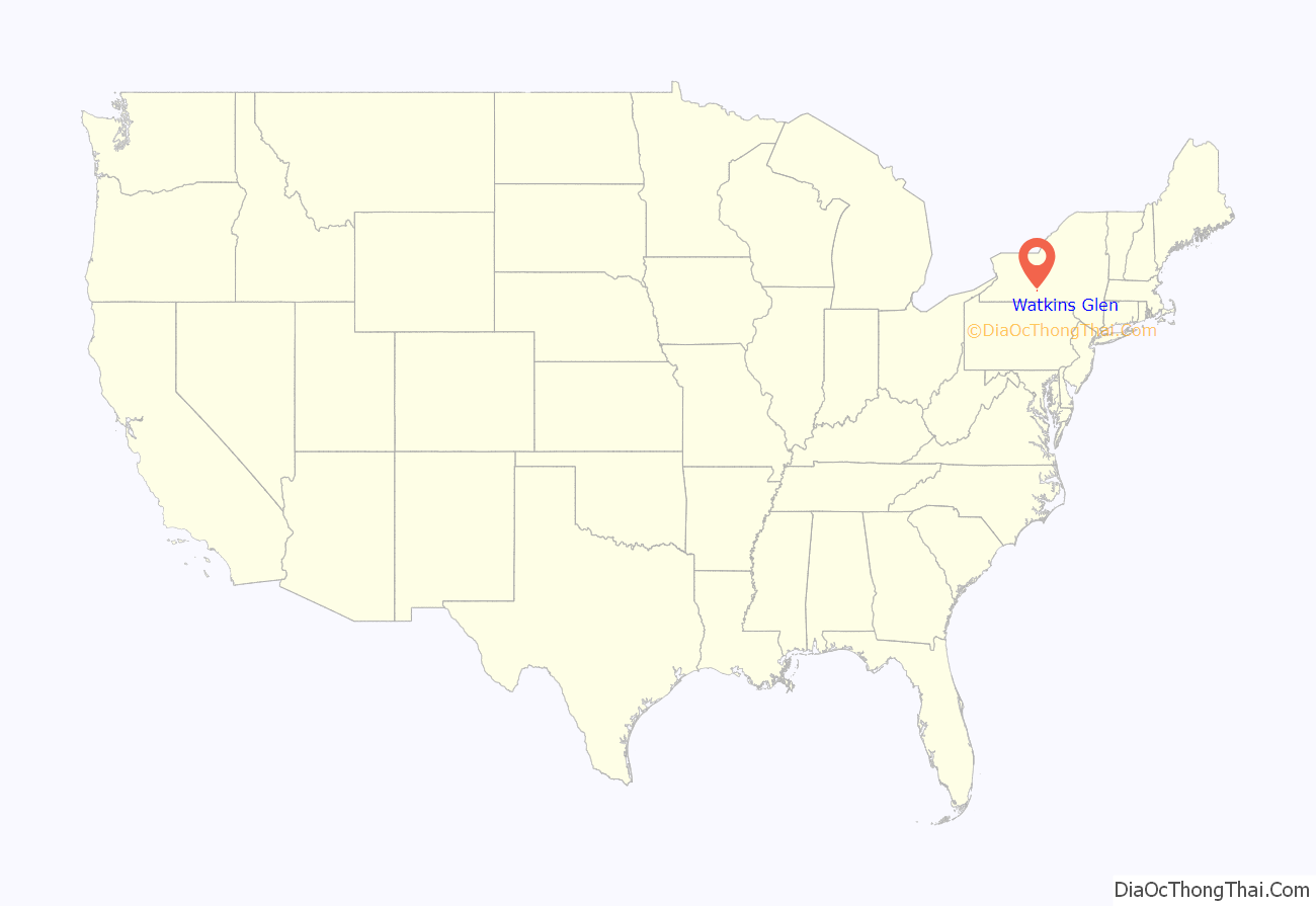
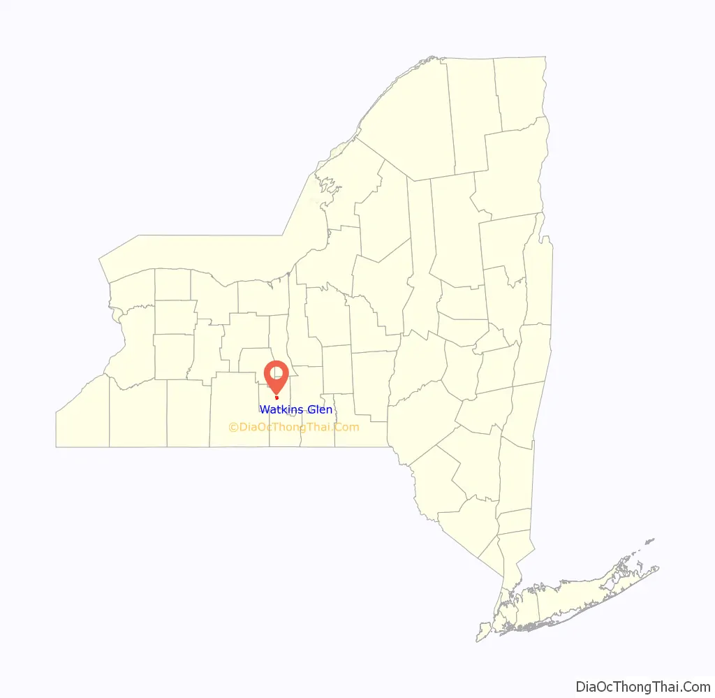
Watkins Glen location map. Where is Watkins Glen village?
History
The settlement of the village began in 1791. First named “Jefferson” in 1842, the village was later renamed in 1852 to honor Dr. Samuel Watkins. Watkins’ older brother John purchased property around the gorge in 1794 and constructed mills. After his brother’s death, Samuel Watkins inherited the property and spent four decades building up the area with roads, shops and a hotel.
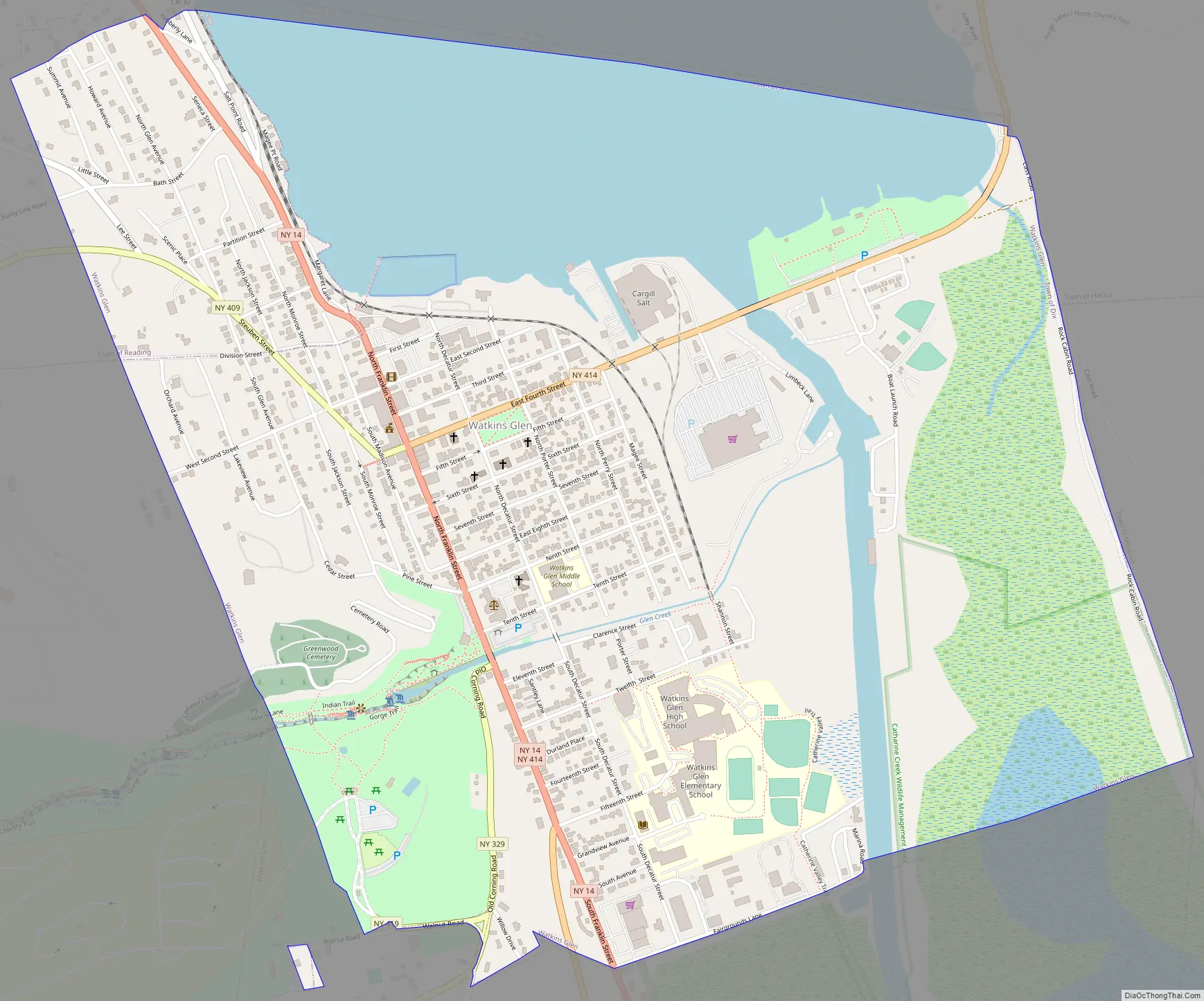
Watkins Glen Road Map
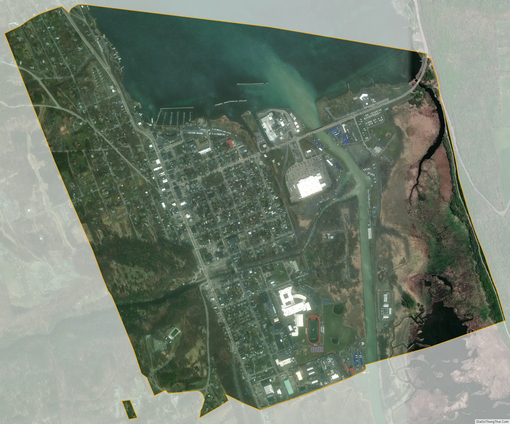
Watkins Glen city Satellite Map
Geography
Watkins Glen is located at 42°22′52″N 76°52′16″W / 42.38111°N 76.87111°W / 42.38111; -76.87111 (42.380984, -76.871079).
According to the United States Census Bureau, the village has a total area of 2.2 square miles (5.7 km), of which 1.9 square miles (4.9 km) of the village is land and 0.4 square miles (1.0 km) (17.41%) is water.
New York State Route 14 joins New York State Route 79 and New York State Route 414 by Watkins Glen. NY-14 is one of the principal streets in Watkins Glen village. New York State Route 329 and New York State Route 409 lead into Watkins Glen from the west.
See also
Map of New York State and its subdivision:- Albany
- Allegany
- Bronx
- Broome
- Cattaraugus
- Cayuga
- Chautauqua
- Chemung
- Chenango
- Clinton
- Columbia
- Cortland
- Delaware
- Dutchess
- Erie
- Essex
- Franklin
- Fulton
- Genesee
- Greene
- Hamilton
- Herkimer
- Jefferson
- Kings
- Lake Ontario
- Lewis
- Livingston
- Madison
- Monroe
- Montgomery
- Nassau
- New York
- Niagara
- Oneida
- Onondaga
- Ontario
- Orange
- Orleans
- Oswego
- Otsego
- Putnam
- Queens
- Rensselaer
- Richmond
- Rockland
- Saint Lawrence
- Saratoga
- Schenectady
- Schoharie
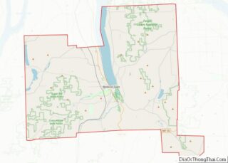
- Schuyler
- Seneca
- Steuben
- Suffolk
- Sullivan
- Tioga
- Tompkins
- Ulster
- Warren
- Washington
- Wayne
- Westchester
- Wyoming
- Yates
- Alabama
- Alaska
- Arizona
- Arkansas
- California
- Colorado
- Connecticut
- Delaware
- District of Columbia
- Florida
- Georgia
- Hawaii
- Idaho
- Illinois
- Indiana
- Iowa
- Kansas
- Kentucky
- Louisiana
- Maine
- Maryland
- Massachusetts
- Michigan
- Minnesota
- Mississippi
- Missouri
- Montana
- Nebraska
- Nevada
- New Hampshire
- New Jersey
- New Mexico
- New York
- North Carolina
- North Dakota
- Ohio
- Oklahoma
- Oregon
- Pennsylvania
- Rhode Island
- South Carolina
- South Dakota
- Tennessee
- Texas
- Utah
- Vermont
- Virginia
- Washington
- West Virginia
- Wisconsin
- Wyoming