Map of Clyde town, North Carolina

Map of Clyde town, North Carolina

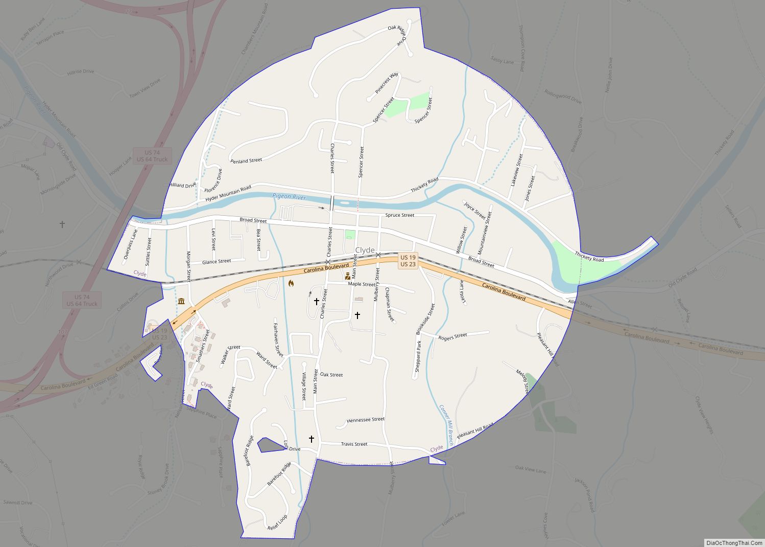
Clyde is a town in Haywood County, North Carolina, United States. The 2010 census recorded the population at 1,223 people. It is part of the Asheville Metropolitan Statistical Area. Clyde town overview: Name: Clyde town LSAD Code: 43 LSAD Description: town (suffix) State: North Carolina County: Haywood County Elevation: 2,543 ft (775 m) Total Area: 0.87 sq mi (2.24 km²) … Read more

Map of Clinton city, North Carolina

Map of Clinton city, North Carolina

Clinton is a city in and the county seat of Sampson County, North Carolina, United States. The population of Clinton is 8,639 according to the 2010 Census. Clinton is named for Richard Clinton, a Brigadier General of the North Carolina militia in the American Revolution. Clinton city overview: Name: Clinton city LSAD Code: 25 LSAD … Read more

Map of Cliffside CDP

Map of Cliffside CDP

Cliffside is an unincorporated community and census-designated place (CDP) in southeastern Rutherford County, North Carolina, United States. Its population was 611 as of the 2010 census. Cliffside has a post office with ZIP code 28024. U.S. Route 221 Alternate and North Carolina Highway 120 pass through the community. Cliffside CDP overview: Name: Cliffside CDP LSAD … Read more

Map of Cleveland town, North Carolina

Map of Cleveland town, North Carolina

Cleveland is a town in the Cleveland Township of Rowan County, North Carolina, United States. The population was 871 at the 2010 census. Cleveland town overview: Name: Cleveland town LSAD Code: 43 LSAD Description: town (suffix) State: North Carolina County: Rowan County Elevation: 807 ft (246 m) Total Area: 1.53 sq mi (3.98 km²) Land Area: 1.53 sq mi (3.98 km²) Water Area: … Read more

Map of Cooleemee town

Map of Cooleemee town

Cooleemee (/ˈkuːləmi/ KOO-lə-mee) is a town in Davie County, North Carolina, United States. The population was 940 at the 2020 census. Cooleemee town overview: Name: Cooleemee town LSAD Code: 43 LSAD Description: town (suffix) State: North Carolina County: Davie County Elevation: 738 ft (225 m) Total Area: 0.77 sq mi (2.00 km²) Land Area: 0.75 sq mi (1.95 km²) Water Area: 0.02 sq mi (0.05 km²) … Read more

Map of Conway town, North Carolina

Map of Conway town, North Carolina

Conway is a town in Northampton County, North Carolina, United States. The population was 836 at the 2010 census. It is part of the Roanoke Rapids, North Carolina Micropolitan Statistical Area. Conway town overview: Name: Conway town LSAD Code: 43 LSAD Description: town (suffix) State: North Carolina County: Northampton County Elevation: 102 ft (31 m) Total Area: … Read more

Map of Conover city

Map of Conover city

Conover is a city in Catawba County, North Carolina, United States. The population was 8,421 as of the 2020 census. It is part of the Hickory–Lenoir–Morganton Metropolitan Statistical Area and Charlotte Metropolitan Area. Conover city overview: Name: Conover city LSAD Code: 25 LSAD Description: city (suffix) State: North Carolina County: Catawba County Elevation: 1,060 ft (323 m) … Read more

Map of Connelly Springs town

Map of Connelly Springs town

Connelly Springs is a town in Burke County, North Carolina, United States. The population was 1,669 at the 2010 census. It is part of the Hickory–Lenoir–Morganton Metropolitan Statistical Area. Connelly Springs town overview: Name: Connelly Springs town LSAD Code: 43 LSAD Description: town (suffix) State: North Carolina County: Burke County Total Area: 4.99 sq mi (12.93 km²) Land … Read more

Map of Conetoe town

Map of Conetoe town

Conetoe (/kəˈniːtə/ kə-NEE-tə) is a town in Edgecombe County, North Carolina, United States. It is part of the Rocky Mount, North Carolina Metropolitan Statistical Area. The population was 294 at the 2010 census. Conetoe town overview: Name: Conetoe town LSAD Code: 43 LSAD Description: town (suffix) State: North Carolina County: Edgecombe County Incorporated: 1887 Elevation: … Read more

Map of Como town, North Carolina

Map of Como town, North Carolina

Como is a town in Hertford County, North Carolina, United States. The population was 91 at the 2010 census. Como town overview: Name: Como town LSAD Code: 43 LSAD Description: town (suffix) State: North Carolina County: Hertford County Elevation: 75 ft (23 m) Total Area: 3.15 sq mi (8.17 km²) Land Area: 3.15 sq mi (8.15 km²) Water Area: 0.01 sq mi (0.02 km²) Total Population: … Read more

Map of Cove Creek CDP

Map of Cove Creek CDP

Cove Creek is an unincorporated community and census-designated place in Watauga County, North Carolina, United States. Its population was 1,171 as of the 2010 census. Cove Creek CDP overview: Name: Cove Creek CDP LSAD Code: 57 LSAD Description: CDP (suffix) State: North Carolina County: Watauga County Elevation: 2,795 ft (852 m) Total Area: 8.54 sq mi (22.13 km²) Land Area: … Read more

Map of Cove City town

Map of Cove City town

Cove City is a town in Craven County, North Carolina, United States under the leadership of its mayor, Dred Charleton Mitchell, Jr. The population was 399 at the 2010 Census. It is part of the New Bern, North Carolina Micropolitan Statistical Area. Cove City town overview: Name: Cove City town LSAD Code: 43 LSAD Description: … Read more