Columbia is a town in Tyrrell County, North Carolina, United States. The population was 610 at the 2020 census. It is the county seat of Tyrrell County.
| Name: | Columbia town |
|---|---|
| LSAD Code: | 43 |
| LSAD Description: | town (suffix) |
| State: | North Carolina |
| County: | Tyrrell County |
| Elevation: | 3 ft (1 m) |
| Total Area: | 1.24 sq mi (3.23 km²) |
| Land Area: | 1.23 sq mi (3.18 km²) |
| Water Area: | 0.02 sq mi (0.05 km²) |
| Total Population: | 610 |
| Population Density: | 496.74/sq mi (191.75/km²) |
| ZIP code: | 27925 |
| Area code: | 252 |
| FIPS code: | 3713940 |
| GNISfeature ID: | 1019747 |
| Website: | www.townofcolumbianc.com |
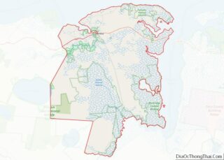
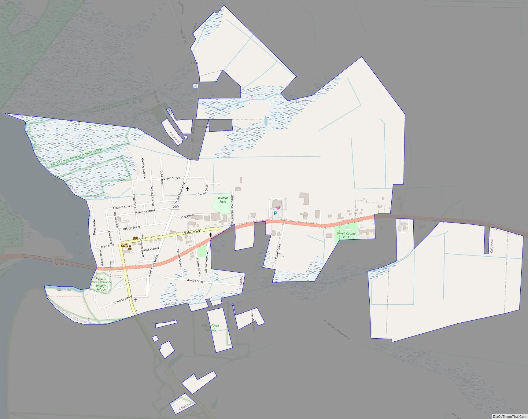
Online Interactive Map
Click on ![]() to view map in "full screen" mode.
to view map in "full screen" mode.
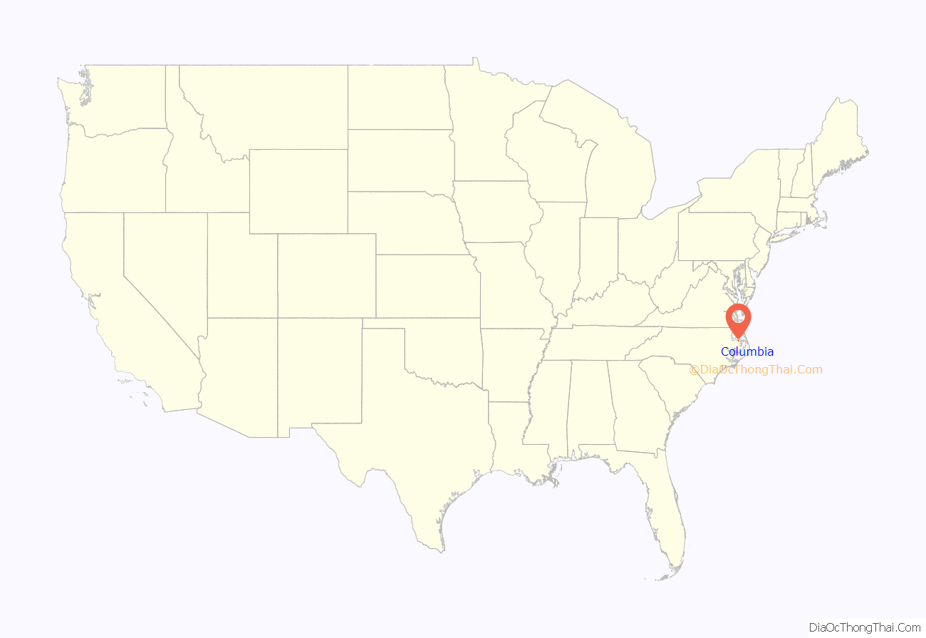
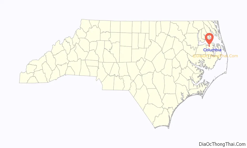
Columbia location map. Where is Columbia town?
History
Tyrrell County was Named for Sir John Tyrrell, one of the Lords Proprietors of the Carolina colony. Tyrrell County’s original boundaries originally stretched westward from Roanoke Island to near present-day Tarboro. In 1870 the territory was divided and resulted in what is now known as Tyrrell, Martin, Washington, and Dare counties. Elizabethtown, later renamed Columbia, was established on the banks of the Scuppernong River in 1793 and became the Tyrrell County seat in 1799. [3]
Somerset Place State Historic Site, a representative antebellum plantation dating from 1785, is located near Columbia. Beginning in 1829, this was home to two generations of the Collins family-Josiah Collins III, his wife Mary, and their six sons. It was also home to more than three hundred enslaved men, women, and children of African descent whose lives and work are interpreted here as well. Somerset Place offers an insightful view of plantation life during the antebellum period. [4]
The earliest news paper in Columbia is known as the Eagle[5] and last known issue: Apr. 1, 1943.
Columbia’s archaeology and National Register of Historic Places.[6].
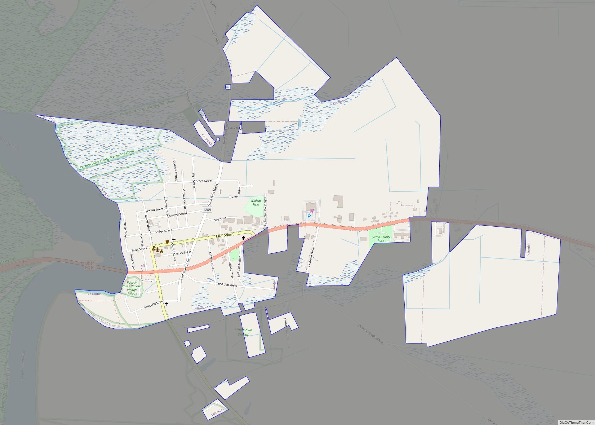
Columbia Road Map
Columbia city Satellite Map
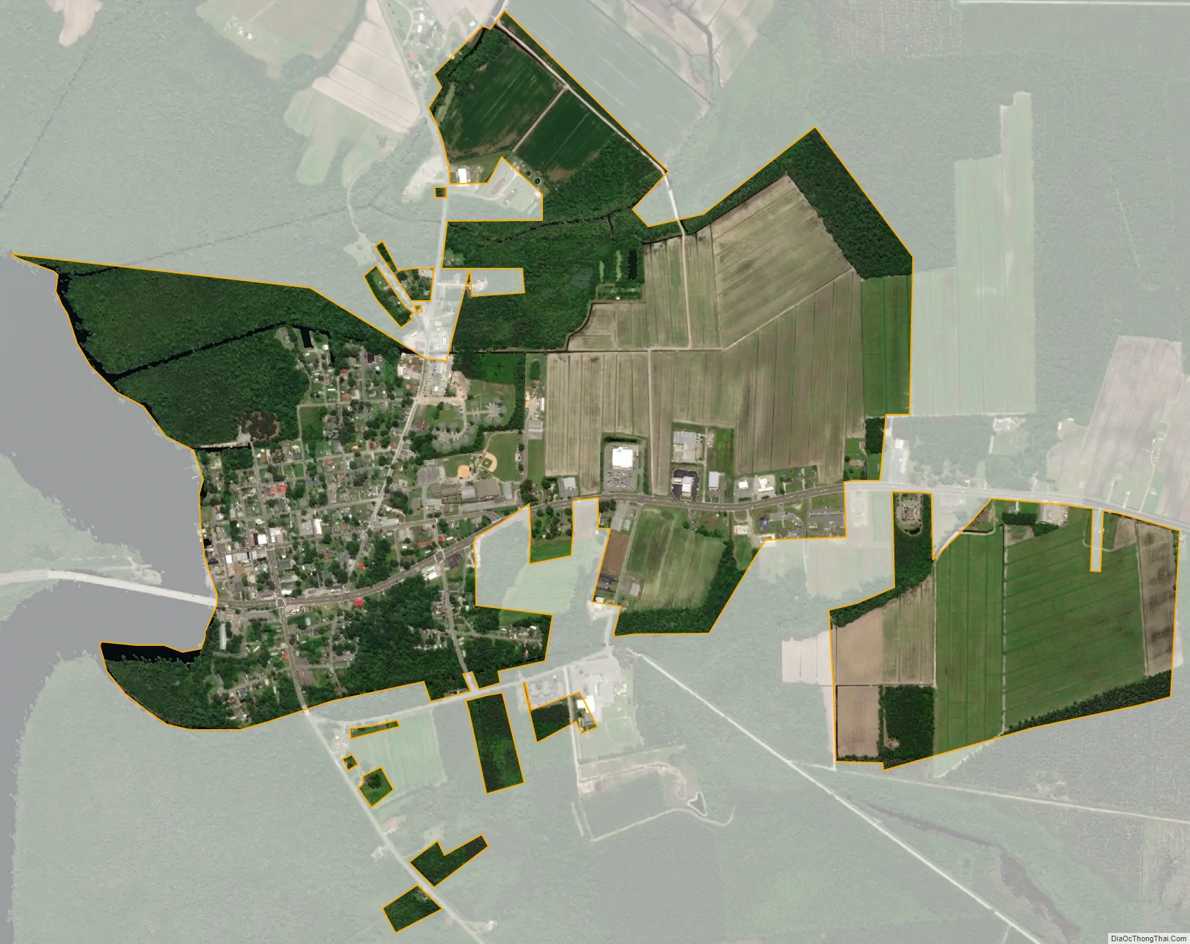
Geography
The Albemarle-Pamlico Peninsula is located in northeastern North Carolina, inshore of Nags Head and the Outer Banks in the Inner Banks region. The peninsula is framed by Albemarle Sound to the north, Alligator River to the east, and the Scuppernong River to the west. [1] [2] In addition to the Scuppernong River, Tyrrell County is bordered on the north by the Albemarle Sound, one of the East Coast’s largest estuarine systems, and to the east by the Alligator River.
According to the United States Census Bureau, the town has a total area of 0.5 square miles (1.3 km), all land.
See also
Map of North Carolina State and its subdivision:- Alamance
- Alexander
- Alleghany
- Anson
- Ashe
- Avery
- Beaufort
- Bertie
- Bladen
- Brunswick
- Buncombe
- Burke
- Cabarrus
- Caldwell
- Camden
- Carteret
- Caswell
- Catawba
- Chatham
- Cherokee
- Chowan
- Clay
- Cleveland
- Columbus
- Craven
- Cumberland
- Currituck
- Dare
- Davidson
- Davie
- Duplin
- Durham
- Edgecombe
- Forsyth
- Franklin
- Gaston
- Gates
- Graham
- Granville
- Greene
- Guilford
- Halifax
- Harnett
- Haywood
- Henderson
- Hertford
- Hoke
- Hyde
- Iredell
- Jackson
- Johnston
- Jones
- Lee
- Lenoir
- Lincoln
- Macon
- Madison
- Martin
- McDowell
- Mecklenburg
- Mitchell
- Montgomery
- Moore
- Nash
- New Hanover
- Northampton
- Onslow
- Orange
- Pamlico
- Pasquotank
- Pender
- Perquimans
- Person
- Pitt
- Polk
- Randolph
- Richmond
- Robeson
- Rockingham
- Rowan
- Rutherford
- Sampson
- Scotland
- Stanly
- Stokes
- Surry
- Swain
- Transylvania
- Tyrrell
- Union
- Vance
- Wake
- Warren
- Washington
- Watauga
- Wayne
- Wilkes
- Wilson
- Yadkin
- Yancey
- Alabama
- Alaska
- Arizona
- Arkansas
- California
- Colorado
- Connecticut
- Delaware
- District of Columbia
- Florida
- Georgia
- Hawaii
- Idaho
- Illinois
- Indiana
- Iowa
- Kansas
- Kentucky
- Louisiana
- Maine
- Maryland
- Massachusetts
- Michigan
- Minnesota
- Mississippi
- Missouri
- Montana
- Nebraska
- Nevada
- New Hampshire
- New Jersey
- New Mexico
- New York
- North Carolina
- North Dakota
- Ohio
- Oklahoma
- Oregon
- Pennsylvania
- Rhode Island
- South Carolina
- South Dakota
- Tennessee
- Texas
- Utah
- Vermont
- Virginia
- Washington
- West Virginia
- Wisconsin
- Wyoming