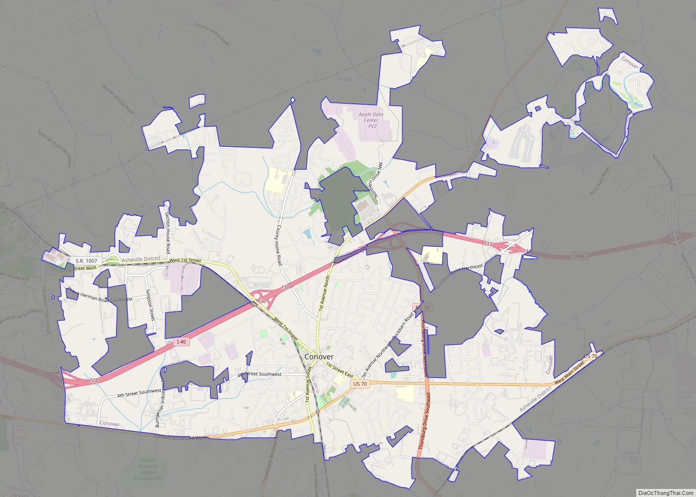
Conover is a city in Catawba County, North Carolina, United States. The population was 8,421 as of the 2020 census. It is part of the Hickory–Lenoir–Morganton Metropolitan Statistical Area and Charlotte Metropolitan Area.
| Name: | Conover city |
|---|---|
| LSAD Code: | 25 |
| LSAD Description: | city (suffix) |
| State: | North Carolina |
| County: | Catawba County |
| Elevation: | 1,060 ft (323 m) |
| Total Area: | 11.20 sq mi (29.01 km²) |
| Land Area: | 11.17 sq mi (28.93 km²) |
| Water Area: | 0.03 sq mi (0.08 km²) |
| Total Population: | 8,421 |
| Population Density: | 753.83/sq mi (291.05/km²) |
| ZIP code: | 28613 |
| Area code: | 828 |
| FIPS code: | 3714340 |
| GNISfeature ID: | 0983463 |
| Website: | www.conovernc.gov |
Online Interactive Map
Click on ![]() to view map in "full screen" mode.
to view map in "full screen" mode.
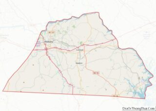
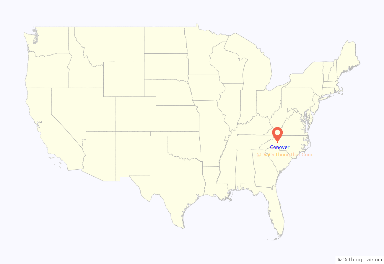
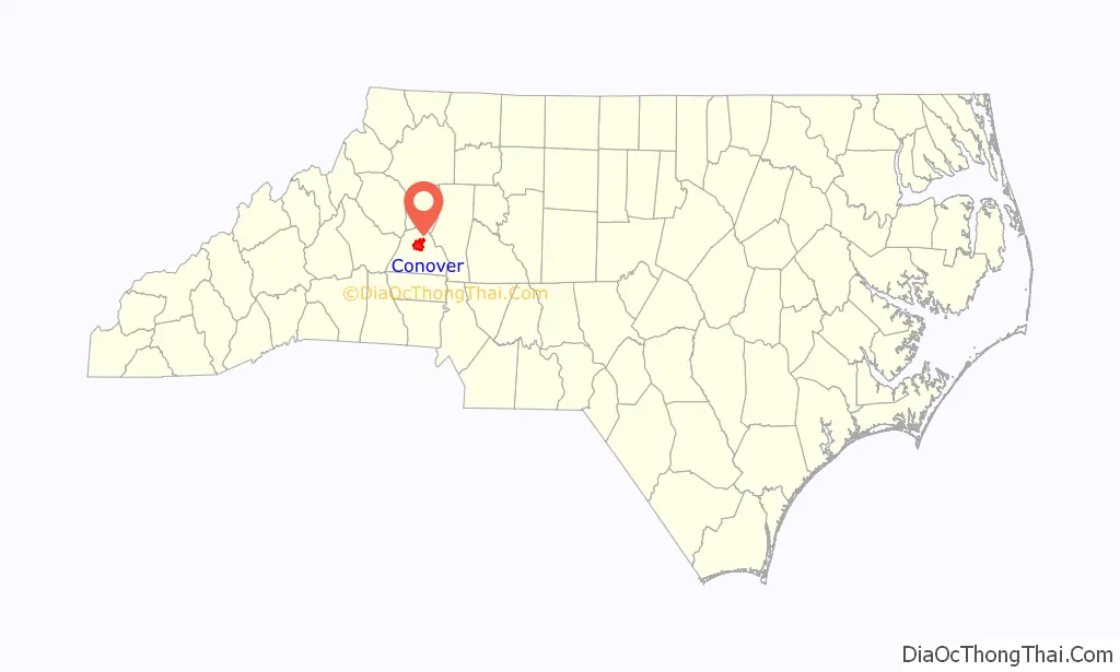
Conover location map. Where is Conover city?
History
The City of Conover began to develop in the mid-1800s as a “Y” intersection of the railroad traversing North Carolina. Although originally called Wye Town, legend says the name “Canova” was adopted, but transposed to Conover over several years. The City of Conover was chartered in 1876 and incorporated in 1877.
The Bolick Historic District and George Huffman Farm are listed on the National Register of Historic Places.
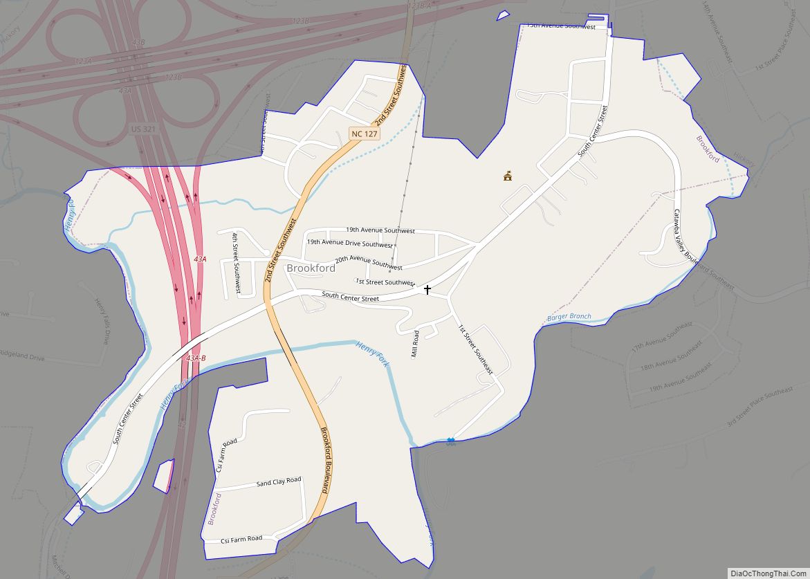
Conover Road Map
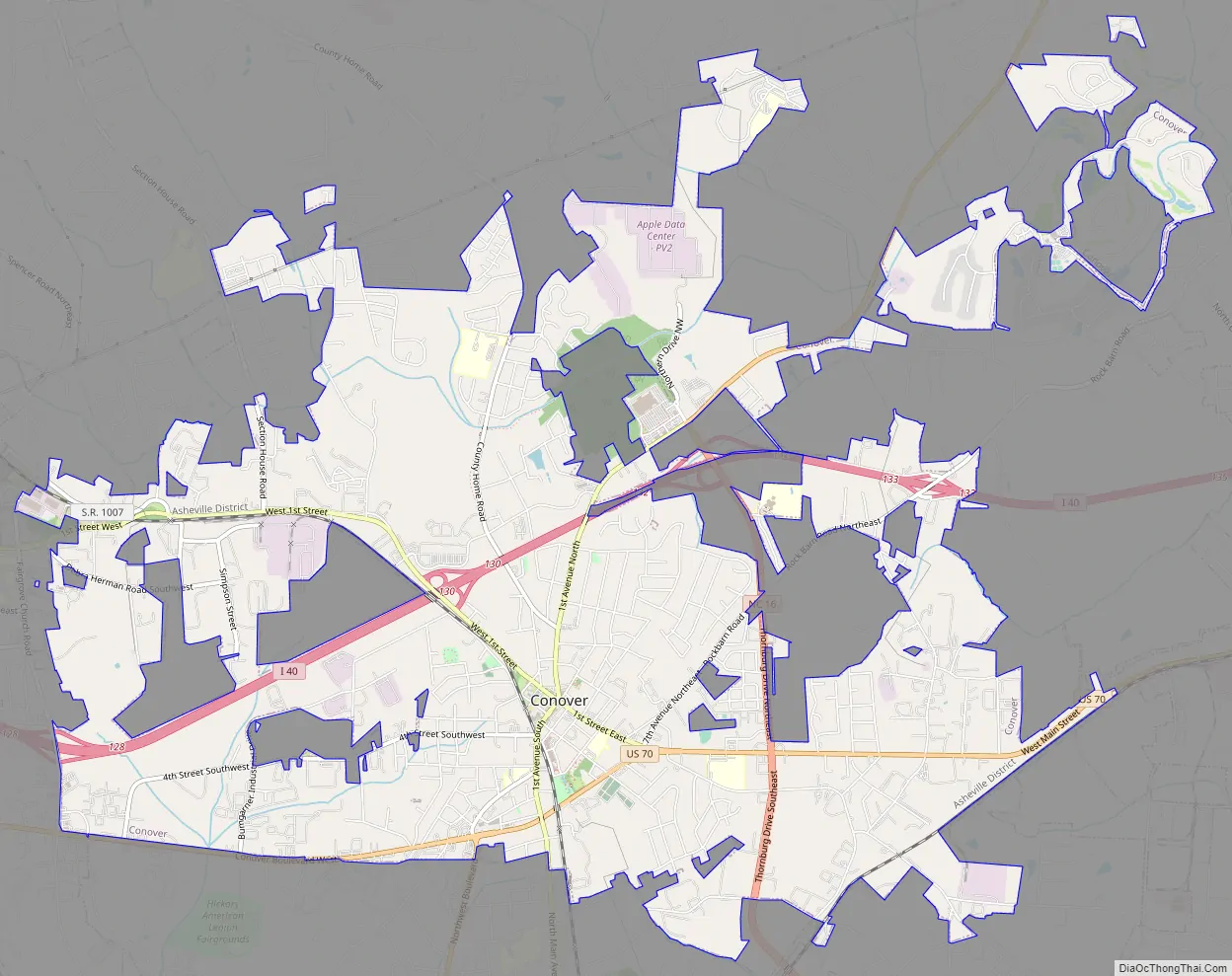
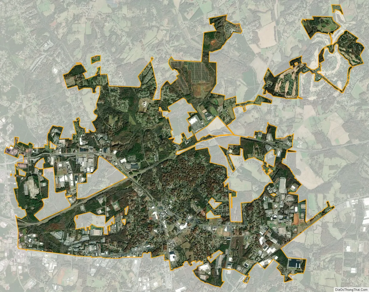
Conover city Satellite Map
Geography
Conover is located in the geographic center, as well as the population center, of Catawba County and is bordered by the City of Hickory to the west, the City of Newton to the south, and the City of Claremont to the east. Interstate 40 traverses Conover, with access from four major exits (128, 130, 132, and 133). U.S. Route 70, U.S. Route 321, and North Carolina Highway 16 all pass through Conover, making Conover one of the most easily accessible cities in the Charlotte Metro Region.
According to the United States Census Bureau, Conover has a total area of 10.9 square miles (28.3 km), of which 0.031 square miles (0.08 km), or 0.27%, is water
See also
Map of North Carolina State and its subdivision:- Alamance
- Alexander
- Alleghany
- Anson
- Ashe
- Avery
- Beaufort
- Bertie
- Bladen
- Brunswick
- Buncombe
- Burke
- Cabarrus
- Caldwell
- Camden
- Carteret
- Caswell
- Catawba
- Chatham
- Cherokee
- Chowan
- Clay
- Cleveland
- Columbus
- Craven
- Cumberland
- Currituck
- Dare
- Davidson
- Davie
- Duplin
- Durham
- Edgecombe
- Forsyth
- Franklin
- Gaston
- Gates
- Graham
- Granville
- Greene
- Guilford
- Halifax
- Harnett
- Haywood
- Henderson
- Hertford
- Hoke
- Hyde
- Iredell
- Jackson
- Johnston
- Jones
- Lee
- Lenoir
- Lincoln
- Macon
- Madison
- Martin
- McDowell
- Mecklenburg
- Mitchell
- Montgomery
- Moore
- Nash
- New Hanover
- Northampton
- Onslow
- Orange
- Pamlico
- Pasquotank
- Pender
- Perquimans
- Person
- Pitt
- Polk
- Randolph
- Richmond
- Robeson
- Rockingham
- Rowan
- Rutherford
- Sampson
- Scotland
- Stanly
- Stokes
- Surry
- Swain
- Transylvania
- Tyrrell
- Union
- Vance
- Wake
- Warren
- Washington
- Watauga
- Wayne
- Wilkes
- Wilson
- Yadkin
- Yancey
- Alabama
- Alaska
- Arizona
- Arkansas
- California
- Colorado
- Connecticut
- Delaware
- District of Columbia
- Florida
- Georgia
- Hawaii
- Idaho
- Illinois
- Indiana
- Iowa
- Kansas
- Kentucky
- Louisiana
- Maine
- Maryland
- Massachusetts
- Michigan
- Minnesota
- Mississippi
- Missouri
- Montana
- Nebraska
- Nevada
- New Hampshire
- New Jersey
- New Mexico
- New York
- North Carolina
- North Dakota
- Ohio
- Oklahoma
- Oregon
- Pennsylvania
- Rhode Island
- South Carolina
- South Dakota
- Tennessee
- Texas
- Utah
- Vermont
- Virginia
- Washington
- West Virginia
- Wisconsin
- Wyoming