Map of Gatesville town

Map of Gatesville town, North Carolina

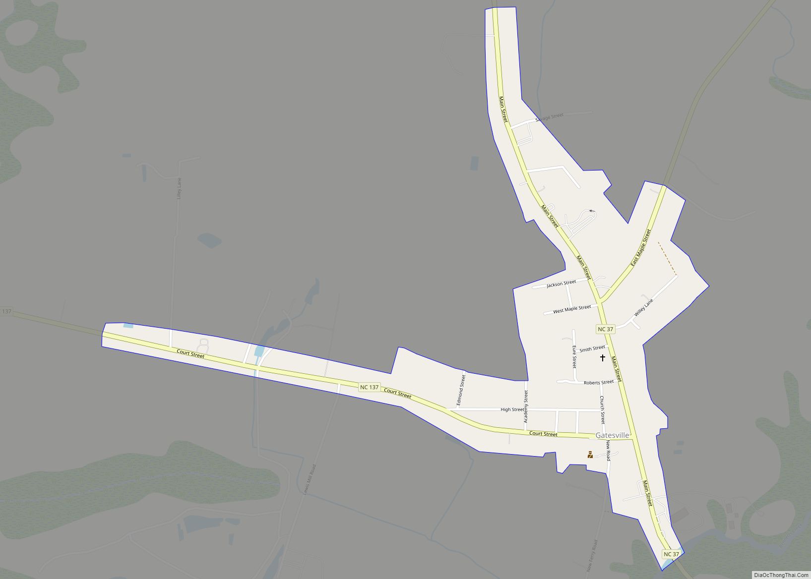
Gatesville is a town in Gates County, North Carolina, United States. The population was 321 at the 2010 census. It is the county seat of Gates County. Gatesville town overview: Name: Gatesville town LSAD Code: 43 LSAD Description: town (suffix) State: North Carolina County: Gates County Elevation: 23 ft (7 m) Total Area: 0.40 sq mi (1.05 km²) Land Area: … Read more

Map of Gastonia city

Map of Gastonia city

Gastonia is the largest city in and county seat of Gaston County, North Carolina, United States. It is the second-largest satellite city of the Charlotte area, behind Concord. The population was 80,411 in the 2020 census, up from 71,741 in 2010. Gastonia is the 13th most populous city in North Carolina. It is part of … Read more

Map of Gaston town, North Carolina

Map of Gaston town, North Carolina

Gaston is a town in Northampton County, North Carolina, United States. The population was 1,152 at the 2010 census. It is part of the Roanoke Rapids, North Carolina Micropolitan Statistical Area. Gaston town overview: Name: Gaston town LSAD Code: 43 LSAD Description: town (suffix) State: North Carolina County: Northampton County Elevation: 177 ft (54 m) Total Area: … Read more

Map of Garysburg town

Map of Garysburg town

Garysburg is a town in Northampton County, North Carolina, United States. The population was 1,057 at the 2010 census. It is part of the Roanoke Rapids, North Carolina Micropolitan Statistical Area. Garysburg town overview: Name: Garysburg town LSAD Code: 43 LSAD Description: town (suffix) State: North Carolina County: Northampton County Elevation: 135 ft (41 m) Total Area: … Read more

Map of Garner town, North Carolina

Map of Garner town, North Carolina

Garner is a town in Wake County, North Carolina, United States and a suburb of Raleigh. The population is 31,159 as of the 2020 Census. The city limits are entirely within Wake County, though portions of unincorporated Wake County, as well as the Cleveland community in northern Johnston County, have Garner mailing addresses. It is … Read more

Map of Garland town, North Carolina

Map of Garland town, North Carolina

Garland is a town in Sampson County, North Carolina, United States. The population was 625 at the 2010 census. Garland town overview: Name: Garland town LSAD Code: 43 LSAD Description: town (suffix) State: North Carolina County: Sampson County Elevation: 131 ft (40 m) Total Area: 1.08 sq mi (2.80 km²) Land Area: 1.08 sq mi (2.79 km²) Water Area: 0.01 sq mi (0.02 km²) Total Population: … Read more

Map of Godwin town

Map of Godwin town

Godwin is a town in Cumberland County, North Carolina, United States. The population was 139 at the 2010 census. Godwin town overview: Name: Godwin town LSAD Code: 43 LSAD Description: town (suffix) State: North Carolina County: Cumberland County Elevation: 154 ft (47 m) Total Area: 0.63 sq mi (1.63 km²) Land Area: 0.63 sq mi (1.63 km²) Water Area: 0.00 sq mi (0.00 km²) Total Population: … Read more

Map of Gloucester CDP, North Carolina

Map of Gloucester CDP, North Carolina

Gloucester is an unincorporated area and census-designated place (CDP) in Carteret County, North Carolina, United States. As of the 2010 census it had a population of 537. Gloucester CDP overview: Name: Gloucester CDP LSAD Code: 57 LSAD Description: CDP (suffix) State: North Carolina County: Carteret County Elevation: 6 ft (2 m) Total Area: 1.45 sq mi (3.76 km²) Land Area: … Read more

Map of Glenville CDP, North Carolina

Map of Glenville CDP, North Carolina

Glenville is an unincorporated community and census-designated place (CDP) in Jackson County, North Carolina, United States. It is now a popular lakeside vacation community with many second homes that sometimes are rented around Lake Glenville, which flooded and destroyed the original town. As of the 2010 census, the year-round population was 110. Glenville CDP overview: … Read more

Map of Glen Raven CDP

Map of Glen Raven CDP

Glen Raven is a census-designated place (CDP) in Alamance County, North Carolina, United States. It is part of the Burlington, North Carolina Metropolitan Statistical Area. The population was 2,750 at the 2010 census. Glen Raven CDP overview: Name: Glen Raven CDP LSAD Code: 57 LSAD Description: CDP (suffix) State: North Carolina County: Alamance County Elevation: … Read more

Map of Glen Alpine town

Map of Glen Alpine town

Glen Alpine is a town in Burke County, North Carolina, United States. The population was 1,517 at the 2010 census. It is part of the Hickory–Lenoir–Morganton Metropolitan Statistical Area. Glen Alpine town overview: Name: Glen Alpine town LSAD Code: 43 LSAD Description: town (suffix) State: North Carolina County: Burke County Incorporated: 1883 Elevation: 1,201 ft (366 m) … Read more

Map of Grandfather village

Map of Grandfather village

Grandfather is a village in Avery County, North Carolina, United States. It is the namesake of Grandfather Mountain. The village is a fully gated community within Grandfather Golf and Country Club, located along NC 105. The population was 24 at the 2020 census. Grandfather village overview: Name: Grandfather village LSAD Code: 47 LSAD Description: village … Read more